Ruvicha, Brian, Steve and I met in Bishop on August 11 for our annual visit to the Sierra Nevada. We dubbed this year’s hike series the 2014 TWT – Terror and Whining Tour. Terror, because that’s the feeling each of us gets when peering over the edge of a lot of exposure (yes, a strange affliction for guys who enjoy hiking high mountains). Whining, because that’s something we are really, really good at, be it over sore feet, false summits or the closure of Bishop’s Whiskey Creek, our favored restaurant for victory dinners – whether or not we had victories to celebrate.
Ruvicha had secured a great site at the Four Jeffrey Campground, within easy driving distance of the trailheads for our first three hikes. The first aimed for Cloudripper. Steve and I made it to the top of Vagabond Peak, but the day was late and our legs were fading, so Cloudripper would remain for another time. (As official recorder of the TWT hikes, I had to resist revisionist attempts by others on the team to proclaim Vagabond Peak the original objective.)
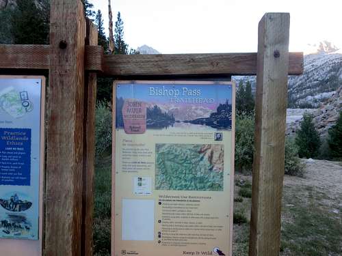
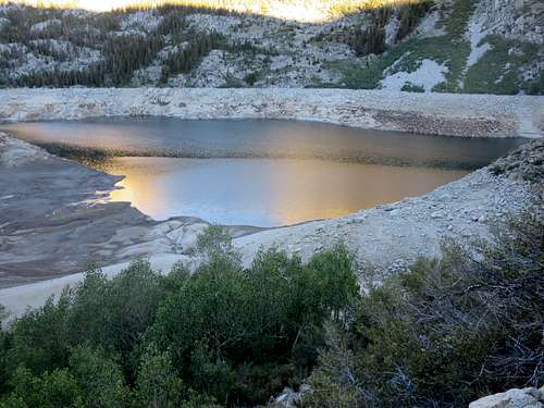
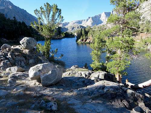
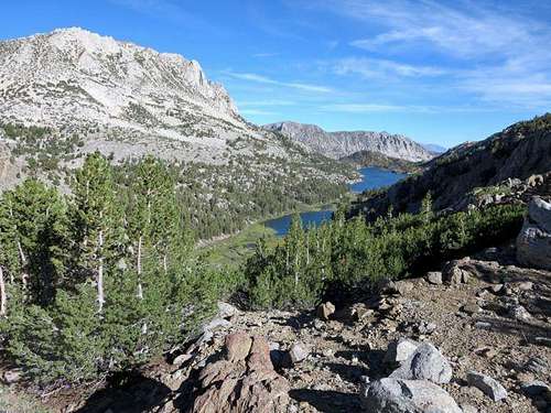
Our second hike targeted Bishop Pass and Mt Agassiz, on the pass’s eastern flank. We got an early start from the parking lot at South Lake, which was good, as it turned into a really long day for a couple of us. The trailhead was clearly marked at the south end of the parking lot, overlooking South Lake, whose extremely low level showed the full effect of California’s third year of drought.
![Bishop Pass Trailhead]() Bishop Pass Trailhead
Bishop Pass Trailhead![South Lake]() South Lake
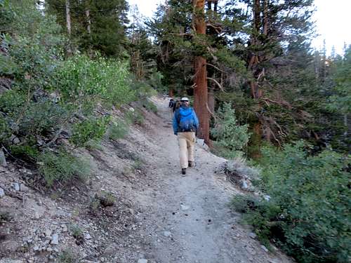
South LakeThe broad, sandy trail climbed alongside of South Lake for one-third of a mile before ascending into a forest, gaining elevation from the beginning.
Bishop Pass Trail above South Lake
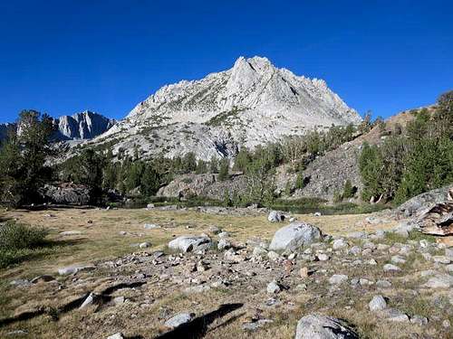
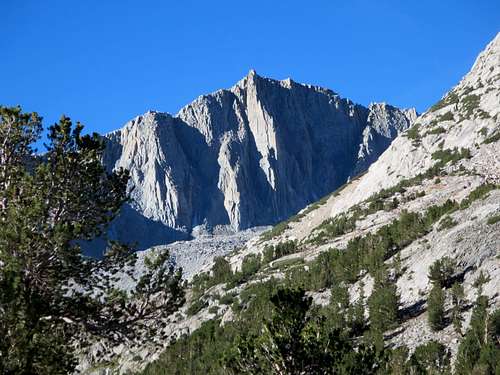
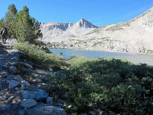
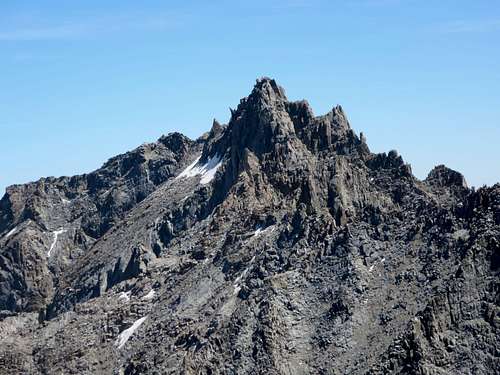
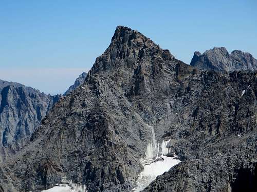
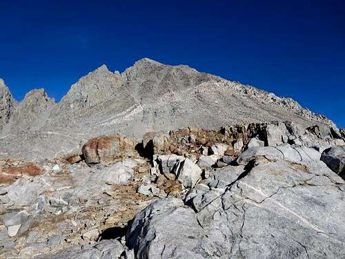
We hit the Chocolate Peak trail cut-off at about two miles, having climbed about 900 feet since the trailhead (from 9800 feet at the parking lot to 10,700 feet at the junction). The Bishop Pass Trail leveled off for the next 1.75 miles, only gaining about 300 feet as we passed up the east side of Long Lake, the first of a series of lakes and tarns that the trail skirts on its way to the pass. The trail offered great views of Hurd Peak, first of its north face and then of its longer east face from across Long Lake.
![East Face of Hurd Peak]() East face of Hurd Peak
East face of Hurd Peak![Hurd Peak and Long Lake]() Hurd Peak and Long Lake
Hurd Peak and Long Lake
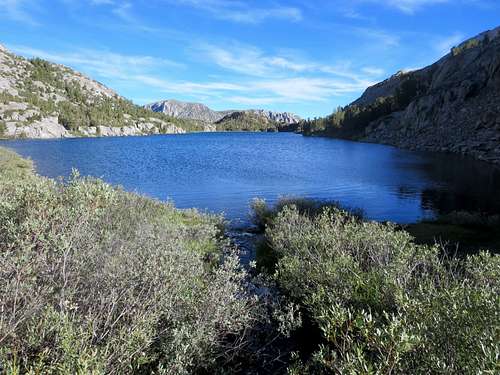
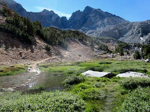
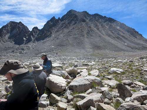
As we moved further up the trail, we passed other lakes and tarns – the Timberline Tarns, Saddlerock Lake and Bishop Lake, plus some smaller unnamed tarns.
![Mt Agassiz]() Mt Agassiz over Bishop Pass Trail
Mt Agassiz over Bishop Pass Trail![Mt Goode]() Mt Goode from Bishop Pass Trail
Mt Goode from Bishop Pass TrailBishop Pass
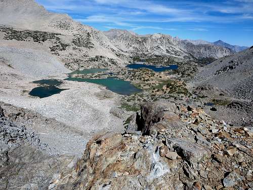
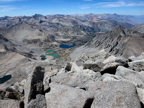
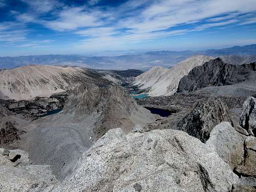
The trail climbed almost 1000 feet over the last 2.25 miles from Saddlerock Lake to the pass. Just before reaching the pass, we had a nice view back toward South Lake, overlooking several turquoise and blue lakes. At the pass, we met a couple of parties coming out of the Sierra backcountry.
![BIshop Pass Lakes]() Looking back at lakes from near Bishop Pass
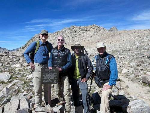
Looking back at lakes from near Bishop Pass![At Bishop Pass]() Our group at Bishop Pass
Our group at Bishop Pass
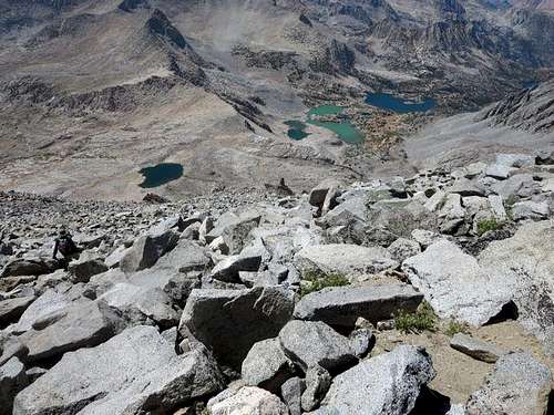
After water, snacks and pictures at the pass, Ruvicha and Brian decided to call it a day and head back to South Lake. Smart decision, as it made for a reasonable day for them. Steve and I decided to cross the plateau to the base of Agassiz, which entailed lots of boulder-hopping, in order to see what kind of terrain climbing Agassiz would entail: scree, talus or more solid rock.
![Mt Agassiz]() Agassiz from Bishop Pass
Agassiz from Bishop PassAscending Agassiz
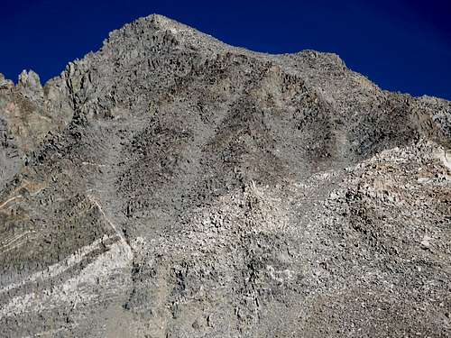
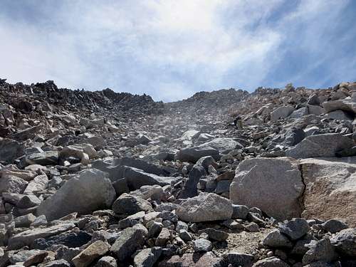
We planned to follow a route suggested by one of Kathy Wing’s photos, which we had purchased from Smug Mug. The route proceeded up a couloir that began just above a small, lingering snow patch. The couloir climbed up and to the right, with a vee about two-thirds of the way to the chute’s top. We planned to move up the right section of the vee.
![Couloirs on Mt Agassiz]() We ascended the couloir that climbs from the lower left (under the white band) to the upper center of the photo
We ascended the couloir that climbs from the lower left (under the white band) to the upper center of the photo![Mt Agassiz]() The couloir tops out at the upper right, then turn left to the summit
The couloir tops out at the upper right, then turn left to the summit
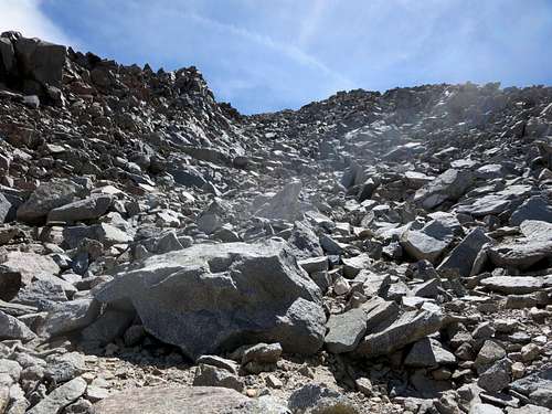
We found lots of good, solid rock for much of the ascent, though the going was slow for our not-yet acclimatized lungs at 12,000 feet-plus elevation. There were occasional patches of scree or talus, but it was relatively easy to keep on solid rock most of the time. The climbing was Class 2, easy Class 3 at the most, though we found sturdy gloves to be helpful on the ascent. We came across a number of rock cairns, which reassured us we were heading up the correct couloir.
![Mt Agassiz Couloir]() Ascending the couloir
Ascending the couloir![Mt Agassiz Couloir]() Ascending the couloir
Ascending the couloirSteve ascending the couloir
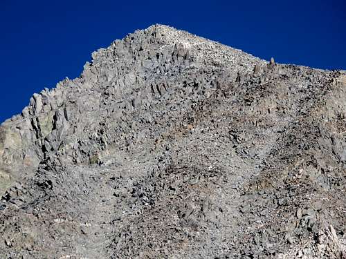
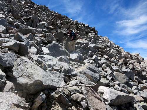
On reaching the couloir’s top, we turned left (toward the northeast) and immediately had a clear view of Agassiz’s summit. As in the couloir, we found lots of large, solid rock on the last stretch to the top.
![Agassiz Summit]() Out of the couloir and heading to the summit
Out of the couloir and heading to the summitOn Top of Agassiz
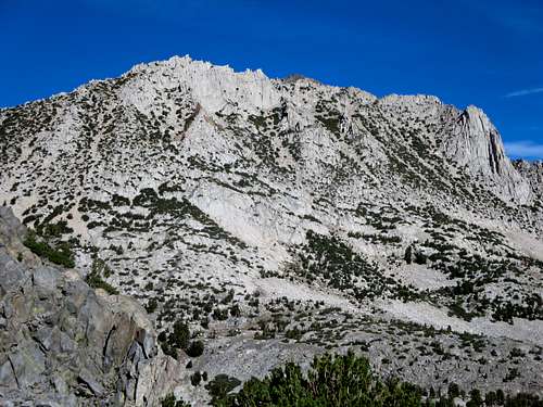
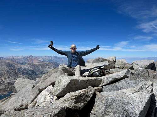
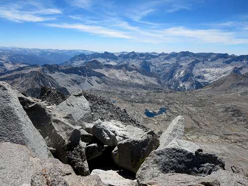
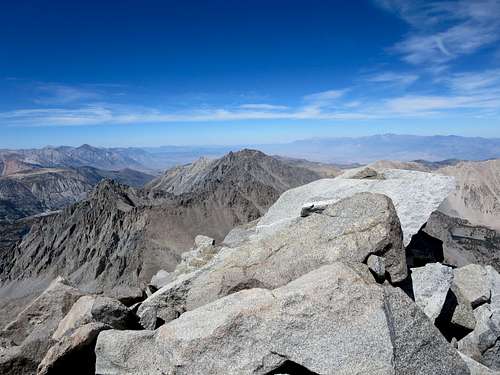
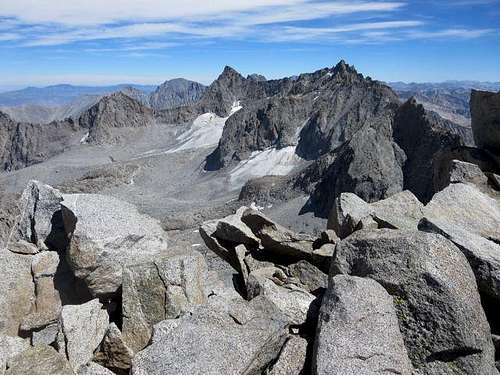
As promised, the summit of Agassiz offered spectacular views, in particular of the Palisades, to the southeast of Agassiz, and the basin below the Palisades. To the southwest, we had a nice view of the Dusy Basin and the mountains further to the west. To the northwest, we could see much of the valley that we had climbed through on the Bishop Pass Trail. We also had a nice view of Cloudripper to the north of Agassiz.
![Descending Agassiz]() Descending from Agassiz's summit
Descending from Agassiz's summit
Once we regained the Bishop Pass Trail, we had very good views of Agassiz in the fading early evening light as we took off for the trailhead.
![Mt Agassiz]() Agassiz in early evening light
Agassiz in early evening light
The climb up (and down) Agassiz sapped a lot of energy, and our pace back down the trail to South Lake was slower than we would have liked. Fortunately, we had brought headlamps, as we completed the last couple of hours in the dark. Ruvicha and Brian, who had returned to the trailhead hours earlier, proved real gems. They were waiting for us as we trudged into the South Lake parking lot with cold drinks and cold but still very tasty hamburgers from the Bishop Creek Lodge.
Whether to the top of Agassiz or just to Bishop Pass, we found this one of the prettier hikes that we have done in the eastern Sierra. The mountain and lake views are on par with those in Little Lakes Valley or the hike to Mt. Lamarck (and Lamarck Col). We hiked and climbed slow, making for one very long day. Most should find Agassiz a manageable day hike (but get an early start). The stunning views make it well worth the effort.