Page Type Page Type: Trip Report
Location Lat/Lon: 37.11170°N / 118.53°W
Date Date Climbed/Hiked: Jun 22, 2008
Activities Activities: Hiking
Seasons Season: Summer

Stats

Peak Name
CA Rank
Contiguous US Rank
Elevation
Mount Agassiz
21
97
13891

Distance: ~12.3 miles
Elevation Gain: ~4610’
Time: 6 h

Mount Agassiz

I drove to the South Lake Trailhead from Reno Sunday morning. I arrived at the trailhead in just over three hours including two brief stops. At the busy trailhead, I hit the bathroom, applied sunscreen, laced up my shoes and began hiking up the trail towards Bishop Pass. I didn’t start hiking until 10 am, so I was sweating a lot on the sun-exposed area west of South Lake. I was glad to encounter dense trees and shade above South Lake. I passed many people going up and down.
Mount Agassiz

Most people appeared to be fishermen or day hikers. There was more snow than I expected and was hoping that I didn’t need any snow gear since I didn’t take any with me. In fact, in a snowy area, I lost the trail briefly. After reaching Bishop Pass, I noticed a couple of women lounging amidst many overnight packs. After speaking with them I learned that the rest of their party was climbing Mount Agassiz. They helped me identify them. I could see that they weren’t even a quarter of the way up and that they had left thirty minutes ago. I told the ladies that I would pass them on the ascent. I ate a Cliff Shot Razz and continued up the west slope of Mount Agassiz. The route is mostly stable boulders and talus. There was some snow and ice on route, but was very easy to contend with. I passed the group of five quickly and made good progress towards the summit.
Mount Sill, Polemonium Peak, North Palisade, "Starlight Peak", Thunderbolt Peak & Mount Winchell, from left to right.

The summit has the summit register ammunition box, but is missing the lid and register. I was impressed by how the summit appeared to be overhanging on its east side. The views from the summit are spectacular. The most impressive sight is North Palisade above the Palisade Glacier. Also, looking north, I could see Mount Humphreys.
Looking north towards Mount Humphreys.

On my descent I saw a solo climber coming from the south, then passed the group of five I saw on the ascent. Back at Bishop Pass, I spoke with the women again and told them I saw their party just below the summit. I continued down towards the trailhead trying to avoid mosquitoes and admiring the scenery, especially Mount Goode. I stopped at the Bishop Creek Lodge for a good meal.
Mount Goode from Long Lake

Map. Click to enlarge.


Comments

Post a Comment
Viewing: 1-2 of 2
RickF

RickF - Jul 21, 2008 9:15 pm - Hasn't voted
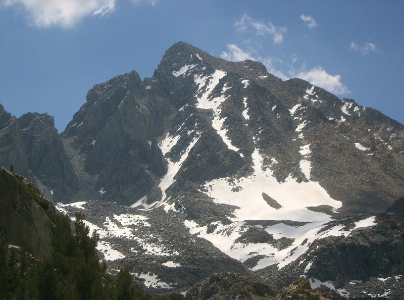
Great picture of Goode

Kalet,

Nice postcard photo! good report too!

Brian Kalet

Brian Kalet - Jul 22, 2008 1:54 pm - Hasn't voted

Re: Great picture of Goode

Thanks!

Viewing: 1-2 of 2