
-
 140077 Hits
-
 93.6% Score
-
 44 Votes
|
|
Mountain/Rock |
|---|---|
|
|
44.16640°N / 121.7714°W |
|
|
Mountaineering, Scrambling |
|
|
Spring, Summer, Fall |
|
|
10085 ft / 3074 m |
|
|
Overview
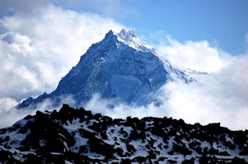
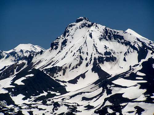
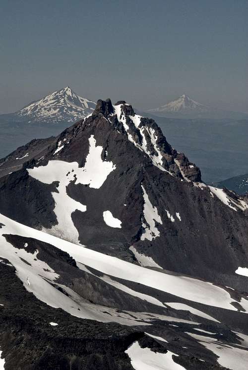
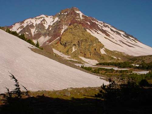
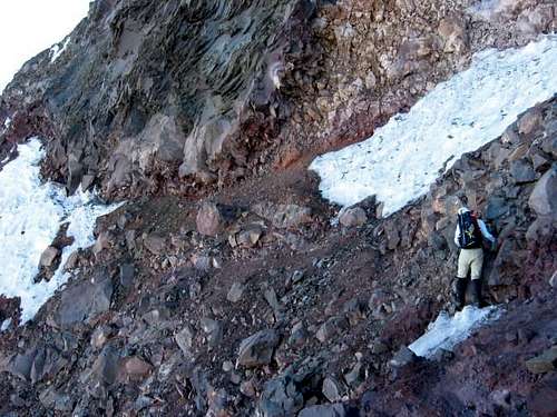
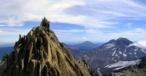
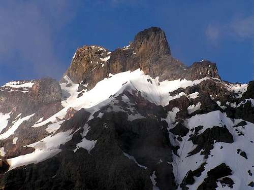
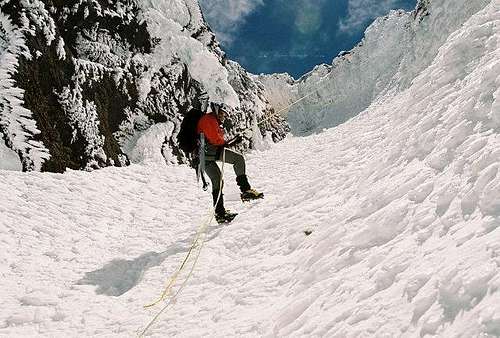
North Sister is the most rugged and considered the hardest climb of the Three Sisters in central Oregon. It also could be considered one of the hardest of the Cascades volcanoes when comparing "standard" routes. It's the oldest and least climbed of the Three Sisters. First ascent was by H. H. Prouty in 1910 for which the summit pinnacle is named. Originally thought to be over 11,000 feet, it has eroded and is basically a large pile of loose volcanic rock. There are two pinnacles at it's summit and many gendarmes. There is also lots of loose rock and rockfall.
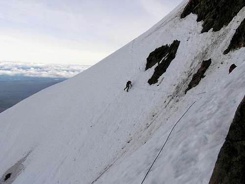
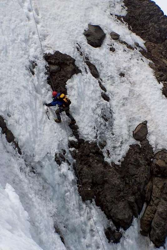
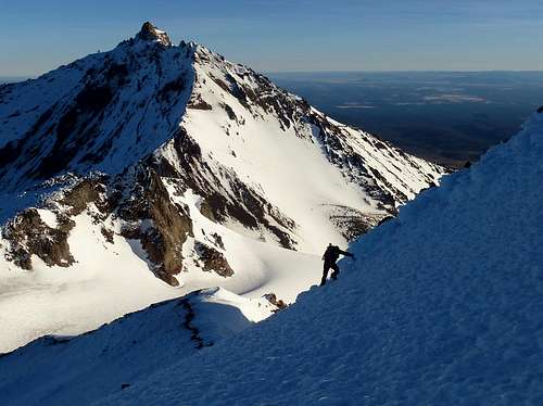
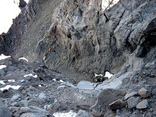
Only the easier routes are often climbed. These include the south and southeast ridges as well as the northwest ridge. There are two main approaches: the Obsidian Trail approach from the west and the Pole Creek Springs approach from the east. The two south routes meet up and share the same final ridge. In summer conditions, the traverse to the Bowling Alley, the final summit pitch up a loose, steep gulley, is on a narrow, crumbly, loose rock ledge and the Bowling Alley is Class 4 junk. Under snowy conditions, the traverse is a steep side-stepping affair around a ridge and the Bowling Alley can be 70-80 degree hard snow or ice.
To see a 3D topo map showing the Obsidian Trail, click here. The route to the summit starts at the trailhead and goes through Point 1 on this map to Point 2. From there you depart the Obsidian Trail and head up the valley and ridge aiming for the point between the two peaks.
For a kinda neat NASA shot of the area click here.
To see the volcanic history of the area, click here.
 |
 |
 |
 |
 |
Getting There
For the west approach if coming from the Eugene area, take Highway 126 to Highway 242. Just southwest of McKenzie Pass there is a well-marked sign for the Obsidian Trailhead 3528.
For the east side approach, head south from the McKenzie Pass (242) on Pole Creek Springs Road 15 to it's end to Pole Creek Springs Trail 96D.
 |
 |
 |
 |
Red Tape
You'll need a Northwest Forest Pass to park at the trailhead. Additionally, if you are approaching from the Obsidian Trail, you need to get a special Limited Entry Permit. It's required for day and night trips in to this area. These are free and only issued from the McKenzie Ranger District. They can be obtained over the phone or in person within 30 days of your trip. (see below for contact info)
 |
 |
 |
When To Climb
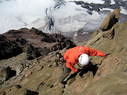
You can climb all year here except Highway 242 is closed in winter. It's generally recommended to climb when the mountain is frozen and has some snow cover to avoid as much loose rock as possible. The rockfall potential is only lessened in the winter, not removed. Helmets are a good idea year-round.
Camping
Camping is allowed around the mountain. Permits are required and are self-service and free at the trailhead for the east side approach. See the Red Tape Section for the special permit needed for the west side approach.
Mountain Conditions
Sisters Ranger District
PO Box 249
Sisters, OR 97759
541-549-2111 or 541-549-7700
(located on the corner of Pine St. and Highway 20 in Sisters)
McKenzie Ranger District (for west side permit as well as info)
57600 McKenzie Highway
McKenzie Bridge, OR 97413
541-822-3381
(same link as Sisters Ranger District, just click there)
Weather Conditions from Weather.com
External Links
- The Five Sisters Marathon by Pat Credican
Pat Credican of Bend, describes his 24 hour five peak marathon, climbing over 15,000 of vertical gain in the Three Sisters Wilderness - Pat Credican of Bend summits in 24 hours, the five major peaks in the Three Sisters Wilderness
- A North Sister north ridge summit attempt
- Photos of the North Sister crux - the "terrible traverse" and the "bowling alley"
- Martina Testa dies in a solo attempt on North Sister