
|
|
Mountain/Rock |
|---|---|
|
|
37.68930°N / 107.6022°W |
|
|
Hiking, Mountaineering, Trad Climbing, Scrambling |
|
|
Spring, Summer, Fall |
|
|
13864 ft / 4226 m |
|
|
Overview
Of the five main mountain ranges in Colorado, the San Juan Mountains in southwestern Colorado are home to some of the state's most rugged peaks. The valleys are usually deep, mountains typically rise steeply, rock quality dubious and the area is one of the state's least accessible-though with the sheer number of mining structures, ruins and ghost towns, that seems a bit questionable.
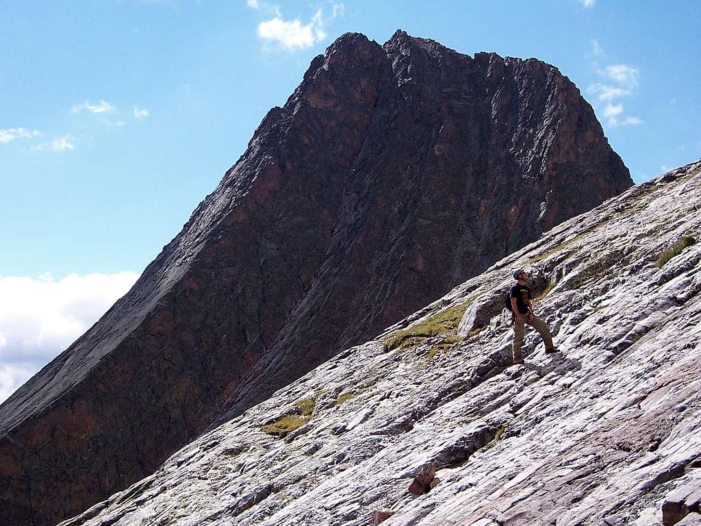
However, smaller sub-ranges exist within the San Juan Mountains that lend unique characteristics to the area. One of those sub-ranges is the impressive Grenadiers. This particular area is known for it's batholith peaks rising from heavily forested valleys. The rock is generally moderate in terms of protection and trustworthiness. Within the Grenadiers are two peaks in particular, that often see comparisons to the Maroon Bells outside Aspen. Not because of their picturesque similarities but because Vestal Peak and Arrow Peak rise from the lower valley steeply and sharply giving an immediacy to their inimical and stoic appearances. But also, Vestal Peak lays claim to unquestionably, one of the best alpine climbing routes in the entire state....Wham Ridge.
Located in San Juan County within the massive Storm King Peak Quadrangle, Vestal Peak was first climbed in 1908 by William Cooper and John Hubbard. It is Colorado's 77th highest peak and for peak-baggers, those chasing the centennial list (top-100 highest), it is a mountain often looked forward to climbing. At 13,864', it doesn't reach that coveted 14,000' mark and thus, sadly, doesn't receive the attention that this peak deserves. But thankfully, because of it's absolutely massive north face, Wham Ridge attracts climbers to its ramparts to climb the infamous Wham Ridge.
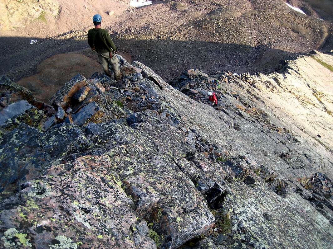
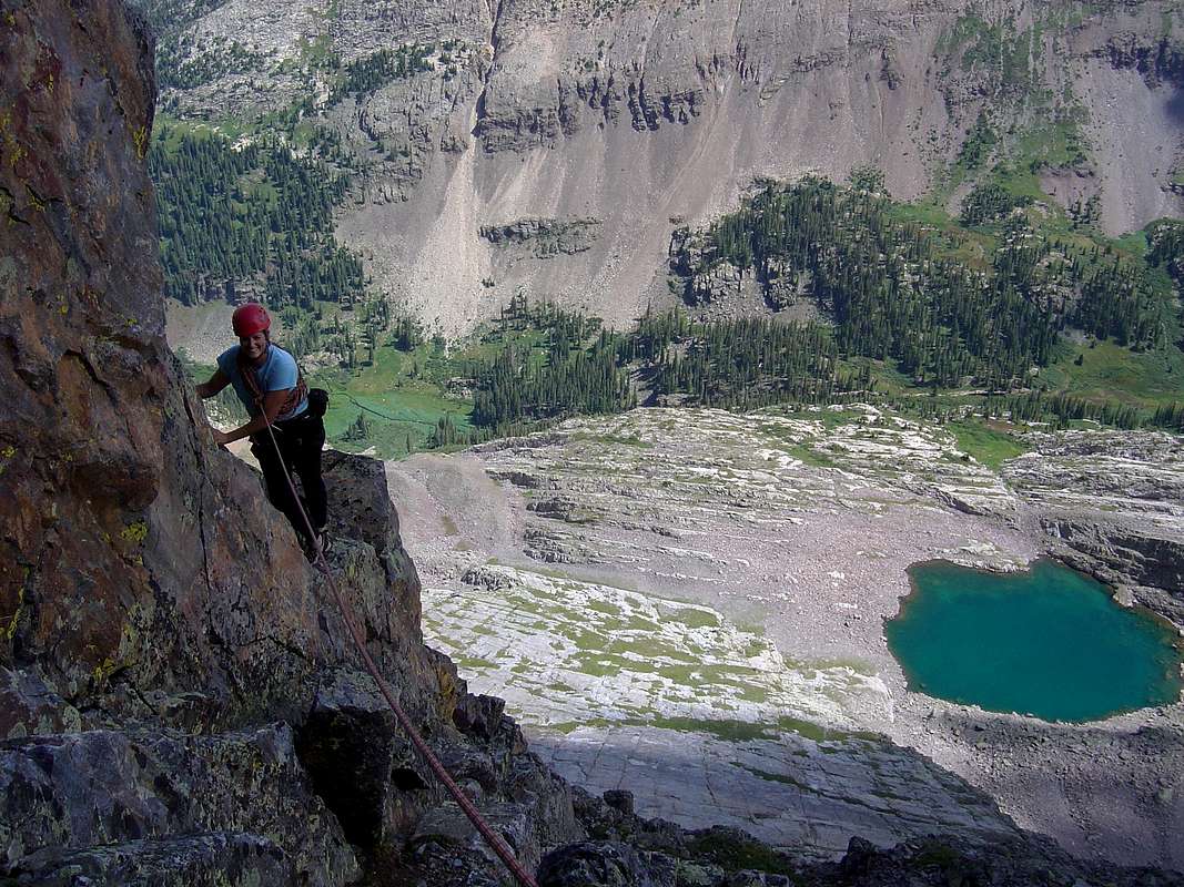
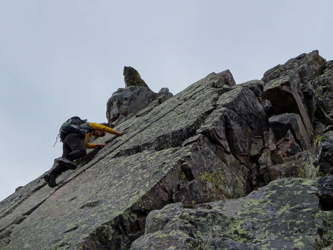
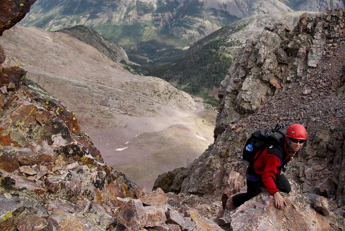
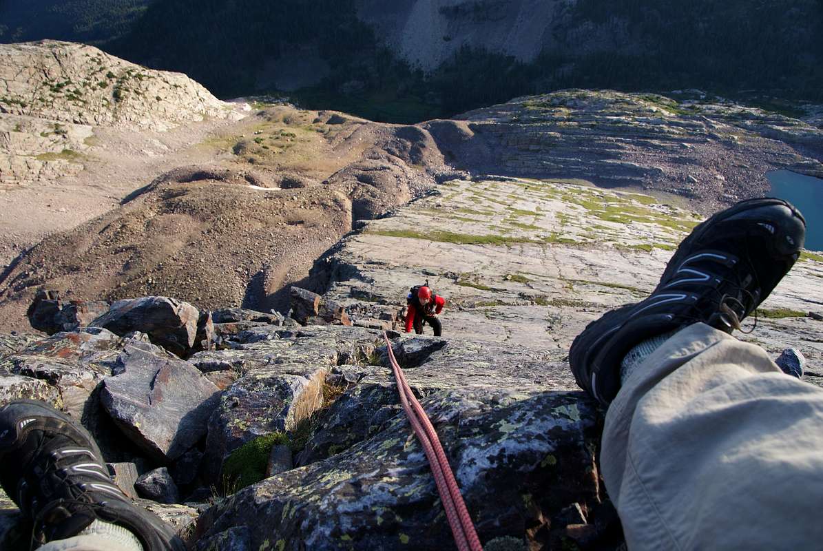
For anyone who sets eyes upon Wham, the allure will be instantaneous. It is singularly beautiful, as aesthetic as they come and strangely, easily difficult. The North Face is often used as the ascent route with Wham Ridge being 5.3-.4 in difficulty and an alternative called "Center Shift" being around 5.6. The crumbly and oft-fractured South Face (3rd class) is typically used as the descent route.
The approach to Vestal Peak isn't the easiest one out there either. Depending on which approach one uses, either an additional 4-5 mile hike from Molas Pass is necessary to reach the Animas River or a train ride on the narrow gauge from either Durango or Silverton to Elk Park is mandated. From there, an up-valley hike (good trail) of a few miles to a set of beaver ponds is necessary. Vestal, Arrow Peak, Electric and Graystone Mountains slowly come into view. The last mile or two is through dense forest resplendent with deadfall and felled trees. This must be negotiated, until finally coming out into the upper Vestal Basin where some great camp sites await at treeline below the massive peaks. It is a sublime place to be.
Vestal Peak carries 1,104' of prominence, lies within the San Juan National Forest and the beautiful Weminuche Wilderness.
If there's ANY destination in Colorado that deserves a few days time, it's this wonderful place. It feels like a smash-up of Colorado and Switzerland and is worth the extra time and logistics to visit.
Getting There
Vestal Peak is located in the Grenadier Range of the San Juan Mountains in southwestern Colorado far from Denver. There are technically three approaches (trailheads) one can use for the Vestal Group. There is Molas Pass accessed from Hwy. 550 which is the most frequently used and considered the standard approach, Elk Park which can be accessed by taking the historical and rather aesthetic narrow gauge train from Durango (or Silverton) and the little used Beartown which provides access from the remote east and involves more of an adventure.
Molas Pass
This trailhead is more often used as it keeps the climber from having to rely on the train schedule thus having to keep to a specific timetable. If one is approaching from the north (from Silverton), leave town and drive south on Hwy. 550 for 5.0 miles. Turn left (east) onto a dirt road marked by a large brown sign stating Molas Pass and Molas Park. If you drive to the top of Molas Pass (10,910ft), you've gone too far.
If one is approaching from the south, leave the junction of 32nd avenue and Main Street in Durango and drive north on Hwy. 550 for approximately 40.5 miles. Once you crest the summit of Molas Pass, continue driving north for an additional 1.0 mile and look for a brown sign indicating the turn for Molas Lake and Molas Park (and campground) on the right side.
Take the turn and follow the dirt road to a large parking area. This is the trailhead.
The approach trail follows a large segment of the Colorado Trail (#665) as it winds down the slope (dropping roughly 1,700ft) away from Molas Lake to the southeast. The trail is good and easy to follow all the way to the Animas River. It drops initially from the plateau where Molas Lake sits to another flat bench of sorts, paralleling it for perhaps a half-mile before dropping sharply in a series of switchbacks to the bottom of Animas Canyon.
Once the bottom is reached, hike south along the Animas River for roughly 3/4 mile to a mile to the mouth of Elk Creek Drainage which services the upper Elk Creek Drainage & includes the Vestal Group, Peaks One and Two and White Dome. This is your entrance...Elk Park (8,860'). Just before reaching Elk Park, cross the Animas River via a footbridge, then head south for 400 yards (.1 mile) to the Elk Park train stop. Follow the little railroad spur about 100 yards east and pick up the Elk Creek/Colorado Trail. Hike uphill for a short distance to a bench where you will find the official Elk Creek Trailhead and the Weminuche Wilderness Boundary.
Durango/Silverton Narrow Gauge R.R.
The other option is to take the Durango/Silverton Narrow Gauge train and start your approach from Elk Park. This saves you 6.6 miles round-trip and a steep climb back to Molas Pass once your adventure is over. The disadvantages to taking the train are the cost of the ticket and that you are at the mercy of the train schedule. As of the 2013 season, a round-trip ticket is $90.10 + $10.00 for your pack. That's $100 bucks round-trip for a train ticket! However, if you can afford it, the train ride is fun, and it sure is nice once you reach Elk Park and realize you don't have to make that 1,700' climb back up to Molas Pass.
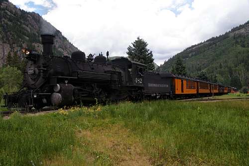
The train is a great way to start your Vestal Peak adventure. Photo by Alan Ellis
Approach Continued: Once on the Elk Creek trail, hike east for three miles on a well-maintained trail until reaching the Beaver Ponds. Good camping can be found on the north side and the southeast side of the Beaver Ponds. On the east side of the big pond, look for a large monolithic boulder. At the boulder, the trail splits to the south between two large cairns. Turn right (south) and follow the faint trail behind the boulder, then across the rocky east side of the Beaver Ponds. Immediately upon leaving the vicinity of the pond is a very flat camping area...probably the best camping area near the Beaver Ponds.
The faint trail leaves the camping area to the southeast and soon crosses Elk Creek after a steep descent into Elk Creek gorge. In early season, the crossing of Elk Creek can be an adventure, so plan accordingly. After the creek, follow the Vestal Creek trail to the south, then back south east until reaching Vestal Basin. The trail will stay on the left (east side) of Vestal Creek. The Vestal Creek trail is not maintained and has a somewhat bad reputation for being rough, steep, copious amounts of downed trees and hard to follow. Although steep and loose in a few places, the trail is fairly evident and easy to follow. There is quite a bit of down-fall, but not enough to inhibit progress.
After approximately three miles, the trail arrives at Vestal Basin. Head east and look for a little cairn and a trail that splits to the south. This is the trail to begin your climb of Vestal Peak. You will find this trail about 100 yards west of the trees on the east side of the basin meadow. If you reach the trees and the trail starts climbing, you've missed the Vestal Peak trail. At the trail split, go south and do an easy crossing of Vestal Creek. The trail will then climb 800 feet to a bench above Vestal Basin. Once at the top of the bench, head southeast across talus and find Vestal Lake where the Wham Ridge route begins. If climbing Vestal via the class 3 route, head directly south across rough talus and climb to the top of the loose and steep Vestal/Arrow saddle.
Beartown
This is a very remote and little used trailhead. Most people using this approach will actually progress south towards Hunchback Pass instead. This approach is located at 11,700ft and provides access to the Vestal Group from the east via Upper Elk Creek & Vallecito Creek. The drive to reach this trailhead is long and somewhat rough (moderate to rough in difficulty) requiring over 25 miles on 4x4 roads. But, if you're looking to maximize your backcountry experience & get some off-roading in, this approach is definitely your ticket.

From the town of Creede, travel west on State Hwy 149 for 18 miles. Turn left and go west on the Rio Grande Reservoir Road (Forest Road 520). Pass the turnoff for Ute Creek. Set your odometer here and start counting. At mile 0.9, pass the Lost Creek Campground and again, pass the Lost Trail Creek Trailhead at mile 1.3. Around mile 4.5, cross a cattle guard which more or less, marks the entrance to Brewster Park (medium-sized grassy meadow). Another 2.2 miles will bring you to the bottom of Timber Hill. Continue up the rough road for another 2.0 miles to the top. You'll have to get out of the vehicle to unlock a gate.
Continue driving and shortly after, look for Forest Service Road #506 (Beartown Road) on the drivers left around mile 9.6.
WHEW! Reset that odometer!
Drive downhill for about half a mile and cross the Rio Grande River (DO NOT try this during Spring runoff). Over the next few miles, the road will gradually climb about 400' with the exception of the last half mile when the road ramps up sharply (about another 300') to meet the lower end of a pristine meadow. The ghost town of Beartown is located at the upper end of this meadow. It has pretty much all but disappeared and chances are, unless you park and leave the vehicle, you won't see it at all. Only foundations are left.
The official Beartown Trailhead (trail #787)is reached at 5.8 after crossing Bear Creek. Parking is limited but there is a trail placard (sign) and a register marking this location. If full, another half mile up the road will deposit you to Kite Lake where there is more parking. The lake is sterile (no fish or vegetation) but absolutely stunning and well worth the extra time to check out! Needless to say, this trailhead is NOT accessible in winter.
Red Tape
Vestal Peak is located in the Weminuche Wilderness of the San Juan National Forest. No permits are required to hike, climb, or camp. The wilderness area begins about 200 yards east of Elk Park and includes the Beaver Ponds area and Vestal Basin. No motorized vehicles, including bicyles or chainsaws, are allowed in the wilderness area. Pack animals however, are permitted. No campfires or wood stoves in Vestal Basin.
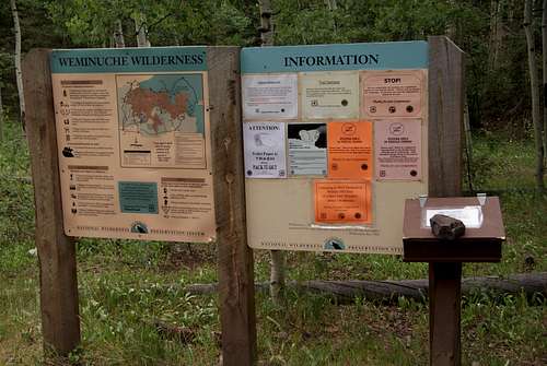 Weminuche Wilderness boundary and Elk Creek Trailhead.-Photo by Alan Ellis
San Juan Mountains Center
P.O. Box 709
1246 Blair St.
Silverton, CO 81433
(970) 387-5530
(open 9:30-3:30pm/closed on Wednesdays)
(joint FS/BLM office, closed in winter)
When To Climb

As with most Colorado high peaks, late June through mid September are best for summer season climbs. September can be a wonderful time to climb. The weather tends to settle as fall high pressure systems move through and provide several continuous days of cool, clear skies signaling the end of the annual monsoon season.
Otherwise, violent afternoon thunderstorms are a daily occurance in summer, something the San Juan Mountains are notorious for. Regardless of the route, start early. Storms typically hit early afternoon and can last until after dark. The San Juan monsoon is notorious for also producing several continuous days of abysmal rainy weather. Plan accordingly.
In terms of winter climbs of Vestal Peak and the surrounding mountains, this is without doubt, one of the least visited places in the state and most demading during winter. The approach is long, there is no established trail and avalanche concerns are huge. The physical commitment in reaching Vestal Basin is monsterous and typically involves two days JUST to reach the basin. And it is, I believe still unclimbed in calender winter.
Camping
![]() Vestal Peak is in the Weminuche Wilderness, so general wilderness rules apply. No camping within 100 feet of lakes, ponds, or streams (basically any water source).
Vestal Peak is in the Weminuche Wilderness, so general wilderness rules apply. No camping within 100 feet of lakes, ponds, or streams (basically any water source).
Great camping spots are can be found in Elk Park, the Beaver Ponds (north and southeast), the east side of Vestal Basin meadow, and above Vestal Basin meadow to the east. If camping at Elk Park, I recommend avoiding the Animas River as a water source (silt, particulates and possible heavy metal contamination from upstream mines). Instead, get your water from Elk Creek about 100 yards south of the train stop. Look for the bridge. These are all wonderful places to camp. With such an amazing and sublime location, it really would be a shame to day-trip this amazing peak.
Mountain Conditions

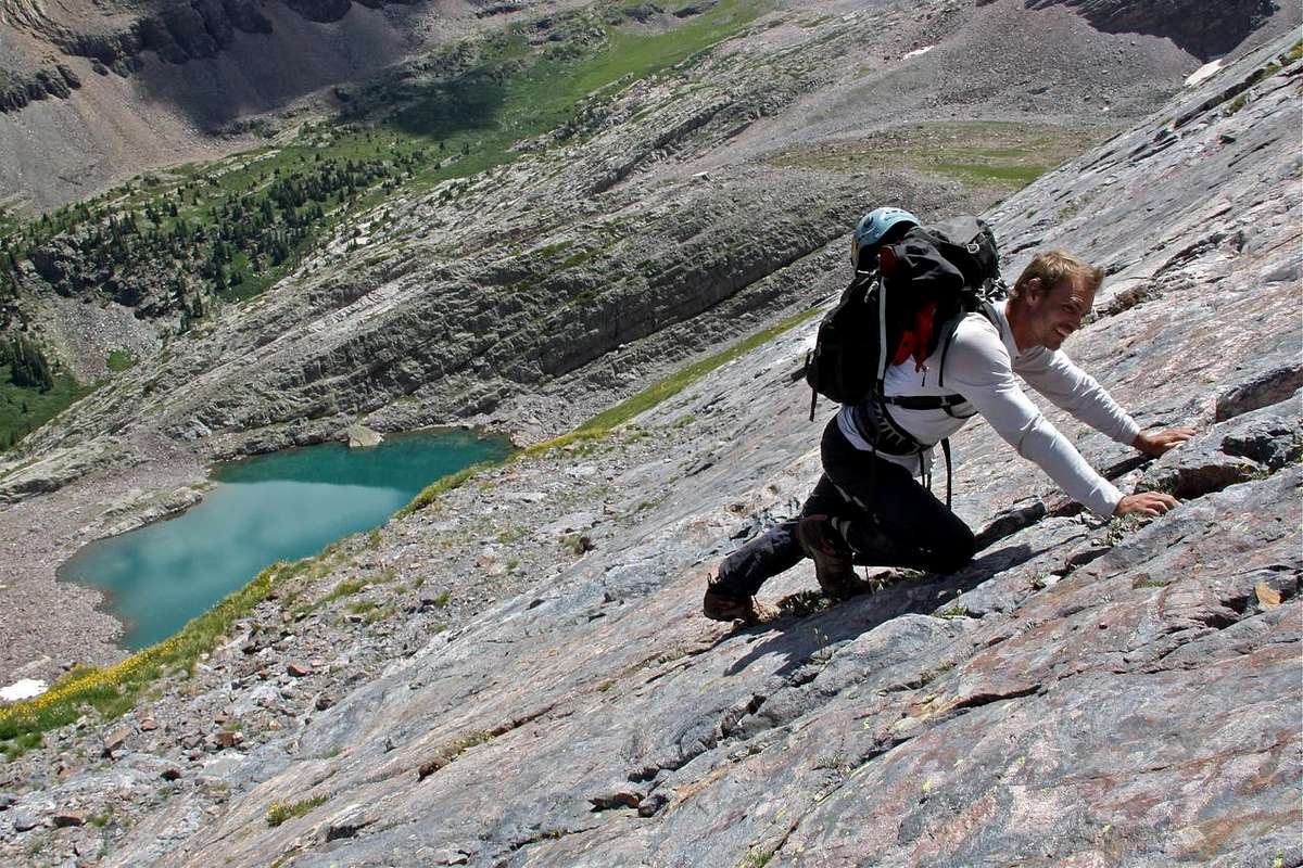
Approaching the false summit
The rock on Wham Ridge is generally pretty good and gear placements are very solid. However, when placing gear in the vertically-running cracks, check to make sure they're not fractured. Some will be slightly moveable. Loose rock becomes more common the higher one climbs, so test ALL holds and gear placements. The southeast couloir route is a loose mess of kitty-litter gravel (think Jagged Peak), rock, and scree. As an ascent route, it is not very exciting. A helmet is definitely recommended for all routes on Vestal Peak.
The "Center Shift" route (alternative to Wham Ridge) which runs up the center of the North Face, finds slightly better rock for longer but eventually, merges with the upper ridge.
External Links
Photo report from July, 2012 by strudolyubov
Trip Report from summer, 2013
"Glass Half-Full" -An EXCELLENT report using the Beartown Approach!
Pine Needle Mountaineering
13ers.com -Sister to 14ers.com
Mountain Project -Wham Ridge
List of peaks inside the Storm King Peak Quadrangle
Durango/Silverton Narrow Gauge Railroad
Topographic Map
View Larger Map
Climbing Pictures
 |
 |
 |
 |
 |
 |
climbermike85 - May 7, 2014 10:38 pm - Hasn't voted
Molas Pass trail drops down 1,700 feet.Correction needed for: "The approach trail follows a large segment of the Colorado Trail (#665) as it winds down the slope (dropping roughly 11,700ft) away from Molas Lake to the southeast." Shouldn't it say the trail drops 1,700 feet and NOT 11,700 feet?
Kiefer - May 8, 2014 9:12 am - Hasn't voted
Re: Molas Pass trail drops down 1,700 feet.WHOA! Thanks for the catch. With a drop of 11,700', I don't think anyone would be using the trail...ever. Thank you! Kiefer
Monster5 - Nov 28, 2017 7:01 pm - Voted 10/10
WinterThere's record of the Harvard Mountaineering club climbing Wham in winter 1968 (Roof of the Rockies). That was a pretty prolific era for HMC (David Roberts, etc).
Kiefer - Nov 28, 2017 9:42 pm - Hasn't voted
Re: WinterThanks, Ryan. I'm starting to update everything I own here. I appreciate this link. Let me look into it and add it to the page. Thanks!