Mount Russell and Mount Carillon
I wish I could claim that I was inspired by a picture, somebody or some story to hike Mount Russell. But I wasn’t. The idea to hike Mount Russell was pure practicality. In my attempt to hike as many 14ers as possible in the week I was going to spend in Eastern Sierra, the research led me to Mount Russell, amongst others. I researched the easiest, non-technical, no-climbing-equipment-required peaks over 14,000 ft. Since class 1 & 2 summits were already on the list, class 3 came in order: Muir, Russell and Middle Palisade. I never made it to Middle Palisade (hopefully in 2015), but I bagged Muir and Russell.
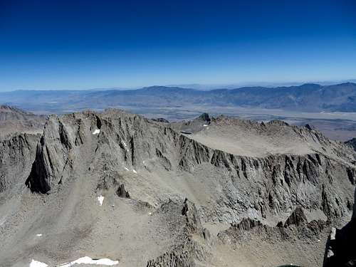
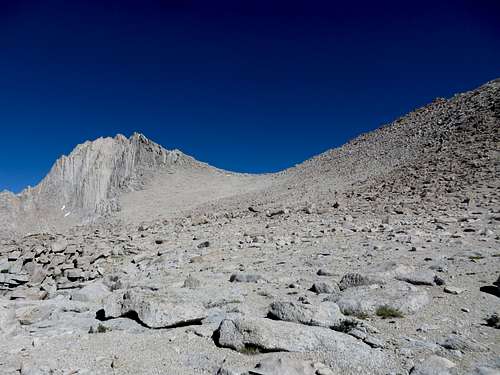
![Mount Russell]() Mount Russell from Mount Whitney
Mount Russell from Mount Whitney
Mount Russell is situated in the Whitney Zone, meaning it requires a day hike or overnight hike permit. The same permit lottery, quota availability, subject to destiny, nerves wracking bureaucracy, applies to getting a permit for Russell as is for Whitney. But, I planed ahead, and I got my hiking permit in April.
To hike to Mount Russell one starts at the Whitney Portal and follows the same trail for about ¾ of a mile. Just before Lone Pine creek crossing, there is a sign NORTH FORK that points to the right. That is also the trail that goes to Mount Whitney on the mountaineer route. The written directions that I followed belong to the Summit Post’s member icecream4breakfast. I had actually a printout with me and I referred to it a few times. It is not a step by step description of the route, but it is a clear, easy to follow account.
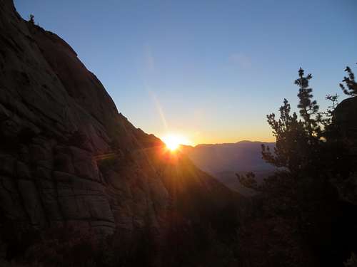
![North Fork on the way to Mt Russell]() North Fork on the way to Mt Russell. Looking back, Mr. Sun said mornin'.
North Fork on the way to Mt Russell. Looking back, Mr. Sun said mornin'.
I left Whitney Portal, the way I always like to start my hikes: at daybreak. At 5:00 AM I nonchalantly left the Portal. On my way to North Fork, I hiked along with an older gentleman that was going up to Whitney, and who was a regular of the area ( he told me he had hiked to Whitney 15 times, with some other attempts when he had to bail out due to bad weather.) One thing he told me, in response to my concern of never having hiked a class 3 mountain like Russell before: “hike smart” – he said. Well, that stayed with me the whole time and acted as a calming medication, especially on the blade of Russell. Going up the Ledges was not bad. I got confused a few times but not nearly as bad as when I descended and I got completely off track. Thank Goodness, it doesn’t take too long to realize you are going in the wrong direction.
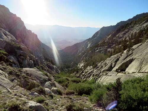
![North Fork on the way to Mt Russell]() North Fork on the way to Mt Russell, looking East. Close to Lower Boy Scout Lake.
North Fork on the way to Mt Russell, looking East. Close to Lower Boy Scout Lake.
Going up to the Lower Boy Scout Lake, the trail is abrupt but clearly defined, with some creek crossings, which don’t present many difficulties. I made it to LBSL at 6:30. I crossed the creek at the Eastern tip of the lake and followed the trail on the left side of it.
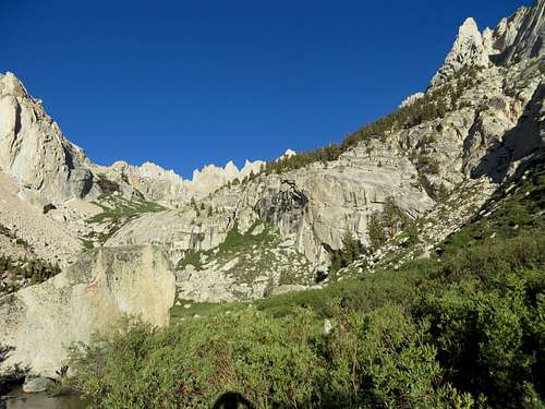
![Trail to Russell]() Trail to Russell - view of the mountaineer route. LBSL is behind of the rock in the foreground.
Trail to Russell - view of the mountaineer route. LBSL is behind of the rock in the foreground. To me it appeared as if there was another trail going up on the right side of the lake, but I am not sure if that goes to the Upper Boy Scout Lake or just runs around the LBSL. I continued on the trail on the left of the lake which shortly gave way to a use trail on rock fall, a little bit harder to follow. There were small cairns here and there that reassured me I was going the right way, but, at one point, I went entirely cross county until I finally made it to UBSL on the long way,ending up at the upper end of the lake (West). Going down at the end of the day I realized the correct way of going up. But such is hiking.
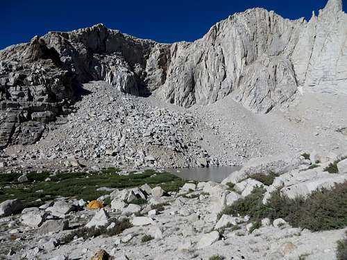
![Upper Boy Scout Lake]() Upper Boy Scout Lake, looking South. View from the bottom of the scree hill.
Upper Boy Scout Lake, looking South. View from the bottom of the scree hill.
I made it to UBSL at 7:45. From there I understand there are two ways of going up to Russell. Either going up on what is called the Rackwell Variation, following a use trail at the West end of the lake or, going up a scree hill at the East end of the lake. Some guy in Lone Pine told me he went up by the trail at the West since, although more technical, doesn’t have the hardship of hiking up on scree. I decided that, since until that point, I had followed the description of icecream4breakfast, I should continue that way. I went up the scree hill.
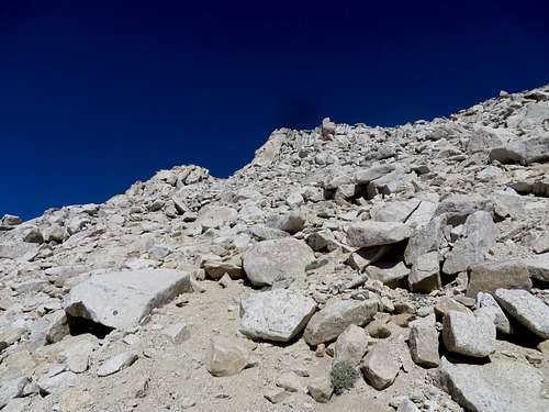
![Scree hill]() Scree hill from 2/3 up.
Scree hill from 2/3 up.
As everybody that hiked this hill can attest, it is a bit of a hassle. There is no diffined trail going up the scree hill. There are a lot of footsteps, but they are made by the people going down, so I decided to just go up according to my judgment. I tried as much as possible to step on solid rocks in order to avoid sliding back half a foot for every foot I was going up. I was successful for the most part. Near the top of the hill I should have kept toward the center but I didn’t. It appeared to me that to the left of the top of the scree hill was an easier, more manageable route. I took that one and I ended up on a class 3 climb. Not too bad but it had a bit of exposure and it took me by surprise. Anyway, the climb was short and I made it to the top.
![Scree hill]() Scree hill looking up. I went for the notch to the left. I should have gonne toward the center of the saddle.
Scree hill looking up. I went for the notch to the left. I should have gonne toward the center of the saddle.
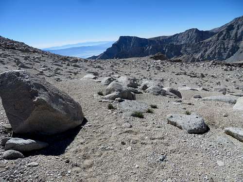
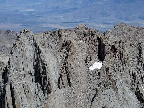
![Scree hill]() The plateau between the scree hill and Russell. The saddle in the middle is the top of the scree hill. I popped up to the right of the saddle, where the darker rocks are, just a bit of center.
The plateau between the scree hill and Russell. The saddle in the middle is the top of the scree hill. I popped up to the right of the saddle, where the darker rocks are, just a bit of center.Looking back, I saw the logical way I should have gone up; I should have aimed for the center. From there, it’s just a nice walk to the saddle between Russell and Carillon (I read somewhere the saddle being called “Pass” but it does not look like a pass to me) and the base of Mount Russell.
![Mt Russell from the top of the scree hill]() Mt Russell and the saddle from the top of the scree hill
Mt Russell and the saddle from the top of the scree hill
At 9 AM I was already pass the scree hill and I had Mount Russell in full sight. At 9:15 I started my ascent. The first serious move was scary indeed. I remember icecream4breakfast mentioning it: a slide around a rock with a huge drop underneath, with nowhere to get a solid footing. The entire weight of the body was supported by the hands in a sumo squat like position. That was scary. However, in retrospect, it had to be another way going up than that, because coming down, I did not make that move again. Anyway, I kept telling myself “hike smart” although it was quite a few times that I almost hit my head against the rocks above me, which I did not see climbing up. My concern was not with hitting my head, since I was not really moving very fast, but rather hitting my head and losing balance for a split second: that would have been the end. Going up, I climbed a few times to dead ends, and I had to go back and try a different route.
![Mt Russell]() Mt Russell - I got to this rock and had to go back. There was no way around it.
Mt Russell - I got to this rock and had to go back. There was no way around it.At one point, I got to this summit which I thought was the East Ridge. I continued my climb to what I thought was the West Ridge which is a very nice, manageable, vertical climb with little exposure. When I got to the top I saw the real West Ridge and my heart dropped. I was only on the East Ridge.
![Mt Russell]()
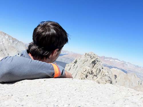
From East summit looking at West summit.
It took me 30 minutes to get to the West Summit. Now, everywhere I read, it said that the East Ridge is the highest point. Looking to West Ridge it appeared to me that it was higher than East Ridge. I continued to the West Ridge. This traverse seems easier compared to the climb so far. Also, the exposure is not as bad.
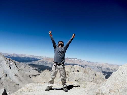
![Mount Russell]() Mount Russell - yes I did! I dreamed of this moment for eight months.
Mount Russell - yes I did! I dreamed of this moment for eight months.
I got to the West Ridge at 10:55 AM. That is almost 6 hours since I left the Portal. I looked around and I was finally able to enjoy and relax: the day was beautiful, almost no wind, temperature just right. Well, I was almost able to relax, since I kept thinking that I had to also get down from this mighty summit. But, I signed the log (which is on the West Ridge), I took pictures, looked around and headed back. All that in exactly 7 minutes! I guess I don’t have much interest in relaxation.
![Mount Russell]() Mount Russell - West summit to the left, East in the center-right of the pic. The hiking trail is on the other side of the ridge.
Mount Russell - West summit to the left, East in the center-right of the pic. The hiking trail is on the other side of the ridge.
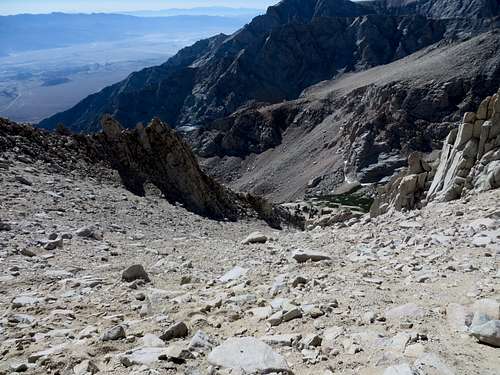
![Mt Whitney]() People on Mt Whitney. I was there three days ago.
People on Mt Whitney. I was there three days ago.I headed back down, this time being more mindful of my descent. Going down, I was able to avoid some risky moves I did going up. Once I cleared the main part of the blade, I thank God for protecting me and I decided to go up to Carillon. Since I was there and it was only noon - the weather was great and I was in good spirits - why not bag a 13,553 ft peak?
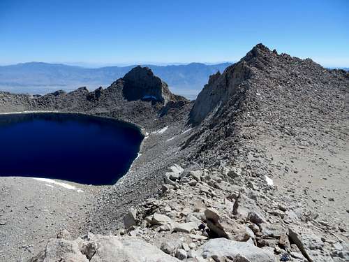
![Mount Carillon]() Mount Carillon. Tulainyo Lake to the left.
Mount Carillon. Tulainyo Lake to the left.
Going up to Carillon is not a big deal. I was very surprised to notice that, although Russell and Carillon are so close to each other, the rocks these two mountains are made of are very different. Russell is made of granite, sharp rocks, while Carillon is made of round, pressed sand-like rocks. Up on Carillon there are beautiful views of Russell, Whitney and Owens Valley. Also, since Carillon has a direct view of Lone Pine, I had a little bit of cell phone reception, so I was able to tell my family I was safe and sound. I signed the climbers log on Carillon and I headed down.
![Mount Carillon]() This big rock is the Top of Mount Carillon. Mt Russell in the background.
This big rock is the Top of Mount Carillon. Mt Russell in the background.
Once down from the summit I stopped and pulled out my secret weapon: gaiters. Everybody was talking about the scree hill so I came prepared with gaiters. I did not want to stop every 3 three minutes to clean my shoes. I have to admit that this was a smart move. I practically flew down that scree hill. Well, actually more like skated down. It was beautiful, so easy and worry-free. It took me 8 minutes to get down that hill. From the UBSL, I continued down the correct trail this time. Easier to see going downhill I guess. I finished my water here and I reloaded from the creek. Approaching LBSL I ran into the first person all day. He was a climber and was going with his girlfriend to UBSL planning to climb Whitney on East face. He had done it before, so I guess, he knew pretty well what he was doing. I talked to him for a while but the girlfriend never showed up. I saw her, eventually, trying to find her way up on the same use trail that I had tried earlier that day.
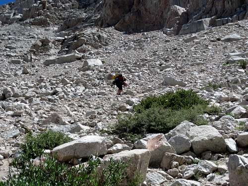
![North Fork Trail]() Hiker girl strugling on North Fork Trail.
Hiker girl strugling on North Fork Trail.
Once at the LBSL, I turned towards the Ledges which gave me a lot of headaches going down. At one point I continued on what I thought was the trail until I hit a dead end. Boy I was upset, since I had to go up from there for a little while and going up was the last thing I wanted to do. But, I had no choice other than going up and finding my correct way down. I finished my water again so, I got water from the Lone Pine creek, which I had no courage to drink it as such, so I treated it with iodine. I finally made it down to the Portal at 3:45 PM. Not bad for a city boy hiking Russell and Carillon as a day hike. I like solo hiking but sometimes I wish I had a partner. Maybe I should have an osprey taimed and trained to hike with me. That would be cool.
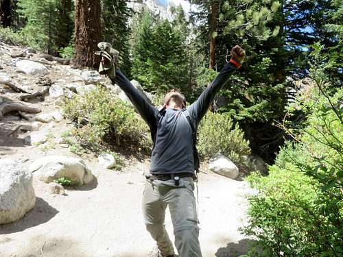
![Mount Russell]()
Theatrical finish! (Actually I was genuinely happy to be back safe)
Mount Russell was my 4th summit in 6 days so, by this time, I was very well acclimatized; altitude sickness didn’t bother me at this point. This was also my 4th summit over 14,000 ft.
Comments
No comments posted yet.