
-
 2280 Hits
-
 77.48% Score
-
 8 Votes
|
|
Mountain/Rock |
|---|---|
|
|
46.58717°N / 12.89696°E |
|
|
Hiking, Skiing |
|
|
Spring, Summer, Fall, Winter |
|
|
7165 ft / 2184 m |
|
|
Overview
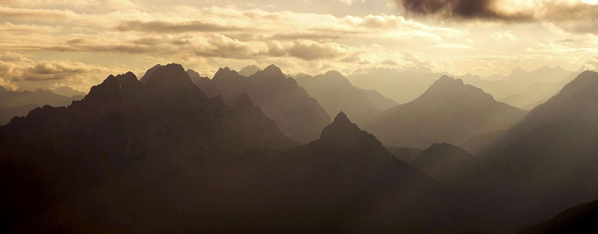

By itself, it is so unimportant mountain this Monte Floriz! It can hardly become the main goal of a tour. But if you are spending a night in the nearby Marinelli hut, it is an absolute sin not to observe a sunset from the summit of Monte Floriz!
The name of the mountain is of a quite obvious etymology. Southeast of the summit there were once two alpine pastures: Casera Floriz bassa (lower) and Casera Floriz alta (higher). In Furlani language the word means the place, abundant with flowers, which refers to the alpine meadows.
As elsewhere in Carnic Alps, the area is also interesting by its geology. The main ridge of Monte Coglians / Hohe Warte is made of mostly brittle Devonian (paleozoic) limestone, placed on carboniferous clay and shale layers. But south of the main crest the picture changes abruptly. The rounded, grassy summits of the Crostis group, where also Monte Floriz belongs, are made of carboniferous schists and sandstones, and on several places volcanic protrusions can be found (similarly as on Monte Dimon, further to the east).
So, Monte Floriz rises in the ridge, which connects in the north-south direction the range of Monte Coglians / Hohe Warte with the range of Monte Crostis. The northernmost notch is Forcella Monumenz, 2326 m, south of it Piz Chiadin rises (2302 m). Southeast of it is Forcella Morareet, 2122 m, hosting the famous Marinelli hut. Then the Point 2169 m comes, another notch with a small pond just east of it and above it Monte Floriz. Further towards the south the ridge lowers on Forcella Plumbs, 1976 m, on which our ridge orthogonally connects to the ridge of Monte Crostis.
When said that hardly anyone will choose Monte Floriz as the main goal of a tour, this may not be true for mountain bikers. For them the main goal is Rif. Marinelli, but usually not being equipped for higher mountains, may extend the tour also on this nearby summit.
Summit Views
Towards the south the views are obscured by the quite unattractive, long ridge of Monte Crostis. The whole northern side is blocked by the most impressive, high, rocky barrier of Monte Coglians / Hohe Warte massif. On those summits and walls you can see every detail. Towards the east and west the views are mostly opened. To the east you see the remaining high summits of the Carnic Alps Main Crest, some summits of the Southern Carnic Alps and already quite in the distance the giants of Julian Alps. Towards the west and southwest the most impressive is the view on Pesarina Dolomites and behind them many other high Carnic summits and 'true' Dolomites.
 M. Crostis M. Crostis |
 Western views Western views |
 Towards the N Towards the N |
 Carnic Alps Carnic Alps |
Getting There
The approaches to Monte Floriz are mostly the same as for Rifugio Marinelli.
- On the west you can start the tour on the big parking place near Rif. Tolazzi, 1350 m. You get there through the village of Collina. Good 2 h to the hut.
- On the east you can start the tour either on Passo del Monte Croce Carnico / Ploecken Pass (see the route description here), 1360 m, or lower on the road towards Timau. Perhaps you can drive by car even up to Casera Val di Collina, 1445 m. Some 2 h 30 min to the hut.
- I guess there are very rare visitors who would start the tour on the south in Ravascletto, 963 m, or drive from there northwards towards the ridge of Monte Crostis.
The Route from Rif. Marinelli
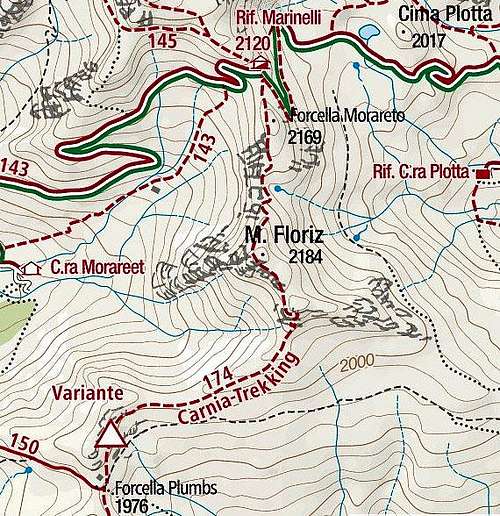

From M. Floriz towards Rif. Marinelli
It hardly needs any description. From the hut you cross the Morareet saddle and ascend those good 40 meters till below the nearby ridge bump. As it gets a bit sharp, the marked path crosses it by the western slopes. There some care is needed when walking. Then the path descends in a few zig-zags on the next saddle, where the final ascent starts. Some more switchbacks go by the northern ridge, finally the path goes a few meters below the summit and you go over a pathless, grassy slope on top. 30 min from the hut, an easy hike of T2 difficulty.
Mountain Huts

Rif. Marinelli, 2122 m. A very popular mountain hut, reachable in 2 h from the west and 2 h 30 min from the east.