I have mixed feelings about the Colorado 14ers phenomenon. It’s great that the peak-bagging craze has stimulated lots of people to spend time in, and to appreciate, the mountains. But, at the same time, I think it’s a pity to introduce a competitive box-checking mentality into an activity that should, for me at least, be primarily about the aesthetics of what you’re doing — about challenging yourself in a beautiful, wild place and about engaging fully with every aspect of that environment. Because the 14ers are so popular, they tend to be crowded, which, selfishly, I suppose, is not how I like my mountains. One of the reasons I for one go to the mountains, after all, is to escape my fellow human beings. But there’s a silver lining to this: because the 14-ers serve so effectively as hiker magnets, every other peak is wonderfully neglected. One of my favourite of Colorado’s mountains is the Sawatch Grizzly Peak, which, at 13,988’, is Colorado’s highest non-14er; because of those missing 12 feet, you can be pretty sure, even in high season, that you won’t meet a soul all day.
Another advantage of 14er popularity is the wealth of available information about them — access, routes, etc. There’s Roach, SP itself, 14ers.com, and no end of personal website/blog posts on any and all of the peaks. This can be very useful. There are parts of Colorado I know well — primarily the Sawatch and the Elks — and there I frankly don’t need much guidance on where and what to climb: I know the back roads (and whether or not they’re negotiable in my rental de jour) and I know the best points of access (i.e. the trails that will get me up to above tree-line which is where I can then ungratefully forsake them). But when I’m in other parts of Colorado, I’m much more dependent on published sources of information, and this is where 14ers are useful: tons of easily accessible information so no need to spend hours trying to dig up beta of questionable reliability. This summer, when I had a few days in the San Juans with my daughter Megan, 18, then, we would think “14-er.”
At considerable risk of massively over-generalizing, I would say that a feature of 14er-ing is a “there and back” mentality. Because the focus is on bagging the peak, all that matters is getting up it and down it. Why complicate things? But what a lost opportunity! It’s almost always a more fulfilling experience to traverse a peak (i.e. go up one way, down a different one), and I would claim (perhaps rather pretentiously) that it’s the way a mountain should be experienced. For me the greatest climb on Everest was not Hillary and Tenzing’s or Messner’s extraordinary solo effort, it was the Hornbein-Unsoeld 1963 climb which saw them ascending via the West ridge and descending via the South Summit. Maybe it sounds foolishly new-agey, but my feeling is that a traverse shows more respect to the mountain — you’ve not simply come and gone via the easiest route — and it also inevitably exposes you to multiple aspects of a mountain’s character (not to mention multiple vistas). The plan for our three days based in Lake City, then, was to explore some of the local San Juan 14ers, but with an eye to turning each summit into something more than just a 14er.
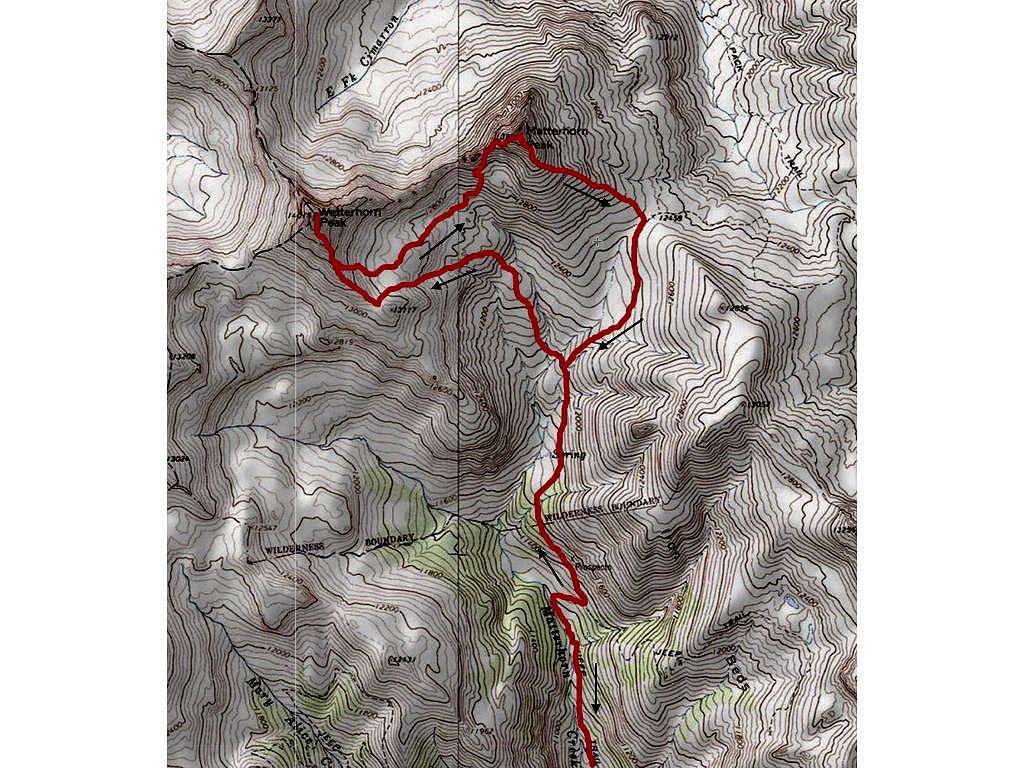
1. Wetterhorn Peak
![Wetterhorn Pk Map]() Wetterhorn Pk Map
Wetterhorn Pk Map
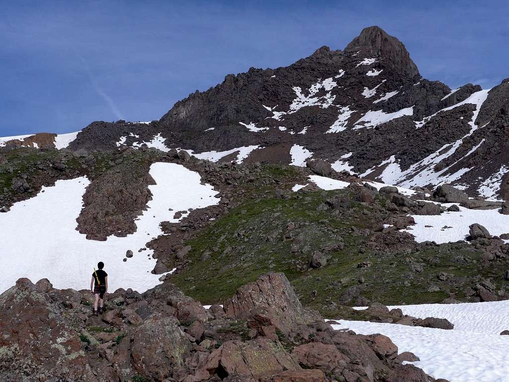
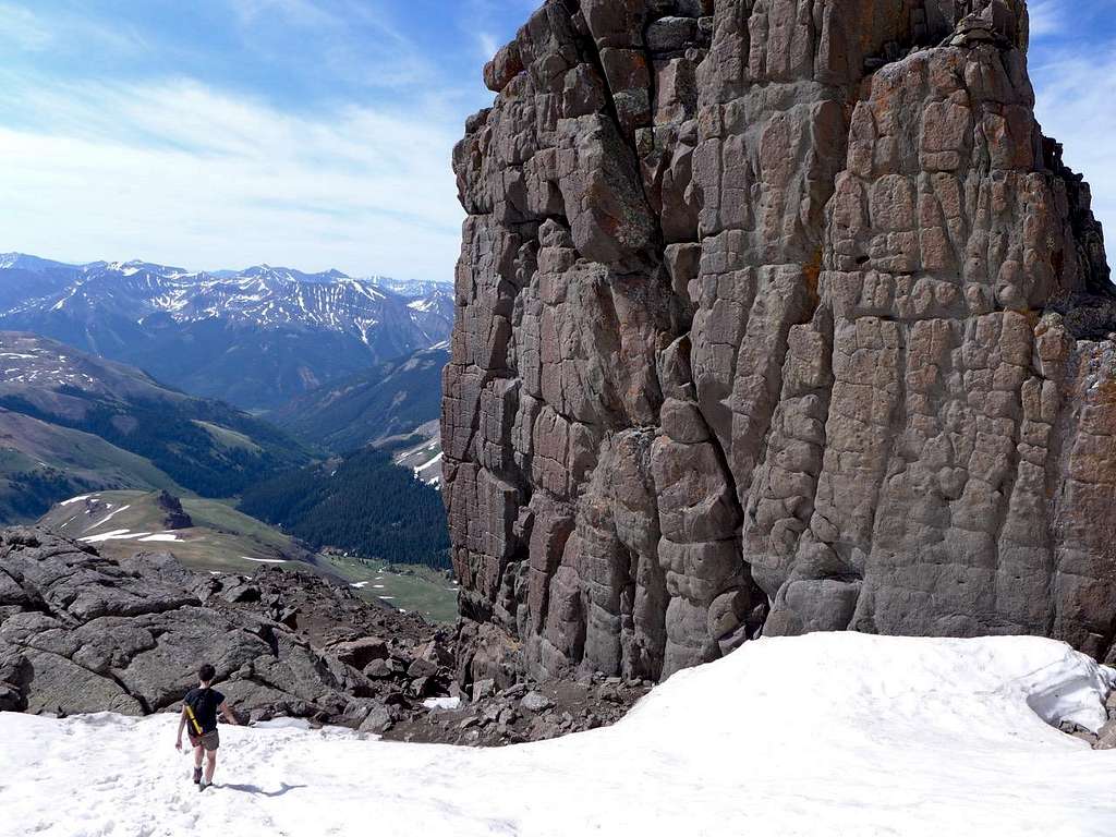
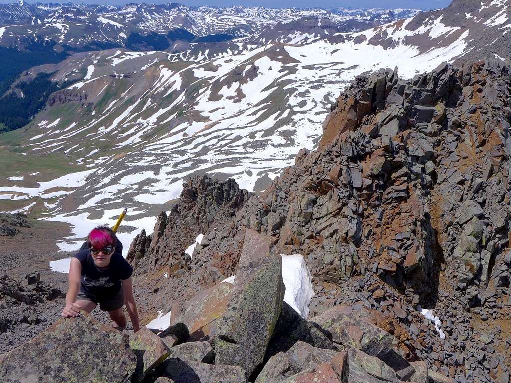
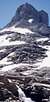
Given my peak-traversing plan, this was not, I admit, the best place to start. Sticking up a bit like a gigantic tooth, Wetterhorn Peak (14,015’) is only readily accessible by a single route, via its southeast ridge (and that is Class 3 with some mild exposure). There’s a snow route on the east face, and Roach also suggests that you can go from the E-W running ridge connecting Wetterhorn Pk to its neighbor, Matterhorn Pk (13,590’). Both mountains were named in reference to their namesakes in the European Alps. With all due respect to the conscientious cartographers of the Hayden Survey (1874), I reckon there was a fair bit of wishful thinking going on when they did this. Yes, the Colorado Wetterhorn is dramatic from some angles, but, a propos Matterhorn Peak, it would definitely be a mistake to exchange your travel plans for a visit to Zermatt, at the foot of the original, for the delights of Lake City and vicinity. [Not that Lake City doesn’t have lots of things going for it; it’s just that what is arguably the most dramatic mountain view in the world isn’t one of them]. Roach refers to the full ridge traverse between the Wetterhorn and Matterhorn Peaks as “arduous”, with loose rock and Class 4 to look forward to, and I hunted up some trip reports on the route that confirmed this assessment. Probably not. The plan was to follow the standard (SE ridge) route up the Wetterhorn Peak, descend to the basin below the Wetterhorn-Matterhorn ridge and find a way up Matterhorn Peak that was simultaneously safe and practical, and minimized altitude loss. The standard route up Matterhorn Peak is via the S ridge (basically a broad shoulder until you get close to the top), and I presumed we would probably end up cutting up from the Wetterhorn-Matterhorn basin to join the S ridge somewhere not too far below the summit.
![Wetterhorn Pk Approach]() Wetterhorn Pk Approach
Wetterhorn Pk Approach
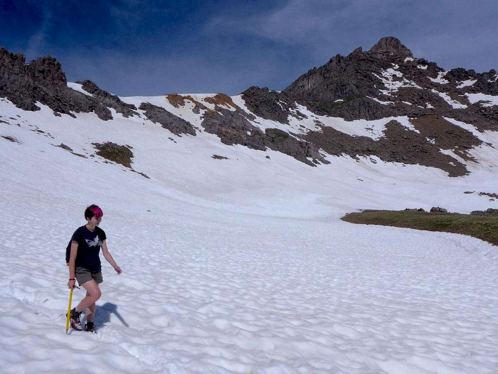
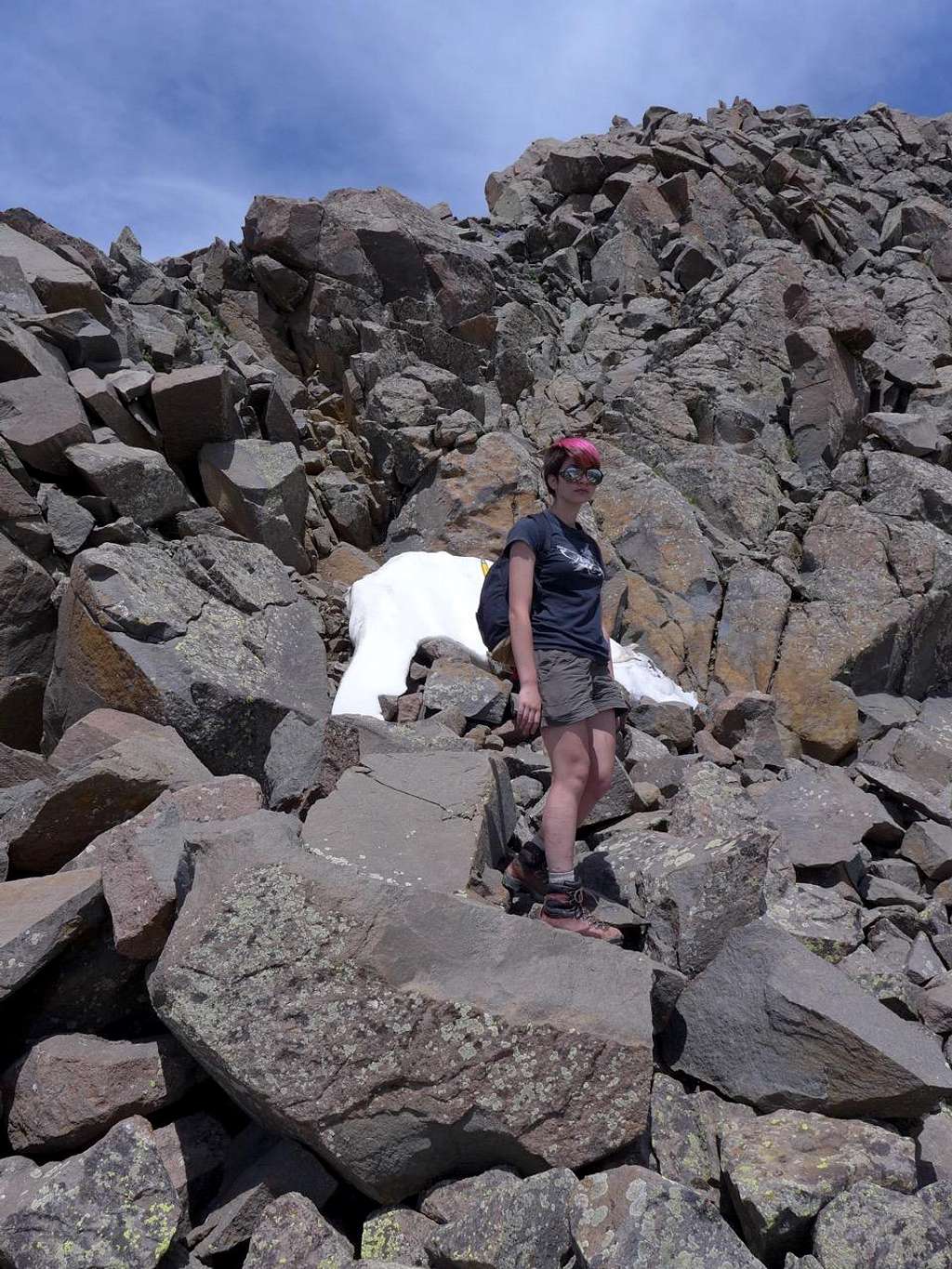
July 1. A gorgeous morning as it almost always is in Colorado. I grew up hiking in the Scottish hills, where horizontal rain and low cloud are, well, expected, so I have a special and powerful appreciation of the wonders of Colorado weather. The first part of the drive out of Lake City wasn’t too bad, but the final phase of 4WD road to the Matterhorn Creek TH (10,720’) was brutal. It puzzles me that there are people who enjoy driving these roads. A handful of cars at the TH, but it was clear that this wasn’t going to be one of those swarming-crowds 14-er experiences. In fact, we met a grand total of three people (in two parties) in the course of the whole day, so my whining, in this instance, about the 14er crowds was hardly warranted. It had been a late snow season in Colorado, and there was still plenty around. The approach is lovely: snow, blue sky, and the Wetterhorn tooth in view. Megan, for reasons best known to her, doesn’t like the hassle of gaiters, preferring it seems to let her boots fill with cold wet soft snow. To start with, however, the snow was hard enough and easy to cross.
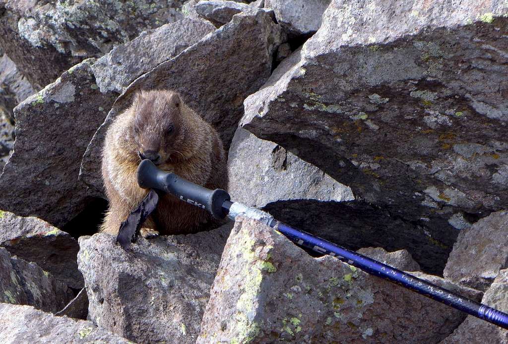
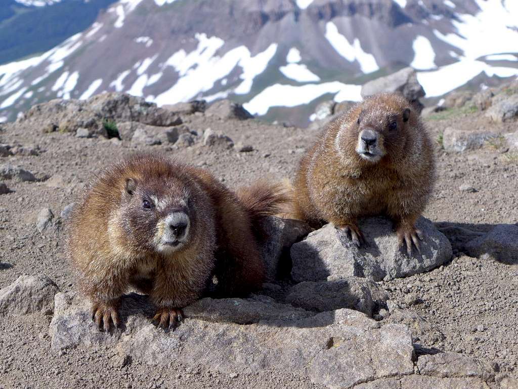
Shortly after the route joins the SE ridge proper, things get a little steeper and it’s a matter of either scrambling over lumpy towers to stay close to the ridge crest or of dropping down W to bypass the obstacles and then working your way back up to the ridge crest in well trodden gullies blessed with a plethora of confusing cairns. Here we encountered the first of the day’s many marmots. Someone ahead of us (we occasionally glimpsed them on the rocks above us) had ditched their trekking poles beside the trail, presumably because these things are basically an encumbrance when you’re on rock. Mr Marmot perceived this as a gift from the mountain gods, and was cheerfully chewing through the webbing loops on the handles, presumably because he (or she?) appreciated the accumulated salt derived from dozens of sweaty past hikes. Lovely. I wrestled the pole from the resentful marmot and found a spot in the snow where I could park them upright in the hope that this would defeat Mr Marmot’s plans.
![Greedy, destructive marmot]() Greedy, destructive marmot
Greedy, destructive marmot
I suppose this is one advantage of there-&-backing: you can deposit unwanted bits of kit for pick up on the way back. No doubt this possibility is a source of never-ending delight to the marmot inhabitants of 14ers. Something similar to this once happened to me on a non-14er. On the Lackawanna-Casco Peak-French Mountain traverse in the Sawatch (close to Mounts Elbert and Massive), I left my pack on an intermediate top, Frasco Benchmark, before going on to French. When I got back from French, I found two marmots trying to chew their way into my pack. Unlike Mr Marmot here on Wetterhorn, these guys were properly jumpy when approached by a large potentially predatory mammal like me (I presume that 14er marmots are much more human-habituated than their colleagues on less frequented peaks), and duly skedaddled. However, they had left their mark, in the form of a significant volume of pungent urine. I’m not sure whether this was precipitated by my scary appearance (i.e. they literally wet themselves — well, wet my pack) or by some territorial marking imperative. Either way, my pack stank strongly of marmot. As soon as I got down into the Lackawanna drainage, I washed it as well as I could in cold creek water. But marmot urine is powerful stuff, and I must have provided a curious mismatch to animal onlookers as I made my down through the forest: he really doesn’t look like a marmot but, boy, does he smell like one. I did occur to me, as I stumbled trail-less and alone through steep forest, that a bear might choose to privilege its olfactory analysis over its visual one. Happily, though, that didn’t happen.
![From the top of Wetterhorn Pk]() From the top of Wetterhorn Pk
From the top of Wetterhorn Pk
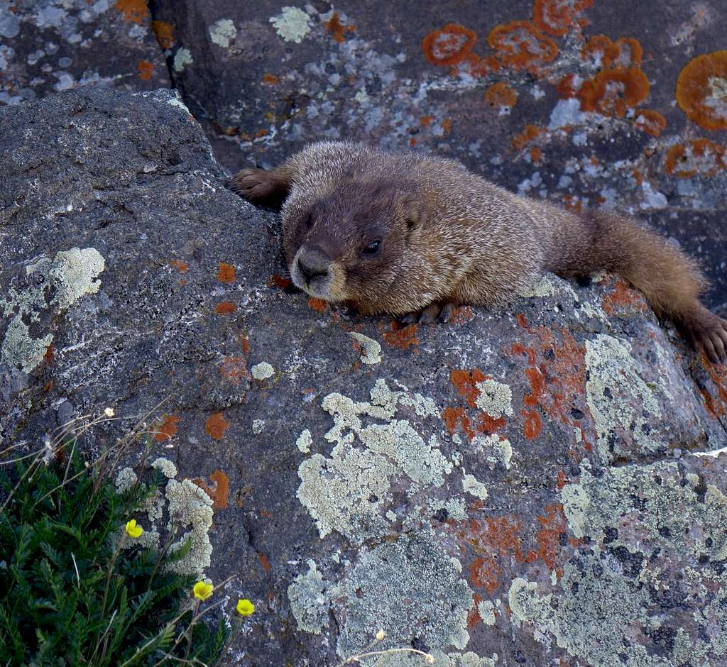
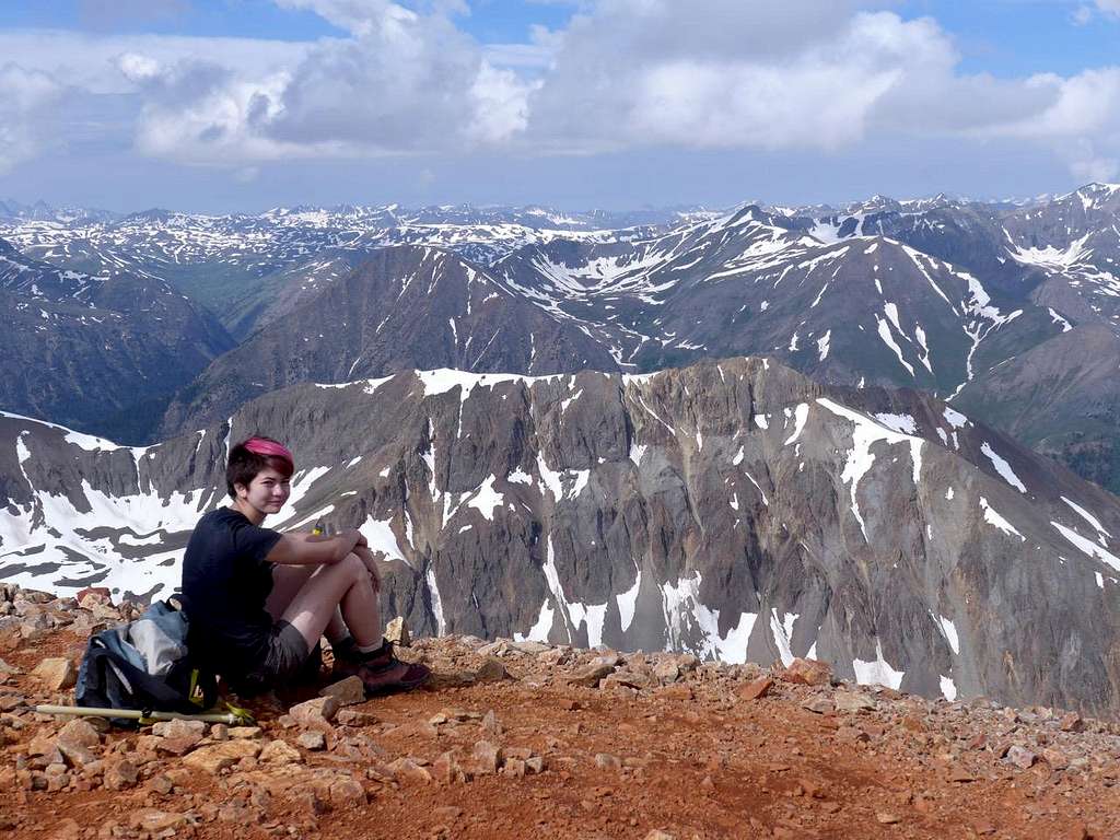
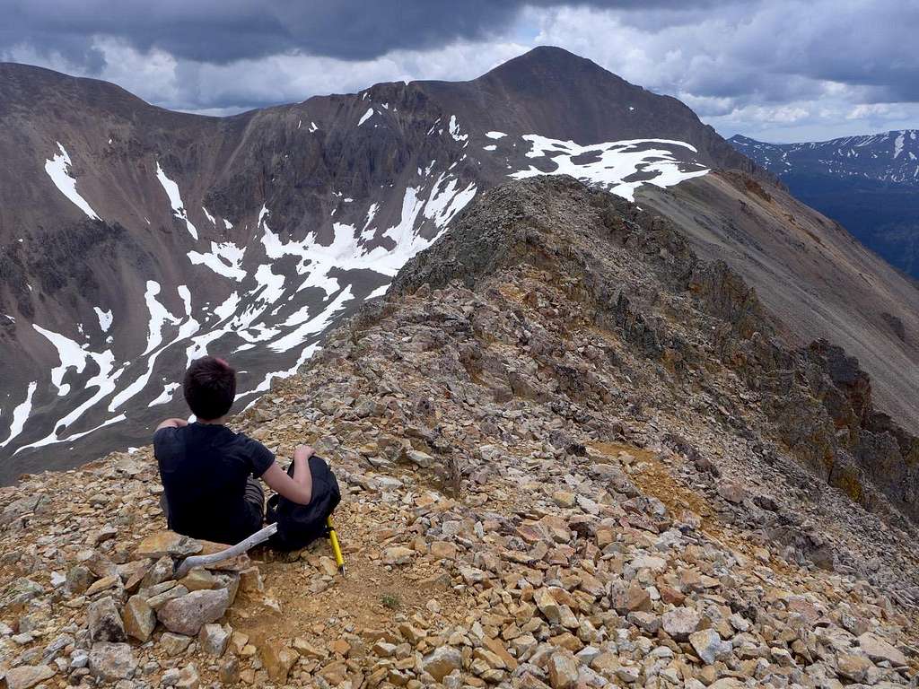
Because I’m scared of heights (Megan has not inherited this trait), I was mildly apprehensive about the final pitch to the summit of Wetterhorn Pk, which is billed as something of a scramble and having some exposure. Indeed, the hike is written up by SP as “a great “step up” peak for people as they move from the “walk up” fourteeners to the harder ones.” Turned out, however, to be perfectly straight forward — that familiar outcome when a perceived obstacle is far more difficult in prospect in one’s neurotic imaginings than it is in reality — and Wetterhorn Pk was ours. Well, it belonged at that moment to us and to a pair of give-us-your-lunch marmots. Gangster marmots. Too early for lunch, sorry.
![Gangster Marmots]() Gangster Marmots
Gangster Marmots
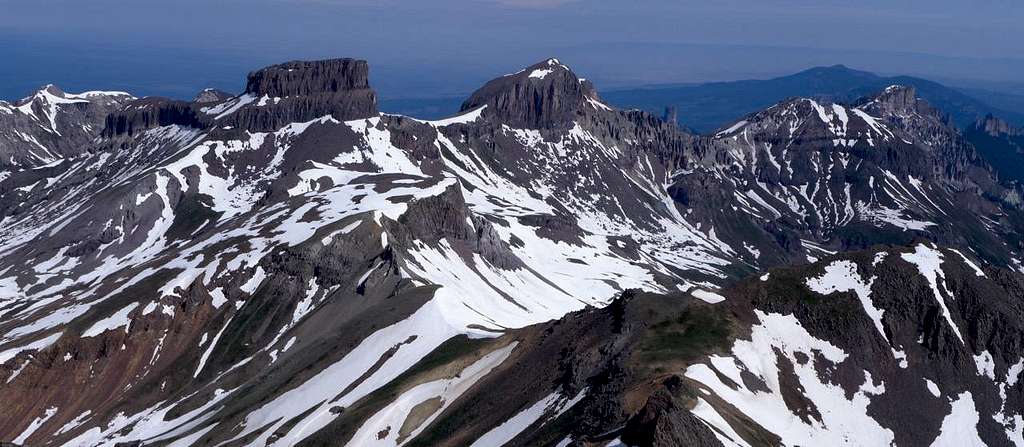
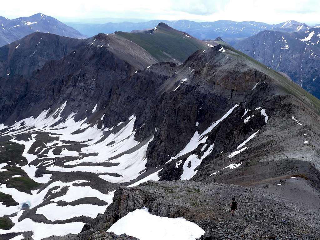
We admired the geomorphological freak show that is the San Juans. Coxcomb Mountain, for example — whose idea was that? And we peered over the edge of the daunting sheer N face, that wraps itself around more than just the N side of the peak. With that drop off, there was no true traverse to be done, sad to say. We headed down the way we had come up, down the SE ridge, to a point close to where we had met Trekking Pole Marmot (the poles were gone. Presumably we had missed their owner somewhere in the jumble of crags and gullies between this point and the final summit pitch).
![Wetterhorn Pk, the Prow]() Wetterhorn Pk, the Prow
Wetterhorn Pk, the Prow
![S E Ridge, gullies to avoid towers]() S E Ridge, gullies to avoid towers
S E Ridge, gullies to avoid towers
![It's hard work being a marmot]() It's hard work being a marmot
It's hard work being a marmot
From here, we peeled off E and dropped directly into the Wetterhorn-Matterhorn basin down steep snow slopes. The sun had done its work, and the snow was soft and occasionally treacherous (i.e. we would suddenly plunge in up to our thighs, coming to an abrupt and uncomfortable halt), but, regardless, nothing beats a speedy snow descent.
![Snow descent 1 July 15]() Snow descent 1 July 15
Snow descent 1 July 15
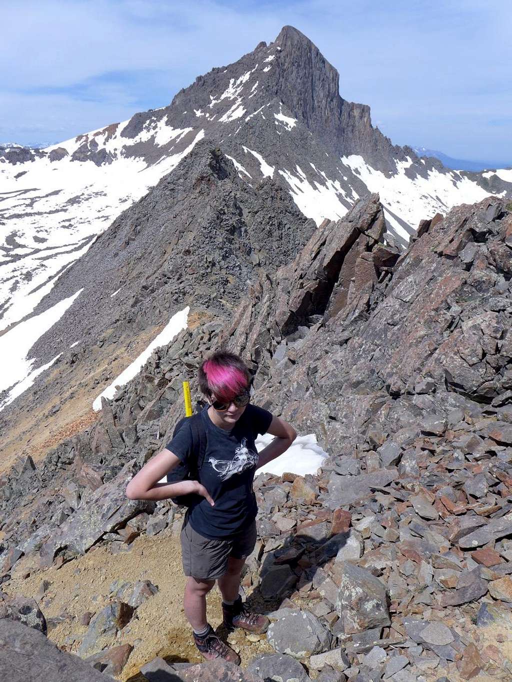
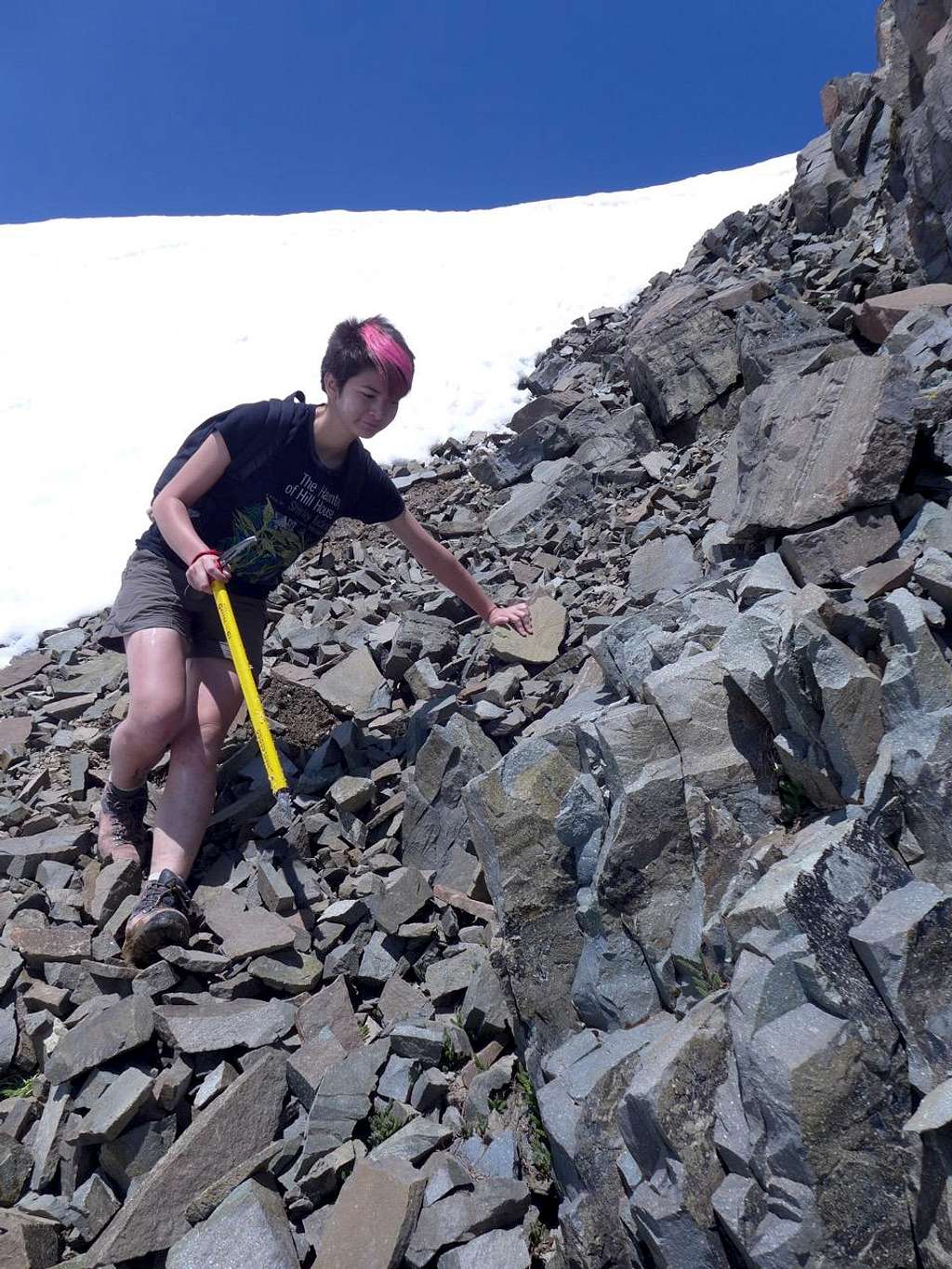
We contoured E, trying to minimize our altitude loss. On the way in, I had sized up what looked like a viable route up the W side of Matterhorn Pk’s S ridge via a combination of talus and a steep grassy ramp. But, as we headed in that general direction, other alternatives revealed themselves. OK, so we’ve not done a traverse of Wetterhorn Peak; at least we could have a crack at doing one on Matterhorn Peak. (If, as I thought we would, we picked up Matterhorn Pk’s S ridge for the final part of the ascent, we’d be arriving at the summit via the same route we would be taking down). Close to the low point of the Wetterhorn-Matterhorn ridge, we headed steeply up on lousy loose scree to join the ridge. From there it was simply a matter of following the ridge E to the top of Matterhorn Pk. Not completely straight forward, this. Some awkward towers that had to be sidestepped on slide-y, somewhat exposed, loose ledges. Not difficult, but it required care, especially as everything was so loose. Helmets? Idiot that I am, I had left these in the back of the car. I had not anticipated needing them today.
![Wetterhorn-Matterhorn Ridge]() Wetterhorn-Matterhorn Ridge
Wetterhorn-Matterhorn Ridge
![Wetterhorn-Matterhorn Ridge]() Wetterhorn-Matterhorn Ridge
Wetterhorn-Matterhorn Ridge
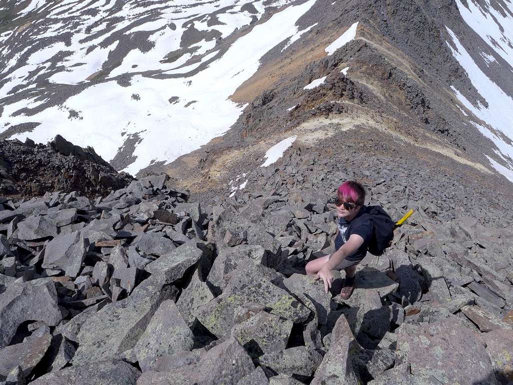
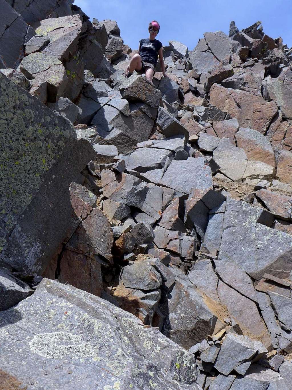
The final tower before the summit was the most awkward. It didn’t occur to me to try to go round it because, confused, I thought this was the summit. Eventually we found ourselves on top of a vertiginous choss pile, looking over and up to the actual summit not far away, but with a significant (and steep) notch between us and it. Nothing for it, but to scramble down into the notch. I went first, taking, it seemed, half the mountain with me. Horribly loose stuff, all of it. We should be wearing helmets! Once I was out of the way, Megan followed me, elegantly and much less destructively. And then we were on top of Matterhorn Peak.
![Descending a loose tower]() Descending a loose tower
Descending a loose tower
![Close to the top of Matterhorn Pk]() Close to the top of Matterhorn Pk
Close to the top of Matterhorn Pk
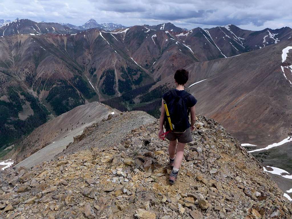
Lunch and not a hungry marmot to be seen. We headed down the ‘standard’ route, down the shoulder a little E of S. For part of this, the great bulk of Uncompahgre provided the back drop. I’d hiked it via the standard (Nellie Creek) route previously, but Megan has not. Getting into the very 14er peak bagging mindset that I’ve just dissed, we discussed whether it was worth extending our day (substantially) to include it. Tempting — it’s always a pity to go back down when you’re high and there is more to be done, and approaching the mountain from this side would be new to me — but the weather was looking a little dodgy. It would be a pity to go all the way over there only to be driven back by thunderstorms. We settled for the twofer and headed down. Probably a wise decision: there was plenty of electrical storm activity in and around Lake City over the second half of the afternoon.
![Descending Matterhorn Pk, standard S ridge route]() Descending Matterhorn Pk, standard S ridge route
Descending Matterhorn Pk, standard S ridge route
![Uncompahgre viewed from the descent of Matterhorn Pk]() Uncompahgre viewed from the descent of Matterhorn Pk
Uncompahgre viewed from the descent of Matterhorn Pk
A good feeling. Matterhorn Pk had been much more fun than I’d expected, and it me gave my summit traverse for the day. But good feelings are, as we all know, just an invitation for something to go wrong. Puncture! Not far down the road from the TH. Ultimately my fault I suppose: a Denver rental on regular road tyres, and we’d already done a fair bit of fairly serious 4 WD-roading in it. I replaced the wheel with the nasty high pressure “donut” wheel provided and we limped the 12 miles or so back to Lake City, all the time hoping that that the feeble donut wouldn’t protest at being exposed to rutted dirt roads by exploding. Happily, it hung in there. And the wonderfully helpful
Rene’s Garage in Lake City fixed the original that same afternoon.
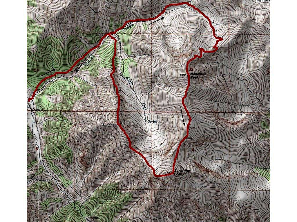
2. Redcloud and Sunshine
![Map: Silver Ck trail to Redcloud, Sunshine, Sundog]() Map: Silver Ck trail to Redcloud, Sunshine, Sundog
Map: Silver Ck trail to Redcloud, Sunshine, Sundog
July 2. The road out of Lake City to the Silver Ck TH (10,400’) is OK, certainly not as bad as the bad bits of the road to the Matterhorn Ck TH, but, regardless, yesterday’s lesson had been learned and it was a rather less cavalier piece of driving that got us early morning to the Red Cloud-Sunshine TH. Again, not too many vehicles, suggesting there shouldn’t be too much traffic on the hills. In the end, I think we met one person all day.
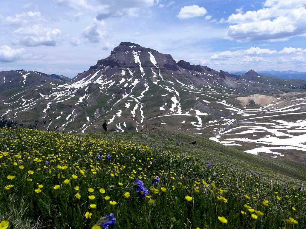
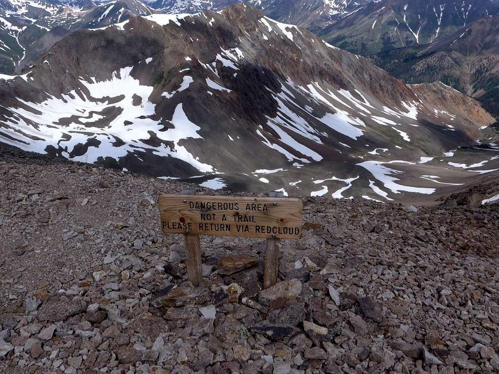
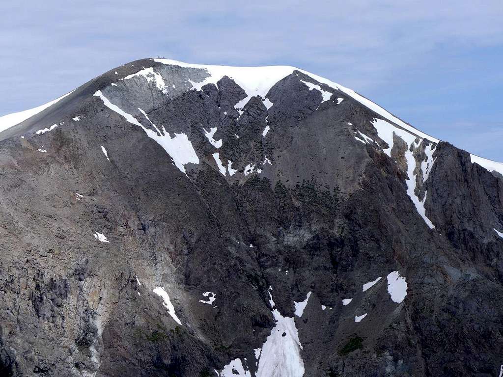
This pair must be among the least sexy of all 14ers: lumpish, and generally (in my opinion) undistinguished, neither of them is the kind of hill that sets pulses racing. Even Roach, who’s very properly obliged to say something nice about all the mountains he’s writing about, is kind of stuck: “These peaks are in the San Juans! This alone recommends them.” He mentions that, at 14,001’, Sunshine is the lowest 14er. “But even the lowest Fourteener needs to be climbed!” OK. The standard route involves following the Silver Ck valley up to the col between Redcloud (14,034’) and Pt 13,561 to the NE of Redcloud, followed by a sharp haul up to Redcloud. From there, it’s a stroll along an undulating whale-back-y ridge over to Sunshine. The recommended route is, having reached Sunshine, to turn around and do the whole thing in reverse (i.e. re-ascend Redcloud, and head back down Silver Ck). A case of There-&-Back on steroids, I have to say. Not surprisingly, many have apparently succumbed to the temptation to cut off the return-over-Redcloud segment of the descent by dropping off the Sunshine-Redcloud ridge at the low point between Redcloud and Sunshine. This would be a steep scree-y descent into the top of South Fork Drainage (which connects to Silver Creek). This option, however, is discouraged, to the extent of there being a sign in place prohibiting it. I can certainly see good reasons for discouraging people from going this route — presumably the erosion would be extreme if a lot people took the route, and, also, I imagine there would be some danger of people sending rocks down on to people below them. The faintly ironic thing about all this is that there’s a wonderful way to turn the Redcloud-Sunshine twofer into a superb ridge-y loop; there’s no need even to consider dropping down into South Fork.
![Summit of Redcloud, with Sundog ridge in view]() Summit of Redcloud, with Sundog ridge in view
Summit of Redcloud, with Sundog ridge in view
![No Access!]() No Access!
No Access!
![Summit, Sunshine Pk]() Summit, Sunshine Pk
Summit, Sunshine Pk
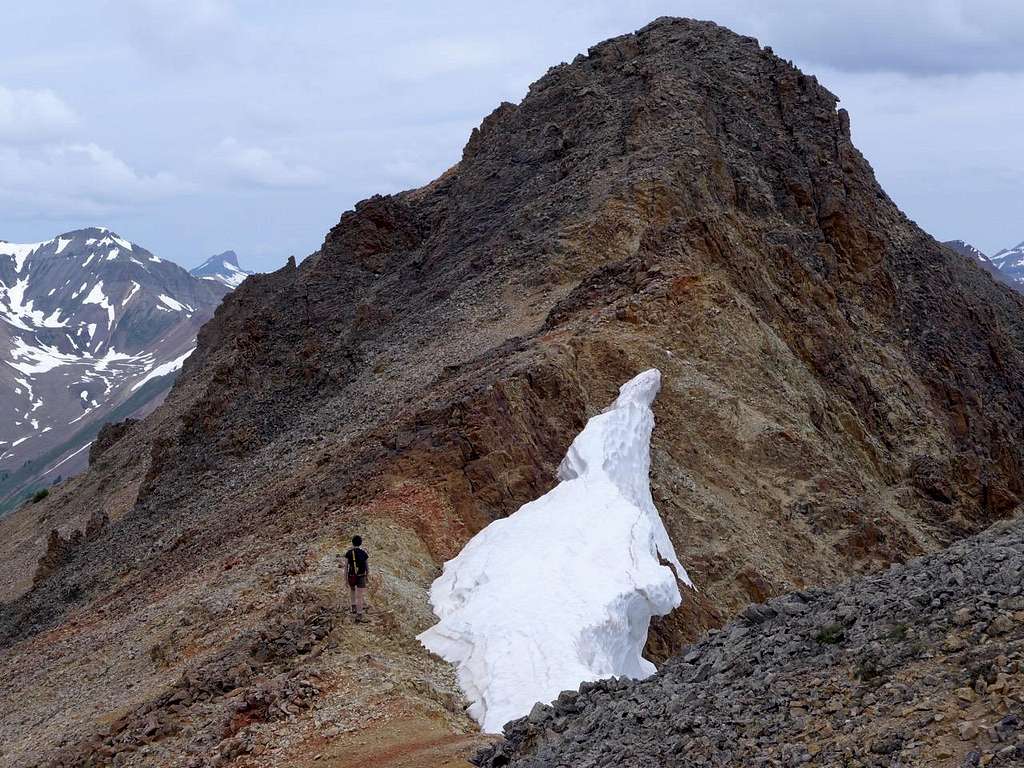
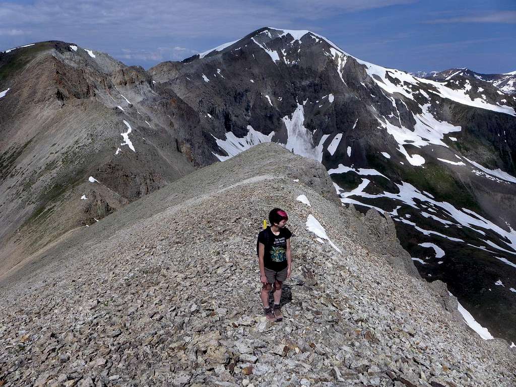
Our hike up Redcloud and over to Sunshine was utterly uneventful. I was mildly concerned, though, that the weather was misbehaving; it was certainly clouding over early in the day, and there was some potential for electrical storms, I thought. Once we had followed the standard route to Sunshine Pk via its NE ridge, we headed down its W ridge to a plateau-y area lying between Sunshine and the start of the Sundog ridge. Sundog, which is essentially the NW ridge of Sunshine, is, no question, the best way to complete the route. The descent from the summit of Sunshine was steep but straight forward; I preferred to follow the line of the ridge rather than picking a way down the NW face of the mountain. Joining the Sundog ridge involves a little bit of a scramble, 2+ I would say, and the ridge itself is a pleasure: reasonable rock, and narrow enough to be interesting without ever being difficult. It gave us a wonderful sense of being “up there.”
![Heading N along Sundog ridge]() Heading N along Sundog ridge
Heading N along Sundog ridge
![Summit, Sundog Pk, looking SE to Sunshine Pk]() Summit, Sundog Pk, looking SE to Sunshine Pk
Summit, Sundog Pk, looking SE to Sunshine Pk
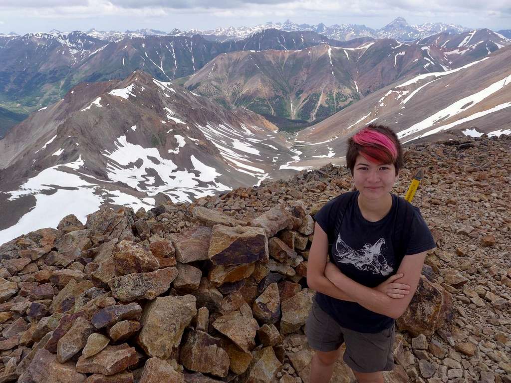
We paused for lunch on the summit of Sundog (13,432’) where a summit register dwells in a Starbucks coffee drink screw-cap bottle. Whatever works. The ridge then veers N as it heads down to Silver Creek. On the way up earlier, I’d noted that there were still some residual snow bridges across the creek at the base of an avy chute on the N side of the creek; with snow still in the gully high above the creek, we had the perfect landmark to aim at as we headed through the forest covering the lower reaches of the Sundog ridge.
![Descending N Ridge of Sundog]() Descending N Ridge of Sundog
Descending N Ridge of Sundog
And, bingo, we hit Silver Ck at just the right place, and crossed on the snow bridge. The weather had held.
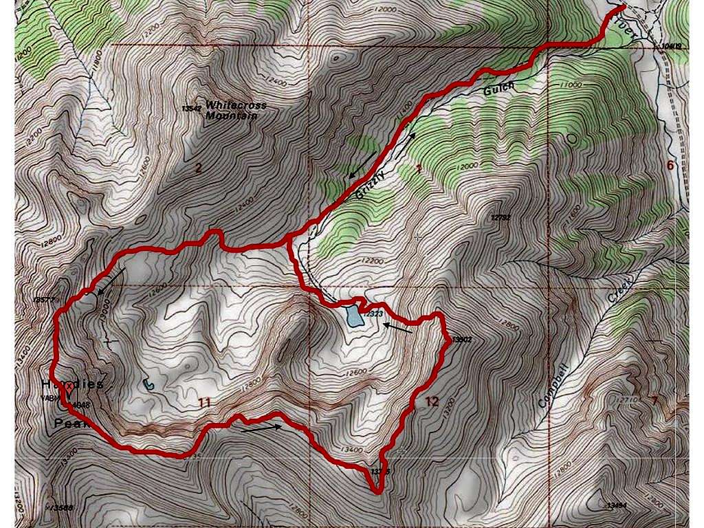
3. Handies
![Map: Handies from Grizzly Gulch]() Map: Handies from Grizzly Gulch
Map: Handies from Grizzly Gulch
July 3. July 4 was on a Saturday this year, so I think a lot of people had Fri 3 July off work. Certainly that was the impression I got when we arrived at what I thought was a reasonably early hour at the same TH as the day before. There must have been 30 cars there; the ample parking area was full, and parked cars had overflowed on to the road. Most of these people were presumably planning on doing some version of what we had done the day before, because Silver Ck is the standard route for Redcloud-Sunshine. We, however, were planning to head up the valley on the opposite side of the road: Grizzly Gulch. This gives access to Handies Pk (14,048), but there is a shorter and more direct route on Handies, via American Basin, further up the road — hence my guess that most of the people parked at the Silver Ck/Grizzly Gulch TH were focussed on Redcloud/Sunshine rather than Handies. Still, this wasn’t going to be one of those days in the mountains that appeals to the misanthropist within me.
![Handies approach, Grizzly Gulch]() Handies approach, Grizzly Gulch
Handies approach, Grizzly Gulch
As we headed up Grizzly Gulch, I suggested to Megan that we peel off N up the steep slopes that would take us to White Cross Mountain’s E ridge. This idea wasn’t greeted with a great deal of enthusiasm: “Let’s deal with Handies first.” OK. One of the reasons, I think, I prefer my mountains to be people free is that, when you’re on a trail, there’s too often awkwardness associated with passing people going in the same direction. This is especially true on 14ers because most people are on more or less the same schedule and on the same route — everyone is, give or take, going in the same direction at the same time. Passing people going the other way is simple: you get out of the way, or they get out of the way, a cheery “Nice day for it!” (even if it’s currently snowing. It’s an all purpose greeting that can be taken on face value — good weather — or interpreted as irony — bad weather), and perhaps a little banter along the lines of “How far?” or “Did you see the mountain goats?" Easy. When you’re going in the same direction, especially if that direction is up, things are much more complicated. If you’ve caught up with someone, then, presumably you’re going faster than they are. Not everyone likes to be reminded that they’re crawling along at a snail’s pace. There are the people ahead of you who stop, bent over their trekking poles, to suck in that extra oxygen; they’re 30 yards ahead and are paused in a place that’s ideal for you to pass; then, when you’re just 5 yards from them, they suddenly perk up and hurtle forward at a rate of knots. Hmm. And next, about 50 yards further on, you actually do pass them, probably at a spot less well suited to passing, as they sag once more on their trekking poles, the oxygen sucked out of them by their spurt. “Nice day for it!” And of course it’s not just about passing people; it’s about being passed as well. There are the people sauntering up behind you, and you’re forever anxiously glancing backwards to ensure that you don’t impede them, and that you get out of the way in good time: “Nice day for it!”
![View E from Handies]() View E from Handies
View E from Handies
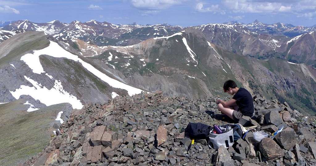
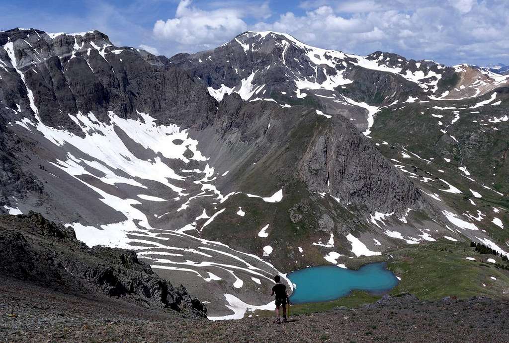
The top of Handies was crowded. There must have been ten people up there, with more coming up from the American Basin side all the time. The weather wasn’t great, with grey squalls in prospect, and people were rather hunkered down over their summit snacks. We didn’t linger long, setting off within a couple of minutes for phase 2 of the day — the bit without other people. The idea was to follow the ridges around to effect a high level tour of the tops clustered around the upper reaches of Grizzly Gulch, heading first east-ish towards Pt 13,795 and then north east-ish to Pt 13,502. From there I hoped to find a reasonably painless route down, ideally to down to Lk 12,323, though this is fairly cliff-y terrain and I didn’t fancy a steep snow gully descent late in the day. From the top of Handies, however, I spied what looked like a reasonable descent to the Lake from the north shoulder of 13,502. If that didn’t work out, we could keep going along the ridges, paralleling Grizzly Creek, until the descent gradients became kinder lower down (though that would involve an unpleasant creek crossing. Still a great deal of water coming down).
![East face of Handies: people on top]() East face of Handies: people on top
East face of Handies: people on top
![Heading along the ridges away from Handies: What hiking is all about!]() Heading along the ridges away from Handies: What hiking is all about!
Heading along the ridges away from Handies: What hiking is all about!
![Atop Pt 13,795]() Atop Pt 13,795
Atop Pt 13,795
A couple of brief hail squalls greeted the first part of our descent from Handies, but the going was straight forward. A particularly steep pitch down to the low point between Handies and 13,795 was no more than 2+ with a bit of route-finding care. The squalls had moved on, and the sun was intermittently giving its blessings to proceedings. Up towards 13,795 and this was ridge-walking at its best, the world at our feet, tiny distant figures visible on the summit of Handies. Lunch atop 13,795, and the first tricky part of the day. I’d not seen this when I’d been checking out the route out from the other side, as we climbed Handies, but the descent from the very top of 13,795 to the ridge running NE to 13,502 is messy: a near vertical pitch of some 100’ with horribly loose rock. Once again, preparation genius that I am, I’d left our helmets in the vehicle. What kind of parent brings his daughter out to places like this without proper protection?! No matter, we would avoid the direct route, and we created a rather cumbersome workaround: off the top down the SE ridge and then some awkward steep snow side-hilling to regain the NE ridge. The great thing about Megan is that it’s these forced-to-scramble/improvise parts of hiking that she likes best. Paternal irresponsibility — those neglected helmets — was therefore greeted with enthusiasm as it provided the pretext for some fun stuff.
![Coming off Pt 13,795]() Coming off Pt 13,795
Coming off Pt 13,795
![Heading down to Lk 12323, Handies on the skyline]() Heading down to Lk 12323, Handies on the skyline
Heading down to Lk 12323, Handies on the skyline
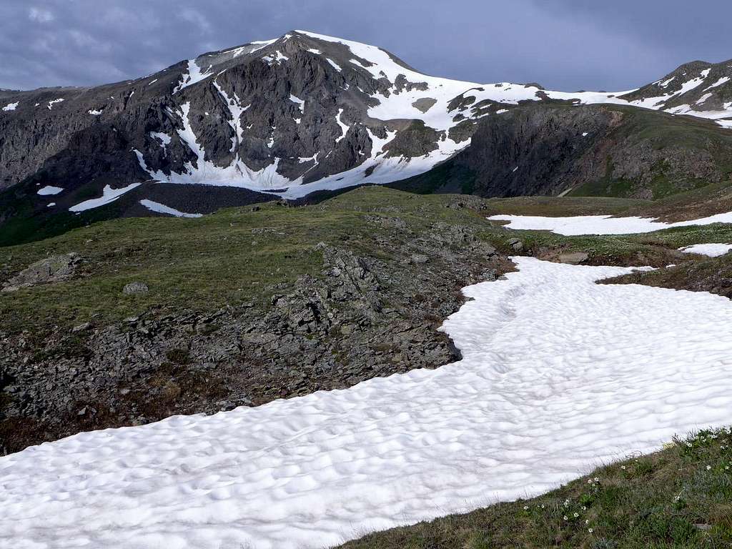
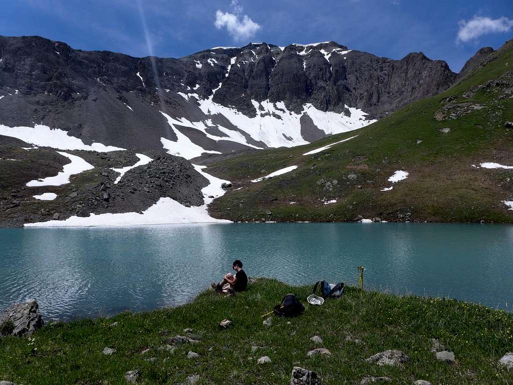
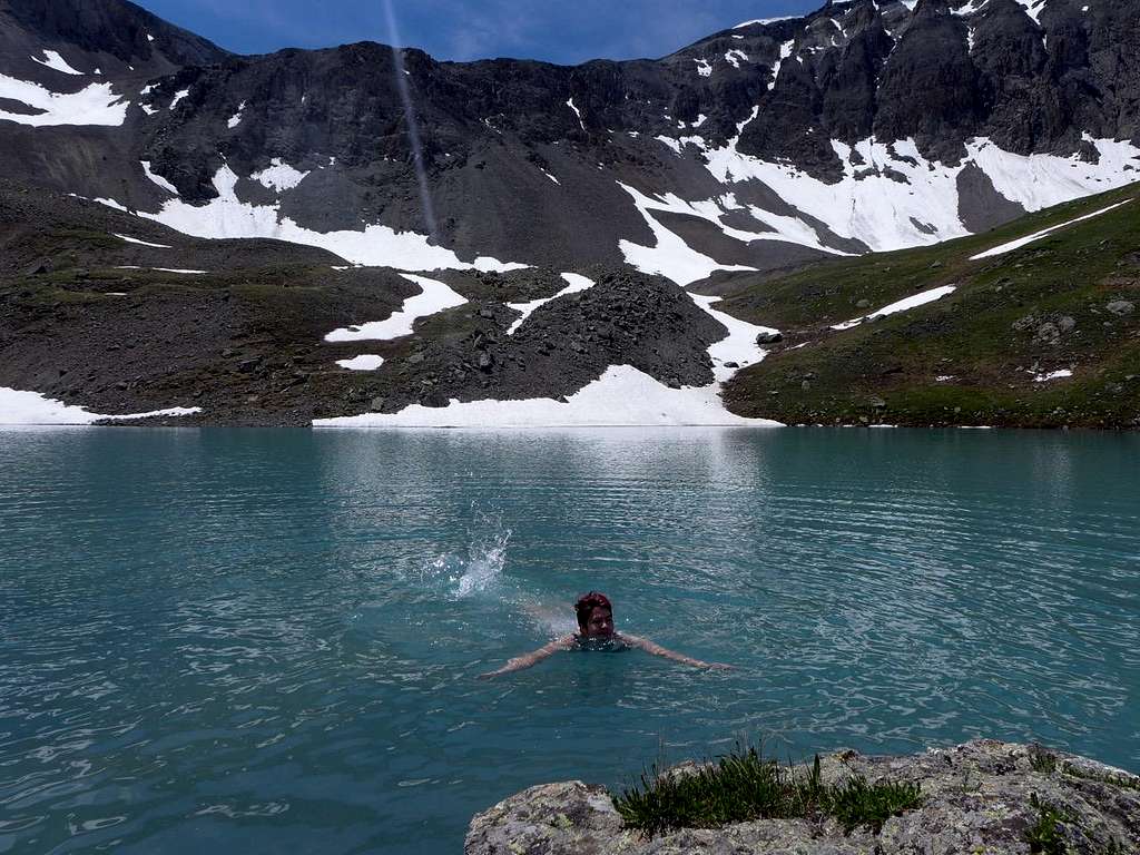
On to 13,502: clouds, splashes of blue sky, Grizzly Gulch laid out below us to the left, Lk 12,323 looking peculiarly like an aquamarine silhouette of a rubber duck from this angle, and, on the bowsprit, our tops of yesterday, Redcloud, Sunshine, and Sundog. There too, plaintiff and pointy, were Wetterhorn and Matterhorn Peaks. The descent route that had looked user-friendly from afar looked steep but straight forward when viewed from close to, and down we went, a simple gravel-y slide taking us down to the lake. There, rather to my surprise, Megan agreed to join me for a chilly dip (usually it’s just me). Great way to cap off a lovely day, shivering in the occasional sunshine as we tried to dry off beside the brilliant blue-turquoise of the lake.
![Lake 12,323]() Lake 12,323
Lake 12,323
![Cold]() Cold
Cold
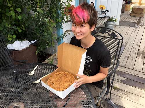
Energized by that cold water zing, we skipped down into the main valley from the little hanging valley that holds the lake, and crossed the main creek at a point high enough to render the crossing trivial. And we were back on the main drag, heading back down Grizzly Gulch. Once down, we were driving over the divide to spend the fourth with friends close to Carbondale. We stopped en route in Lake City to visit the Lake City Bakery. Megan had had a piece of pie for dinner the night before at a Lake City restaurant that advertised itself as having been made there, and she was keen to mark the end of our brief San Juans visit with another slice. “Sorry, we don’t sell our pies here at the Bakery by the slice. You’ll have to buy a whole pie.” Heck, why not? Three good days to celebrate — three days of more-than-just-14ers.
![Lake City Bakery]() Lake City Bakery
Lake City Bakery


Comments
Post a Comment