
-
 3121 Hits
-
 72.08% Score
-
 2 Votes
|
|
Route |
|---|---|
|
|
46.70110°N / 12.43050°E |
|
|
Hike and Scramble |
|
|
Half a day |
|
|
Walk-Up |
|
|
Approach
The ascent of the mountain starts at the small village of Hollbruck, which you reach from Kartitsch in the Tyrol Gailtal Valley. Follow the "Getting There" Instructions on the main page
Route Description
- Start altitude: 1360mm
- Summit altitude: 2581m
- Prevailing exposition: N, later E
- Type: 1h 30min over forest roads, 2h over paths, 15min exposed over the south ridge
- Protection: marked but without security
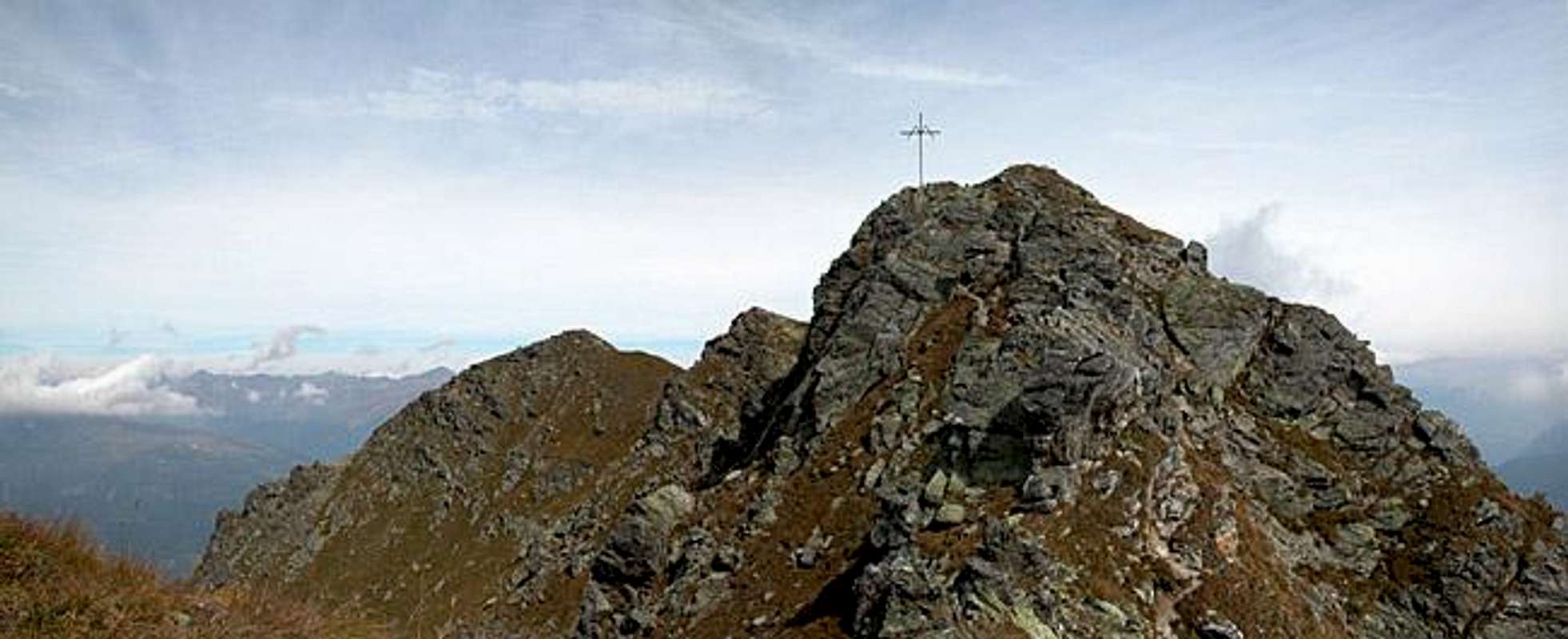
This is the normal route ascent to Hollbrucker Spitze, Demutspitze and Schöntalhöhe (though the latter has a similar second ascent route through Schustertal - the next valley to the east). It follows a forest road for most of the distance. The trail is marked 467. At an altitude of 1525m you can choose between the road and a short cutting trail which runs close to the Hollbrucker Bach Creek. Both recombine at the Ochsenboden Alm at 1955m.
From here on the ascent trail (again marked 467) heads west to climb for a bivouac at 2300m. Here you can head eastwards, directly heading for the Hollbrucker Spitze South Ridge. The normal ascent, however heads southwest, directly to Hochgränten Pass (war cemetery, heart shaped lake). From here you can choose between three trails, one along the ridge (the best in my opinion), one on the Austrian, one on the Italian side. All three head northwest and lead to Hollbrucker Spitze. To reach the cross at Hollbrucker Eck, a short exposed ridge has to be crossed.
 |  |  |
Essential Gear
Hiking gear is sufficient.