
-
 7223 Hits
-
 72.08% Score
-
 2 Votes
|
|
Route |
|---|---|
|
|
45.87900°N / 7.15730°E |
|
|
Hike and Scramble |
|
|
Half a day |
|
|
Walk-Up |
|
|
Approach
The Pointe de Drône is located a little west of the pass of Gd. St. Bernard on the border between Italy and Switzerland. The trailhead therefore is on top of the pass at 2469m of altitude. To get there be sure to miss the tunnel - you need to get to the top!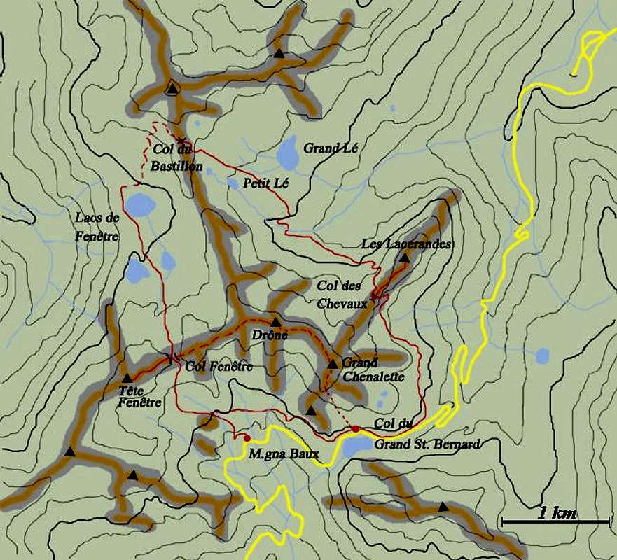 |
 |  |  |  |
Route Description
Altitude gain: 500mDuration: 2h
Trailhead: Gd. St. Bernhard
The ascent via Fenêtre de Ferret first heads down the pass road (italian side) for about 500m and then leads upwards to the pass "Fenêtre de Ferret" at 2698m. On the left hand side of the trail there is Pain du Sucre (2919m) which can be climbed "on the fly".
From the Fenêtre you can take the (rocky) ridge up to the Pointe de Drône. The ascent is a scramble of about one hour and rewards you with great views of the highest peaks of the Alps.
The route can be combined with the ferrata via Grand Chenalette. On the other hand you can descend to the Lacs de Ferret and from there on make a round trip via three mountain passes and a multitude of beautiful lakes.
 |  |  |  |
Essential Gear
Normal hiking gear is sufficient. |  |