
-
 3280 Hits
-
 77.48% Score
-
 8 Votes
|
|
Route |
|---|---|
|
|
46.39107°N / 13.93355°E |
|
|
Download GPX » View Route on Map |
|
|
Skiing |
|
|
Spring, Winter |
|
|
Half a day |
|
|
Fairly easy ski tour |
|
|
Overview
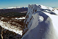
Debela peč from the neighbouring summit of Brda
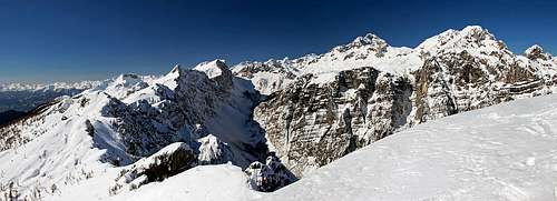
Triglav group from Brda
General Information

Winter graphics
Orientation: The mountains above Pokljuka are very frequented also in times of tour skiing (actually then relatively even more than in summer). So the trail to Lipanca huts is almost always well beaten. Also inscription plates are very good, on all crossroads you will find inscription: 'Lipanca'. Also from the huts on both summits there is usually a track. If there's none, you simply go northwards and use the most obvious passages. Only if you come there after really heavy snowing as the first visitor, you may have issues with orientation. See the GPX track in the header!
Exposition: There's no serious danger of fall or more exposed slope.
Slopes orientation: The slopes are mostly south oriented, so on a sunny day snow can soon get soft. The exception is below in the woods. On the Debela peč ascent the final part goes across the western slopes of Okroglež bump. There the snow can be hard in the morning.
Objective dangers: The majority of slopes is relatively safe of avalanches. Dangerous can be the slopes below Lipanca and the steep passage on the lower ridge of Brda. In Slovenian mountains avalanche risk report (on the international 5-points scale) is issued every day.
Best months: The tour can be done throughout the whole winter and spring, usually there is enough snow from December till April. Due to some flat sections a lot of fresh snow doesn't bring much to attractiveness of the tour.
Gear: Only usual gear for tour skiing. As there are many visitors also with snow shoes or even with only ordinary shoes, also snow borders may hope to find a beaten track on top.


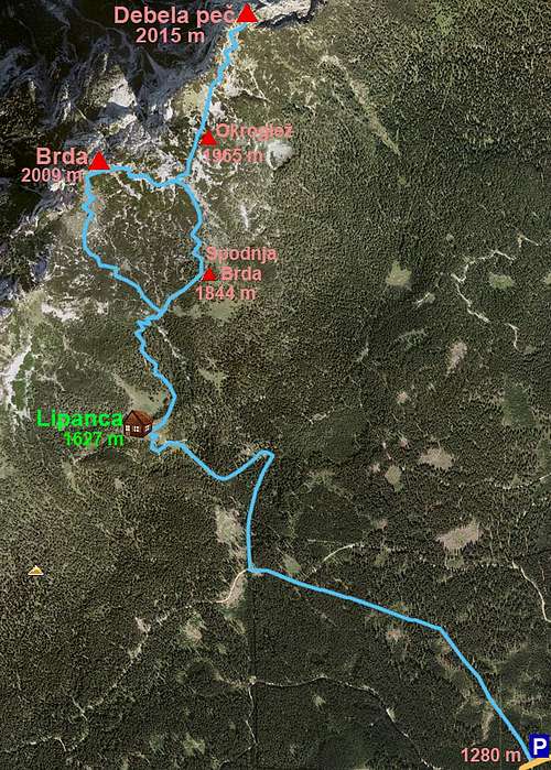
Coming on Javornik meadow from the main Pokljuka road
Highest point: Debela peč: 2015 m, Brda: 2009 m.
Altitude to overcome: cca 740 m on Debela peč and 725 m on Brda.
Time for ascent: To Debela peč 3 h, to Brda 2 h 45 min.
Route Description
From the parking place north of Javornik meadow, 1292 m, we go by a well marked (and usually well beaten) trail towards the N-NW. The first section is very flat and we mostly ascend through nice Pokljuka woods. On 1400 m the trail crosses another mountain road (not cleaned), now we already walk in the NW direction. But inscriptions (and beaten trail) soon turn us right and the path starts crossing more steep forrested slopes - we go towards the N. On some 1500 m there's another crossing, our trail turns sharp left, westwards. When gaining some more altitude we get around a corner and ahead of us is a nice, open valley. At the end of it the last grassy slope below Lipanca meadow awaits us, the three mountain huts are just above the valley step, on 1627 m. 1 h 15 min till here (or from the main road 1 h 45 min). In Pokljuka woods |  Below Lipanca meadow | 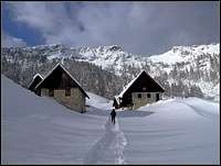 Lipanca huts |
From Lipanca huts we continue a bit right, so that we avoid quite a deep basin north of huts. The trail soon starts crossing in a slight ascent quite steep slopes, but then terrain gets much nicer. Light woods, mostly of larches, are ideal for skiing, the ascent track leads us northwards. Left below is the main valley, leading on Lipanska Vrata (notch, summer passage), ahead of us is a quite steep barrier of Brda. Soon we reach its base and the trail starts ascending through a steep passage, right of some rocks. There we ascend in many hairpins, in winter that slope can be dangerous for avalanche.

On the slopes of Brda

Ascending Brda
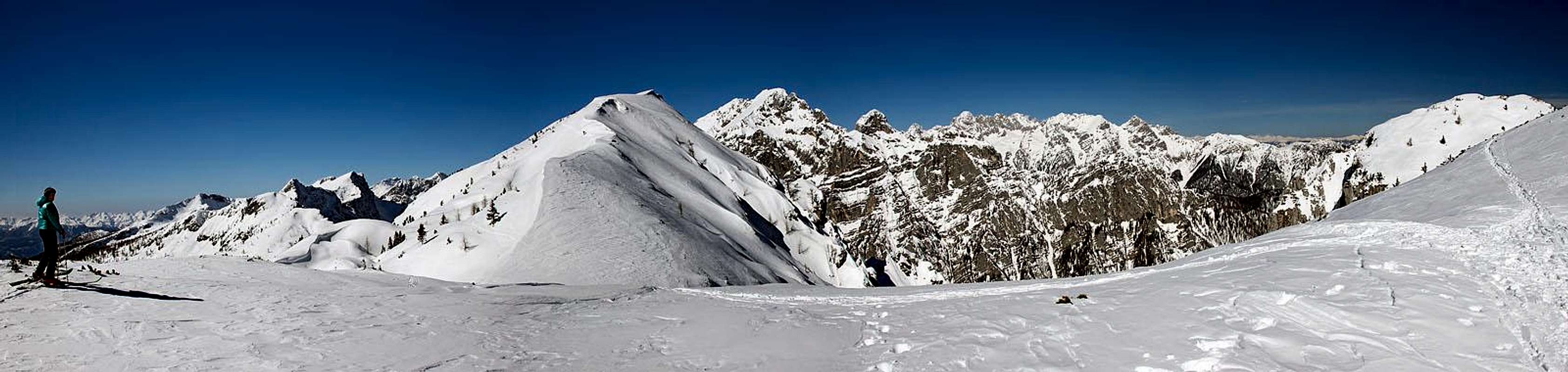
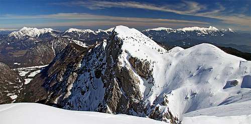
On the saddle between Brda and Debela peč this great panorama opens
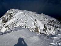
On Debela peč
For Brda summit we continue from the small saddle on the main ridge towards the left. Direction is westwards. The ascent route goes left of the distinct summit ridge, a bit higher we do one or two turns up and soon the summit ridge brings us on top. Skiing down from Brda summit by the East variant goes almost entirely by the ascent route.
 Brda summit ridge |  Reaching Brda summit |  On the summit |
Brda SW slopes