
-
 11887 Hits
-
 83.69% Score
-
 17 Votes
|
|
Route |
|---|---|
|
|
44.91133°N / 6.64707°E |
|
|
Via Ferrata |
|
|
Summer |
|
|
Half a day |
|
|
Peu Difficile |
|
|
OVERVIEW
Croix de Toulouse via ferrata
Croix de Toulouse via ferrata is a delightful sunny, protected climbing route, arising just above the top end of ‘Old’ Briançon, in the Haute Dauphine region of the French Alps. It is one of eleven Via Ferrata routes within an approximate radius of 15km from Briançon. For the other routes please see links section below, but also my page on one of these: Aiguillette du Lauzet via ferrata
The route is graded PD (Peu Difficile – ‘a little difficult’) so not technically very hard, nor especially strenuous. However, with a height gain of 390m and length of 800m, it is quite long - and a reasonable degree of fitness is desirable. A head for heights is also an asset, since the route ascends steep and, in a few short sections, vertical terrain. The route will take between 2-3 hours for most parties – and around an hour for the descent.
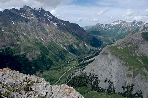
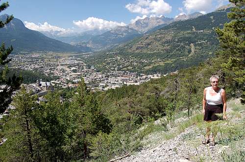
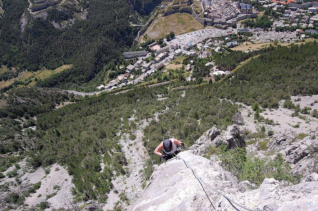
The via ascends a south facing spur and thus catches the sun. It also catches a magnificent view of Briançon and the main Briançon valley, which becomes increasingly impressive as more height is gained, all the way up to the top of the spur, at 1962m. The view goes a long way towards making up for the fact that the route doesn’t end at a summit – but at a wooded promontory at the lower end of a long ridge, which eventually reaches the summit of Serre des Aigles at 2567m, 2 km further to the north.
With the route being of high quality as well as accessible, it has a reputation for becoming crowded on fine days. That said, there is plenty enough of the route to be able to accommodate quite a number of parties before much risk of people tripping over each other – and, especially in the upper half, there are places for a fast party to safely overtake a slower group.
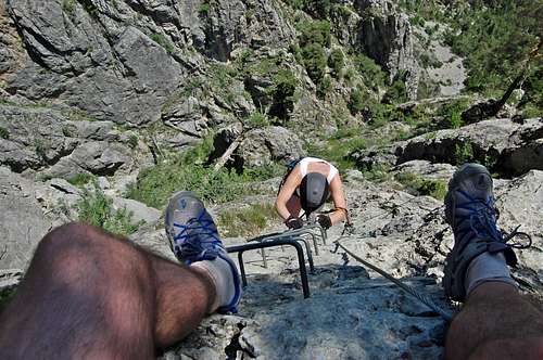
Climbing the Croix de Toulouse via ferrata
GETTING THERE
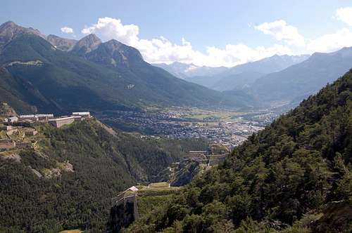
Briançon, at 1326m highest city in the EU and ‘Via Ferrata capital of France'.
The main centre is the town of Briançon which has been quoted as ‘via Ferrata capital of France’ – and is also gateway to the formidable Massif des Ecrins, which rises to over 4000m just to the southwest. Additionally it can boast some 300 days of sunshine per year – and (for those who like a little history) it was declared a UNESCO World Heritage site in 2008. Finally, at 1326m, it is the highest ‘City’ in the European Union (population 11,000+ and City defined as population >2000).
Map
Carte IGN TOP 25: sheet 3536 OT – Briançon/Serre-Chevalier/MontgenevreConnections to Briançon
By road:Most straight forward approach is from the south, along N94 (from Gap, Sisteron, Marseille).
All other routes and directions involve crossing a mountain pass:
- From the west, from Grenoble slow road through spectacular gorge and over Col du Lautaret
- From the north, from Savoie most direct route over Col du Galibier and Col du Lautaret
- From the east, from Italy two attractive but relatively slow roads over Col de l’Echella or Col de Montgenevre.
By Bus:
2 buses per day from Grenoble
Bus route from Marseille to Briançon via Gap
By Rail:
There are rail connections with Paris (north), Grenoble (west) and Marseille (south).
Connections to the east are via Oulx, just across the border in Italy (and thence with Milan/Turin).
By Air:
Nearest airports to Briançon are:
Turin (Italy) – 120km
Grenoble – 160km
Lyon – 205km
Marseille – 250km.
Col de Montgenevre: 1854m pass on main route into Briançon from east, and Italy. Mont Chaberton 3131m on skyline.
Col du Lautaret: 2058m pass on only route into Briançon from west, and Grenoble (view from Aig.du Lauzet)
APPROACH
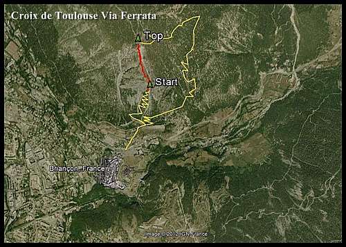
Google Earth view of entire route including approach & descent.
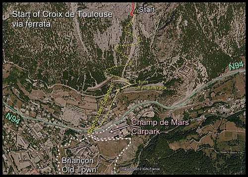
Google Earth view of approach
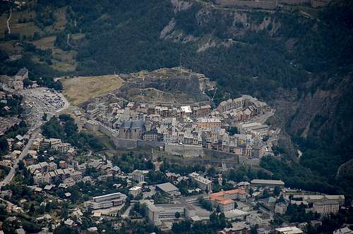
Briançon old town – with Champ de Mars Car Park to the left in the picture
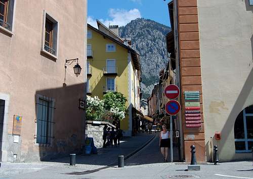
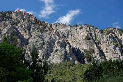
Croix de Toulouse via ferrata viewed from bottom end of Briançon old town
To reach the foot of the via ferrata, the most convenient starting point is the largish Champ de Mars Car Park, just off the N94, at the top (northern) end of Briançon old town. It is easy to identify this feature on Google Maps, Google Earth – and even Google Street view (whatever did we do before the internet?). The car park is about 2km uphill from Briançon train station – with 100m height gain, say about a half hour walk.
Standing in the car park and facing north, you will see the rocky buttress with via ferrata of Croix de Toulouse, towering overhead the buildings on the other side of the busy N94 road. Not far from a pedestrian crossing and between two restaurants is a side road called Chemin des Salettes. Follow this narrow little street until it reaches the start of a major forest track angling off to the right.
At this point there is a little clearing and a big sign all about the Croix de Toulouse via ferrata. Follow the main forest track a few meters keeping a good look out for a smaller track, branching off into the trees to the left – and up the hillside. This is the approach to via ferrata. Once on this, it is easy to find the start of the route following the well defined and pleasant forest trail uphill, for about ¾ hour.
Note that the continuation of the main forest track, beyond the left turn to the via, marks the end of the descent route from the top. Thus the whole route, with ascent and descent completes a rough circle.
At the end of the approach it is easy to identify the start of the Croix de Toulouse spur, which arises abruptly out of a small clearing, marked with a sign.
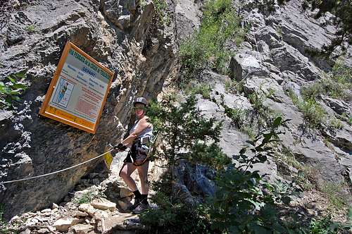
The start of the Croix de Toulouse via arises abruptly out of a small clearing, marked with a sign.
On the approach to the bottom of the via
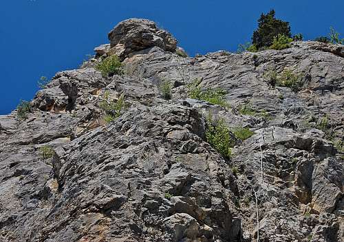
VIA FERRATA 1 - the first 100 meters
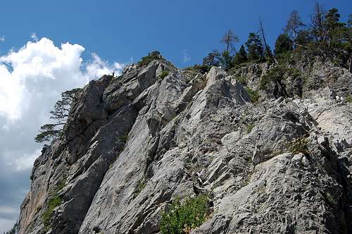
The lower part of the route is consistently steep
The little clearing at the bottom of the via is the last shaded place to find for some time to come. As well as ‘tooling up’ with via ferrata kit here, it is worth taking time out to have a breather from the ascent, apply some sunblock and drink some water.
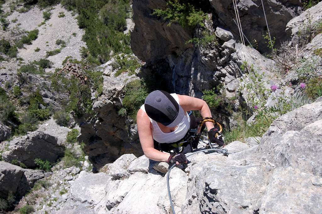
The first 100m of the climb is consistently steep and, as more height is gained, quite exposed. The route ascends rock buttresses on the very edge of the deep, broad gulley to the right of the main spur. Despite the steepness, which occasionally reaches the vertical, the line of ascent is generously provided with metal brackets – and at all times, steel cable to clip onto. The cable is continuous from here, all the way to the top.
There is one particularly striking corner to ascend which features a ladder of metal brackets climbing straight up - and with a small bulge to surmount at the top. This is one of the few parts of the climb where modest upper body strength is helpful.
The corner with the ladder of metal brackets - above the bulge.
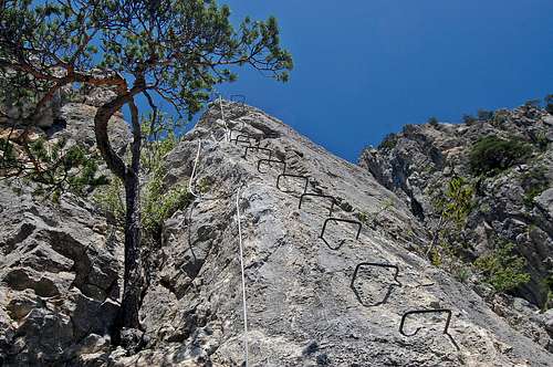
The corner with ladder of metal brackets - bulge at top.
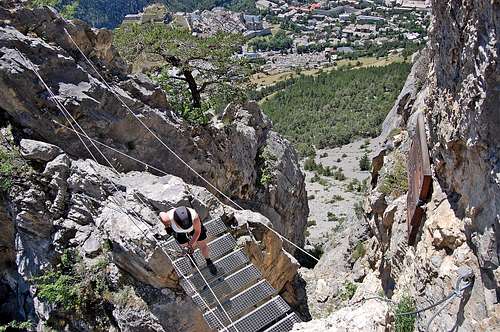
VIA FERRATA 2 - middle section and bridge
The approach to the little bridge.
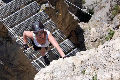
On the little bridge.
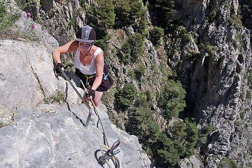
The wall above the bridge.
Climbing the wall above the bridge
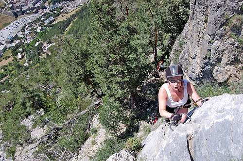
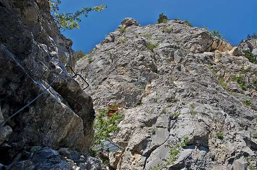
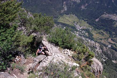
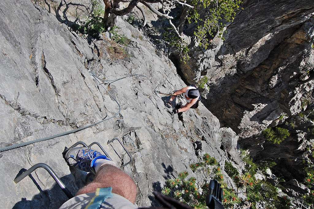
A little beyond the first 100m of ascent, the route becomes a little more broken, as it follows a more serrated edge of the big gulley. Due to the increase in height exposure gets even more breathtaking in some situations, but there are occasional brief respites in the nooks and crannies around the serrations. At the end of a short rising traverse is the main landmark of the middle section; in the form of a delightful metal bridge – which spans a deep cleft in the rock.
Immediately above the bridge is an exposed looking wall. It is easy to discern the continuation of the cable alongside a ladder of metal brackets, heading more or less straight up – but broken by just one shallow vegetated ledge about half way up. This section is quite spectacular, with stunning views straight down onto the bridge – and with the back-drop of Briançon, spread out below like a map.
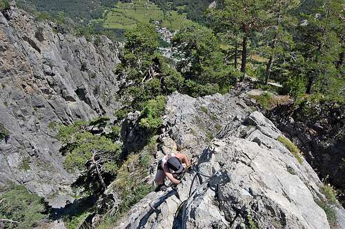
Subsequently the route angles to the right, into the crags of the left wall of the big gulley, before ascending straight up again; another spectacular pitch, this time with the back drop of the gulley, as it plunges precipitously into hidden depths below. At the top of this section, the route now re-joins the spur.
At the top of the exposed wall above the bridge.
Rising traverse onto L wall of the big gulley.
Climbing out of the gulley to re-join the main spur
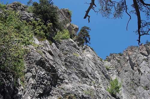
VIA FERRATA 3 - upper section and spur
The return to steep rock at the very crest of the spur.
The section of zigzag trail and scramble before the return to steep rock.
The average angle of the upper 2/3 of the route is progressively falling back now and the spur becoming increasingly ridge like. At one point the route appears to end as rocky crag becomes replaced with an easy zigzag trail and scramble up between pine trees. The cable still continues though, anchored as before at intervals – but for a substantial distance scarcely necessary to clip into now. But the continued presence of the cable suggests somehow that there is more to come – and that it would not be a good idea to take off the via kit just yet. A look into the big gulley, still to the right, soon reveals that there is plenty more height to be gained.
And indeed there is soon a return to steep rock again, as a prominent prow juts up out of the trees ahead. But the overall steepness is less sustained now, with much of the route clinging to the crest of the ridge, with a few short walls to surmount, but often easy scrambles or level traverses in between. There is occasional exposure on narrow bits of ridge crest, but muffled by the close proximity of pine trees now as the top of the route is neared.
Abruptly the little viewing platform with oratory comes into view at the top of the last few meters of rocky scramble. The crest protrudes above most of the trees at this point exposing a near perfect view of Briançon again, but far below now. And now, very soon, it really is time to un-clip from the cable, as it finally terminates up by the viewing platform.
Steep climbing on the crest.
Final steps with near perfect view of Briançon below.
Top of the exposed wall – not far below the top.
THE TOP
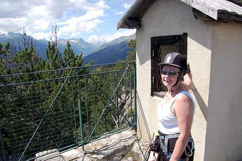
At the little oratory on the viewing platform at the top.
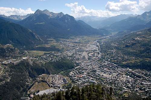
View from the top of the Croix de Toulouse.
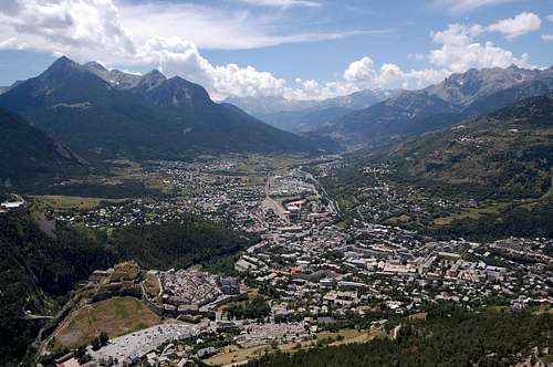
The view from the top of Croix de Toulouse is beautiful – straight down the rocky crest to the fortifications of old town about 600m below – but then with the sprawl of ‘new-town’ spreading out into the main valley beyond.
In the trees behind the platform are places to sit in the shade and have a drink and a snack, whilst stowing away the via gear. Sat facing out towards the valley, the main walk-way of the descent crosses from right to left. If this is followed a few meters then there is an excellent view to be had of the entire spur of the via in profile – and the possibility of picking out the ant-like figures of people laboriously climbing up.
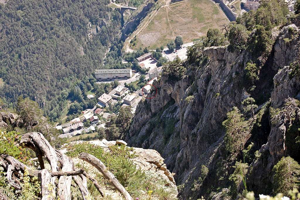
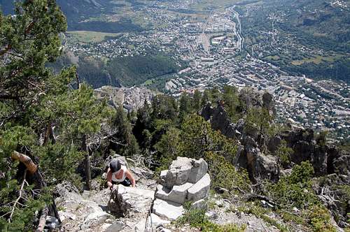
Looking down the profile of Croix de Toulouse – 2 climbers encircled, ascending lower 1/3.
DESCENT
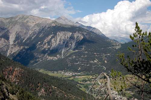
Signs mark the descent and it is barely necessary to consult the map. However, some caution would be needed should the clouds roll in – or if descending in the dark after an evening ascent of the via. The forest trail of GR5 follows a wide looping course initially to the east, away from the Croix de Toulouse - with occasional good views, between the trees, of Mont Chaberton and the Col de Montgenevre pass over from Italy (see photo in ‘getting there’ section above).After some loss of height and a few switch backs here and there, the trail is heading back towards the west again – as it completes the loop and heads back towards the starting point. The last part of the forest trail is nearly horizontal and there are spectacular views again, of the Croix de Toulouse – in profile again, but this time from below. Once again, it is possible to pick out the ant-like figures of people inching slowly up.
Finally the end is reached – back down at the little clearing with the big sign, just at the top of the Chemin des Salettes. The street cafes and ice-cream vendors of Briançon old town are just 15 minutes away now – and a wander through the ancient streets a fitting end to an enjoyable mountain excursion.
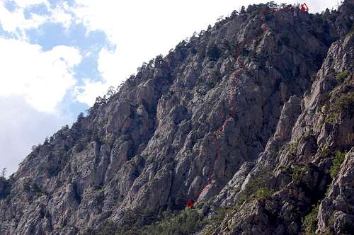
On the descent – the spur comes into view again – a large party is on the lower part of the route, but too small to be visible in the photo.
On the descent – top of Briançon old town coming into view.
TIMINGS
Timings are as for start and finish at the Champ de Mars Car-park at the top (northern) end of Briançon old town.Approach: 1 hour
Via Ferrata: 2-3 hours
Descent: 1-2 hours
Total
= 4 hours for a fast/confident party, up to 6 hours for a slower/less confident party.ESSENTIAL GEAR
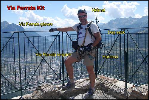
Equipped for a high mountain via ferratta.
1)Harness
2)Via Ferrata lanyard and helmet.
3)Via Ferrata gloves
4)Day sack containing essentials for a day in the mountains: warm clothes & waterproofs, water & snacks, first aid kit & mobile phone
LINKS/GUIDES
GUIDES
Cicerone guide: Via Ferratas of the French Alps by Richard Millar 2014
Via Ferrata – a complete guide to France by Chavy/Poulet 2004
Toute les Via Ferrata de France by Jocelyn Chavy 2011
ACCOMODATION
General listings
A comfortable stay with nice people and a great view: Chalet Chez Bear
WEATHER
Brianconnais weather
OTHER ACTIVITIES
Walks in the area: Brianconnais walks
Mont Chaberton ascent: Mont Chaberton
Riding: Grand Eagle Ranch
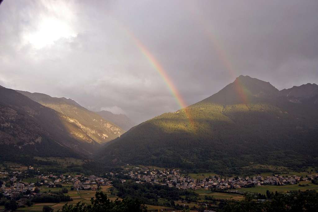
Double rainbow in Briançon valley, after a storm – view from Chalet Chez Bear.