Kings at Last - September 17th, 2014
The time had finally come for Kings. After procrastinating on the state highpoint and my last Utah ultra for almost three years I realized that it was now do or die…with the infamous Uinta weather and upcoming storm fronts in the area I had to get the peak or wait till next season. I flew back from the Orlando wedding Sunday night and took Monday off to unwind and prepare for a very long Tuesday.
With daylight hours dwindling by mid-September Greg convinced me to borrow a headlamp from him just in case, though I hoped that I would not need it. The weather forecast was optimistic with just 20% chance of tstorms after noon before serious weather moved in the rest of the week, and I figured that I could sneak in the peak before the storms, if any, and this day trip before a planned Glacier outing and yet another Vegas bachelor party the last weekend of September.
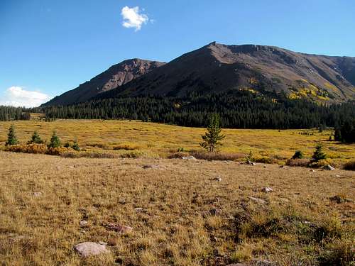
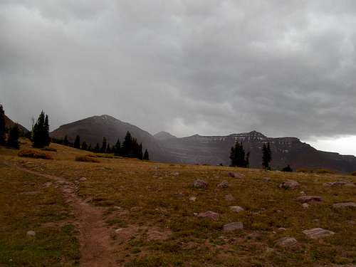
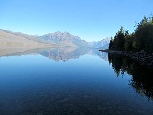
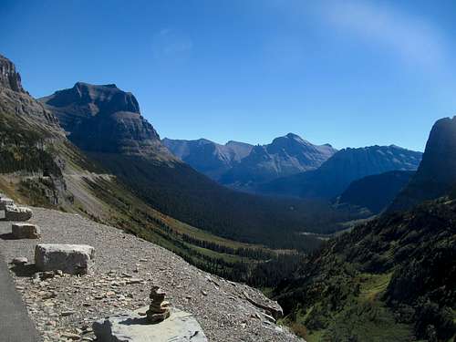
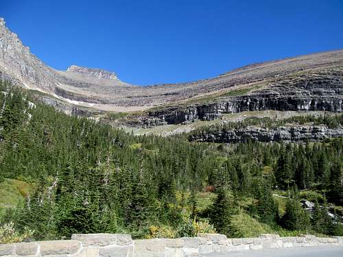
It was still dark when I left the highway and drove through the sleepy hamlet of Mountain Home. It’s a lot of dirt roads, albeit smooth ones, to get to the cold and empty trailhead, where the only cars parked were presumably backpackers. The one surprise for me was how the northern slopes of the Uintas were buttressed by a rather wide set of foothills, which made for an awesome sight when the road crested to the south and the just before sunrise vistas of the central High Uintas sparkled with golden aspen came into view.
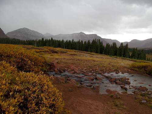
As expected it was a very boring start to the hike, with only my podcasts and an occasional open views down into Henrys Fork Creek for stimulation. The skies were crystal clear when I passed a bridge and finally crossed into the open basin for the first time, peering at the long north ridge of Wilson Peak on the far right.
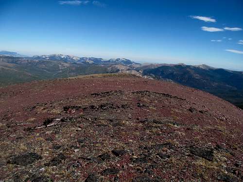
My first takeaway for these high central Uintas was then, that they were big, big as hell, and all objects when viewed in the central Uintas stand further than they appeared. I kept a steady pace all the way through the first few miles of the basin, stopping only to take some pictures of the small buttes to the left. I planned to rest and regroup at Dollar Lake, but never saw it as it apparently isn’t visible from the trail. I did walk by a mama moose and her babies though, and likely used to highpointers, they let me by without complaint.
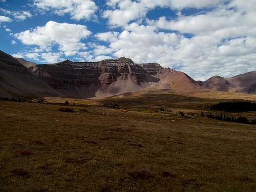
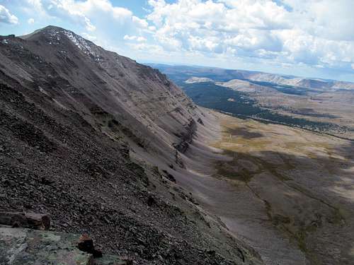
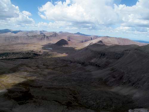
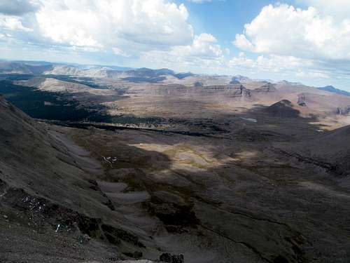
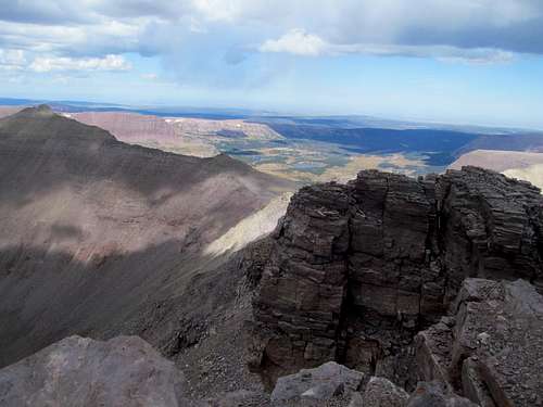
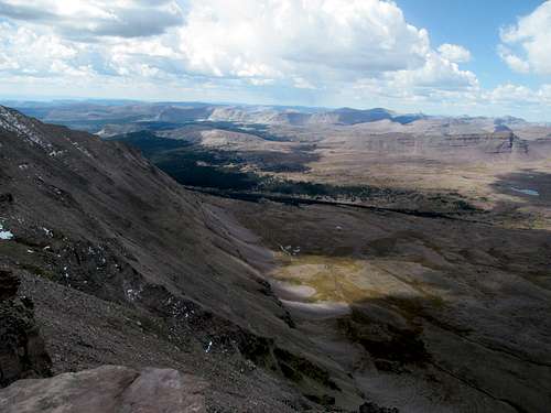
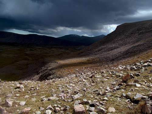
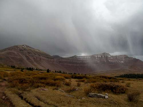
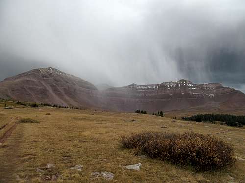
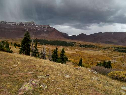
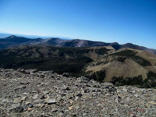
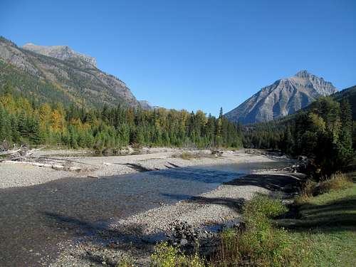
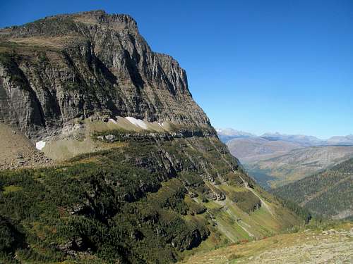
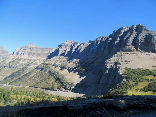
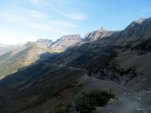
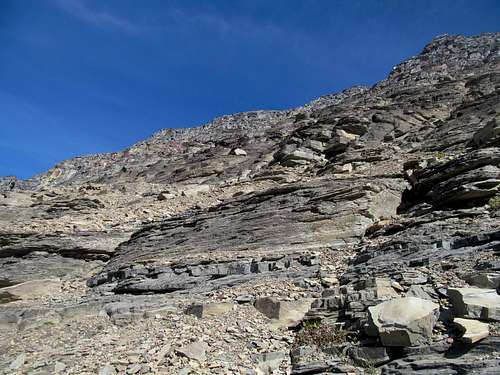
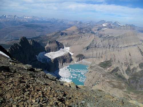
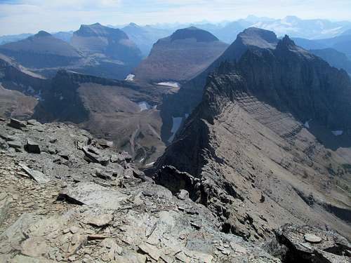
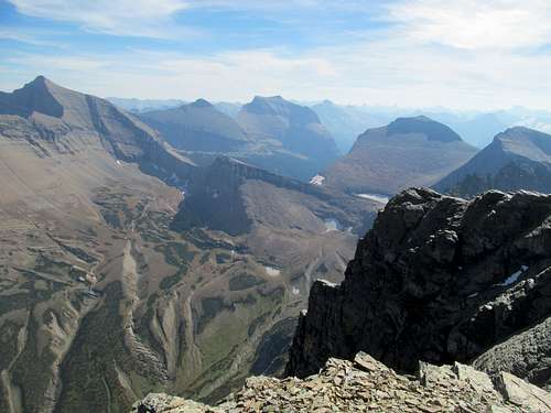
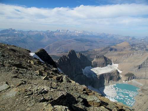
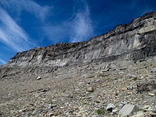
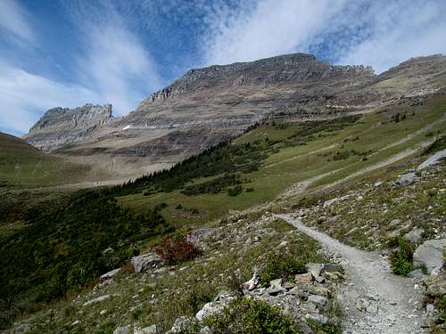
I passed by a few groups of hikers leaving the basin after a multiday expedition, but I was the only one heading in thus far. I wasn’t all too tempted by the garbage chute, spying a long and possibly tedious sidehill from the trail to the loose rockpile between Kings, West Gunsight, and Dome. The celebrated Henry’s Fork Basin was beautiful, admittedly, but oddly barren and alien, and I wondered if it were lusher and greener in the early summer, though undoubtedly much thicker with mosquitoes.
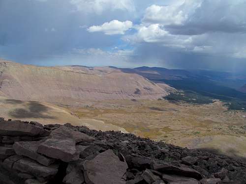
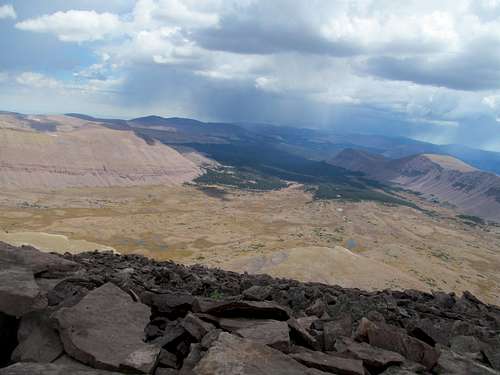
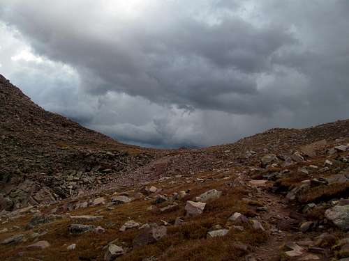
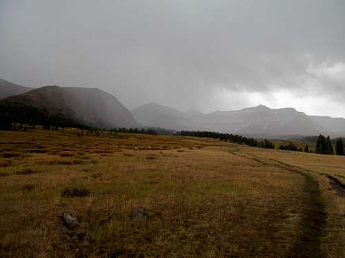
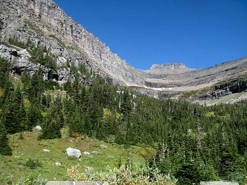
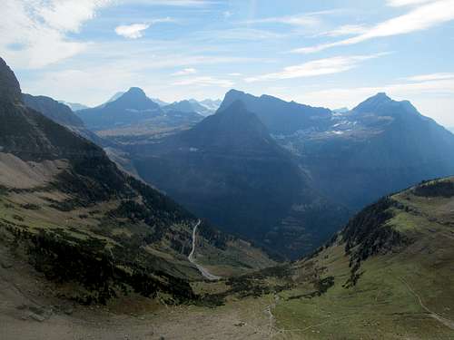
Gunsight Pass seemed a natural option, presenting a gentle ascent through a wide gully still shaded by the mid-morning sun. I planned on taking the traverse/shortcut between Gunsight and Anderson Passes, well described here on SP, to cut down on overall distance. After a couple of switchbacks I reached the zenith of Gunsight Pass and enjoyed my views over to the sublime yet still alien Painter Basin and, to my dismay, light showers forming to the southeast that immediately escalated the weather sitch to a de facto 100% chance of precip.
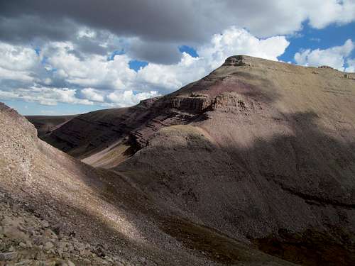
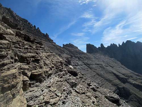
The direct sidehill from Gunsight to Anderson pass was pretty basic, with the occasional cairn leading the way, though to what you could wonder. The talus slopes of West Gunsight made the summit for this Utah 13er seem probably closer than it was, but with thunderheads building this early in the day I did not tempt fate.
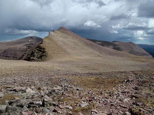
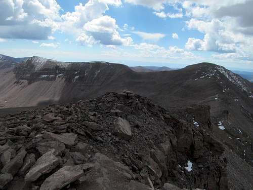
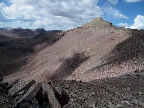
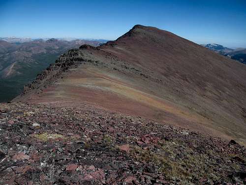
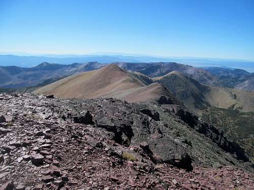
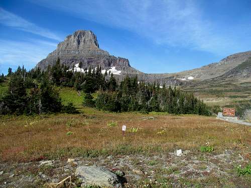
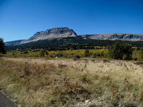
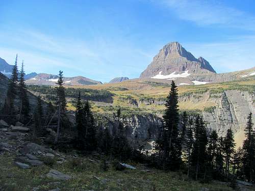
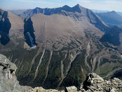
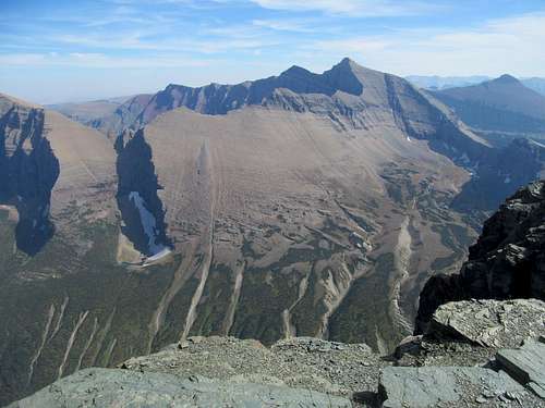
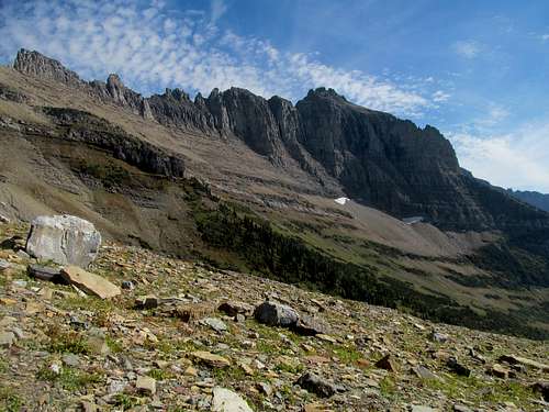
The more distressing part of the shortcut was after the sidehill, where the flat traverse across the southern backside of West Gunsight seemed to really drag on for longer than what it looks. Kings looks puny from here, an small and oblong ridge sticking out of a vast tundra, but I figured this sight was be just as deceiving as the distance to Anderson Pass.
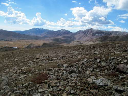
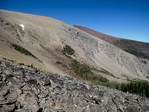
Again the terrain was no more than class 1+, with maybe 10-20 feet of elevation loss…but the terrain often consisted of flat stretches of flat boulders, which made the walking a little more tiresome. Upon reaching the tripod saddle extending to Kings, Henry’s Fork Peak and West Gunsight I turned immediately for my primary objective, figuring that what looked like an easy traverse to Henry’s Fork could wait pending a successful Kings summit, a break in weather, and good tidings in my legs.
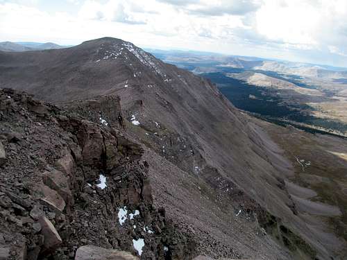
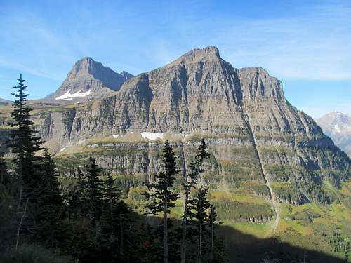
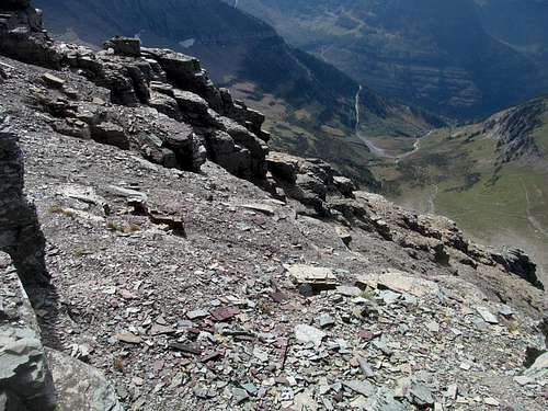
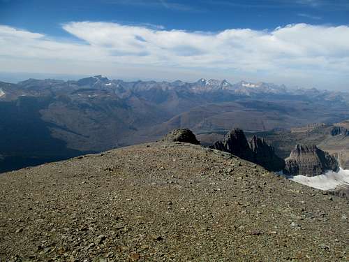
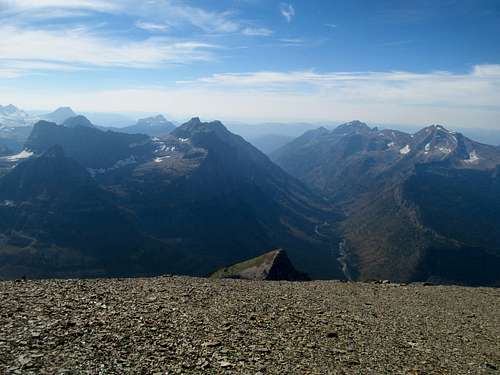
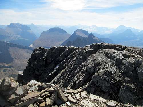
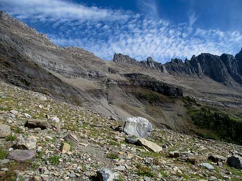
As expected the Kings summit ridge took longer than it looked from afar, but skewed perceptions aside felt exactly like its 1,000+ feet of gain would suggest. There was a climber’s trail but here also was some of the loose Uintas boulders I had heard so much about from Greg, wobbling and making me uneasy despite the fact that they sat right next to a popular highpoint trail.
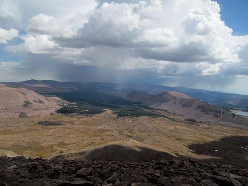
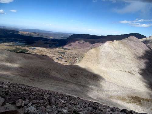
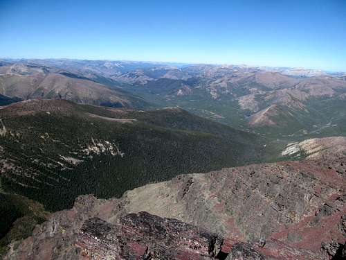
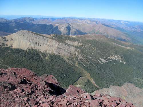
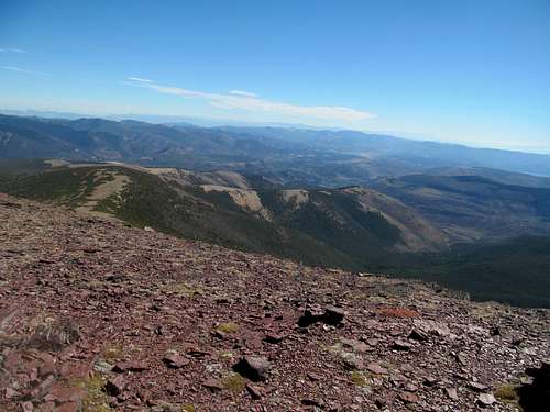
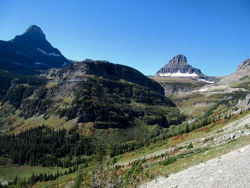
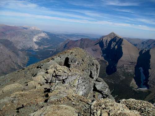
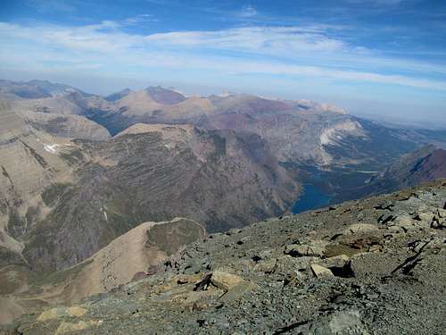
Peeks right down towards the Yellowstone Basin and up at South Kings, which seemed way higher than Kings itself, were exhilarating, though I could do without the exhilaration of the sound of distant thunderclaps from the east (?) arriving earlier than anticipated.
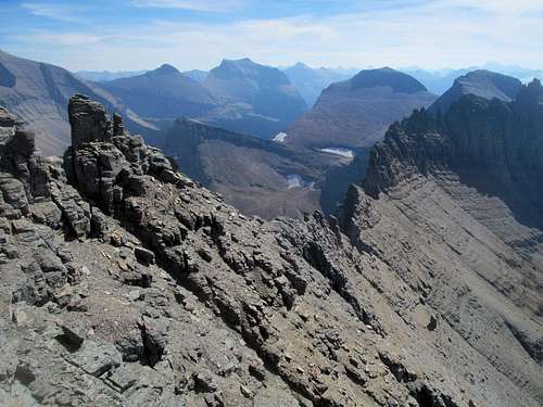
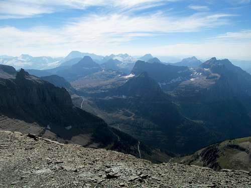
Views from the summit were less exciting despite how otherworldly the Yellowstone and Painter Basin looked from above.
And perhaps it was due to my timing in the fall, but they looked so goddamn barren, the high alpine peaks looking like duller and less colorful desert buttes. The scenery was raw, primitive and prehistoric, perhaps properly evoking images of those dull, plodding dinosaurs who probably would have felt right at home here.
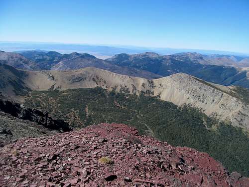
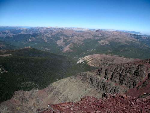
Meanwhile huge storms already brewed to the southeast near Marsh Peak and Vernal, so while I lingered I crossed off any plans of getting South Kings or any other of the Uintas 13ers this trip, especially in light of even more ominous thunderclouds building and approaching from the north.
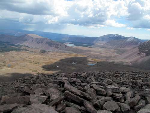
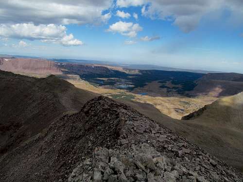
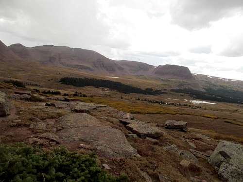
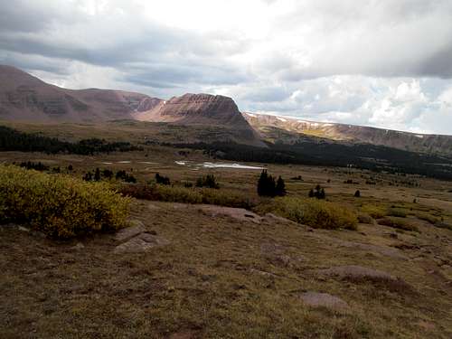
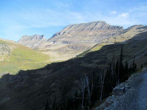
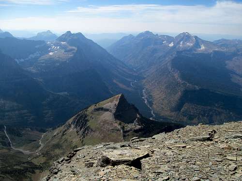
I came down the ridge and made my way back around the tedious boulder fields and the traverse back down to Gunsight, but not before snapping some final shots of the lake scattered Henry’s Fork Basin below.
It was getting dark as I rounded the last downhill section to Gunsight Pass, and the cairns beckoned more like druidic ruins warning of banshees on a dreary moorland evening.
Lightning seemed nearer, louder and more frequent by the time I started down Gunsight Pass, where I greeted some backpackers heading up. I warned them of loud noises and very dark clouds above Painter Basin on the other side of the pass, and wished them luck on their trip seeing as the weather looked bad for the reason of the week.
I figured I was out of the woods as I descended back into Henry’s Fork Basin, having gotten off the high ridges by noonish and now had only safe ground the rest of the way back.
Much to Taytay's likely chagrin however, being out of the woods was precisely the problem, as the storms intensified and I realized I had three or four miles of wide open fields to cross before I got back into tree cover at the end of the basin.
I’d imagine the top two levels of terror as either fear for a loved one or fear for one’s own life. To compare the two would be too complicated a philosophic pandora’s box to open on a goddamn trip report about hiking with crutches. The point is, much of the rest of my Kings excursion comprised of the latter category of the top category of terror…fear for one’s own life, punctuated by a few last miles of cold, wet and soggy misery. To my chagrin lightning in these parts was not confined to the high above-timberline ridges that I had already left behind, but all around me as I waded like a sitting duck through the open fields.
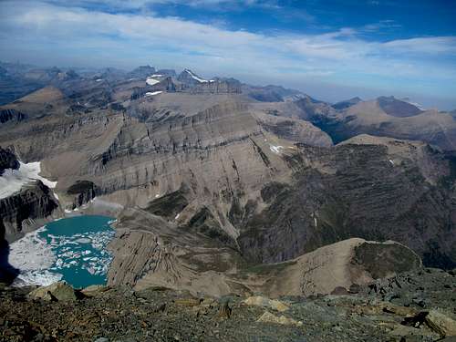
A thin but glaring and growing layer of new hail and snow already covered the north face of Henry’s Fork Peak. Booming claps of lightning rang astride the high peaks behind me, but also extremely violently to my left, past the ridges of Mt. Powell and soon enough, banged closer to my right just past the high reaches of the Gilbert/Gunsight ridgelines. Most alarmingly though, any sense I had of a safe space was soon violated by lightning strikes spreading into the basin itself, including on maybe only 500 yards in front of me.
So I ran…knowing that I’d be vulnerable all the way until the trail returns to the woods several miles away, my best bet for a safe space could only be to run on what was still not a fully recovered knee with hiking pole in one hand and crutch in another through each stretch of open terrain, taking cover and mentally relaxing slightly when the trail skirted brief pockets of trees, and rinse (literally through the alternating downpour and hail) and repeat.
Then the misery…by the time I reached the trees and the long walk back to the car I was damn soaked, cold, and yet the rain and hail continued to drench my spirits as I hopped beside the trail, traversing light layers of snow rather than the muddy and mucky quagmire parts of the trail had become. While I’ve often had occasional issues with my left ab and hip flexor muscles, the initial week after the accident and now this long trek back from Kings on a right knee that was still undergoing the last stages of recovery really aggravated those muscles. Like I had told Greg after our hike up Wind River Peak years ago, the muscle wear I felt now was structural, not just normal wear and tear fatigue, and even today I continue to experience daily discomfort on that left hip flexor, going to PT partly because of that long panicked trip back from Kings.
But like Greg always says, no one can take the peak away from you, and now I had finally completed both the state highpoint of my state of residence for the past three years, as well as all of its eight ultraprominents.
Shivering, exhausted mentally and physically, body weakened on drive back, I watched these violent system continue to bury the Uintas under the early evening sun, and thought to myself nevertheless how lucky I was to have gotten Kings during what was literally its last snow-free day, nay hours, of the year.
Seeing Red - September 20th, 2014
I dropped off the headlamp at Greg’s house, thankful that I didn’t have to use it, and prepped myself for the next week plus. I feared catching a cold or some king of bug after that ordeal but thankfully remained healthy. My legs in addition to the hip flexor felt like shit so I took two days to rest them. Days were limited, however, as the following FridayI needed to be in Vegas for my buddy’s brother’s bachelor party. I had initially figured I’d stop by, maybe grab lunch with my friend Phil, and go on to the Sierras, but he said I should do the entire party, and who am I to say no?
Time was running out, and by my calculations once I left for Vegas, the next time I returned to Salt Lake would be my last. My buddy and now roommate had already booked a plane ticket for early mid-October, as he would be flying to Utah and driving back east with me. This meant that after Vegas I needed to squeeze in my entire plan to check out the Pacific Northwest, the volcanoes, national parks, redwoods and, what had always been an impossible dream for me, the Oregon Coast, for immediately after Vegas to even maybe have a day afterwards to pack and move out of my room in SLC. So even leaving only two days to prep for Vegas, a long PNW trip, and move, which meant I had four days and little slack for my long-anticipated Glacier trip.
I had a very jam packed schedule. I would leave Friday morning and sleep in my car near Lincoln, MT. Saturday was Red Mountain, the highest point in the Scapegoat Wilderness and a good moderate peak to warm up my legs. Sunday I’d sacrifice the Pats Raiders game to go after Great Northern Mountain, Monday was Siyeh, a Glacier 10er, I’d check out the park those two days as well, and then Tuesday I’d go after Rocky Mountain on the eastern slope of the Bob before a long drive back to Salt Lake.
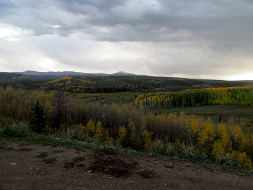
My buddy’s timeline weighed heavily on me as I drove north on a hazy Friday afternoon, my last ever trek up I-15 through northern Utah and the barren Idaho potato wastelands. Doing the math I realized that I didn’t have enough time between Vegas and his flight to be able to get in a good trip to get some Cascade Volcanoes such as South Sister AND do the Oregon Coast. I really, really, really wanted to drive the length of the coast of what I had always imagined as the most magical place in the world; luckily Brian booked his ticket via JetBlue, which allowed him to change itineraries within a week or something like that, so I convinced him to push his flight a week back, giving me some more breathing room. A car wash in Logan took the back left sidepanel of my 4Runner off. I didn't notice this until well past pretty Monida Pass, glazed by those first hues of fall, when I was gassing up in Dillon, where I bought an 8 pack of Cold Smoke cans that I planned to bring to Vegas for everyone to try this Montana brewed delicacy. Concerned, I called the gas station, and thankfully after a few calls they were able to locate it and promised to hold it until I returned to retrieve it. While I’d have to tour GNP looking like a scumbag, at least the image would be temporary, if not entirely misleading.
Evening hit past Deer Lodge and a mass text chain planning a guys trip back to UMass later that fall. Crazy that I would be back home by then. I lost reception for about an hour until I traversed by the beautiful Swan Valley at sunset, pulling into Lincoln just after dark. I learned at a local bar over Cold Smokes that this was where the Unabomber had hid out for all those years; no hotel rooms were available due to some antique car show that weekend, so I turned in an unplanned night in the back of the truck.
I actually felt pretty spry in the morning driving past dewy meadows north of town on the very well graded Copper Creek road. Things got a little complicated once the road rounded west into the main drainage where the road ends and the hike begins though, as I found the rest of the good road gated after the road curved north and back east to round the north side of the drainage. Based on Cedron’s book directions and other online beta I should have been able to drive further. There was an offshoot road further back, so I backtracked several times trying to figure things out, but couldn’t follow the rougher road, which seemed to cut north directly into the drainage, due to a truck parked and blocking the way. After much deliberation my lazy ass finally parked at the gate and I walked the extra mile or so down the end of the Copper Creek road.
The problem is that the road was now leading me away from Red. It eventually switchbacks back west and one branch follows the a small northwest tributary of Copper. Across the creek on the other side was a long east-west running broad ridge whose south face looked to have been extensively burned. I eyed that as I followed the road to the creek crossing, whereupon the jeep track disappeared and I waded through some pretty dense brush, coming up on the other side already huffing and puffing up the south facing toothpick forest slope.
Cedron had mentioned this area was dense with grizzlies, so I had been taking care to yell bear frequently. I saw a few hunters in the distance and they spotted me, so fortunately my yells didn’t scare them too much. They mentioned though that bears were more rare in these here parts now since recent fires had cleared a lot of the vegetation, which helped put my mind at ease a little.
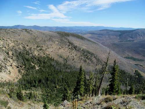
Over a thousand feet of steep, calf straining gain later I had gained the ridge. The bushwhacking had been pretty heinous down low but got better further up, and the rest of the route was a pretty monotonous yet pleasant hike through often dense tree cover. Without the benefit of open views and benchmarks I followed my GPS west, gaining some elevation ever so slightly, until the trees finally opened up to views of my summit objective.
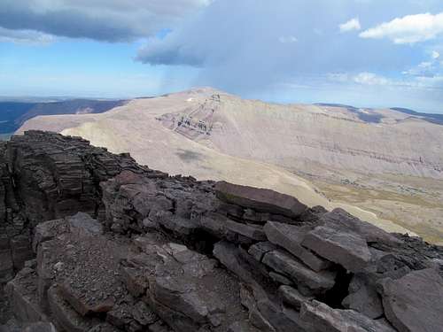
The west running ridge narrowed and now ascended a sandy white rock slope, then turned north to become Red’s south ridge proper. A white knob stood at the top of the ridge and behind it, the rock turned red fulfill the nomenclature’s prophecy.
It was tedious going up the white ridge, with lots of flat sandy sections that bogged down forward progress ever so slightly.
Perhaps light terrain distorts distance too, as similar to a flat desert floor the false summit ahead where white became red belied its actual proximity. The ridge from the false to true summit was a discouraging sight, starting with what looked to be a significant minor loss in elevation.
After a final bit of rubble I enjoyed the wholly new views in to the personally uncharted territory of the Scapegoat and Bob Marshall wilderness on a perfect and pristine indian summer day.
But alas on a Saturday which, by definition, meant that it was wholly overlapped with college football season. Thus I scurried back down the red then the neverending white ridge, then back into the even longer flat section back under tree cover.
Staying left (north) along the east-west running ridge would have led me back to my original ascent route. I decided instead to lean right and descend a steep but reasonable looking slope on the GPS down by a mine to return to the stream crossing from the west.
Somehow from this high ground I had cell reception still and got a call from Brian, who was already done studying and was on his way to the Poconos casino with our buddy Mochismo, a miniature Italian house painter. He asked if Mochismo could come for the cross-country drive back. I was a little concerned that my 4Runner could fit all my belongings, two additional passengers as well as their luggage for the weekend, but Brian said he’d figure it out. I assented while making the main downclimb, hanging up with the dry dirt got a little loose near the mine and I had to downclimb a few easy short ledge sections.
Further down I found the trail and stream crossing but lost it afterwards, thrashing through the thick brush and vegetation for quite awhile before finding the jeep track a little further back east. Sweating heavily in the afternoon heat, I continued down the jeep road until my GPS told me it was close to the main road, from which I turned right and made one last bushwhack back down to one last hot and humid road walk to the 4Runner.
I drove past the antique cars lined up through downtown Lincoln and made my first foray into the beautiful and terrifying Swan Valley. Beautiful because it was damn pretty, especially with the initial section of roadside lakes near Seeley Lake, and terrifying both because of the intimidating peaks on either side of the road, peaks I hoped to go after one fearful day, and also because of long stretches sans cell reception, which meant I had no clue what was going on with Bama/Florida, the prime afternoon game.
What seemed to be clear views left to the Missions were blotted out by a fire raging on the range’s eastern slope, but the neck craning views up to the Swan Range peaks were clear, though I couldn't tell which one was Holland, the range monarch. Another day I would have set Holland as a priority peak, but the elevation gain and the reputed scrambling would be way too much for my knee at this point (aka a cowardly copout, the first of many this trip).
Bama had unfortunately pulled away by the time my phone refreshed again at Bigfork, and I checked into a motel in Kalispell, which for the urban hub at the gateway of Glacier National Park, seemed surprisingly trashy. And it was, but I had a fun time nevertheless at Scotty’s Bar, a cozy saloon with good beer and friendly passerby’s, chatting with locals, tourists, and even a travelling Albertan rodeo cowboy. I enjoyed my fair share of Cold Smokes and also tried Kokanee, a crisp and refreshing Canadian beer, for the first time.
Being Basic in GNP - September 21th, 2014
I woke Sunday hungover yes, but facing a true sea of troubles even without the headache. My laptop’s motherboard, hanging on by a thread since spilling water on it in Missoula during the first leg of CripBag, finally seemed to croak before I hit the bar Saturday, flat refusing to boot. This was a concern not just because I liked to catch up on the world after a mountain every day on the laptop (facebook, barstool, news, etc), but I needed to upload my pictures after each trip, else run the risk of running out of memory space on my camera.
I had hoped to drink away my troubles the previous night, but woke with a heavy head and a still broken laptop. Greg had suggested buying a larger memory chip for the camera, which I had to do at a CVS Sunday morning. That fixed a logistical issue for the trip, but not the logistical issue with my body which was, in addition to the mild hangover, suffering from a pretty badly upset stomach. It wasn’t violent or furious by any means, not that type that I’ve occasionally gotten from food poisoning, but it was slow, and it was persistent, and unlike other occasions, it lingered on for days as a slow burning pain. Not knowing that at the time, I figured it was a day thing and, combined with the hangover, general fatigue, and a desire to just play basic bitch tourist at one of the most spectacular places in the world for basic bitch tourists, I decided to do just that instead of a long and steep trek up Great Northern Mountain.
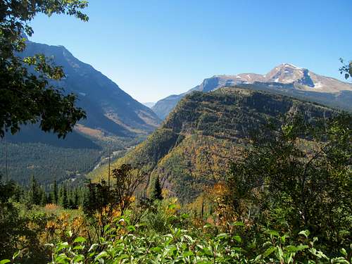
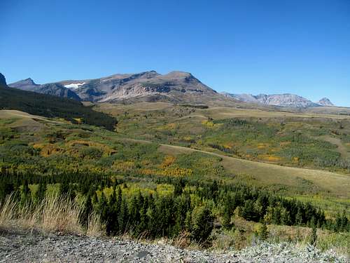
It was actually a surprisingly long drive from Kalispell to Glacier, the construction and my stops for supplies, breakfast and coffee not helping. I finally arrived at Apgar visitor center, got some info, and enjoyed some pristine morning views by Lake McDonald. Glacier is truly amazing in the fall with its abundant groves of golden aspen, and I enjoyed the long and scenic drive after taking a quick drive along the northern shore of McDonald and checking out the namesake falls.
Neck craning views below, yet the drive up to Logan Pass was dominated by spectacular views of Heavens Peak flanked by bright yellow fall hues, the late morning shadows playing tricks with steep alpine faces near the visitor center. I enjoyed views of the Garden Wall and such and tried to stop at the visitor center, but finding no parking I continued down the eastern side of the park.
I was however dismayed to find out that this day would be the last day the road would be open from Logan Pass to Saint Mary Lake. This was evident on the drive down, as much of the road had been stripped of concrete and I labored behind every other basic bitch RV tourist taking their damn time with ever tiny curve. This meant that Mt. Siyeh was out of the question for Monday, as its trailhead lay between the pass and the lake and would therefore be inaccessible. Though I considered whether or not to regret taking a day off, I rationalized that whatever my plans, I could not have gotten Siyeh since it had always been planned for Monday, and only advanced knowledge of the early closure could have resulted in a shuffling of days budgeted for each peak.
I googled furiously amidst questionable reception upon leaving the park at Saint Mary, weighing all my options before finally deciding on Mt. Gould as an alternative. While not a P2K, it came damn close and also earned brownie points for being the highpoint of the Garden Wall as well as one of the emblem peaks of the park, as seen on any such calendar featuring the standard basic shot from Many Glacier.
Frequent internet updates between summitpost searches also told me the Pats pulled out a close one against the Raiders, which further reinforced my rare decision to skip a New England game. There were few advantages to sacrificing a precious day in Montana to watch a game in which a loss would have been brutally horrific, a blowout win unexciting and expected, and a close win a disappointment at best.
I had originally planned to spend the night on the eastern side of the park seeing that it was closer to Siyeh, but the road closure meant that I had to swing back west around Marias Pass in order to reach Gould the next morning. Which was just as well, as I found the eastern portion to be oddly abandoned and undeveloped for such a prime national park location, not really seeing any bars or other basic betch tourist hoopla shit.
US-2 around Marias Pass in fall was sublime in its own way, not jaw-dropping like the sights in Glacier but the mild rounded woods and ridges felt special if only because you knew how they masked something extra special behind them.
Occasionally peeks at St. Nicholas along the Flathead River were mixed with frustrations once more with lack of cell reception and updated score for the afternoon games, but I managed to catch the 2nd half at a small dive bar next to a gas station in Columbia Falls. The area immediately west of GNP was oddly rustic as well too but the folks at the bar were friendly enough and gave me a pretty good briefing about the area. I enjoyed some bar appetizers as a late lunch and noticed Drew Bledsoe doing some local commercial on the TV. I remembered how my childhood hero always spent time in Whitefish in the offseason, and asked whether they saw him in the area. They said yeah, and on NFL Sunday’s if he was guaranteed to be in one bar it would be the Great Northern in Whitefish. I thanked them for the tip and headed on to the bar in time for the Sunday night game, but alas my old hero was not present. Regardless it was a worthwhile trip to a delightful and unique bar in what I found to be finally a nice upscale touristy, if expensive, city near GNP.
What else could go wrong this trip? First my car, then my laptop, then my body and now my phone, which had been struggling to charge the last few weeks, finally stopped charging altogether. I panicked, thinking that the phone itself was conked and wondering how I was going to make an emergency return to Salt Lake completely phoneless and unable to read barstool sports. Thankfully, I found a CVS that was kind enough to allow me to try several plugs and chargers, and I found that replacing the charger cord worked like a charm.
I bade a reluctant farewell to Whitefish and drove through an early evening Fall Montana dusk to a side road outside of Hungry Horse, where I parked and roughed it in the back of the 4Runner for the night.
A Gould Enough Consolation - September 22nd, 2014
I woke drove to Logan Pass, this time not stopping for pictures and purrty sights. At the visitor center I parked and readied myself, stomach still not 100%, for the hike up Gould. The description seemed basic enough…follow the Highline Trail for about 4 miles or so to a notch below Gould’s west face, aim for a narrow chute visible from the trail, then climb some basic GNP ledges to get to an airy summit with one of the best views in Glacier. Easy enough, right?
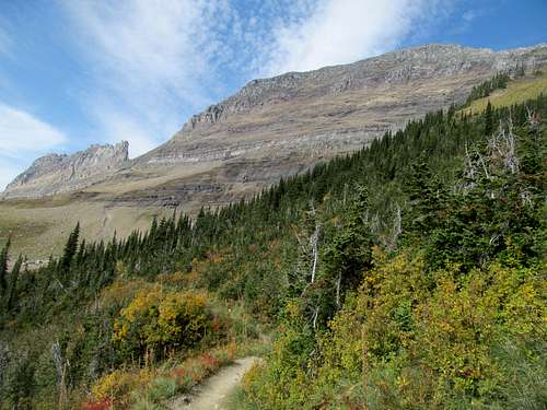
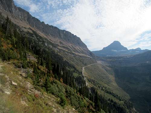
The Garden Wall looked spectacular from the well-manicured first mile past Logan Pass, though I was dismayed how it lost elevation to start things off.
The trail was great but miles and miles of relatively flat terrain got a little dull, #GNProblems ya know seeing as even though the trail wasn’t exciting the views certainly were, from the spectacular back at Logan Pass, to the far off peaks north and west of the divide, from the small intimate waterfalls still trickling down to the highways below, to the sheer size and intimacy of the wall itself, each crevice, dip and gendarme changing form with each new angle as they work fruitlessly to ward off the rising sun.
The sun was upon me by the time I walked below and past Gould’s west face, following the trail as it made a brief foray away from the peak before switching back to the small notch between it and a small butte. The approach thus endeth, and the climbing commenced after a quick granola break. The goal was to aim for a small black “diorite sill”, whatever the hell that meant. It was gained after several hundred feet of moderately steep grassy and pebbly slope. This first initial section of climb was damn fun, and supposedly the crux of the route. However, as I was to find out….your mileage can vary on these glacier slopes, and deviations can create new cruxes.
Physically past the crux I had the funny idea that I was mentally past the crux as well. Indeed, the edge of the Garden Wall seemed pretty close as the climbing eased through easy sandy ledges and occasionally unreliable cairns.
Eventually eye level with parts of the Garden Wall to the right, I noted that the amphitheater like rows of ledges guarding the summit loomed higher than they originally appeared. The climbing finally got tougher too, as each lego like block ledge, looking innocuous from afar, progressive increased in height and climbing difficulty. In an effort to avoid the larger cliff blocks I veered right, but not too much as the previously annoying though harmless landscape now revealed some serious cliffs and exposure between the west face, of which I was on, and the continuation of the Garden Wall towards Logan Pass.
I knew I was only a few hundred feet below the summit, but nearly all of this required scrambling.
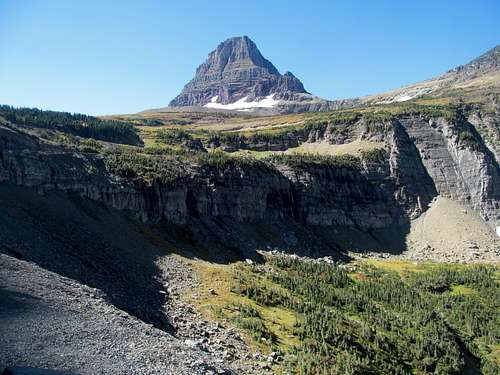
Wearily I continued, through a tight squeeze through a small chimney, until I felt the exuberation of reaching the summit crest, where a final turn back left led me to an incomparable summit.
Though I couldn’t climb my original target, I got the benefit of one of the most breathtaking views of Siyeh and its glacier carved west slopes from atop the Garden Wall.
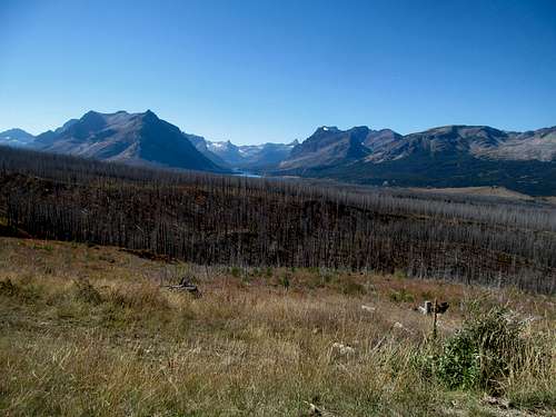
To north Iceberg Lake gave me a first true taste of Glacier’s secrets, hidden from the busy park road, and the endless views of peaks north towards Cleveland and Kintla suggested much much more. The silhouettes of peaks and ridges faded away in a heavy smog which I later found out came from some controlled burns south of the park.
I enjoyed these views as much as possible before descending, following my initial tracks back south but quickly losing my way despite my GPS. At close quarters between cliffs, the small squiggly lines on my screen became useless, and I often found myself caught in seemingly cliff out territory. I think I downclimbed too far south from the summit, and traversing back north required several very sketchy descents through loose chutes amidst cairns that were most definitely useless at this point.
I looked helplessly as one of my shitty hiking poles bounced and fell hundreds of feet down the cliffs during one downclimb section, which left me with only one crutch for the rest of the hike in addition to a lone hiking pole back in the car (I had lost another crutch at some point at either the Sacagawea trailhead or my sleeping spot near Gardiner MT).
During another descent move I lost my footing and slid down the scree slope ten feet or so. No flesh wounds, but I had twisted my right knee, the one that felt the impact from the car collision less than two months ago, in the worst way (inwards), and I sat on the ground and gasped in the immediate pain. I was worried that the injury was serious but eventually, though it was now pretty sore and ginger, it could support my limping ass as I continued down. With only one crutch now to bear the burden, I downclimbed carefully as I made it back to easier terrain.
Back down through the first supposed crux and the trail, I waded back to Logan Pass exhausted and in a fugue like state, though occasionally snapping pictures of the sun retreating over a hazy Logan Pass.
Thoroughly exhausted and stomach still bubbling in all the wrong ways, I pondered my options as I drove back towards West Glacier. I needed to be in SLC by Tuesday night in order to have enough time to either fix or get a new laptop if necessary for my last trip northwest. On the drive back I would need to a.) get an oil change and b.) make sure I stop through the Logan UT gas station to retrieve the 4Runner’s back left side panel. Oh, and I needed to get that reattached in SLC as well.
Part of me wanted to just return to civilization, relax, drink at the Flathead Brewery in Bigfork, sleep a shit ton, and get an easy peak along the drive back. Alas I couldn’t identify really any easy yet rewarding peaks alongside that western return route, and the high motel rates in Bigfork deterred me. Instead I made the long looping drive back around Marias Pass (due to the GNP road closure) to reach the sleepy hamlet of East Glacier so that I would be in position to tackle Rocky Mountain the next day. I was beyond exhausted and my stomach felt like shit, so I was almost relieved that the town seemed to offer no bars or real amenities. I grabbed a burger from a local diner and pass the fuck out.
Painfully Basic yet again - September 23rd, 2014
The forecast for Tuesday had been bad and got worse in the morning. With all the factors including the ominous weather, my sore legs and ginger knee still smarting from the fall, a persistent stomachache, lingering fatigue and a yearning to play basic bitch yet again, I decided to let Rocky slide and instead do a last bit of sightseeing before embarking on the long drive back.
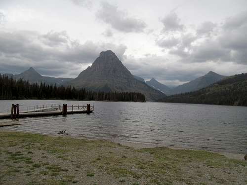
First up was Two Medicine. I enjoyed views of the lake on a perfectly still and cloudy morning. I hopped on the short trail to check out Running Eagle Falls, then cut north to Many Glacier; after all, having climbed Gould I might as well get a shot of it from its most famous, calendar worthy angle sitting over Swiftcurrent Lake.
I parked by the Many Glacier Lodge. It had just finished operating its last night of the season. Lingering groups of lodgers were trickling out as construction workers were already arriving to board up windows and get it ready for a long winter. I took some pictures of the lake with low clouds still lingering over the high peaks of Gould and Siyeh, then started the long drive back.
Some ginger ale at the St. Mary’s general store did wonders for my stomach, and the drive along the east side of Glacier and down along the Rocky Mountain Front through a barrage of golden fall foliage was spectacular. I stared at Rocky Mountain forlornly, my decision not to climb it bittersweet especially as the thunderstorms, promised for 11 AM, failed to materialize and the skies remained crystal clear (though hazy) for the remainder of my drive to Helena.
I got my oil changed at a Meineke and indulged in a Dairy Queen smoothie before continuing the long drive back to Utah. Lower Montana and Idaho passed with a blur on my last ever drive through the familiar stretch of 15 from Idaho Falls back down to Salt Lake. The gas station fortunately held on to my car paneling, and I only had a laptop to worry about in the two days I had before having to leave for Vegas.
Eyeing Telescope - October 1st, 2014
I got the car fixed at the same body shop that handled the post Notch Peak deer collision a year back, and brought the laptop to Greg’s house Wednesday night, where he fortunately diagnosed an issue with the boot settings that kept it going on life support. Laundry and a shit ton of packing, and I was ready to go for one last round, my longest outing from Salt Lake.
Not that I got homesick of Salt Lake itself, but being on the road can get tiring and one misses the familiar mattress and though I wasn’t working, peakbagging isn’t exactly slouching. Since my last day at work I had taken four mountain trips, none lasting more than an extended week at the most. Now I would depart for Vegas on September 26th, knowing that if all went well I would not be back until October 14th, two days before I was scheduled to move back east. I already felt the road fatigue really start to kick in this past trip and had a creeping feeling that it wouldn’t go away. I was honestly tired of peaks at this point, but needed to make my last weeks count. I yearned for the ocean though, to see and drive the length of the Oregon Coast; with that goal in mind I still needed to slog through and get as many worthwhile peaks as possible before being able to finally relax.
Vegas was fun as hell. I got in during the afternoon, met up with my friend Phil and the bachelor party crew, and embarked on an excellent adventure on a weekend at the Hard Rock. We did up the bars, the strip, a night at a mediocre club, and finally, after all these years, a Sunday Funday going hard at Club Rehab, the original pool party now a few years long in the tooth and overshadowed by places such as Marquee Dayclub and Encore Beach Club, and yet still a blast. My buddy Dana, who was the first on the scene when I got struck by the car in Savannah as well as the subsequent wedding in Orlando, was in town as well for work, so he joined the crew for one night. What struck me about this trip, late in September, was how every single girl we talked to were all from Great Britain, all seemingly staying in the same place, doing the same schedule (in the city for the week, helicopter tour over the Grand Canyon on Tuesday), that we figured that they all must be booking their trips through the same company or something.
Everyone flew back east Monday; exhausted and with a Patriots Monday night showdown against the Chiefs coming on later that night, I stopped by my buddy Dave’s house in North Vegas. He had just arrived from an overnight shift at the AFB, so while he slept upstairs I took one hell of a catnap on the downstairs couch. I was barely recovered for the night game, which turned out to be the infamous blowout in which each and every single prognosticator pronounced Belichick, Brady, and the Patriots done forevs. Luckily I’d live to see those proclamations rescinded in less than a week.
I hung around Tuesday morning, running some errands with Dave before embarking in the afternoon for Death Valley. Mentally I was out of it. My stomach barely recovered from midway in the Vegas weekend, but still backed up on sleep from God knows how long, I had a long way to drive from the desert to the lush Oregon Coast. My goal Wednesday was Telescope Peak, a kickass ultra with some of the greatest vertical relief on the continent but, after months spent up north, I just wasn’t feeling all that motivated by the desert. I usually try not to schedule middle of nowhere shit after Vegas because I know how I have city/nightlife/#chillinwitmahcrew withdrawals even without having to embark into the middle of nowhere. Tahoe was ahead of me at some point and I would enjoy that return to civilization, but in the meantime I dreaded the desert purgatory of Beatty, where I planned to spend the night.
I stopped by the Devils Hole unit of DVNP to check out the pupfish cave, though I couldn’t see anything. I arrived in the crickety town of Beatty and figured what the hell, might as well have a night out seeing as I had an easy peak the next day. Not knowing what to expect I stepped into the saloon to catch the Jon Lester pitch the Royals/A’s Wildcard game and found, out of all things…more Brits! Yup, squadrons of them, the less party-inclined ones, all on extended vacations but opting for the NatGeo rather than the Kardashian version of America instead.
I had a great time chatting with the Brits (one of them was even a diehard fan of NFL football!) and marveling at how they all travelled in packs. Alas my boy Lester lost in an albeit exciting as hell baseball game, but it was still an unexpected hell of a good night.
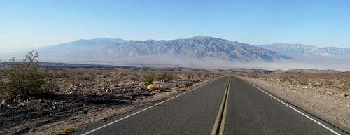
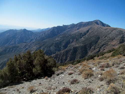
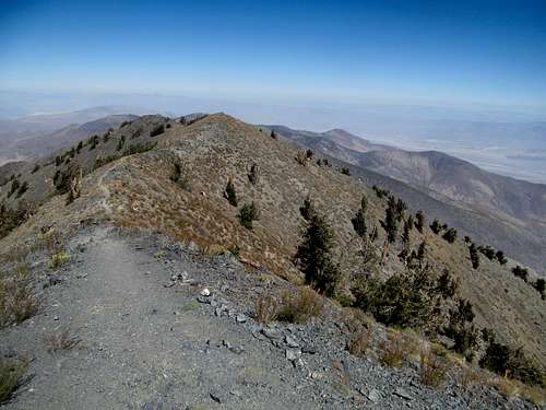
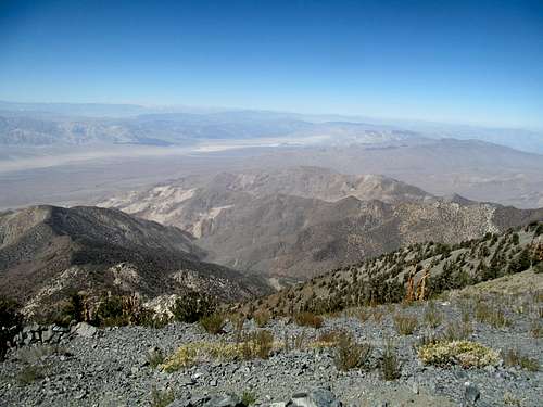
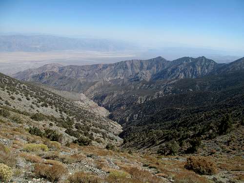
Despite having driven it 3 and a half years prior I was surprised yet again at the steep downgrade of the highway as it plummeted down from Beatty into the depths of North America. I did enjoy the views, primeval, stark and so different from Glacier and the northern Rockies. Obviously I found myself alone at the trailhead on a casual Tuesday morning and started up.
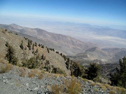
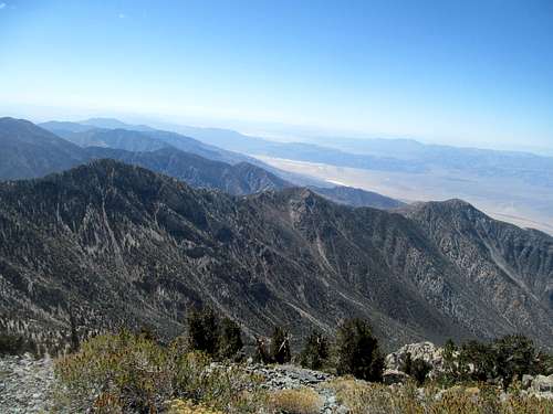
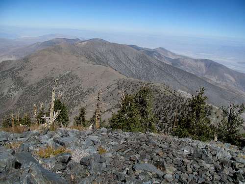
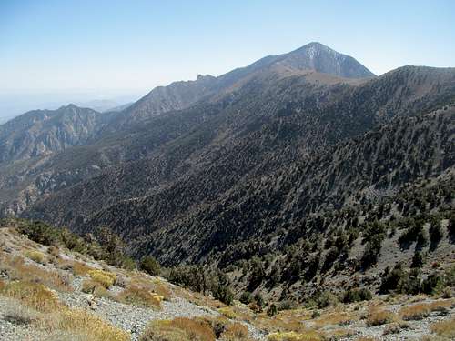
I mean honestly, I’m sure I would have appreciated this hike a lot in a different season, perhaps spring or early summer…through lusher, greener climes and bathed in the excitement of those first major 10er+ peaks of the year. Yet again, coming fresh off of Glacier National Park clad in foliage and several weeks in the Northern Rockies, my hard heart was unfortunately unfazed by the stark beauty of Death Valley this time around, at least on Telescope itself. The trail honestly feels a bit less than 12-13 miles round trip, since you can often see its straightshot progress miles ahead of you, especially on the initial section where it crosses over and ascends steadily yet gently up the eastern flank of the ridge.
The trail is damn narrow though, that was my main takeaway from this section, and having to squeeze my legs closer while walking really made my knee and left hip flexor sore as hell. Things got better when it reached the broad saddle between Rogers and Bennett, and continued its slow progress up to the summit, which looked deceivingly close for the rest of the way.
Apparently I was and would be hot on the trail of the famed National Park graffiti vandal of 2014.
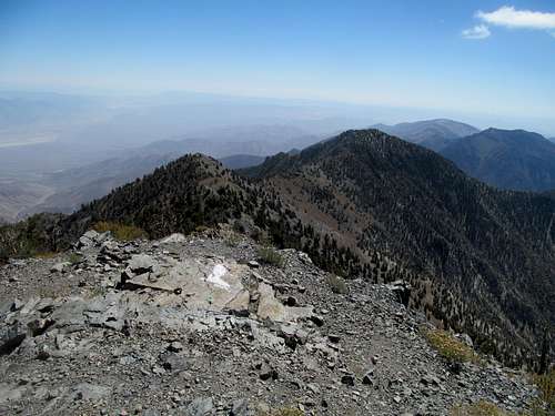
I vaguely noticed her odd mural on one of the summit rocks, even took a picture of it thinking that perhaps it was some kind of local inside joke or something.
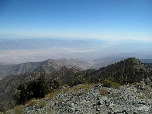
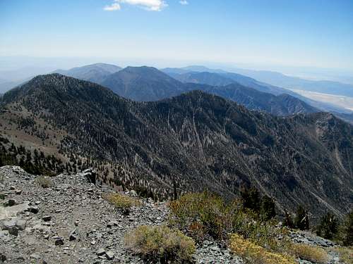
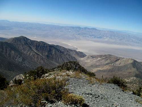
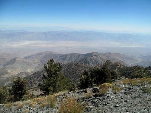
The views were alright, slightly hazy, towering over everything in sight, but no matter what it was damn cool to see from Death Valley to Mt. Whitney and the Sierras in one fell swoop, in addition to pretty much Charleston and what would be a microscopic Vegas strip only a few valleys away.
Serious thunderstorms had grazed Vegas as I was driving in the Friday before. Apparently they had left their mark at higher elevations in California. The trail was pretty much unaffected here but I was chagrined to see what looked to be a very shiny coat of new snow on White Mountain Peak, which I hoped to get the next day en route to Tahoe.
I descended, the narrow first few miles slightly agonizing on my legs once more, and my hopes were in doubt. My body had deteriorated in a few different ways since those spry climbs of Homer Youngs and Electric several weeks ago, and add in what I felt was tangibly accumulating road fatigue, I wondered how I would make it through this last and longest stretch.
Fortunately for me though, Telescope would be the last peak on this tour in which I felt any discomfort due to the accident in Savannah. Despite the soreness, I woke up feeling physically fresh as a daisy the next day and found myself running down Mt. Dana’s snowy slopes (skipping White Mountain Peak). So in my mind this marks the end of my Crippled Peakbagging rehab, one last phase that stretched from a literally stormy ascent up Kings Peak, to a figuratively stormy trip to Montana and GNP, a quick turnabout south through to refuel at the Vegas oasis and finally down to the depths of Death Valley, on an anticlimactic hike of what is still, despite my subject experience from one day, one of the most remarkable peaks amidst one of the most remarkable landscapes in this country. (Temporarily) fully healthy, I would be playing basic bitch, peak by peak, bar by bar, brewpub by brewpub to explore for my first time Tahoe, the Cascade Volcanoes, and finally experience my holy grail…the Oregon Coast.
Comments
No comments posted yet.