
-
 11604 Hits
-
 81.18% Score
-
 13 Votes
|
|
Route |
|---|---|
|
|
46.46482°N / 7.99393°E |
|
|
Mountaineering |
|
|
Summer |
|
|
One to two days |
|
|
II/45° PD+ |
|
|
Overview
What's New on this Page?
* Jan 6, 2023 - Ownership switched by Antonio Giani
* Jan 6, 2023 - Page under review
Long but fascinating journey inside an "Himalayan" environment. It's to be considered as a second "normal route", in addition to the famous ascent from the "Mittelaletsch bivak". Both very long.
However, the ascent from the "Oberaletschhütte", cannot be divided exactly in two days, due to the unconfortable position of the hut, awkward and backward from the moutain.
The first day a simple and panoramic paths from "Belalp" leads to the hut in 3.30h for more or less 9km. But the day after, climbers have to lose 100m to touch the base of the flat glacier, walk for few kilometers on it and then up for 1.700m to the top!
On the way back, climbers have to get back the 100m to the hut, carry on the path to "Belalp", as quickly as possible, to take the last cablecar at 8.00pm.
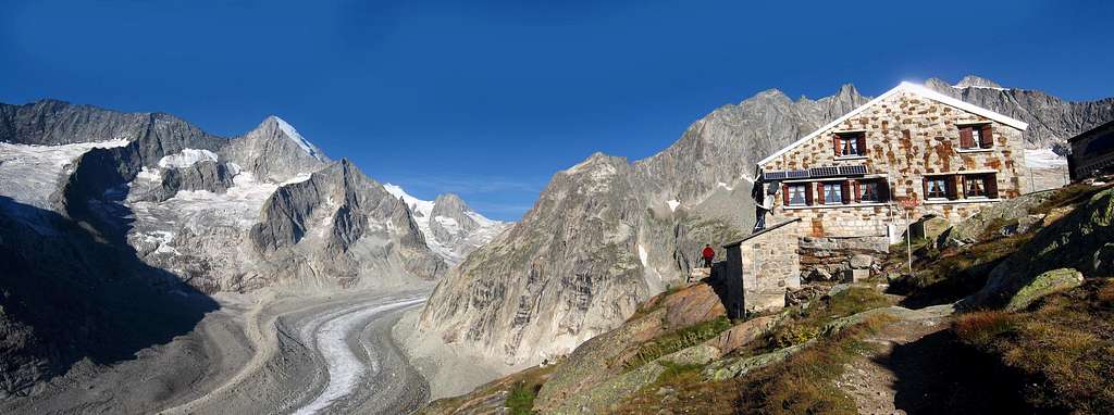 The Oberaletschhutte
Tour absolutely recommended for people really trained and fast. Better to expand the route in 3 days, and spend a second night to the hut.
Anyway the effort is fully rewarded by the impressive scenario and the beauty of the surrounding mountains like the "Nesthorn" and "Schinhorn". And yet the awesome view from the summit towards the "Oberland" glaciers.
The route follow entirely the south west ridge and the approach to the mountain does not require special mountaineering techniques.
It takes place mostly on small ice slopes not very fractured, steep but short snow gullies and easy rocky ridges of reddish rock, not of good quality.
However, these features added to exposure, altitude and tiredness, make this climb a challenge not for beginners.
Approach to the hut
From the village of "Blatten" 1.327m, where is possible to leave the car, a cableway leads to the village of "Belalp" 2.094m (14 euro return).
Check the timetable, but it schould be open more or less from 8.00am to 8.00pm.
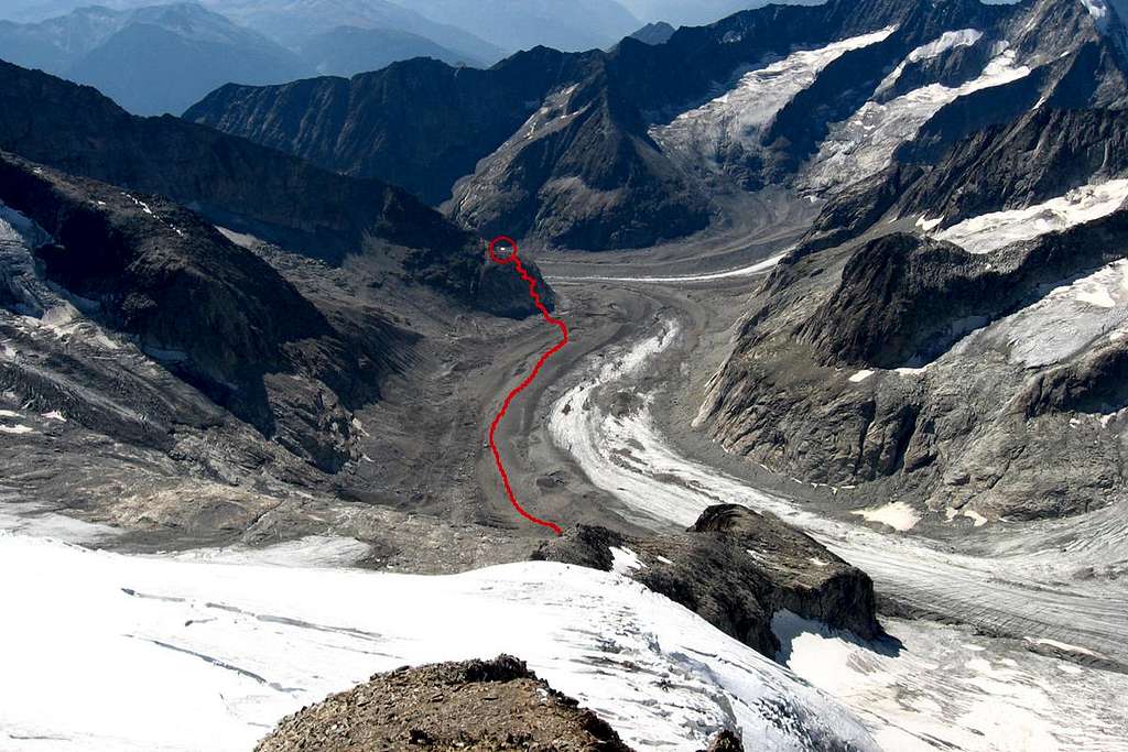
From the upstation, take the signal to "Oberaletschhütte" 4/5 hours. The path starts very wide and smooth crossing pastures and meadows until the "Hotel Belalp" 2.130m. From here the path lose 150 meters along steep grassy slope and points to the first morraines of the "Oberaletschgletscher".
Between the two morraines, an aerial bridge permits to cross over the creek and get on the second morraine on the opposite side of the glacier. photo
From this point, during the year 2005, a new path has been built along the flank of mount "Fusshorn".
The old itinerary, crossed the glacier untill the base of the hut. Today, this route is awkward and dangerous.
The new path, created with explosive charges, crosses steep rocky cliff with many up and down. From here the grandeur of the place begin to be visible. photo
After 3 or 4 hours, the hut is easily reached. 2.640m over the sea and 100m above the glacier.
Route Description
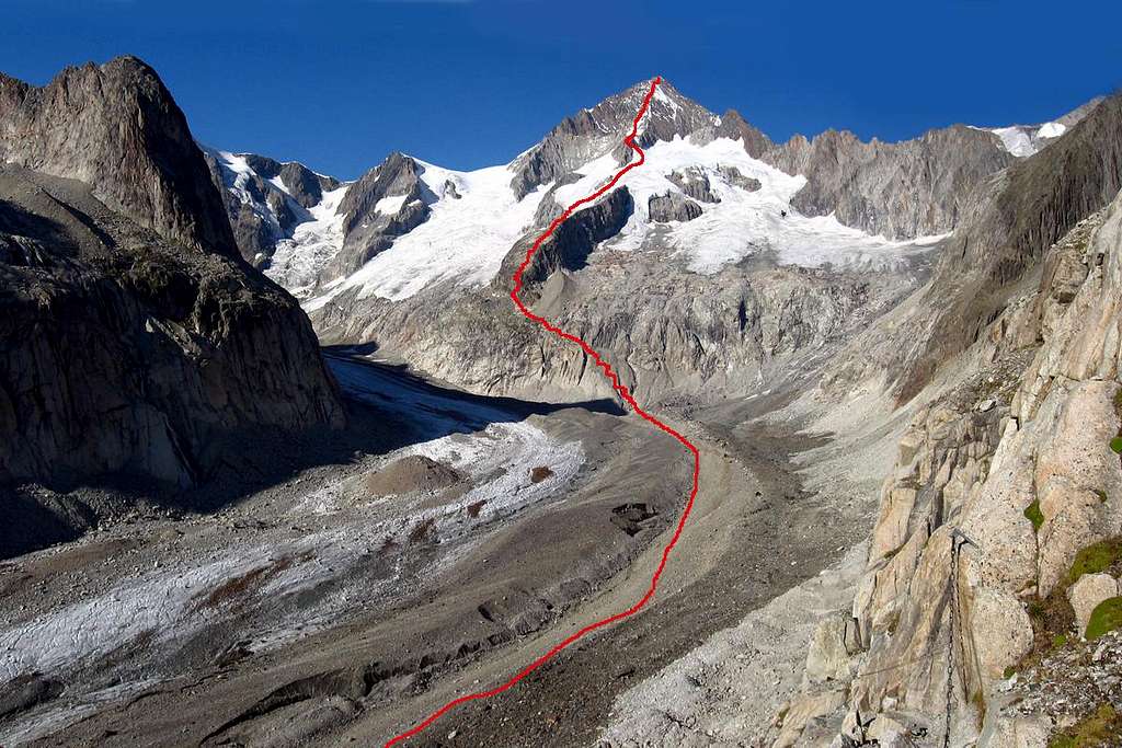
Breackfast at 2.00am. Start walking in the darkness behind the refuge. A path takes to the edge of the cliff. Chains, cables and ladders take to the foot of the cliff in 15m. photo
The glacier is composed of brocken rocks and stones and the ice in the deep is not visible. In the begin many stone piles indicate the right way. (pay very attention to find out the stone piles, because miss the way in the darkness, means wander on the glacier for hours!!).
If the direction is right, the surfice of the glacer is quite smooth and there are no broblem to get the point wherefrom a tortuous path leaves the glacier and go up on the cliff wich is the begin of the SW ridge.
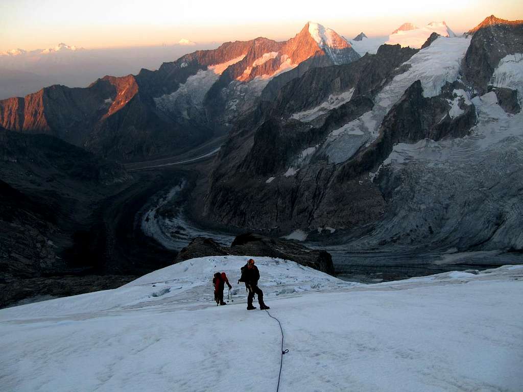
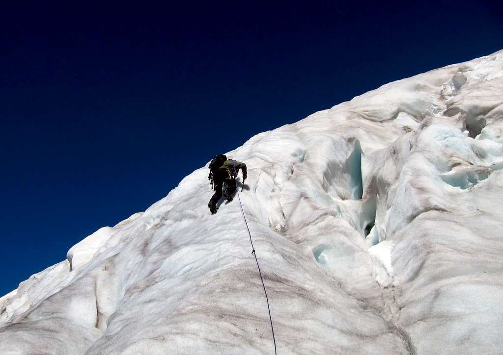
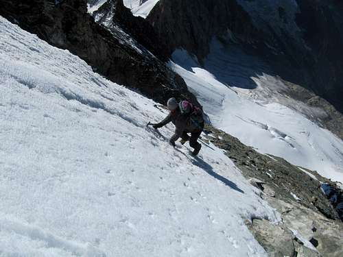
Some reflector signal are placed along the route, and the are very useful in the gloom. While the dawn comes up and and the brightness increases, numerous boulders and funny rocky passages, takes to the ice slope in the middle of the way. The approach to the slope is difficult, especially in the late season when the ice is very hard. After this point the difficulties are over; follow the slope (some crevasses) with a right-left turn. An ice chute leads to a second slope and then to the main ridge that takes to the summit.
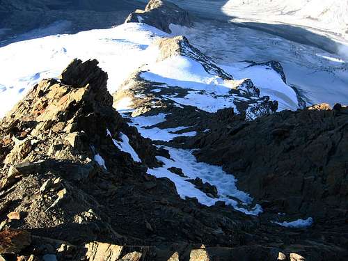
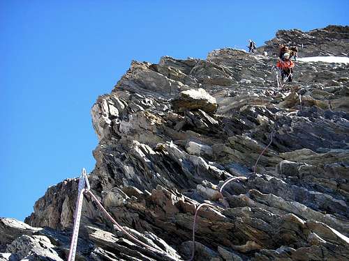
The ridge is composed of reddish rocks not very solid. In relations of the ammaunt of snow, the routes doesn't follow a precise direction. Anyway many anchor pickets placed along the ridge, indicates the right way and help to belay. The grades are never more than II or II+.
Depending to the conditions, you can choose to climb the rocks or the snowy couloirs between them.
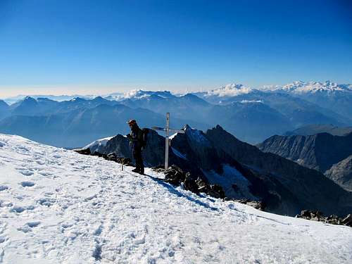
Now the efforts are finisched. The flat summit covered of snow, permits in absence of wind to relax and enjoy the beautiful scenery before the long descent.
For the descent follow the same route, using the anchor pickets for rappeling. If someone exhausted intends to return to Belalp all the way down; the descent is even longer in time than the ascent.
Usually the time required for the way up is 6/8 hours and 7/9 for the way down.
Useful links
Belalp village and Bahnen: linkOberaletschhutte: link
Swissmeteo: link