-
 6870 Hits
-
 90.81% Score
-
 33 Votes
|
|
Route |
|---|---|
|
|
48.65994°N / 113.89423°W |
|
|
Hiking, Scrambling |
|
|
Spring, Summer, Fall |
|
|
Most of a day |
|
|
Difficult - Class 1 and 2 |
|
|
Overview
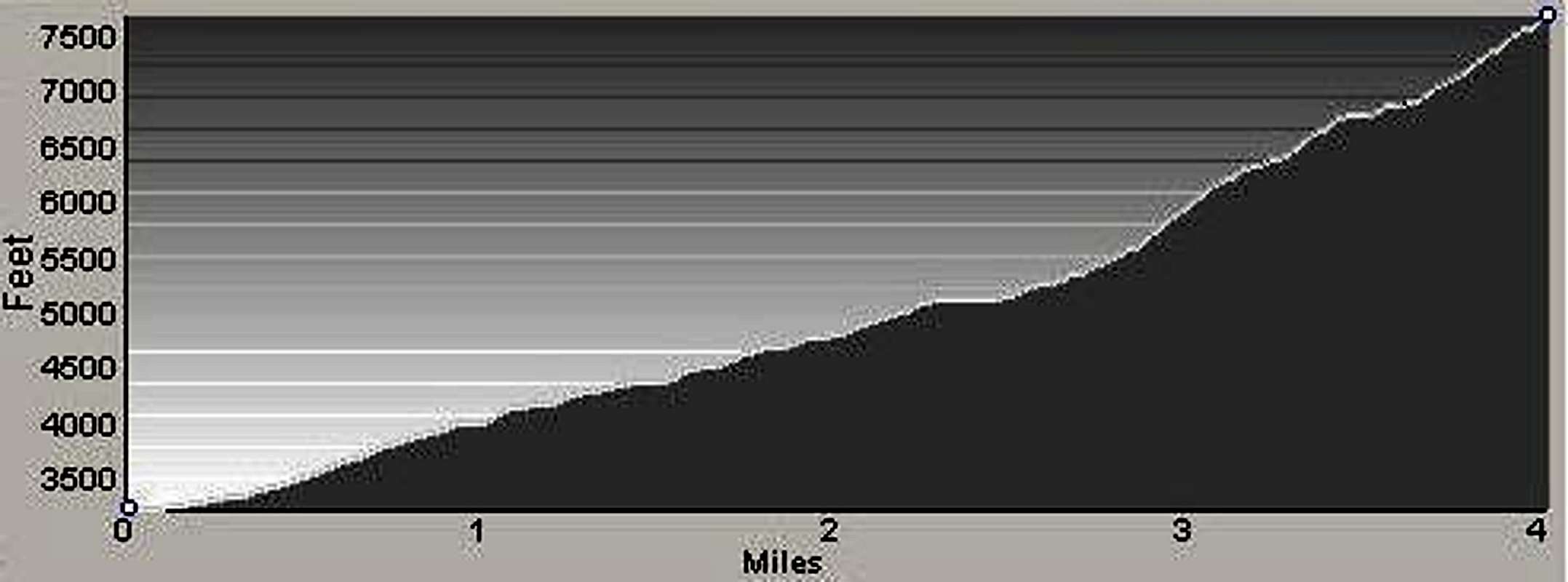
Route Type – Hike and Scramble Class Level – Class 2 Elevation – 7,750’ Elevation Gain – 4,594’ Distance – 4.2 miles (one way) Length of time required to complete route – 6 to 8 Hours (round trip)
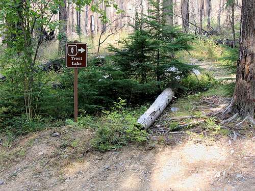
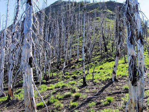
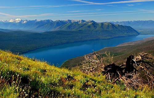
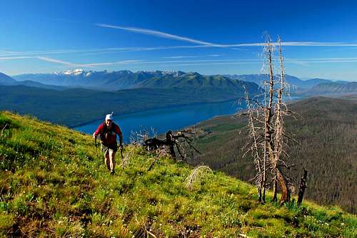
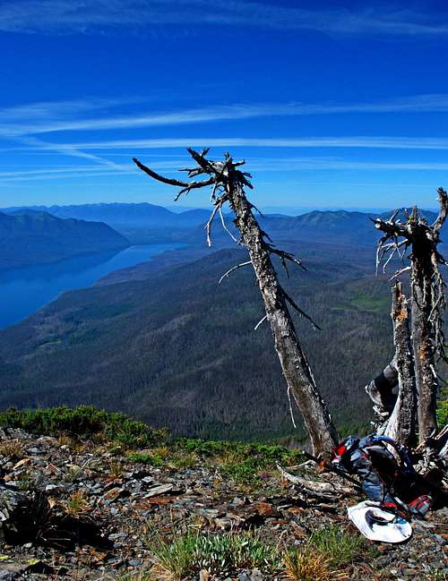
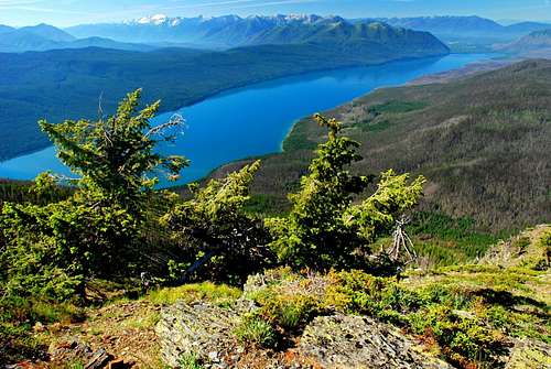
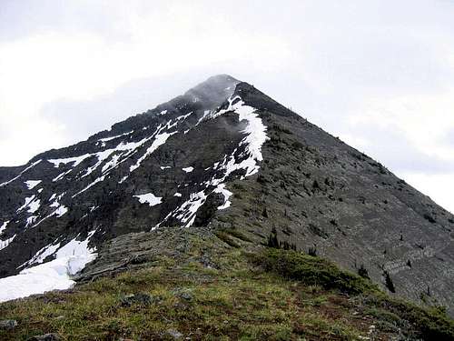
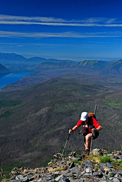
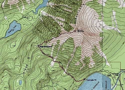
Though Stanton Mountain may not be one of the most "spectacular" peaks in GNP, it is nonetheless worthy of respect. Driving northeast along the shore of Lake McDonald, Stanton and Vaught dominate one’s view to the north. Seemingly rising from the north shore of the lake, the prominence of Stanton Mountain over its surroundings looks quite impressive. Stanton Mountain is composed of sedimentary rock as are the other peaks in the Park. But, unlike on most other peaks in GNP, the rock doesn’t seem to be as crumbly and loose. If one can find no other reason to appreciate Stanton Mountain, being able to climb on comparatively solid rock will do. If spectacular peaks are what you’re after, the summit of Stanton Mountain offers views unavailable anywhere else in the Park. And, in spite of the fact that no trail exists for about half of the trip to the summit, it’s easy to find your way to the top. Getting ThereTrout Lake Trailhead From the south drive north-northeast on Going-to-the-Sun Road along the shore of Lake McDonald. As you reach the north end of the lake, 1.4 miles past the Lake McDonald Lodge, look for an unmarked (at least it was such in 2007) paved road to your left, approximately a hundred yards or so beyond the Johns Lake Trail sign. After crossing McDonald Creek the road passes the Lake McDonald Ranger Station and Park employee housing (about .8 mile after the turnoff), and continues part way around the northwest side of Lake McDonald. Look for the Trout Lake trailhead sign on the right (northwest) side of the road approximately .7 miles after passing the Ranger Station. There is no actual parking lot, but the road is wide enough to allow for the parking of multiple vehicles along the road. Note: There is a gate near the trailhead which is sometimes locked. Park on the appropriate side of the gate to allow for exit in case the gate should be chained closed while you’re on the mountain. Route DescriptionApproach – Trout Lake Trailhead to Trail Crossing of Howe RidgeFrom the trailhead, head west-southwest along the obvious trail which is often used by stock animals heading toward Trout Lake. At approximately .3 mile from the trailhead, the trail makes a long slow turn toward the northwest. About one half mile from the trailhead, the well-used trail crosses a small intermittent stream and continues for another mile where it crosses another stream. Note: Both of these streams originate on the southwest flank of Stanton Mountain, and are the last (and only) places on this route which provide reliable sources of water. When I visited in early July 2007, only one of these intermittent streams still contained runoff. Any later in the season, your best bet is to carry all the water you need and not rely on these streams to replenish your supply. At approximately 2.3 miles from the trailhead you reach the apex of the trail as it crosses a saddle on Howe Ridge. This location is rather obvious because the trail begins an immediate (though gradual) descent toward Trout Lake. Shortly before the actual zenith of the trail there is a trail sign left (west) of the trail indicating the Howe Ridge Burn Trail. That trail is extremely faint and barely discernable in the undergrowth. Climbers’ Trail – Apex of the Trout Lake Trail to the Summit of Stanton Mountain From the highpoint of the Trout Lake Trail, leave the track to the right (east-northeast) and proceed into the undergrowth. From this point for the next .6 mile you will be bushwhacking up a slight rise through deadfall and what, in some places, is extremely dense vegetation. Fortunately humans and other animals have passed through this area, and if you take your time, you should be able to find trail segments going in the correct direction. Approximately .6 mile after leaving the trail, the incline gets steeper. It’s fortunate that this is also where the density of the vegetation begins decreasing substantially. As you climb upward through a mix of Beargrass and trees, stay close to the crest of the ridge. (I found that using animal trails as switchbacks conserved energy as I climbed through this section.) At an elevation of 6,150', there is a little bump (some call this a false summit). There is a nice little grassy area just above it - a perfect place for a short break. Continue uphill to a "real" false summit (6,877’) and another grassy plateau which offers astounding views of the surrounding terrain. The route from this point upward is less steep and mostly along the very obvious ridge-crest over a mix of alpine plants, grass, and rock. Although sedimentary, the rock is quite solid and provides good footing. As you near the summit, you will see obvious segments of trail leading toward the top. The summit, though not large, offers great views of the surrounding peaks, lakes, and back-country areas. The view of Mount Vaught and the ridge connecting it to Stanton Mountain is especially impressive. Descend by reversing this route, or if you wish, by the Southeast Slope (requires a shuttle or the use of two vehicles). When To GoThe use of this route is most often during the summer months, though I see no reason why the route would not be doable during the spring and fall when the road is open to (or close to) the trailhead.Actually, I believe this route would be doable during snow season as long as the snow is consolidated. The only portion of the route which appears to be susceptible to avalanche is on the steep portion of the route as it works its way up from the forest to the narrow ridge-crest. When I climbed this route on July 5, 2007, there was no sign of recent avalanche activity anywhere along the route. Essential GearSturdy footwear and plenty of water (especially during hot weather) are all that are normally required for this route.If you attempt this route while there is snow on the ground, you’re going to need an ice axe and crampons to ascend and descend the steepest portions of the route. Route Statistics |


