|
|
Mountain/Rock |
|---|---|
|
|
48.05573°N / 115.25705°W |
|
|
Lincoln |
|
|
Hiking |
|
|
Spring, Summer, Fall, Winter |
|
|
4728 ft / 1441 m |
|
|
Overview
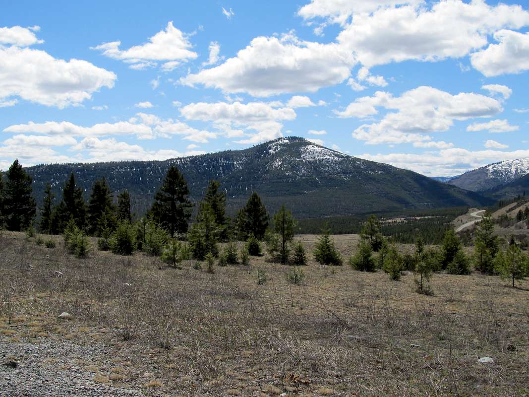
Wapiti Mountain is located on the eastern edge of the Cabinet Mountains of Northwestern Montana. Standing at 4728' in height, Wapiti is not a high peak, but due to its proximity to Hwy 2 it is a very prominent geographical feature and certainly commands your attention as you drive the highway between Kalispell and Libby, Montana. It also proved to be a fun bushwhack and a great mountain to get out on and enjoy a spring day...and the views to the some of the southern peaks of the Cabinet Mountain Wilderness to the west are very rewarding. You can also view vistas of the Salish Range to the east.
Wapiti is a Native American word meaning "elk".
Getting There
Guarded by the Fisher River on three sides, Wapiti is easily accessed from a very close, un-marked logging road on the north-east side of the mountain. Normally you drive approximately 54 miles west of Kalispell on Hwy 2. After passing a Hwy Dept. maintenance facility on the left, begin looking for an un-marked road intersecting from the left. This road is very easy to miss if you're going too fast and not looking for it as it angles in from the direction from which you're coming. Shortly after turning left on this road, make a quick right onto another un-marked road which is the logging road you would use to access the mountain. However, on this day, we were greeted by the scene below. Crystal Creek, which is a tributary of the Fisher River, is actively washing the road out and down into the Fisher River.[img:713961:alignleft:small:Turn left here][img:713960:alignright:small:Turn right here]
After studying the map of the Kootenai National Forest we came up with Plan B which is as follows. Drive approximately 51.1 miles west of Kalispell on Hwy 2 and turn right onto McKillop Road. Travel approximately .14 miles and then turn left onto 535. Travel approximately 2.78 miles on un-paved 535 and then turn right onto the un-marked logging road to the right.
[img:713958:alignleft:small:From parking area out to 535][img:713957:alignright:small:Parking area and view of ridge-top]
Continue down the un-marked logging road for .10 miles to the parking area where there was room for several vehicles.
Route Information
[img:713926:alignleft:small:The bushwhack begins...][img:713927:alignright:small:Moderate cover, but STEEP!]There is no trail to the summit, so this is a bushwhack route. It starts low on the ridge in moderate dense cover and quickly steepens as you gain elevation. As we gained elevation the cover also lessened.[img:713924:alignleft:small:Steep bushwhack up to the ridge][img:713925:alignright:small:First logging road view of summit]
After climbing approximately 262' over .22 miles we popped out onto a logging road switchback. At this point, you have two options. You can continue upward to the top of the ridge or you can hike the logging road toward the summit and then look for a convenient way up. We chose to climb to the top of the ridge.
[img:713929:alignleft:small:Terrain to the top of ridge, steep but open][img:713930:alignright:small:View of summit from ridge-top]
We found a game trail going up from the logging road, but it eventually faded out. The terrain continued to be steep but the views began to open up as the vegetation lessened. After another .12 miles and approximately 179' we made the ridge-top.
[img:713951:alignleft:small:Terrain along the ridge-top][img:713953:alignright:small:Another terrain shot]
From this point forward it is just a matter of picking a line of least resistance as you make your way westward along the broad, rounded, tree-covered ridge-top. Proceed along the ridge for approximately 1.05 miles, gradually gaining 450' in elevation as you hike.
[img:713931:alignleft:small:More open terrain along the ridge][img:713932:alignright:small:Closer to the summit the terrain opens up]
After this mile we popped out onto another logging road below the summit. From here, it just made sense to follow the logging road as it gained elevation. We stayed on the logging road for a short while as it made two quick turns as it wound it's way gently toward the summit.
[img:713948:alignleft:small:Upper logging road below the summit][img:713954:alignright:small:Left upper logging road here]
From the point where we left the road to the summit we gained an approximate 376' in elevation over .45 miles. An easy walk-up, the elevation gain to the summit was actually easier than climbing to the ridge-top at the beginning of the hike. The summit was large, rounded and tree-covered and a great place to soak up some views and have lunch.
[img:713955:alignleft:small:SP Member JFKitty][img:713935:alignright:small:Broad, tree-covered summit area]
Route Portion One-Way Mileage Elevation Gain Bushwhack to Ridge-top .34 441' Ridge Bushwhack 1.05 450' Logging Road to Summit .45 376' Total 1.84 1267'
Summit Views


Camping and RedTape
Wapiti Mountain is located in the Kootenai National Forest which is bear country. Don't hike alone, carry bear spray and know how to use it, and make plenty of noise as you hike.The closest campground is located at Logan State Park at Middle Thompson Lake in the Thompson Chain of Lakes.
Bring water, bear spray and bug repellent as the ticks were somewhat of a problem on this hike. The Kootenai National Forest Map proved invaluable in finding the alternate approach to this mountain.

Parting Shot


