
-
 17873 Hits
-
 91.97% Score
-
 37 Votes
|
|
Area/Range |
|---|---|
|
|
43.21190°N / 5.45425°E |
|
|
Hiking, Trad Climbing, Sport Climbing |
|
|
Spring, Summer, Fall, Winter |
|
|
912 ft / 278 m |
|
|
Overview
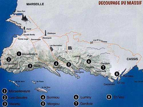
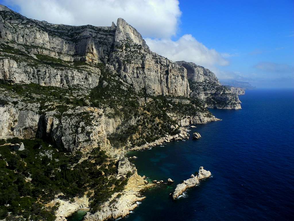
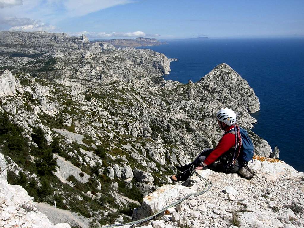
Between Marseille and Cassis the Mediterranean coast forms one of the finest limestone massif of the world, wild and well preserved despite being close to civilization: the Calanques of Marseille. A truly magical place for many outdoor activities, including hiking and climbing. The white limestone of the Calanques overlooks narrow sea coves and blue and turquoise sea with unmatched aesthetics and offers unforgettable sensations. When people talk about "Les Calanques" it actually covers an area that is almost 20 kms long with several climbing sites :
- Calanque d'En-Vau
- La Guardiole
- Calanques de Sugiton/Luminy
- Calanque de Morgiou
- Calanque de Sormiou
- Melette
- Calanque Les Goudes
- Marseilleveyre
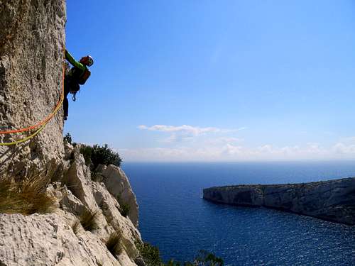
The great thing is that you can climb almost all year long, apart from summer when it is too hot and the access is closed for fire risks. The landscape is stunning, as you climb right above the blue Mediterranean Sea!
The Calanques are also famous in reason of two of its most passionated climbers :
Gaston Rebuffat and Georges Livanos (known as "Le Grec").
Getting There
- How to reach the Calanque de Sugiton
Road access
From Cassis, take the road D559 in the direction of Marseille ( towards West). After crossing the Col de Gineste, the road descends to the East end of the town Marseille. After the village of Vaufrèges and before Le Redon, there is a round-about. Turn left towards Luminy, that is soon reached. The neighborhood of Luminy is located in a wooded area southeast of Marseille. A bit isolated from the rest of the city, Luminy is bordered by Mount Puget and the crest of the Escampons. Especially known for its university center and its many schools, Luminy is the ideal starting point to reach in less than an hour the creeks of Sugiton and Morgiou but also to discover the Belvedere Tower of the Orient or go hiking to the large Candelle and Mount Puget. In front of the university center is a large car park where you can leave your car before taking the main path that starts at the school of art and architecture.
Walking access
There are different trail, depending on the climbing site you have choosen. To get the Calanque de Sugiton take the wide track next to the architecture school and follow it to the Col de Sugiton. At the col, there are different trail. To reach the calanque take a slight right on the trail marked with red dots which descends through the stones and some trees. The path quickly reaches the concrete road and cuts one last corner before becoming one with it. Follow the concrete road until the last bend which finally offers a beautiful view to the calanque. 100 m after turn right on the road always in Red Dots whose soil becomes natural again and finishes its descent to the creeks of Sugiton.
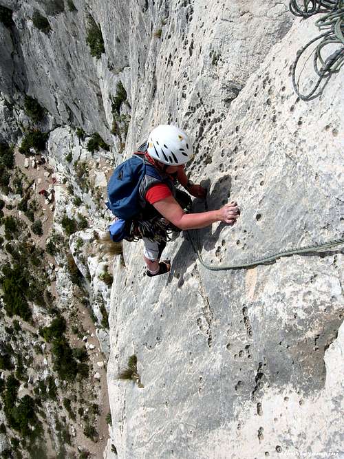
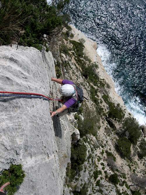
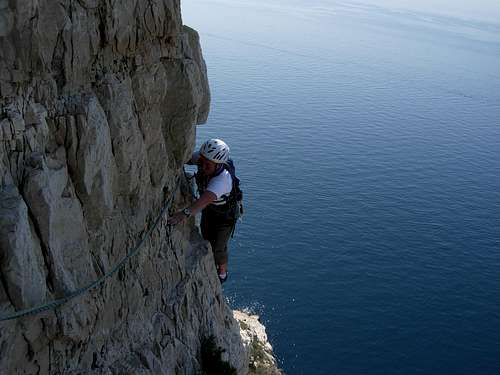
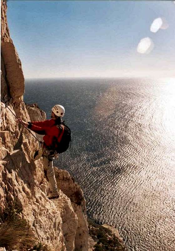
Site Description & Essential Gear
In Les Calanques, the entire rock is limestone.
It's not always perfect as there can be bushes and rotten rock, but usually the rock quality is very good.
Routes can be up to 150m high. A few are long horizontal traverse.
To descend, sometimes you have to abseil, sometimes you can walk down on the other side.
As there can several pitches the usual climbing gear is need :
2x 50m ropes
Quickdraws and sling
Abseiling equipment
Helmet (highly recommended !!)
Sun cream and lots of water in summer (undoubtedly)
Here is a description of the climbing areas in Calanque de Sugiton :
| _______Climbing Area_______ | ____Routes____ | ____Pitches____ | ____Level____ |
| Pointe du Belvédère | 6 | 1 | 6b to 6c+ |
| Le Virage | 31 | 1 | 5c+ to 8a |
| La Grotte de l'Ours | 33 | 1 | 6a+ to 8c+ |
| Paroi des Grandes Toits | 118 | 1 to 2 | 3b to 8b |
| Aiguille de Sugiton | 36 | 1 | 2b to 7b |
| Bonne Mère | 6 | 1 | 6b to 7a |
| L'Oasis | 22 | 1 | 5b to 8a |
| Le Promontoire des Américains | 5 | 1 to 3 | 5a to 7b |
| La Cathédrale | 18 | 1 to 4 | 4b to 8a / A3 |
| Les Pierres Tombées | 38 | 1 to 9 | 4c to 8a / A3 |
| Le Socle de la Candelle | 82 | 1 to 10 | 2b to 7c+ / A2 |
| La Grande Candelle | 35 | 1 to 11 | 2b to 7b+ / A3 |
| Cap Gros | 2 | 2 to 3 | 4c to 6a |
Red Tape
The climbing area is situated inside the Calanques National Park; the climate is dry and the winds may sometimes be violent, with a high risk of fires. Starting from June to the end of September the roads leading to the bays of Sormiou, Morgioux and Callelongue are closed from 7h to 19h. Check the park official website to know the prohibitions and permissions for the access during the summer months: Calanques National Park.

Where to stay
A great place to stay is the little town of Cassis (20 kms East of Marseille) with wide possibility of accomodation, including a good campsite:
Camping Les Cigales
Avenue de la Marne - Cassis
Phone 00330442010734
When to climb
All year round excluding the summer really too hot and with various access restrictions as said at the previous chapter. An excellent advice for planning a climbing trip: the best season goes from October to May.
Climbing images
Guidebooks and maps
“Escalade Les Calanques” by Andrè Bernard - Gilles Bernard - Pierre Clarac – Hervè Guigliarelli – Bernard Privat Ed. Nota Bene
"Alpes du Sud - Provence" by Hervé Galley - Editions Olizane
“Calanques Escalade” by Jean Luois Fenouil and Cèdric Tassan – Ed. VTopo
Map: "Les Calanques de Marseille a Cassis" 3615 IGN 1:15.000
Meteo
Calanques Meteo
Meteo France > Cassis