
-
 2103 Hits
-
 83.1% Score
-
 16 Votes
|
|
Mountain/Rock |
|---|---|
|
|
43.20830°N / 5.46972°E |
|
|
Trad Climbing, Sport Climbing |
|
|
Spring, Fall, Winter |
|
|
1614 ft / 492 m |
|
|
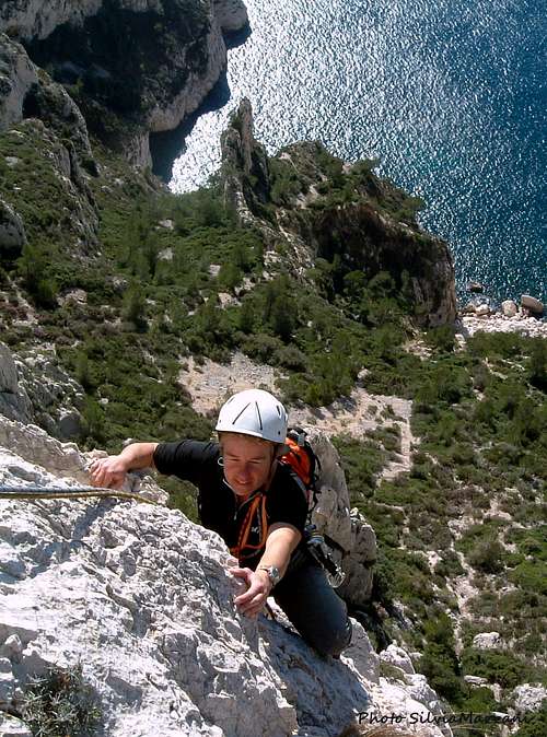
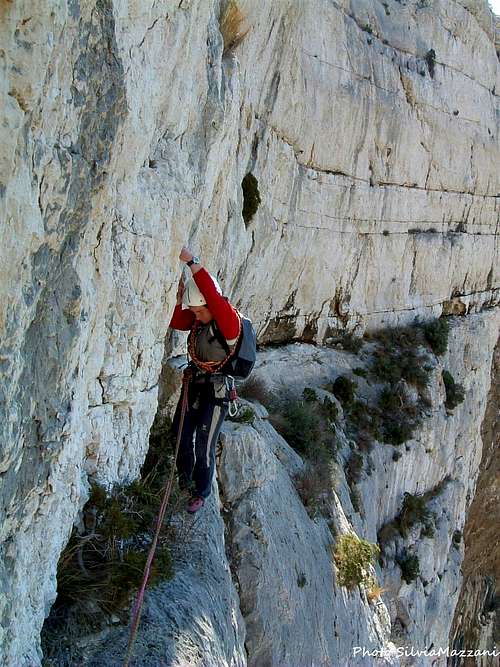
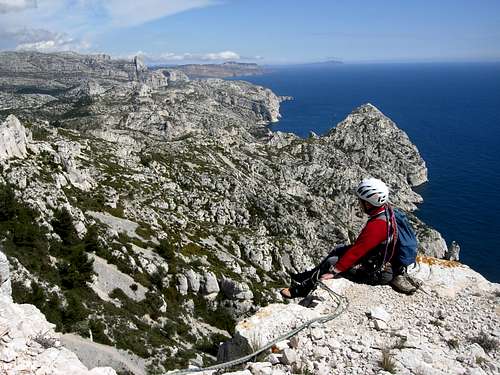
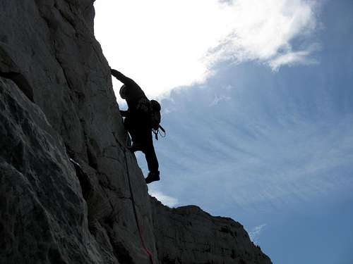
Overview
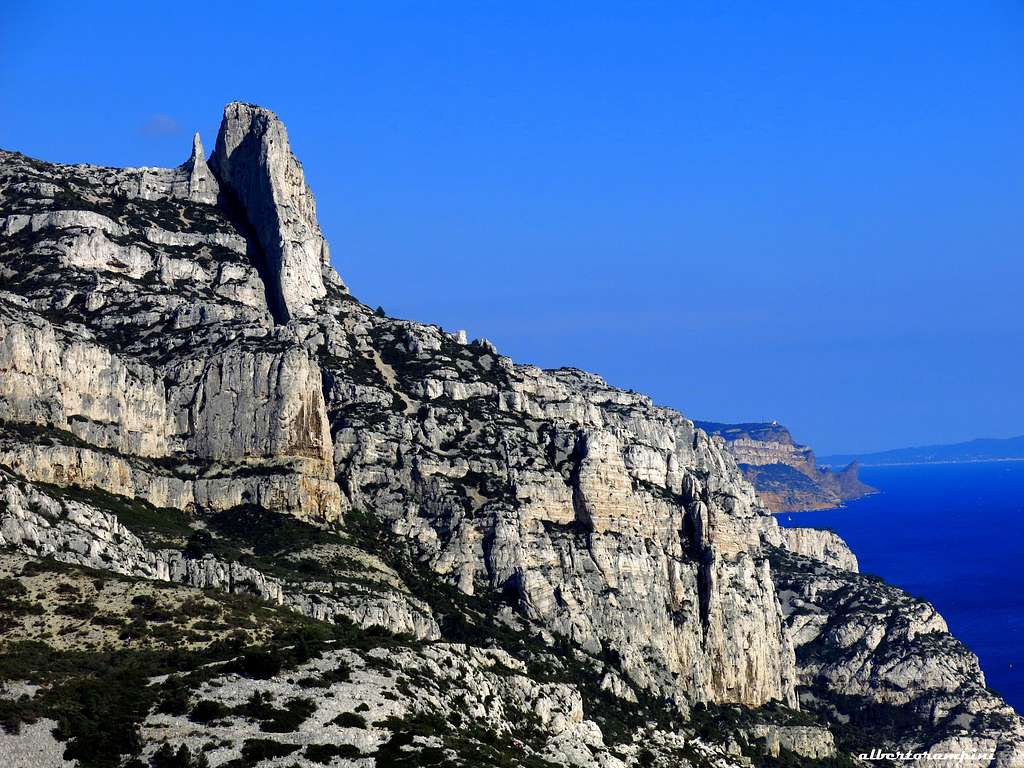
Concave
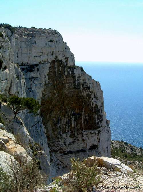
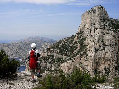
One of the most spectacular venue of the Calanques is located between the Grande Candelle and the Calanque de Devenson: it's the Val Vierge, surrounded by high rocky walls, among which the most famous is the Concave.
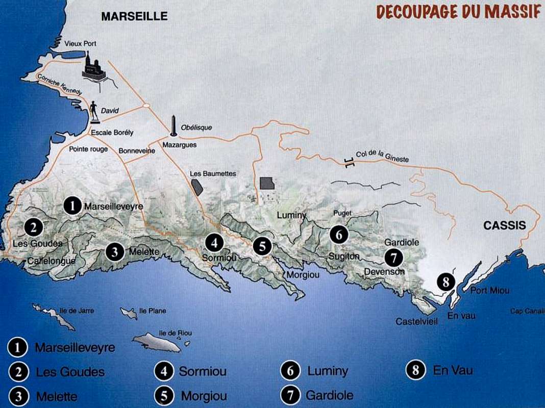
La Concave is part of the Gardiole sector, the wildest one of all the Calanques, located between the Calanque de Sugiton-Luminy and the Calanque d'En Vau. However the approach to the wall takes place from Luminy and therefore the mountain is inserted in the area Calanques of Sugiton-Luminy.
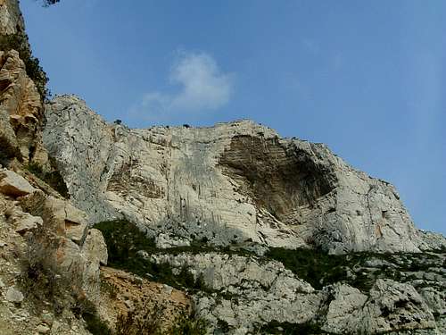
This fascinating rock structure takes its name from an immense overhanging niche of dark rock, where several mythical routes have been traced, such as the Directissime de la Concave in 1966 by G. Livanos et M. Vaucher. The wall of the Concave is oriented to the West. On the left there is a very tormented rock area with the Sector of l'Arête du Diable. It follows a sector characterized by a triangle of dark rock in the middle of the wall, where it's located the route "L'Oeil de Sauron". In the middle sector of the wall there is a gray and compact rock area, where it runs the classic Voie de la Concave, which borders on the left the large blackish cave and then runs diagonally to the left. The immense niche of blackish rock is crossed by 6 routes. Finally at the right end there is a wall of gray slabs with two last routes.
Getting There
How to reach the Concave
Road access
From Cassis, take the road D559 in the direction of Marseille ( towards West). After crossing the Col de Gineste, the road descends to the East end of the town Marseille. After the village of Vaufrèges and before Le Redon, there is a round-about. Turn left towards Luminy, that is soon reached. The neighborhood of Luminy is located in a wooded area southeast of Marseille. A bit isolated from the rest of the city, Luminy is bordered by Mount Puget and the crest of the Escampons. Especially known for its university center and its many schools, Luminy is the ideal starting point to reach in less than an hour the creeks of Sugiton and Morgiou but also to discover the Belvedere Tower of the Orient or go hiking to the large Candelle and Mount Puget. In front of the university center there is a large car park where you can leave your car before taking the main path that starts at the school of art and architecture.
Walk approach
All the routes
From left to right:
Sector Arête du Diable
Le bonheur est dans le cap 6b, 6a obbl. 120 m - P. Clarac, B. Vaucher, S. Gariglio, X. Legendre 2001
Docteur Gecko 6b max, 6a obbl. 135 m - P. Clarac, S. Wyns, P. Chaberty 2000
Le projet du Pierrot 6a+, 6a obbl. 145 m - Nicolas and Pierre Clarac, Jean Philippe Volpi (not equipped)
Arête du Diable intégrale 5c max 145 m - Sonia and Georges Livanos, Robert Gabriel, Albert Ouannon, 1951
Le bonheur est dans le cap 6b, 6a obbl. 120 m
Fabulous Troubadours 6c max, 6a+ obbl. 140 m - Pierre Clarac et Stéphane Wyns, 2003
Requiem pour un con 6b max, 120 m - Xavier Legendre et Thomas Vigan, 2003
L’oeil de Sauron - 6b max, 6a obbl. 120 m - J.L. Fenouil et X. Legendre, 2002
La voie de la Baïonnette A2, 5c 120 m - Georges Livanos et Marc Vaucher, 1960
Tradition commères 7a+ max, 130 m - Hervé Guigliarelli, 2003
Sector Enfant des étoiles
Elle est pas belle la vie ? exit Évidence 6c+ max, 6b obbl. 130 m - Alain Dupaquis, J.-L. Fenouil, Christian Cervoni, Cédric Tassan, 2003. Exit Évidence, H. Guigliarelli, 2003
L’Enfant des étoiles 7a+ max, 6b+ obbl. 130 m - Francis Elichabe, Philippe Legier, Christian Schwartz, Henri Vincens, 1988
Porque te vas ? 6c+ max, 6b+ obbl 130 m - Alexandre et François Bergasse, Patrice De Bry d’Arcy, 1987
Directe de la Concave A3, 140 m - Philippe Hiély, Roger Lepage, Gérard Vallet et Marc Vaucher, 1958
Sector Dévers
Au-delà de la verticale 7b+ max, 6c obbl. - Hervé Guigliarelli,1996
T’as le bonjour du Grec A3/A4, 140 m - Gilles Crespi et Jean-Louis Fenouil, 1989
Voie de La Concave 6a+ max. 6a obbl, 120 m - André Coudray, Georges Livanos, 1942
Tradition galère A3, 140 m - Gilles Crespi et François Ranisse, 2003
Directissime de la Concave A2/A3 ou 8a+, 140 m - Georges Livanos et Marc Vaucher 1966
Barjots land A3, 120 m - Christophe Bignon, 1997
Gaffe A3, 120 m - Lionel Catsoyannis et Laurent Simoni, 1999
Ne te penche pas trop... A4, 120 m - Gilles Crespi et François Ranisse, 1995
Les Amortis A2, 5c, 120 m - Georges Livanos et Marc Vaucher, 1960
Le Con et le cave 7a+ max, 120 m - Guy Abert et Lionel Catsoyannis, 1998
Le Cave et le con 6cmax, 6b obbl. 120 m - Guy Abert et Lionel Catsoyannis, 1998
Descent: along the Cheminée du CAF (black track n. 7) or the Cheminée du Dable (red track n. 6) or abseiling on "L'oeil de Sauroin", then in the direction of Col du Luminy through the Col de la Candelle and the Treize Contours path (green track n. 6)
Red Tape
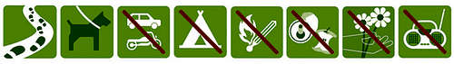
A very frail “milieu”
In the Calanques National Park the climate is dry and the winds may sometimes be violent. These factors, together with the closeness to the urban areas, make this environment particularly frail. Fires risk is very high; Sormiou, Morgioux and Callelongue routes are closed from 7h to 19h starting from June to the end of September. Fires, free camping and bivouac are absolutely forbidden. Check the park official website to know the prohibitions and permissions for the access during the summer months: Calanques National Park.
When to Climb
All year round excluding the summer really too hot and with various access restrictions as said at the previous chapter. Local climbers adapt themselves to the climate, climbing all around the year and choosing the sunny sides in wintertime and North faces during the hot season. Anyhow this is an excellent advice for planning a climbing trip: the best season goes from October to May.
Where to stay
A great place to stay is the little town of Cassis (20 km East of Marseille) with wide possibility of accomodation, including a good campsite:
Camping Les Cigales Avenue de la Marne 13260 CASSIS Tel 04 42 01 07 34
In Cassis you can find shops and petrol easily. It would be a mistake to stay in Marseille as there can be traffic jams (second biggest city in France after Paris... 1 million people) and there is no camp site. However the good thing about is that it is only 3 hours away from Paris by train.
Meteo
Calanques Meteo
Meteo France > Cassis
Guidebook and maps
“Escalade Les Calanques” by Andrè Bernard - Gilles Bernard - Pierre Clarac – Hervè Guigliarelli – Bernard Privat Ed. Nota Bene
"Alpes du Sud - Provence" by Hervé Galley - Editions Olizane
“Calanques Escalade” by Jean Luois Fenouil and Cèdric Tassan – Ed. VTopo
Maps:
"Les Calanques de Marseille a Cassis" 3615 IGN 1:15.000
"Marseille-Les Calanques" 3145 IGN Top 25
 |
 |
 |
 |
 |