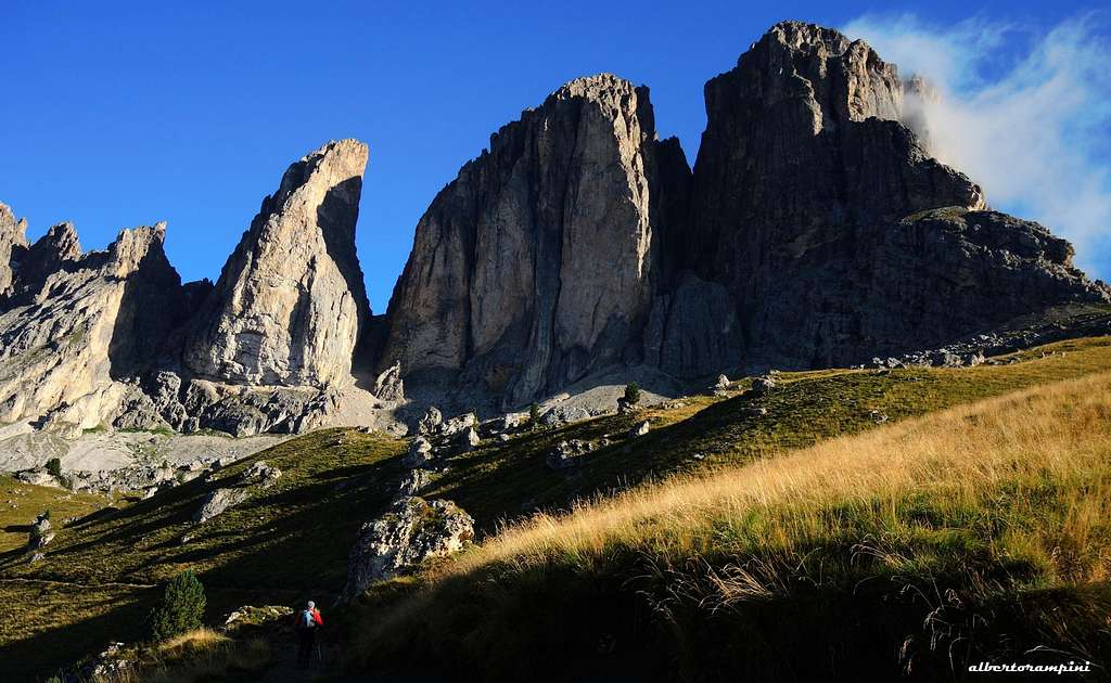
The Sassolungo Group - standing isolated between Val Gardena and Val di Fassa - counts some gems, including Torre Innerkofler, a mighty tower of dolomite situated between the massive Punta Grohmann and Dente del Sassolungo. The name commemorates the famous and great alpine guide Michael Innerkofler from Sesto, who summited the tower in first solo ascent in 1880, August along the East ridge. Notwithstanding it's a summit with a significant mountaineering importance, Torre Innerkofler is not particularly popular, despite the rich choice of several extraordinary routes running through each side and with varying commitment and difficulty.
Dente, Torre Innerkofler and Punta Grohmann from Friedrich August path
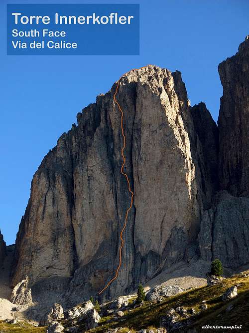
The South face of the tower dominates Val di Fassa with a 500 meters drop yellowish wall, vertically engraved by three deep cracks. Along the rib located in the middle of the wall it runs one of Torre Innerkofler and entire Sassolungo range greatest classic routes of high difficulty: Via del Calice.
Getting There
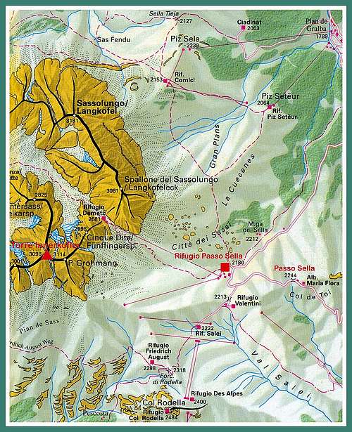
The starting point to approach the route is Rifugio Passo Sella, a few meters below Passo Sella m 2240 on the Val Gardena side, which can be reached either from Canazei either by Selva di Val Gardena.
Road access
- From Trento follow the A22 Brennero Motorway towards North, exit Egna-Ora and follow the road S51 towards Val di Fassa, getting to Predazzo, Moena and Canazei. In Canazei take the road to Passo Sella, reaching the pass and descend briefly on the other side to reach Rifugio Passo Sella.
- From Bolzano North follow the road to Ponte Gardena. From here take the road entering Val Gardena, pass Ortisei and reach Selva di Val Gardena. About 5 km after Selva the road forks; turn to right (signpost Passo Sella), reaching Rifugio Passo Sella
- From Brennero Pass take the A22 Brennero Motorway towards South, exit Chiusa and then follow the roadway joining the Val Gardena road, pass Ortisei and Selva di Val Gardena. About 5 km passed Selva the road forks; take the road on the right (signpost Passo Sella), reaching Rifugio Passo Sella
Marmolada and Gran Vernel seen from Torre Innerkofler
The mighty Sella Group seen from the summit of Torre Innerkofler
Route Description
Via del Calice - Torre Innerkofler South Face
Summit altitude: m 3098 Difficulty: Alpine TD+, UIAA max VI+ Route length: 500 m Exposure: South First ascent: Graziano Maffei and Giuliano Stenghel 1977, september 1-2 Starting point: Rifugio Passo Sella
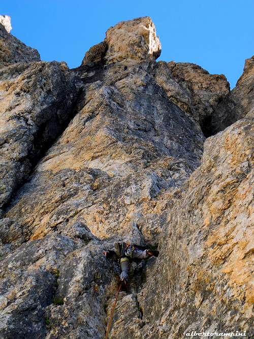
A wonderful challenging route rather often attended, of great satisfaction. One of the greatest classic of difficulty on Sassolungo group. The climb is beautiful and varied on good rock. Pegs are never too generous, but the possibility to integrate with mobile protection, especially medium and large size friends, is good. The stops are all equipped for rappelling.
Walking approach
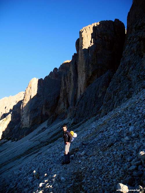
From Rifugio Passo Sella follow at first the dirt road towards Rifugio Salei, pass the hut and reach a wide saddle, where you leave the main trail (Friedrich August trail) and take on the right a path rising along a grassy ridge towards the foot of Punta Grohmann. The path crosses the steep pastures, passes a fence for sheep and continues at altitude, crossing the basal scree of Punta Grohmann and reaching the basal scree of Torre Innerkofler. The start of Via del Calice, at the base of the South wall, is located just beyond and to the left of Rizzi chimney. Climb up some easy rocks in the direction of a large obvious yellowish niche (1.30 hours from Ref. Passo Sella)
Route report
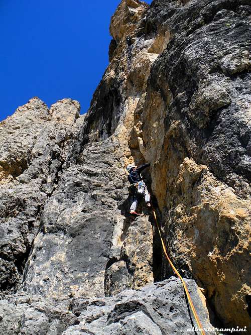
L1 Exit from the niche to the right, climb a short wall, reaching the belay under an overhang (III, 40 m) L2 Move to the right, up to a crack to a terrace at the base of a dihedral ( III, III +, 40 m) L3 Climb the dihedral and in the upper part move to the left on the edge, which leads to a comfortable terrace (35 m, + V+, VI-, a VI move, 35 m)
Torre Innerkofler basal scree
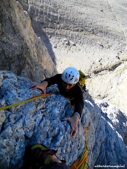
A difficult belaying on Via del Calice, Torre Innerkofler
Torre Innerkofler, Via del Calice
L4 Continue on the left up a steep crack - slightly slanting right - reaching a small ledge (V, V+, VI-, 45 m) L5 Climb a ramp slanting right, pass a short slab and continue on another ramp reaching a belay near Rizzi chimney (IV, IV+, V-, 40 m) L6 Up to a small ledge, traverse a few meters left and climb a small corner to a second ledge (IV, IV +, 30 m) L7 Up to another ledge, follow it to the left, bypass an edge and climb up to a pulpit to the right (III, 30 m) - First climbers bivy site
Yellow dihedral on Via del Calice, Torre Innerkofler
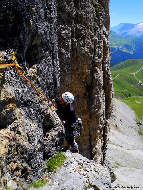
Getting a good ledge on Via del Calice - Civetta far in background
Steep yellow wall on Via del Calice
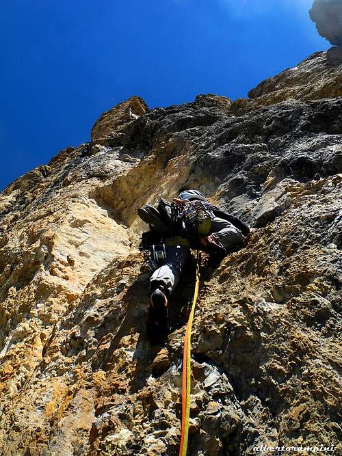
L8 To the right of the ledge climb a crack up the band of yellow overhangs, traverse left and climb a small black dihedral to a belay on the left (V, VI, V, 35 m) L9 Climb a dihedral to the left of the belay, pass and edge to the right and reach the belay inside a niche (V+, VI-) L10 Climb a crack and the next chimney (possibility to avoid the chimney climbing a wall on the right, rock of better quality) (V+, VI-, 30 m) L11 Up another crack at first slanting right, then slanting left, to get a comfortable terrace at the base of two parallel yellowish chimneys (V+, IV) L12 Climb the left chimney up to a belay inside a niche to the left under an overhanging yellow crack (IV) L13 Up the difficult overhanging crack, turning then into a narrow chimney, belaying on the left onto a narrow terrace (crux pitch, VI, VI+, V, 35 m) L14 Reach the crack immediately to the left of the chimney, reaching a narrow saddle at the end of the difficulties where belaying (IV+, 25 m). From this point it's possible to return to the base of the wall rappelling along the route, however losing the satisfaction to get a wonderful summit!
Torre Innerkofler summit cairn
Chimney at the end of the difficulty
L15 Climb a small wall and then follow a crest and a ledge, belay on an outcrop (III, II, 50 m) L16 A steep gully and a ridge, belay an a hole (III, II, 40 m.) L17-L18 Small ledges and grooves (some cairns) to the summit plateau (100 m, II) Descent - Be aware, the descent is not quite easy to find! From the top follow the southwestern debris to SW (cairns), downclimb along a little spur, reaching a first anchor: abseil 20 m. long. Downclimb along the gully, then traverse right (cairns), bypass around a rocky outcrop, continue downhill always to right (at a junction head to the right), reaching a second anchor: abseil 25 m. long. Follow the gully, gettin the third anchor (outcrop): 25 m abseil (easy, it's possible to downclimb instead od rappelling). Downclimb along a ramp leftward (cairns), then follow a steep ridge to another anchor, from which with a 50 m. abseil (possible 2 abseil, an intermediate anchor) you reach the fork between Innerkofler and Dente at 2772 m. Down the unpleasant scree gully, getting the base of the walls on the path that leads towards Punta Grohmann and Passo Sella (about 3 hours from the summit to Rifugio Passo Sella).
Essential Gear
Ropes 2x50, 10 quickdraws, a set of friends
History
Michel Innerkofler from Sesto
This superb peak is dedicated to Michael Innerkofler (Sesto Pusteria 1848 - Monte Cristallo 1888), a famous Alpine Guide from Sesto, resolute conqueror of the Dolomites’ difficult summits, who first conquered this peak in solo climbing in the year 1880. Head of a family of famous guides and one of the strongest mountaineers of his era, he was active in the second half of the nineteenth century and counts many important climbs in Eastern Dolomites in addition to Torre Innerkofler, as Croda dei Toni, Cima Ovest di Lavaredo, Cima Piccola di Lavaredo, Cristallo North Face and Croda da Lago.
Red Tape
No particular restriction in climbing and hiking.
When to climb
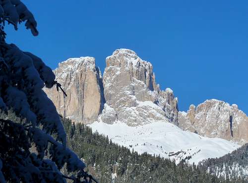
A winter image of Torre Innerkofler and Punta Grohmann
Parents refers to a larger category under which an object falls. For example, theAconcagua mountain page has the 'Aconcagua Group' and the 'Seven Summits' asparents and is a parent itself to many routes, photos, and Trip Reports.

 5366 Hits
 84.82% Score
 19 Votes