Toggle navigation
Mountains
Routes
Images
Trip Reports
Forum
What's New
People
Areas & Ranges
Articles
Trailheads
Canyons
Huts & Campgrounds
Albums
Logistical Centers
Fact Sheets
Lists
Custom Objects
Gear
Plans & Partners
WELCOME TO SUMMITPOST
SIGN IN
REGISTER
Mount Langley
Additional Parents
Tuttle Creek to Mount Langley
Image
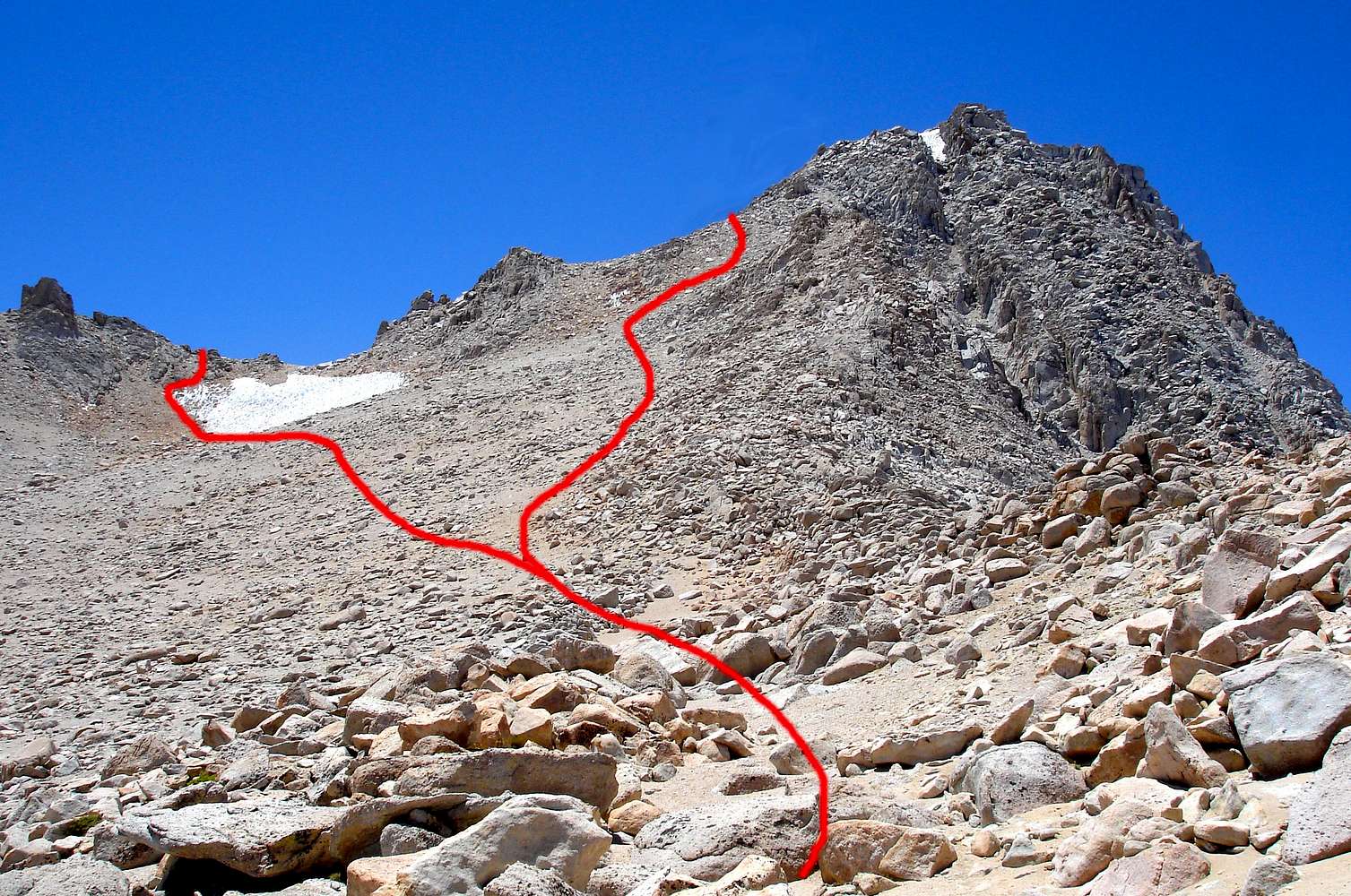
upper route
View High-Resolution Image
upper route
The upper section of the route. We went up past the snow because we were running low on water, and came down the steep way. It is easy going through here a little scrambling but you can go just about any way you want and it's all third class
« PREV
NEXT »
jmc
on
Jul 22, 2007 6:16 pm
Comments & voting
Other parents
Lat/Lon:
36.52330°N / 118.238°W
Image Type(s):
Hiking
Image ID:
314888
9335 Hits
71.06
% Score
1
Votes
Log in to vote
Comments
No comments posted yet.
to post!
Don't have an account?
Mount Langley
(Mountain/Rock)
You are at
the First
Image
Viewing
#1 of 1
GALLERY
You are at
the Last
Image
jmc's Image Gallery
« PREV
Viewing
#188 of 258
GALLERY
NEXT »
Tuttle Creek to Mount Langley
(Route)
Loading....
×
You need to login in order to vote!
User Name
Password
Remember me
Forgot your password?
Log me out when I close my browser.
Keep me logged in all the time.
sign in as a user
Don't have an account?
Register now for FREE
Rating available
Suggested routes for you
People who climb the same things as you
Comments Available
Create Albums
Register Here


