
-
 4895 Hits
-
 83.69% Score
-
 17 Votes
|
|
Mountain/Rock |
|---|---|
|
|
47.76973°N / 15.78202°E |
|
|
Via Ferrata |
|
|
Spring, Summer, Fall |
|
|
4646 ft / 1416 m |
|
|
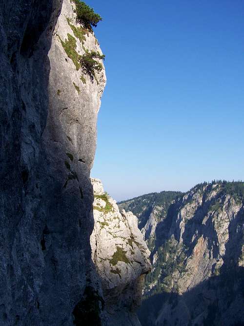
Prominence: 36 m![Turmstein, north face]()
The north face of TurmsteinTurmstein means “Rock-tower”. Yes, Turmstein is a rock tower on the western slopes of Schneeberg. It’s a nice natural formation – a spectacular bare limestone cliff in the middle of the forest. One of the few klettersteig routes of Schneeberg leads to its top. The outlook from the peak is excellent.
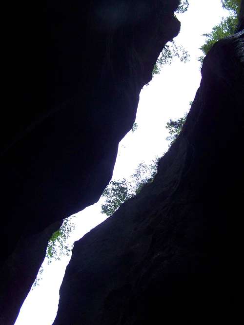
![The canyon of Weichtal]()
The canyon of WeichtalFrom Wien it’s not far. Take the A2 highway to south (direction of Graz). Then leave the A2 highway and continue your way on the S6 highway, in the dirction of Semmering. Get off from the highway at the Gloggnitz junction. Continue your way on road 27. After 12 km you will enter Höllental at Hirschwand an der Rax. After 7 km you arrive reach the tourist hut called Weichtal Hütte, on the right side of the road, at the entrance of a narrow walley. Start your hiking here. You have two options here. On both ways you have to ascend 817 m in order to reach Kienthalerhütte, to the „trailhead” of the klettersteig leading to Turmstein. For a weekend hiker these would need 3 hours:
a) Via Weichtalklamm
It’s an A-B category klettersteig way. It’s only a secured path, good for beginners. I would recommend this way, for most of the way going in a deep, narrow and dark canyon. It’s very interesting
b) Via Ferdinand Mayr Weg
The normal way
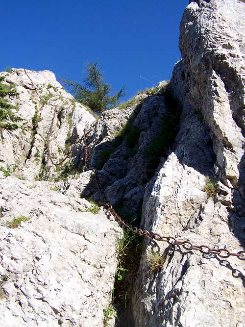
![The upper section of the Klettersteig route of Turmstein]()
The upper section of the Klettersteig of TurmsteinThe route is very short: only with a 36 meter elevation gain, with medium difficulty: 3 – B/C. The climb start only 10 meter far from the Kienthalerhütte tourist hut. The start is a vertical wall, indicated with an information board. And you can see the fixed ropes, too. The first 10 vertical meters are easy (A-B). Then comes the most difficult part (C), a chimney with large metal steps helping the climb. These steps are not very near to each other, and it’salso an exposed place. This section is not longer than 5 meter. The upper section of the route is technically easy (first B, then A). More attention is required only in bad weather here. The exposure is high everywhere on this rock and any fall from here would be fatal.
Return to the tourist hut on the same way.
Despite the short lenght and medium difficulty via ferrata set is recommended due to the big exposures. Not for children!
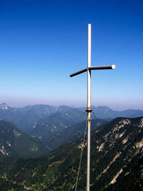
![The summit cross on Turmstein]()
The summit crossThere is a metal cross on the peak. Excellent view to the direction of Rax, Schneealpe, Mürzsteger and Türnitzer Alps. And excellent view also on some parts of Schneeberg, like on Fronbach Wände.![The tourist hut Kienthaler Hütte]()
Kienthaler HütteKienthalerhütte (1380m)
Open: from eastern till 1 November on Saturdays from 11 a.m. till Sundays 4 p.m. Also opened on bank holidays. There are 2 double rooms, a room with 3 beds, and 20 additional places. Limited food and drink services. There is no winter room in the hut!
Reservation: Reservierung@kienthaler.at
Phone: 0680 1406812
![Thalictrum aquilegifolium]()
Thalictrum aquilegifoliumFor weather information click here
Map: freytag&berndt WK220 Semmering – Rax – Schneeber – Schneealpe 1:50000. And many other maps...
Overview
The north face of Turmstein
How to Get There?
The canyon of Weichtal
a) Via Weichtalklamm
It’s an A-B category klettersteig way. It’s only a secured path, good for beginners. I would recommend this way, for most of the way going in a deep, narrow and dark canyon. It’s very interesting
b) Via Ferdinand Mayr Weg
The normal way
Klettersteig Route on the Eastern Wall
The upper section of the Klettersteig of Turmstein
Return to the tourist hut on the same way.
Despite the short lenght and medium difficulty via ferrata set is recommended due to the big exposures. Not for children!
On the Peak
The summit cross
Tourist Hut
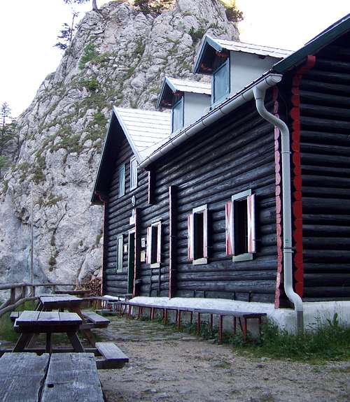
Kienthaler Hütte
Open: from eastern till 1 November on Saturdays from 11 a.m. till Sundays 4 p.m. Also opened on bank holidays. There are 2 double rooms, a room with 3 beds, and 20 additional places. Limited food and drink services. There is no winter room in the hut!
Reservation: Reservierung@kienthaler.at
Phone: 0680 1406812
Useful Information
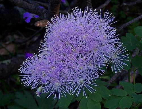
Thalictrum aquilegifolium
Map: freytag&berndt WK220 Semmering – Rax – Schneeber – Schneealpe 1:50000. And many other maps...