
|
|
Mountain/Rock |
|---|---|
|
|
38.66228°N / 120.0605°W |
|
|
Alpine |
|
|
Hiking, Mixed, Scrambling |
|
|
Summer, Fall |
|
|
9805 ft / 2989 m |
|
|
Overview
Thimble Peak is located above the Kirkwood Ski Area in Alpine County, California near Carson Pass. Thimble Peak is adorned with rocky spires and stands out among its neighbors in the area. The summit area provides several opportunities for rock climbing with various degrees of difficulty. The primary approach is from the north, and involves mostly pleasant hiking.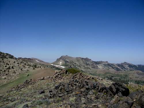
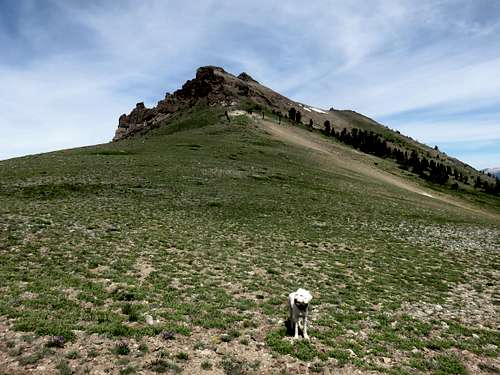
Thimble Peak from the east
Though not as popular as its neighbor to the north Thunder Mountain 9410', Thimble Peak is easily accessible from the Kirkwood ski area and does see hikers from time to time.
The true summit is a rocky spire that requires exposed class 3 climbing. Views from the summit area are tremendous, with the Sierra Nevada encircling the peak, mostly on the north, south, and east sides. The mountains get lower further west.
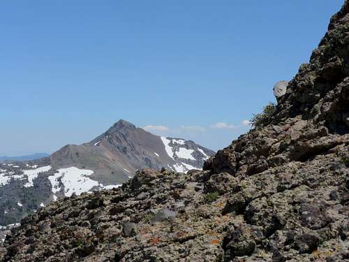
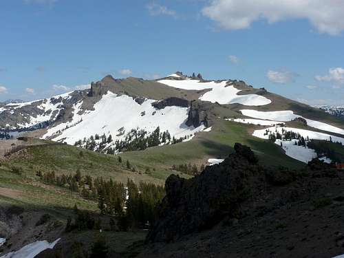
Round Top 10,381' and The Sisters seen from just below the summit of Thimble Peak
Thimble Peak sees plenty of snow, especially on its north and east sides, where the Kirkwood Ski area enjoys a long ski season, typically ending in May. The best time to hike Thimble Peak is probably late June through mid-to-late October.
Getting There
Reaching the lofty summit of Thimble Peak typically requires approaching from the north. The best and shortest routes to the summit are accessed from the southern edge of the Kirkwood Ski Resort. Other options are from the Thunder Mountain Trailhead or the Horse Canyon trail, which approach from the northwest side of the peak.From Sacramento, California, Kirkwood is about 100 miles accessed by taking US 50 to 88 East. From Reno/Carson City to the north, drive south on Highway 395 to the junction with Highway 88. This will take you into California. Once on Highway 88 it is about 28 miles to Carson Pass (which is the trailhead for Round Top, Red Lake Peak, and a few other peaks in the area). Continue past Carson Pass. You will reach Kirkwood in about 5 miles. For the longer routes, drive 1.7 miles past Kirkwood to a small trailhead on the south side of Highway 88. The trailhead has a sign with a trail map, and clearly marks the area as the "Thunder Mountain Trailhead". The northwestern approach is from the Horse Canyon Trail which heads up the northwest side of Thunder Mountain and connects with the route to Thimble Peak. The Horse Canyon trailhead is reached just off the south side of Highway 88 about 2 1/2 miles further west of the Thunder Mountain Trailhead.
Route Information
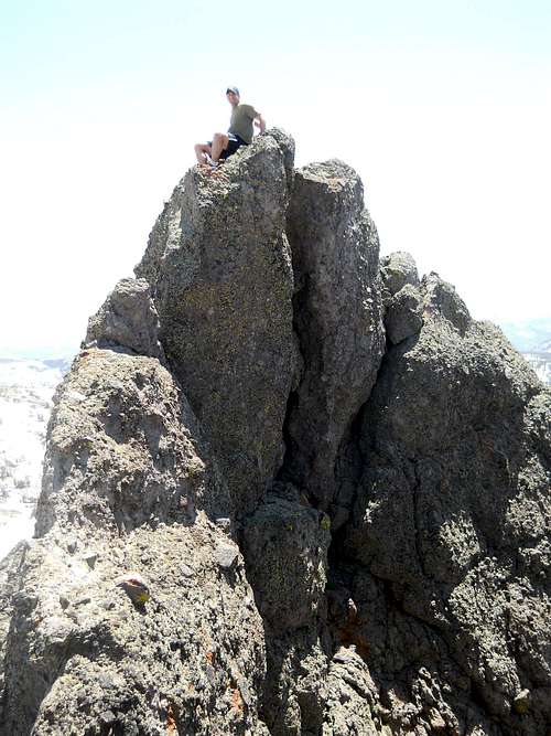
On top of the true summit of Thimble Peak
Kirkwood Ski Area
The most straightforward way to Thimble Peak is from the Kirkwood Ski area. Starting on the southeast edge of the ski area, take the ridge on the east side of Kirkwood. A trail heads up the slope, eventually reaching a dirt road. In about 1.7 miles you reach Point 8947. The trail continues down to the base of Thimble Peak. Once at the base of the peak, at just under 9,000', the east ridge climbs steeply up to the summit ridge, gaining over 700' in just over 1/3rd of a mile.
The east ridge route on Thimble Peak
This route is only 2.9 miles to the summit, gaining just over 2,100'.
Another option is to continue to the south side of Thimble Peak. Go cross-country across the base of Thimble Peak towards the south end of the peak. This is the rocky end, gaining 325' from some ski slope equipment at the edge of the rocky slope to the summit in about 0.2 miles. This route is class 3. Recommended descent is via the east ridge. This is about 3 miles to the summit, gaining just over 2,150'.
South ridge of Thimble Peak
Thunder Mountain Trailhead
If wanting to combine Thunder Mountain and Thimble Peak the best route is to take the Thunder Mountain Trail directly south from the trailhead. The entry to the trail is clearly marked. The first mile or so is in the forest, with some views further up. Soon you reach an overlook and a big rock. The trail heads uphill to the right of a rock formation and up to a saddle between Thunder Mountain 9410' and Martin Point 9250'. The full north face of Thunder Mountain comes into view.
Follow the trail as it heads up towards the north face. The trail crests at about 9,330' and then descends to the back side of the summit ridge. Once at this point you can make a quick trip up the Thunder Mountain in a little over 3/4 miles round trip, or continue on to Thimble Peak.
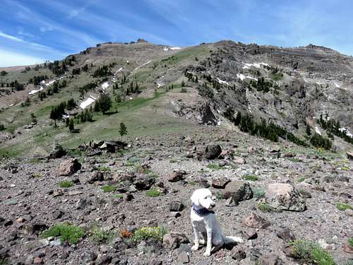
Looking back at Thimble Peak from the crest of the Thunder Mountain Trail
The route is quite obvious. There are a couple buildings dedicated to the ski slope on the east side of the hill at Kirkwood. The ridge rolls up and down slightly towards the summit and the northeast face of the peak. Once you pass the 2nd building you can either climb the crest of the ridge, or walk cross-country along the right side. If you are used to scrambling, I recommend just climbing the crest of the ridge. Once over the top of hill above the 2nd building, it is fairly simple and straightforward to reach the false summit, which involves some light scrambling. The actual summit (not visible at all during the entire hike until you reach the false summit) is just behind it, and requires difficult class 3 climbing with near total exposure due to steep drops on all sides. Climbing to the summit is recommended only for those without a fear of heights. Descend the way you came. It is about 10 miles round trip with a one-way elevation gain of about 2600'. (It is 10 3/4 miles round trip if combining with Thunder Mountain, which only adds about 200' total gain to the trip)
Horse Canyon Trail
You can also choose to park at the Horse Canyon Trailhead on the south side of Highway 88 about 2 1/2 miles or so past the Thunder Mountain Trailhead, and east of Silver Lake. Head up the trail for about 2.2 miles where it connects with a trail on the south side of Thunder Mountain. From the trailhead it is about 5 1/2 miles one way to the summit of Thimble Peak with an elevation gain of about 3100'.
Red Tape
Parking at the Kirkwood Ski Area outside of ski season or the Thunder Mountain Trailhead requires no permits or fees. The same appears to be the case for the Horse Canyon Trailhead.Camping
Camping information for the area is provided on the Mokelumne Wilderness SP page and others SP pages in the Mokelumne Wilderness.External Links
Carson Pass Management AreaMokelumne Wilderness
El Dorado National Forest Highway 88 Hiking Trails