Worked for us
Some pics of our route. We went up and over Castle Rock but our goal was the highpoint of the island and we found a nice route down. The pics here will show the route as if done from the trailhead parking area at the fence. Be aware that much of this route is on private property but unless there is cattle present, it shouldn't be a problem. Your call however, proceed at your own risk. I have no information on
who the landowners are and how you could get in contact with them. This information is simply a recap of the way we found an easier
way to deal with this peak.
![Pic 1 - parking area]() Trailhead view Trailhead view | ![Pic 2 - Terrain to cover]() First view of route First view of route | ![Pic three]() Second view of route Second view of route |
![Pic 4]() Above the saddle Above the saddle | ![Pic 5 - looking down the route]() Looking back down route Looking back down route | ![Pic 6 - upper part]() Upper section Upper section |
![Pic 7]() Near the top Near the top | ![Pic 8]() Route finding Route finding | ![The top]() Summit cairn and pose Summit cairn and pose |
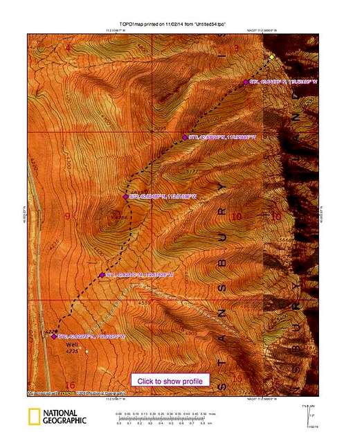
Route Map
I've added the waypoints (nad 27) on the bottom of the map since the topo is hard to read due to the USGS color scheme.
![Map]() West ridge route map
West ridge route map
Comments
No comments posted yet.

 Trailhead view
  First view of route
  Second view of route
  Above the saddle
  Looking back down route
  Upper section
  Near the top
  Route finding
  Summit cairn and pose