
-
 7235 Hits
-
 0% Score
-
 2 Votes
|
|
Route |
|---|---|
|
|
38.06500°N / 119.273°W |
|
|
Hiking, Mountaineering, Scrambling |
|
|
Spring, Summer, Fall, Winter |
|
|
Half a day |
|
|
Class 2-3 |
|
|
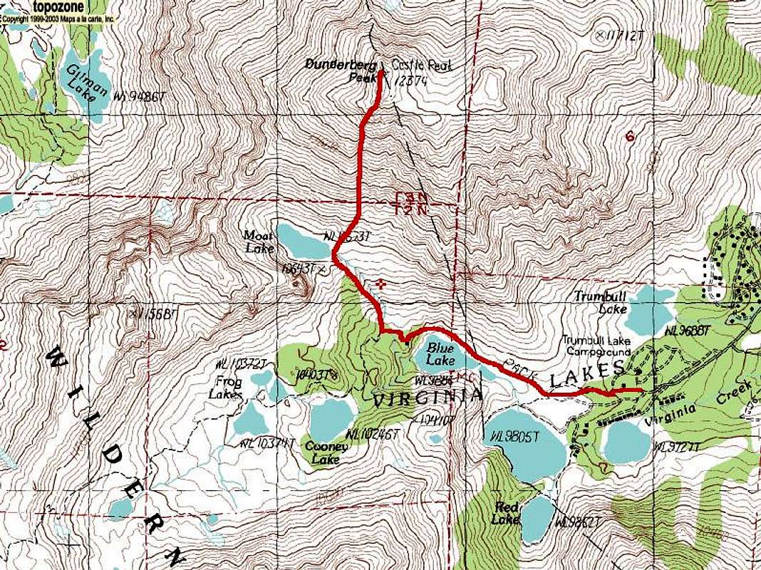
Approach
Head west on Virginia Lakes Road from US-395 at Conway Summit north of Lee Vining and south of Bridgeport. Park at the Virginia Lakes Trailhead (~9,860') at the end of the road. Take the Virginia Lakes Trail 0.2 miles past Blue Lake to a trail to the right (north) that follows the creek up to Moat Lake.Route Description
From the northeast corner of Moat Lake start climbing up to the summit. There is more solid rock here than on the Southeast Ridge.Distance: ~4 miles
Elevation Gain: ~2,720'
![Dunderberg Peak s Southwest Slopes Route]()
Southwest Slopes Route
Winter/Spring: Ice Axe/Crampons
Southwest Slopes Route
Essential Gear
Summer: ShoesWinter/Spring: Ice Axe/Crampons