
|
|
Route |
|---|---|
|
|
39.67830°N / 106.33°W |
|
|
hike |
|
|
Most of a day |
|
|
class 1 |
|
|
Approach
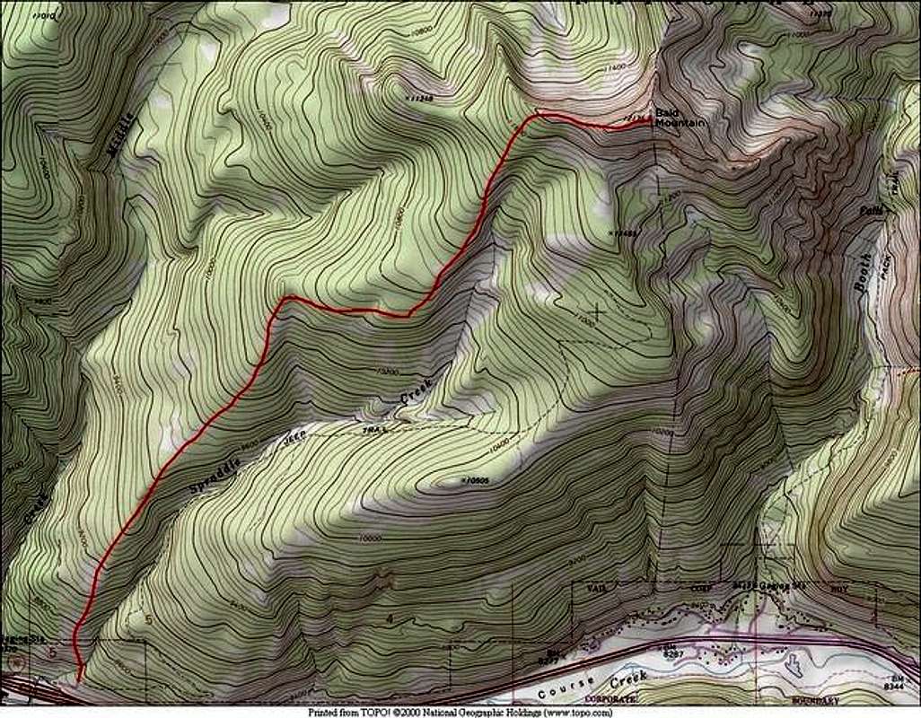
Round Trip-10 miles & 4,000-ft
The following is a winter route description, there may be a trail in the spring/summer that takes a different route but this is the safest winter route. Bring snowshoes or skis, otherwise you won’t make it to the summit.
Starting at the trailhead parking (8,230-ft,) locate the steeper portion of Bald Mountain’s southwest ridge to the left; refer to topo. Begin snowshoeing northeast up the steep portion of the southwest ridge to about 9,600-ft. From here the ridge will relent into a very nice and rather large open area, perfect for glade skiing. After 1.87 miles and 2,200-ft the ridge bends directly east into the pine trees. Hike a half-mile and the ridge will bend back to the northeast.
Route Description
Continue following this ridge past many small gladed areas and finally reach tree line at 11,800-ft, from here you can preview the remainder of the route to the summit. The remaining ridge will be wind scoured and compacted, it is not blown clean as you may expect. Hike east another 400 vertical to the summit.
Descend your ascent route.
Essential Gear
Snowshoes or skis, trekking poles, topo map and the normal array of clothing for a winter climb.
Miscellaneous Info
If you have information about this route that doesn't pertain to any of the other sections, please add it here.