
-
 6660 Hits
-
 74.92% Score
-
 5 Votes
|
|
Route |
|---|---|
|
|
45.26667°N / 109.80852°W |
|
|
Scrambling |
|
|
Summer |
|
|
A few days |
|
|
Class 2-3 |
|
|
Overview
This is the route I imagine most people mean when they refer to approaching Mount Wood from Mystic Lake. It climbs from Mystic Lake into the hanging valley on the southwest side of the mountain and then climbs up to the southwest ridge and on to the summit. In total it is roughly a 20 mile round trip with about 6000 feet of elevation gain from the parking lot at the West Rosebud trailhead. My friend and I did this very slowly over the course of 4 days but I imagine it could be done overnight with two fairly strenuous days or in 3 days with more ease. If you're making a one-day ascent the direct route from the parking lot is probably better. Although the distance is short, roughly half of it is off trail encompassing most of the elevation gain, so don't expect to blow through this like you might a similar distance on trail. The climbing is fairly easy and non-technical but the route does require significant off-trail travel and decent route-finding ability.Getting There
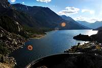
Mystic lake
From the trailhead hike up the road and follow signs through the housing area to the trail that goes to the lake. Follow this trail around to the west end of mystic lake (the lower of the two lakes in the valley). At this point leave the trail and head north (right side of the trail) to the creek connecting island lake and mystic lake. Ford or hop across on logs to reach a number of excellent camping sites on the other side.
Route Description
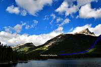
The west end of mystic lake
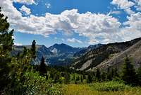
In the meadow in the hanging valley, the view to granite peak is excellent
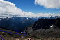
Route through the valley and up to the ridge
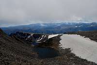
View down to the upper lake from the climb to the summit
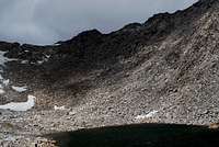
West Summit from the upper lake
Essential Gear
Just the normal gear you would bring for a couple days backpacking. Be sure you have good rain gear. A GPS can also be useful on the featureless plateau when the weather closes in (it was helpful, but not vital, in this context for us). This is bear country so make sure you have equipment for proper food storage (I recommend canisters if you plan on camping in the hanging valley as the trees are mostly too small to hang food).Route Hazards
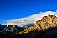
A storm closes in from the west early in the morning