-
 36755 Hits
-
 72.08% Score
-
 2 Votes
|
|
Route |
|---|---|
|
|
44.67440°N / 121.7978°W |
|
|
Mountaineering, Scrambling |
|
|
A few days |
|
|
Class 4 |
|
|
Fourth Class Scramble |
|
|
2 |
|
|
Overview
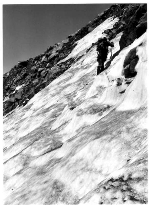
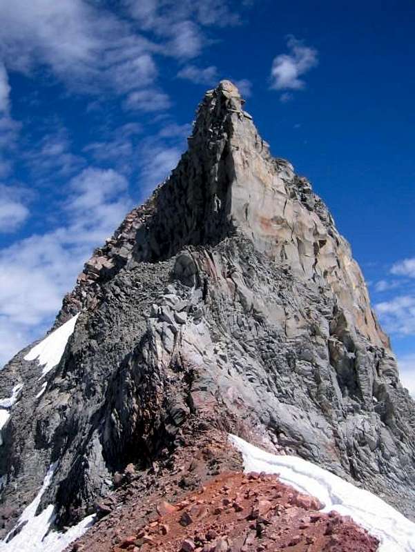
The South Ridge route was perhaps the route followed by Mount Jefferson's first ascent party in 1888. Today, the South Ridge route is one of two common routes on Mount Jefferson that avoid glacier travel. The other common route on Mount Jefferson that avoids glacier travel is the Southwest Ridge route. These two routes originate from the Pamelia Lake Trailhead, diverge at ~5,200' along the Pacific Crest Trail & reconvene at ~7,900' on Jefferson's long, south ridge. The Southwest Ridge route is likely your best option if you are attempting to daytrip Mount Jefferson. If you are planning to spend at least one night one the mountain, then the South Ridge route is likely your better option as camping along the Southwest Ridge route beyond Pamelia Lake is not advisable due to a lack of water source. However, Shale Lake along the South Ridge route provides an excellent campsite with plentiful water.Vertical Gain: ~7,800'
Roundtrip Distance: ~23 miles
![Mount Jefferson Pamelia Lake Routes]()
Mount Jefferson Pamelia Lake Routes. South Ridge (red) & Southwest Ridge (Blue). Click to enlarge.
Approach
The South Ridge is accessible from the Pamelia Lake Trailhead; however, it is not visible from this trailhead due to being blocked by the Southwest Ridge. Follow the Pamelia Lake Trail (3439) to Pamelia Lake (~2.5 miles), turn left (north) onto Trail 3440 and follow this trail briefly until it intersects the Pacific Crest Trail. Turn right (south) on the Pacific Crest Trail through several switchbacks until you reach Shale Lake (~4.5 miles).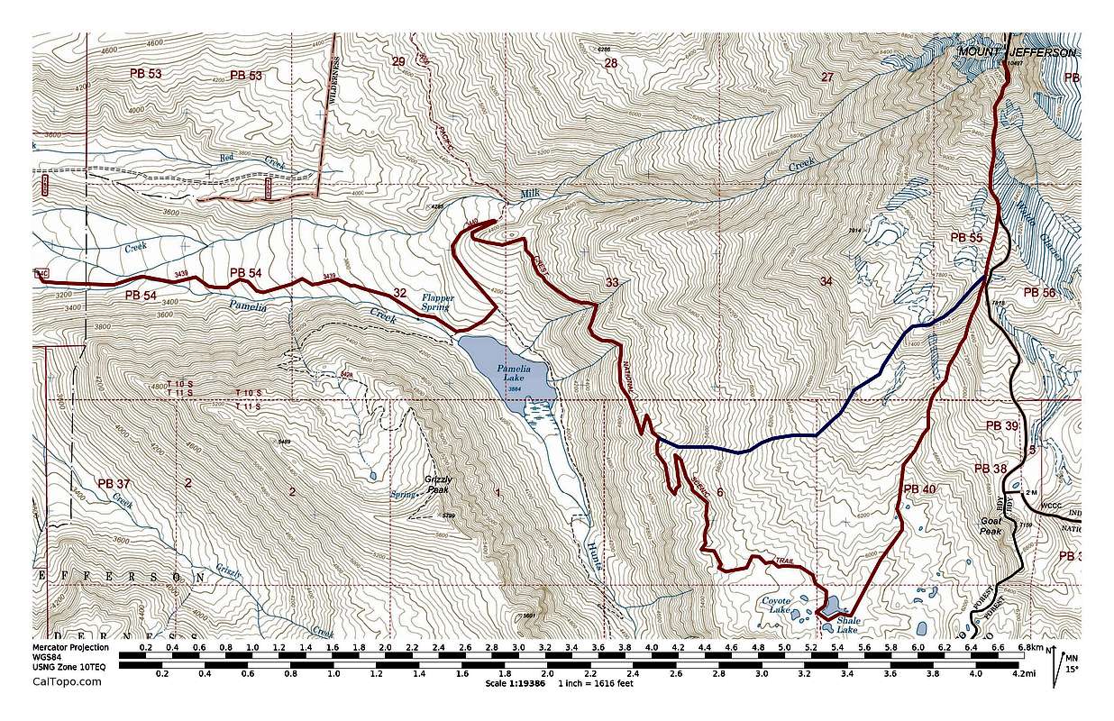
Mount Jefferson Pamelia Lake Routes. South Ridge (red) & Southwest Ridge (Blue). Click to enlarge.