Torre Innerkofler 3098 m is part of the Sassolungo massif, which rises isolated between Val Gardena (Bolzano province) to the North and Val di Fassa (Trento province) to the South. This mighty tower of dolomite is situated between the massive Punta Grohmann and Dente del Sassolungo; looking from P.so Sella it is hidden just behind Punta Grohmann. The tower has been dedicated to the great alpine guide Michael Innerkofler from Sesto, who summited the tower in first solo ascent in the year 1880, August, along the East ridge. Torre Innerkofler is called Innerkoflerturm in German and sometimes it's possible to find Punta Pian del Sass (in italian) on some maps, but I never heard anybody calling it in this way.
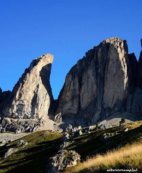
Sassolungo group from Col Rodella - Photo Gabriele Roth
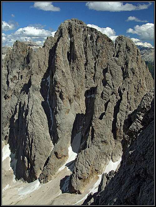
Notwithstanding it's a summit with a significant importance, Torre Innerkofler is not particularly popular, despite the rich choice of several extraordinary routes running through each side and with varying committment and difficulty. Torre Innerkofler appears like a kind of pyramid with the 4 faces oriented N, S, E, W. The summit is a huge balcony and one of its summit ridges connects the Innerkofler with the Dantersass peak (another summit of the Sassolungo group). The steep yellowish South face oversees Val di Fassa with a 500 m. high face cut by three big chimneys. Forcella Grohmann separates Torre Innerkofler from Punta Grohmann, while Forcella del Dente (towards East) separates Torre Innerkofler from the Dente. These "forcelle" (small passes) are quite high (over 2500 m) and steep and are frequently covered by snow, even in summertime.
Punta Grohmann from the summit of Torre Innerkofler
Summit view over the majestic Sassolungo
As told there are a lot of great routes, but this summit is very rarely climbed, when compared with other fashion peaks of the Dolomites. The reason? It's a wild peak, the approach here is long, the routes have not so many pegs in place, the snow persists in the gullies even in summer and the descent is complex and not so easy to find...anyhow Torre Innerkofler has a wild beauty and the climb gives you feelings of high satisfaction!
- It is also possible to reach the top from the summit of Cima Dantersass through a ridge. Anyway I suggest not to use this way, because the ascent of Cima Dantersass is quite dangerous due to the quality of the rock.
Innerkofler Turm / Torre Innerkofler
Dente del Sassolungo and Torre Innerkofler from South
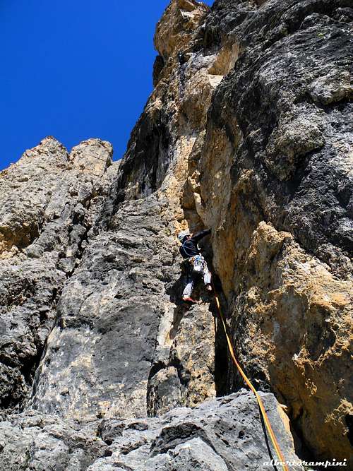
Yellow dihedral on Via del Calice, Torre Innerkofler
Consider that the approach are quite long/hard based on Dolomites standard (the approach here is about 2 hours of complex and tiring paths, while the approach to a route on Torri del Sella is a 20/30 min. comfortable walk). So be careful going there, study well your route and be well equipped.
History
Michel Innerkofler
The tower is dedicated to Michael Innerkofler (Sesto Pusteria 1848 - Monte Cristallo 1888), a famous Alpine Guide from Sesto, resolute conqueror of the Dolomites’ most difficult summits, who first summited this tower in solo climbing in the year 1880. Head of a family of famous guides and one of the strongest mountaineers of his era, he was active in the second half of the nineteenth century and counts many important climbs in the Eastern Dolomites in addition to Torre Innerkofler, as Croda dei Toni, Cima Ovest di Lavaredo, Cima Piccola di Lavaredo, Cristallo North Face and Croda da Lago.
Getting There
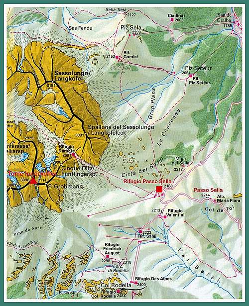
P.so Sella is the natural base for Torre Innerkofler.
Road access
- From Trento follow the A22 Brennero Motorway towards North, exit Egna-Ora and follow the road S51 towards Val di Fassa, getting to Predazzo, Moena and Canazei. In Canazei take the road to Passo Sella, reaching the pass and descend briefly on the other side to reach Rifugio Passo Sella.
- From Bolzano North follow the road to Ponte Gardena. From here take the road entering Val Gardena, pass Ortisei and reach Selva di Val Gardena. About 5 km after Selva the road forks; turn to right (signpost Passo Sella), reaching Rifugio Passo Sella
- From Brennero Pass take the A22 Brennero Motorway towards South, exit Chiusa and then follow the roadway joining the Val Gardena road, pass Ortisei and Selva di Val Gardena. About 5 km passed Selva the road forks; take the road on the right (signpost Passo Sella), reaching Rifugio Passo Sella
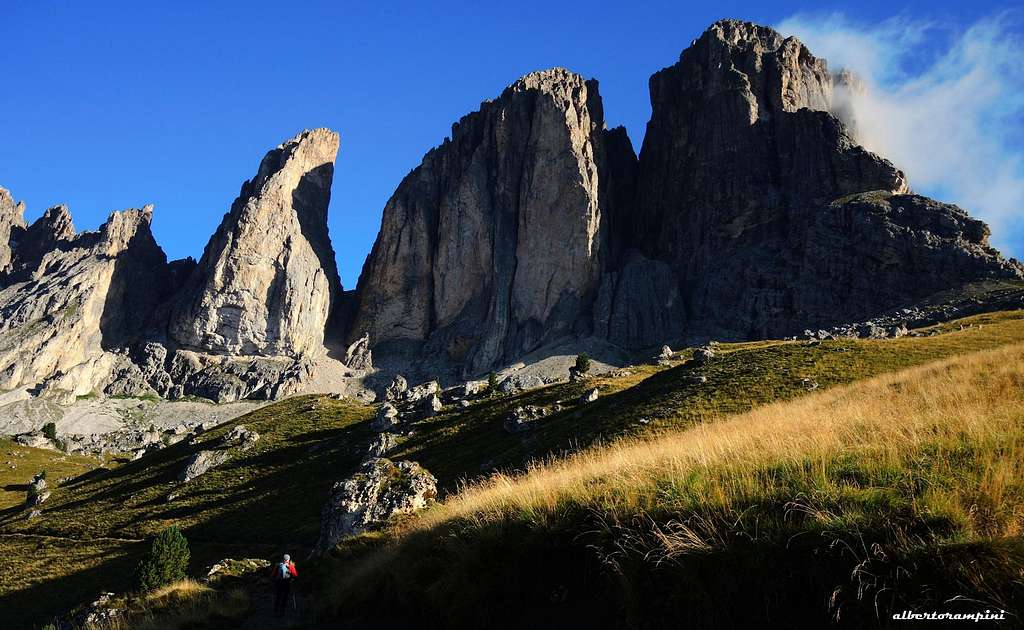
Dente, Torre Innerkofler and Punta Grohmann from Friedrich August path
Main routes
There are many climbing routes on Torre Innerkofler. A brief list of the routes more frequently climbed is:
- Via della Falce- VII+ (or VI/A0) Rabanser, Andreotti e Bertoni 1998
- Via Prinoth- Camino Rizzi - Normal route (around III degree), but it is not so funny, usually is used to descend
Torre Innerkofler summit cairn
Via del Calice, jammed block at the end of the difficult pitches
Descent - Be aware, the descent is not quite easy to find! From the top follow the southwestern debris to SW (cairns), downclimb along a little spur, reaching a first anchor: abseil 20 m. long. Downclimb along the gully, then traverse right (cairns), bypass around a rocky outcrop, continue downhill always to right (at a junction head to the right), reaching a second anchor: abseil 25 m. long. Follow the gully, gettin the third anchor (outcrop): 25 m abseil (easy, it's possible to downclimb instead od rappelling). Downclimb along a ramp leftward (cairns), then follow a steep ridge to another anchor, from which with a 50 m. abseil (possible 2 abseil, an intermediate anchor) you reach the fork between Innerkofler and Dente at 2772 m. Down the unpleasant scree gully, getting the base of the walls on the path that leads towards Punta Grohmann and Passo Sella (about 3 hours from the summit to Rifugio Passo Sella).
Red Tape
No restrictions, you can park the car at P.so Sella (both free and paying parking) or you can park on a little road close to Valentini hut. Consider that there are buses that connects regularly Passo Sella with Selva di Val Gardena and Canazei in Val di Fassa. The only problem is that usually these buses stop the service in the late afternoon.
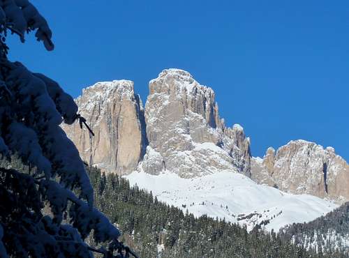
A winter image of Torre Innerkofler and Punta Grohmann
The mighty Sella Group seen from the summit of Torre Innerkofler
Where to stay
The closest campings are in S. Cassiano and Corvara (Badia) and Val di Fassa. There are a lot of hotels/huts nearby. In particular the main huts are:
Children refers to the set of objects that logically fall under a given object. For example, the
Aconcagua mountain page is a child of the 'Aconcagua Group' and the 'Seven Summits.' The
Aconcagua mountain itself has many routes, photos, and trip reports as children.
Parents refers to a larger category under which an object falls. For example, theAconcagua mountain page has the 'Aconcagua Group' and the 'Seven Summits' asparents and is a parent itself to many routes, photos, and Trip Reports.

 14175 Hits
 87.31% Score
 24 Votes