There are two campsites at the end of the trail—one around 5800ft and the other one in the actual basin with direct views of the mountains, at 6100ft. We camped at the second one. We found many people up there, most going for 7FJ alone, but some planning to bag all 3 peaks over the weekend.
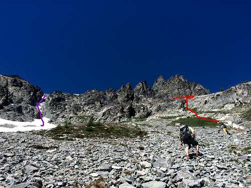
At 3pm we put on our lightened packs and headed up for Seven Fingered Jack. We spent a few minutes studying the mountain and the climbers ahead of us. As we were discussion, we saw an elderly man sitting by the creek and asked him whether he thought our way up was right, to which he mysteriously responded “there are many ways up the mountain.” We decided to now follow the trail at first, but instead follow the other climbers up a waterfall scramble, then up across the meadows (facing directly up the mountain) towards this short cliff. On the left we saw a snow couloir that some reports had mentioned as “the obvious couloir” and led directly towards the summit, but decided to go around since we hadn’t brought our crampons and ice axes with us. After the cliff we traversed north towards the summit for 2 fun hours of scrambling and scree. (By the way, it wasn’t obvious to me, but the summit is actually the leftmost of the “fingers”) We tried to look for cairns, but there didn’t seem to be any obviously easier up, so we tried to stick to solid rock as much as possible.
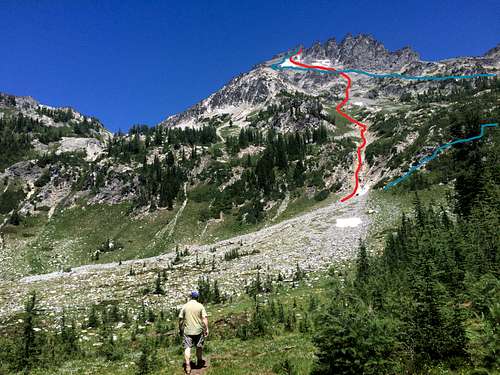
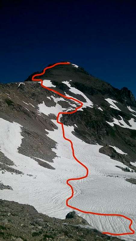
![Way up 7FJ]()
Our way up (red) and what I think was our way down (blue)
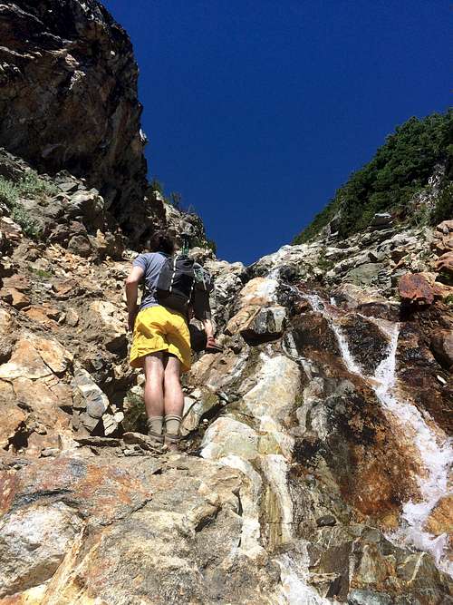
![Waterfall on 7FJ]() Waterfall on the way to 7FJ
Waterfall on the way to 7FJ![Couloir and path to 7FJ]() "Obvious couloir" (purple) and way to 7FJ
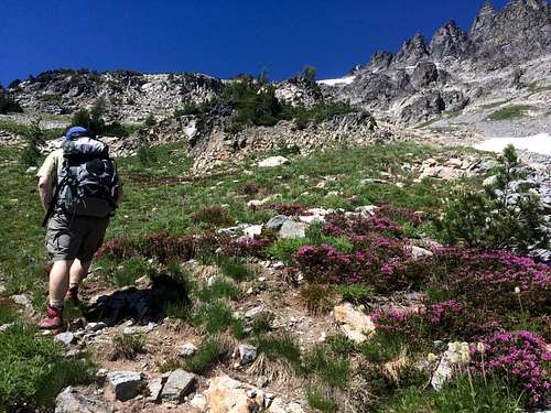
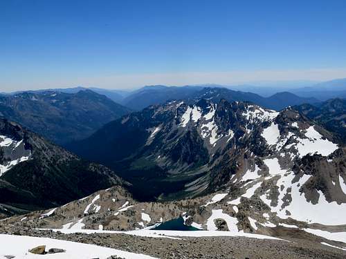
"Obvious couloir" (purple) and way to 7FJ![Alpine Meadows]() Beautiful alpine meadows
Beautiful alpine meadows![View from 7Fj]() View of Glacier Peak from 7FJ
View of Glacier Peak from 7FJ
We summited around 7pm (4 hours to ascend), spent 15 minutes of the summit (checking out the way to Fernow) and went back a different route, first descending low directly below the summit (almost to the top of that “obvious couloir”, following a path we hadn’t noticed on the way up), and then traversed back south above and beyond the cliff, into the meadows below Maude. To be honest I was pretty terrified of the scree falling apart under my feet and sliding uncontrollably. On the way up we could follow some stable rock with solid holds all the way up (hence the puzzle), but going down that would have been too slow. I felt safer wearing my helmet, although my partners who were more comfortable with rock like that did not.
From there it took some route finding to find the optimal way down the meadows, and we finally found the climbers path that was leading to Maude and took it all the way back to camp. The descent took about 3.5 hours, which is quite long, but at least we avoided much of the scree and down climbing the waterfall. Got back to camp, made some warm food, fell asleep. The weather was really warm and a huge moon lit up the night.
Mt Maude
Next day we got up around 7:30am, packed for the day and headed out on the same climbers path we started on the day before, but this time for Maude. After last day’s struggle on 7FJ, Maude seemed like a hike. Quite longer in terms of distance, the standard approach to Maude is all the way around the mountain. We followed the climbers path southeast through the woods and towards the south shoulder. There are some gullies of scree to cross on the path, but many cairns mark the right/easier way. When we got to the south shoulder, we realized there was a very rocky ridge between us and the summit. We consulted the beta that called for ascending the scree of the “south slopes.” Since there was still quite some snow left on the south slopes all the way to the lake southeast of the summit, we decided it would be easier to descend into the basin and follow the snow all the way back up to the shoulder, where it became flat again. The snow was soft (and became much softer when we were coming back), but fairly easy to ascend.
![SW ridge on Maude]() South shoulder on Maude
South shoulder on MaudeOnce we got up to the flat bit of the shoulder, we found a lightly beaten climbers path all the way to the top! The ascent of the south slopes through the talus was much easier than on 7FJ, and the presence of snow made it really fun! It took us 3.5 hours up, which surprisingly beat Fred Beckey’s 4 hour estimate! For some inexplicable reason there were tons of bugs (of all varieties) on the summit, which followed us all the way back to camp and even to the car. Beware!
![View from Maude]() View from Maude over lakes to the southeast
View from Maude over lakes to the southeast
The way down was fairly easy (we followed the same climbers path) and it took 2.5 hours.
We got back to camp around 3:30pm, packed up our camp and left for the car. We were hoping going back the steep Leroy creek trail would be much faster, but in fact it took us a good 2.5 hours (vs. 3 hours going up). On the way back we witnessed many many fireworks from all the towns we passed. Happy July 4th!
(Post-climb highlight: Milkshakes at 59er Diner on Highway 2)