
Comments
No comments posted yet.
|
|
Trip Report |
|---|---|
|
|
48.89197°N / 121.59416°W |
|
|
Jun 8, 2014 |
|
|
Mountaineering |
|
|
Spring |
June 8, 2014
Climbers: Sean and Michael
I had wanted to do Sefrit for a really long time and could just never get the combination of partner and weather and conditions just right to make it go. The way I see it you kind of need to have snow cover in the valley to make it worth it; and it seems to me the route is the most aesthetic when the couloir is snow filled too.
It was looking like we would need our backup plan as we drove all the way to the Hannegan trailhead, arriving about 8:00. As we hiked the snow-free trail things were looking bleak for the couloir to be filled with snow. It has been a really unsuccessful spring climbing season for me so I really wanted this plan to pay off.
Adding to what I later realized was a pretty low chance of success climb was the prospect of fording Ruth Creek. This didn’t seem like such a bad plan for the ascent, but late in the day with the snow melt spiking it could be pretty hairy; I figured that was a problem for future-Sean and put it out of my mind.
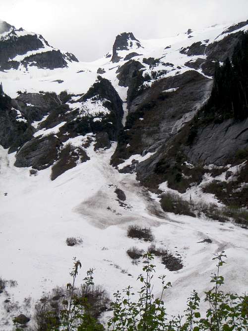
Our hearts sank as we saw a snowy gully with large bare gaps in it, but held out hope that the deep defile of the “Bloody Head Couloir”would hold the cold air. Sure enough, as we rounded the trail for a great look into the slot it was almost totally filled in! Looking into the Ruth Creek drainage we saw what we didn’t even dare to hope for… the valley was snow filled all the way from the trail to the base of the couloir. No creek fording or us today!
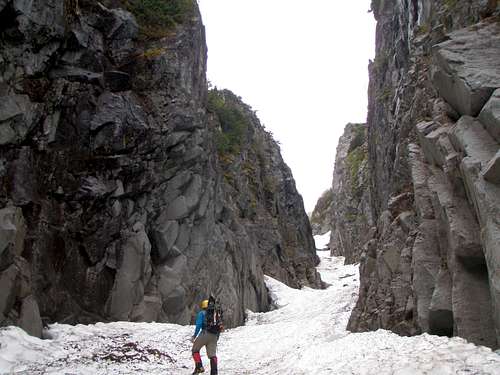
We easily hiked the firm spring snow down to, and over, the creek and up to the base of the gully. The gully was less steep than I expected, I was glad I didn’t carry an extra tool, but there was so little beta on the route we didn’t really know what it would be like. The climb most of the way up the couloir was uneventful until we reached the waterfall at around maybe 5200’? There was about a 15’ section of the waterfall melted out with a 25’ moat that we didn’t particularly want to fall into. Beckey says to take the short gully to the left to avoid the falls, but the rocks adjacent to the falls looked better to us. I would say it was maybe 5.0, we did it free solo with boots without mishap, but it was a little nerve wracking due to the downward sloping edges.
In retrospect the better option to get to the ridge would be
to go straight up to the saddle at 6460, the ridge west of here was easy and it
avoids a lot of tedious side-hilling and some possible crevasses on the open
slopes to the west. (We went up the westerly option and down the direct).
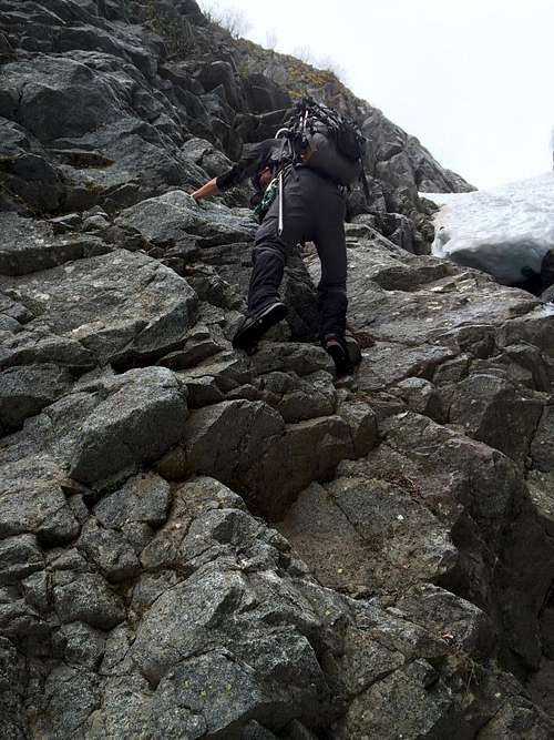
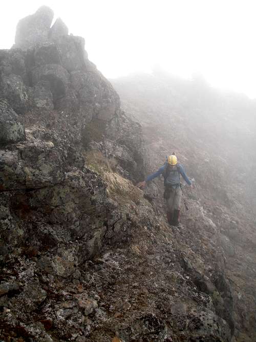
The rock on the lower part of the ridge was total garbage,lots of really loose stuff that is ready to slide. We sent a lot of rock down the south slope, but the scrambling was easy with sections of walking. The scrambling got harder (3rd-4th class) as we ascended but whenever the ridge was steeper the rock was sounder. We made a couple of less-than-ideal route decisions but nothing more than just a little time consuming, and it added up to fun scrambling.
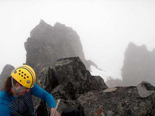
The route is largely on ledges that bear signs of a trail, when in doubt generally stay to the south on dirt and heather. Near the summit there were some steep fourth-class sections with very large loose rocks. My partner almost bought it when a rock the size of a person shifted when he pulled on it. The summit was somewhat between a perch and a needle; I can’t attest to the views as it was socked in the whole day. No one had signed the register since last September, and only once in 2013! (It took us five hours car to summit).
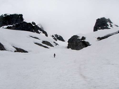
The descent was fast and easy with some awesome glissading.
We were a little worried about the climb down past the waterfall but the rock
seemed a lot easier now that we were all warmed up to it. Three hours from the
summit and we were back to the car and off to Graham’s for coffee and victory
doughnuts (or so we thought!). (Alas no victory beer today)
We carried crampons, snowshoes, a rope and some pro but didn’t use any
of it, just an axe.