

Comments
No comments posted yet.
|
|
Trip Report |
|---|---|
|
|
36.01756°N / 121.52661°W |
|
|
Download GPX » View Route on Map |
|
|
May 4, 2017 |
|
|
Hiking |
|
|
Spring |
+6,000 ft. Elevation Gain in ~6 miles (one way), this is a great trail for those ready to crush some elevation, not a beginner route, it is steep. We made the summit from HWY-1 in 4 hr. 15 min. (Strava Link) taking 3x10-minute breaks in the little bits of shade to snack and apply sunscreen. Note you can summit Cone Peak from a 2.5 mile (each way) from Forrest Route 22S05 via Naciamento Ferguson Rd if the gate is unlocked which it was on this trip. We caught a ride down with friends this way.
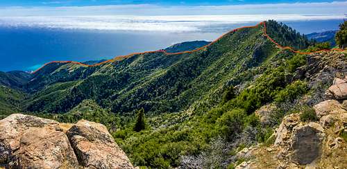
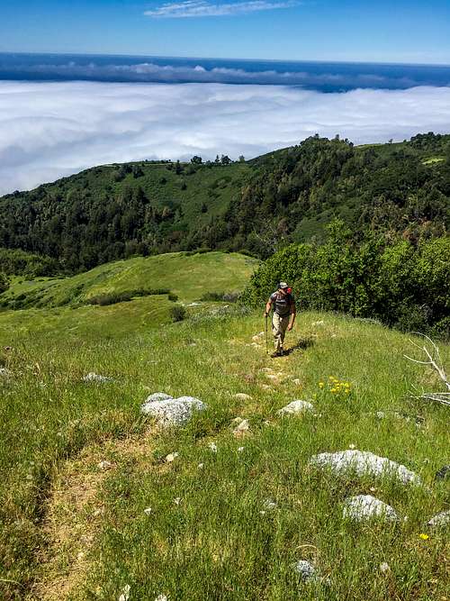
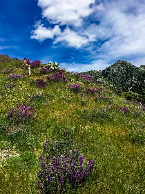
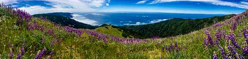
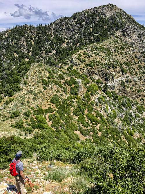
Finding the trail was rather simple from beginning to end, the full “Sea to Sky” route is not a trail printed on any maps I’ve seen however it is not difficult to find the route once you understand the concept of hiking up the ridge-spine “nose” all the way up. The trail starts at 36°01'03.2"N 121°31'35.8"W which on a map looks like the end of an old fire road, perhaps it was years ago, now a jeep would not make it, ( this junction can also be reached from Limekiln via the kiln trail which has a new (2016) spur I’ve seen called Alvin Trail, also not on maps). About a quarter mile after the jeep road ends the trail hits West Fork Limekiln Creek at which point you CROSS the creek as soon as you near it, this may be an area some people mistake because there is a split. After crossing the creek you’re on an unmarked trail called the “Twitchell Elevator” it is obvious, ~1 mile up it passes an old homestead chimney and cistern. About 3 miles in, about 2,280 ft. you’ll hit the “Stone Ridge Trail” which begins at Kirk Creek. This was an obvious 4-way crossroad; to reach Cone Peak hike straight up the nose heading SE, it was trampled grass unlike Stone Ridge trail which was dirt. Maps don’t show the route, just stay on the ridge-line the entire way to Twin Peaks (~5.3 mi @ 4,848ft), from the top of Twin Peak you see the last stretch which is not very technical nor massively exposed, short sections of class 2-scrambling, only 2-3 sections which are class-3, then back to a normal trail for the last 1/2 mile, but many routes are available for the daring climbers.
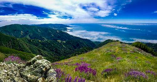
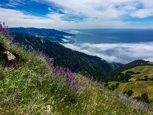
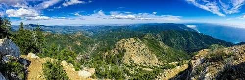
Summit views were fantastic in all directions, a metal fire lookout at the top (locked up) with shade was appreciated. It was sunny, sweaty and the flies were a pest. Wildflowers were spectacular in Early May, many Lupine and Yucca, 2017 rain helped, grass more green than yellow but that will change quick now. Would love to do it in winter when there is snow on the ground!