
|
|
Route |
|---|---|
|
|
48.85940°N / 121.5317°W |
|
|
Basic snow/glacier climb |
|
|
Most of a day |
|
|
Grade II, 25 degree snow/glacier travel |
|
|
Approach
From Interstate 5 in Bellingham take the Mount Baker Highway (WA 542) to the Nooksack River Bridge which is beyond Glacier, WA. Do not cross the bridge but proceed straight ahead on the unpaved Nooksack River Road. After 1.4 miles take the uphill branch of the road (Hannegan Pass Road - FR 402) for another 4.2 miles to the Hannegan Pass trailhead and campground (3,100 feet).The trail traverses along the north side of the Ruth Creek Valley, then follows switchbacks up steep terrain to Hannegan Pass at 4 miles. Campsites are at the pass.
Route Description
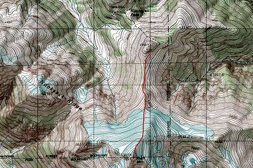
Ruth Mountain Topographic Map
Route Short Specifics:
12 miles; 4200 feet of elevation gain
Basic Glacier Travel and very steep snow during the early climbing season.
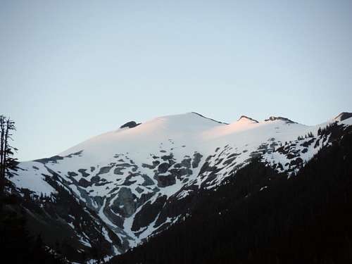
Morning Light on Ruth Mountain
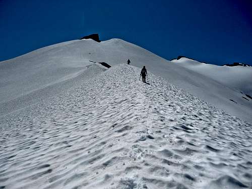
From the Hannegan Pass trailhead take the Hannegan Pass Trail roughly 4 miles Hannegan Pass where there are a number of good camping areas to stay the evening. From there head off south to Ruth Mountain following the ridge all of the way to the base of glacier. This varies in difficulty at different times of the year. In June or earlier one can literally go right over the highpoint on the ridge highpoint to get to the of the glacier. By July this no longer is available. During this time one has to take a very steep side traverse (60 degree snow field) up to the east of the first highpoint on the ridge and then take a boot-path to the base of the glacier. By August this is melted out and now becomes a much more manageable trail to the Ruth Glacier. The only issue here is that the glacier has opened up and roping up really necessary.
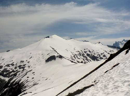
The ridge leading to Ruth Mountain
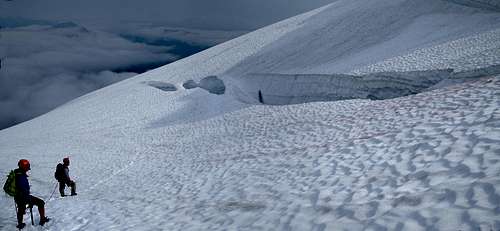
The Ruth Glacier is about a 30 degree snowfield. Ice axes are clearly mandatory here and roping here is strongly recommended especially after early July. Most of the traffic on the will be heading to the summit of Ruth Mountain. However there will be some traffic heading on over to Icy Peak as well.
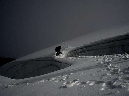
Late season crevasse danger
Essential Gear
descending the Ruth Glacier
Ice axe, crampons, rope, etc. In July many people go up the Ruth Glacier without roping up. If you choose to do this do it at your own risk. The author does not recommend climbing Ruth this way from the crevasses he saw on the way up this mountain. If you do this do it with caution and make it early July and not late July.
Heading Down Ruth