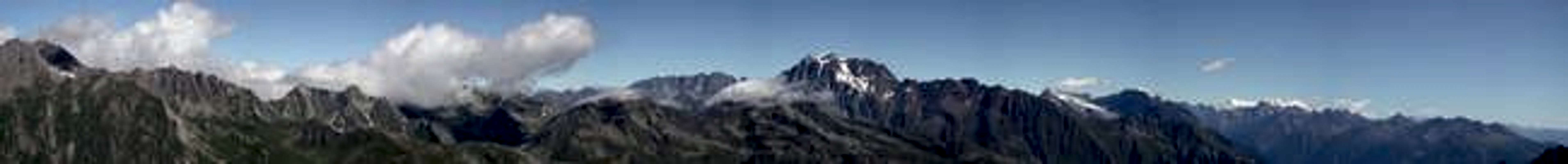
Punta Valletta is a summit between the Comba (side hanging valley) of Vertosan and the Gran San Bernardo Valley. It is very famous for its ski mountanering route, that has a fantastic middle part, with very wide slopes. The view from the top is excellent: going clockwise from north one can see (among the others) Pointe de Drone, Mont Velan, Grand Combin, Mont Gelé, the Valpelline Valley and in the background many Swiss mountains, the far Matterhorn and the Monte Rosa Group; in front towards SE Mont Fallere and the others mountains of the area, then the central summits of the Aosta Valley, Emilius, Becca di Nona, Garin, Gran Paradiso Group, Ruitor Group, part of the Monte Bianco Group, including the main summit and Grandes Jorasses, and finally the nearer Testa di Liconi, Grande Rochere and Testa di Serena.
Getting There
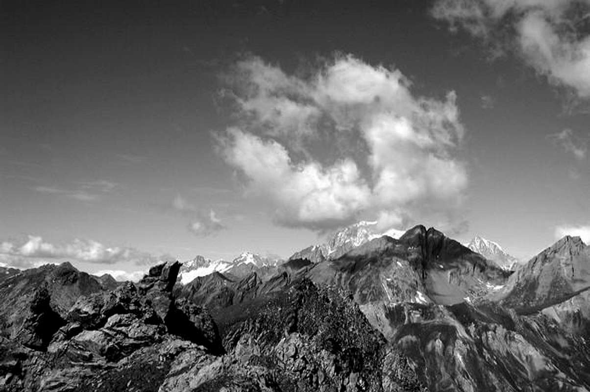
Mont Blanc Group from the summit
Take the highway Torino-Courmayeur and exit at Aosta West; follow the direction Courmayeur; at the first traffic lights, in front of you, up the hill, there is the castle of Sarre, famous because the king of Italy Vittorio Emanuele II decorated all the most important rooms with the head of the animals (mainly ibexes) killed in his huntings courses. Very soon, after more o less a couple of kilometers, at your right will appear another castle that seem the one of the tales: it is the St. Pierre castle, including a Museum of Science. At this point, take the road at your right, following the indication Saint Nicolas. You will reach the village after a few kilometers; it is nice, and close to the church there is a small museum, dedicated to the Cerlogne Abbey, a priest that wrote a lot of books in the local dialect. The hill on theright side the church is named Bois de la Tour, and has a lot of lanes with signes explaining in italian and french how this place was cultivated, and which kind of trees and animals you can find there. On the valley side there is also a Belvedere, that is a small balcony above the Central Valley and the side valleys entering into the heart of the Gran Paradiso group. Leave the village at your left and follow the road at right, looking for the sign: Comba di Vertosan, left at the next cross. Firstly you will reach the small village of Vens: leave it at your left and continue; after the nice small lake of Joux, the road is no more asphalted and becomes a track, that after Col di Joux descends into the long valley named Comba di Vertosan, till Jovencan, a hamlet of few houses at about 1.800m: park here. Come back on foot along the track: at the first cross, there are a lot of yellow signs, for all the destinations of the area; one of them is Colle Citrin, number 10. To go to the Valletta, one must firstly arrive at this pass. Follow the track till the point where it leaves the right side of the valley and crosses a small river by a small bridge. At this point there are no indications, take care, but there is a lane in front of you, along the right side of the small river: follow this lane. After a while, the first sign: left, Laghi di Zioule, up right, colle Citrin, (2.482m). The pass is the one with a very big electrical pylon (2 hours from Jovencan , difference in height of about 700 meters). Punta Valletta is the one at your left, on the north side of colle Citrin. At the pass follow a kind of lane at your left; after a while the lane seems stopped by a stony ground, but there are some cairns indicating the way. In any case, cross the slopes in direction of a small pass, direction north-east; at a certain point you will find the lane 8a coming from Gran San Bernardo Valley, that arrives straight on the top (2.801m) along the north ridge, following the yellow signs: more than one hour from Colle Citrin. The panorama from the top is very wide. To come back, follow the same way, looking at the highest electrical pylon of the pass.
When To Climb
Usually from May to October. Ski mountaneering from February to the beginning of April, depending on the snow conditions; take care, the last slopes are very steep, and sometimes it is better to leave the ski behind a big stone, and to reach the top on foot....
Red Tape
The road from the lake of Joux to the small village of Jovencan is closed in the winter period, and used as a course of nordic ski; in the summer season it is forbidden from the lake of Joux; only when the restaurant in Jovencan is open (usually in July and August), it is possible to drive till there.
Meteo
You can get meteo information at the official site of the Regione Valle d'Aosta
Children refers to the set of objects that logically fall under a given object. For example, the
Aconcagua mountain page is a child of the 'Aconcagua Group' and the 'Seven Summits.' The
Aconcagua mountain itself has many routes, photos, and trip reports as children.
Parents refers to a larger category under which an object falls. For example, theAconcagua mountain page has the 'Aconcagua Group' and the 'Seven Summits' asparents and is a parent itself to many routes, photos, and Trip Reports.


 7963 Hits
 85.87% Score
 21 Votes