
|
|
Mountain/Rock |
|---|---|
|
|
46.40674°N / 13.78754°E |
|
|
8048 ft / 2453 m |
|
|
Overview
Geographical structure: Eastern Alps > Julian Alps > Razor and Prisojnik group.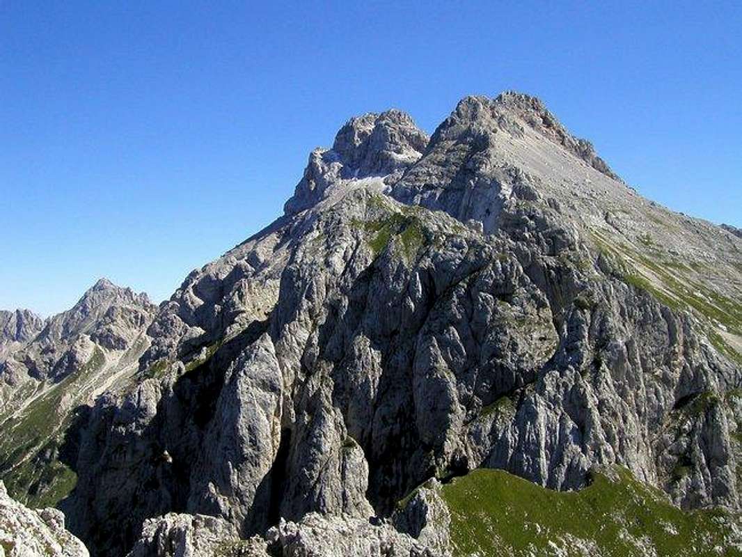
A Beautiful panorama of Razor (on the left) and Planja from Golicica.
Planja is a very powerful mountain in south part of Razor & Prisojnik group.
Planja is not very important mountain in nearness of Prisojnik, 2547m and Razor, 2601m. Razor is its neighbour. Between Razor and Planja is Sedlo Planja pass, 2349m. The Planja pass is from the summit of Planja in NE direction. From Planja pass leads the normal marked route on Planja, which is not hard and it is very short. From the summit is in SW direction very famous ridge over Prevcev stolp, 2213m, Kanceljni, 2133m, Germlajt, 2051m and before it falls down to Trenta valley is the last peak in this ridge called Golicica, 2108m. This is one of the wildest parts of Slovenian mountains. The ridge Golicica – Razor is in the plan of many climbers. But the ridge is very hard. If you want to climb it you must be good in climbing around UIAA IV-V but you can come to harder places if you lose the best passages.
Planja is very heterogeneous mountain. But from all sides it is magnificent. On the south side has very steep grassy slopes and one of the strangest faces called Ogledalo (the Mirror) . It is very popular face for sports climbers. This south face is very hard approachable.
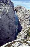
The second famous and interesting sight is Utrujeni Stolp or Tired Pillar, a cliff that got ‘tired’ and leaned on Planja, forming a window.
Planja has beautiful north face. This face is one of highest and hardest in Slovenian mountains. Here are the most reputable climbing aims. For that famous north face is typical the magnificent series of plates. In this face you can find only hard climbing routes. The height, sheer slope and difficulties are graduated from left to right side of face.
Planja is place with a very fine view. You can see all the highest peaks of Julian Alps.
 |  |  |  |  |
Valleys
Trenta is by many most beautiful and most romantic valley of Julian Alps. It is certainly one of longest (around 22km), placed in the heart of Julian Alps, dividing them into western and eastern part. Its mouth or end is near the small town of Bovec where it enters Bovec basin. Through it runs the most beautiful Slovenian river, crystal clear Soca! It has amazing light blue – light green color and is very popular for rafting. Along the river there are few villages and hamlets. Largest and most beautiful are Soca and Trenta villages. Trenta is very deep valley. Some of the peaks rise 2000m above it. Trenta begins bellow beautiful Bavski Grintavec (2347m) peak. Its 5km long upper part, squeezed between Jalovec and Mangart group and Trentski Pelc ridge is called Zadnja Trenta. This is wildest and most beautiful part of the valley. At the end of Zadnja Trenta, where valley begins to make 180 degree turn around Trentski pelc group is source of Soca river. It appears on the surface 100 meters above valley floor, coming out of deep hole filled with crystal clear blue water, surrounded by smooth and dark cliffs. A kilometer lower, at bridge over Soca and Limarica rivers, Vrsic pass road begins to ascend. Few hundred meters up the road is famous monument to Julius Kugy which as ever looking at Jalovec. This is one of most beautiful panoramas in Julian Alps!Krnica valley
Starting point of one of the routes is Koca v Krnici hut(1113m), which lies in Krnica valley. The valley is beautiful, with stunning scenery. All around are some of the highest peaks of Julian Alps that fall into the valley with huge walls: Skrlatica (2740m), Rakova Spica (2545m), Razor (2601m) and Prisojnik (2547m). Krnica ends with probably most beautiful amphitheater in Julian Alps – Kriska Stena.
Hut is accessible from Kranjska Gora to Vrsic pass road. Junction towards the hut is some 2 kilometers behind Kranjska Gora, just at the bridge where main road crosses over Pisnica river to the right, you continue straight. From the bridge is 3 kilometers to V Klinu pasture where you have to park. From here is 20 more minutes to the hut. If you are on foot from Kranjska Gora you will need 1.30-2h.
Getting There
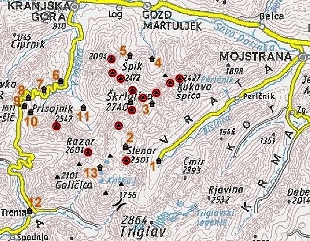
The detailed map. Red spots are summits, posted on SP.
The heart of the region is Kranjska Gora resort town, 84 kilometers from the Slovenian capital Ljubljana. Starting point for Planja is either Vrsic pass (12 kilometers south of Kranjska Gora), Trenta valley or Krnica valley.
By Plane:
If you want to reach Ljubljana by plane check a timetable on the site of Adria Airways, a national airline.
By Bus:
From Ljubljana buses depart towards Kranjska Gora every 60 minutes.
By Train:
From Ljubljana trains depart in Kranjska Gora direction quite often but only up to Jesenice town. There you have to change to bus, which come from Ljubljana anyway.
By Car:
From Ljubljana 84km.
From central Europe via Villach, Austria: Via Karavanke tunnel (around 40km) or Korensko Sedlo pass (around 30km).
From western Europe via Udine, Italy: exit Udine – Villach highway in Tarvisio. Tarvisio – Kranjska Gora 20km.
Maps:
Julijske Alpe - Zahodni del. Planinska zveza Slovenije. 1:50000
Tabacco: Alpi Giulie Occidentali Tarvisiano. No: 019. 1:25000
 |  |
Routes Overview
You can reach Planja over many marked routes from diffrent valleys and huts. I named some of the possibilities. Then I put some hard climbing routes in north face and south face.Marked routes:
North face:
Many others climbing routes too.
South face:
 |
Red Tape
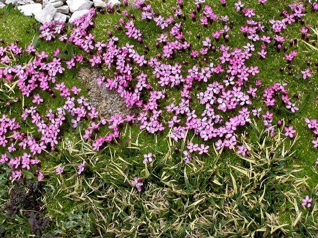
Beautiful flowers on Planja.
No limitations but Planja leads in Triglavski Narodni park so you must be kind to the nature and other beauties.
The only thing you might pay is parking on selected locations.
 |
When To Climb
The best time for climbing on Planja is from early Summer to Autumn. Be careful in early Summer on some snowfields. |
Mountain huts
Some information about huts.Camping
Camping inside the Triglav National Park is forbidden. Beside the mountain huts there are plenty of hotels and private apartments in the towns and villages, which surround the area. Here are few links where you can find info on accommodations closer and further away:Kranjska Gora
Bovec
Mojstrana
Bled
Mountain Conditions
Mountain conditions in Julian Alps are well known, thanks to Kredarica (2515m) hut and meteo station, which is bellow the Triglav.You can observe current conditions and forecast for Kredarica on the Wunderground meteo site. Here is direct link to Wunderground - Kredarica page.
Some weather informatin can also be found here.
Miscellaneous Info
- If you have information about this mountain that doesn't pertain to any of the other sections, please add it here.