Prologue
It all started for me back in December when the winter blues was driving me nuts. I wanted to get out and do something epic but reasonable. Okay, maybe something unreasonable. The Persis-Index traverse seemed to fit the bill but with limited bus service and no car I had to make quick work of it. It had to be in a day. I hastily drew a GPX file following beta from
Matt and Yana's trip and what looked like (on Google Earth anyways) easy-ish snowy terrain. Biking service roads was still fresh in my legs so I felt ready. While not intuitive,
my last epic ended up taking place mostly at night which was a good thing. Soloing Kololo peaks with any margin of safety required that the glacier snow be as frozen as possible and the ascent to White Pass stay cool so I could make good time. I decided that I could extrapolate this wisdom unto the traverse to Index since I wanted those cornices and wind loaded slopes to stay put with me on them. Having never actually been there in daylight, it did sound challenging to stay on route with all the cliffs and gendarmes so good weather and moonlight were necessary.
Attempt#1
My first attempt started from Goldbar at dusk. It was a brisk January evening with a cloud deck at about 5,000'. Not ideal for later on but I was ignorant. Biking highway 2 to FS 62 was relatively easy since the shoulder was wide and I could hear cars coming miles away. A little Metallica served to ramp up my pace. Proctor Creek Road was a little steeper so I walked certain parts of it until I got to several junctions. I stupidly decided not to print a map of the road network, thinking that they'd be well signed. I was dead wrong of course and ended up taking several wrong roads gaining several hundred feet before realizing my error. By this point the clouds were lowering and my headlamp was beginning to illuminate the mist instead of the ground in front of me. I wanted to use the city lights below to navigate but I didn't know what town I was looking at even though it was obviously Index. Riding back down the hill, the smell of burnt rubber from excessive braking punctuated my folly and I almost turned back for home. The gentle grade of FS 62 led me onwards though, and the clouds lifted somewhat to reveal a full moon which fed my desire for adventure. (I would later attempt a painting of the scene since I lacked a camera at the time)
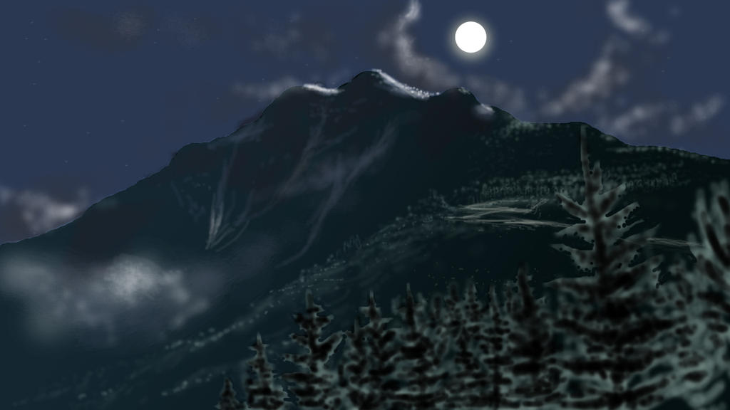 Attempt at painting the scene on Persis
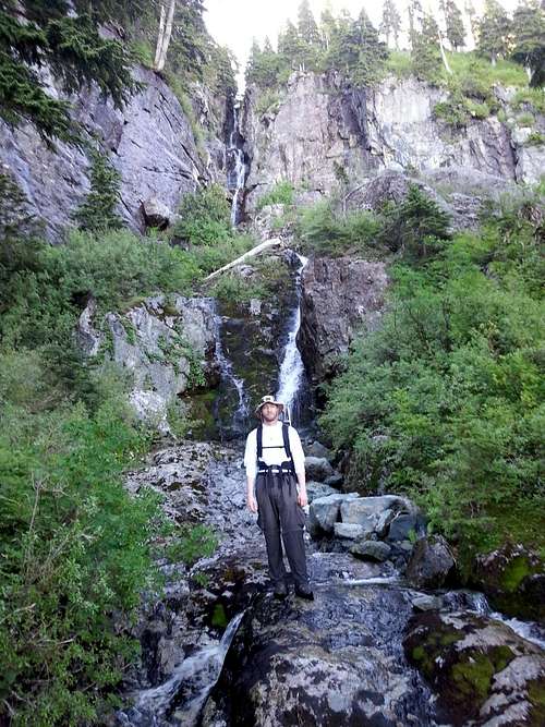
Moon beams pierced the trees and illuminated the road ahead in a magical way but I remember looking up the mountain with slight disappointment in the apparent snow-pack. Not knowing which roads to take, I had the dumb luck to decide to take all left forks which coincidentally put me on track to the Persis trail-head. The road became visibly bumpy and steep and I had to walk the bike for most of it. Frozen puddles and slippery cobblestones made the travel wearisome. When I got to the last junction I hit powder, dropped my bike on some bushes and walked to the right, lured in by the sound of a water fall. I was greeted to an enormous pile of shotgun shells and booze bottles. Probably not the trail-head. Going the other way was a steep climb and as I dragged my rubber legs I kept looking for the hole in the woods. A snowbank was covering the uphill side of the road and I never found it after traveling all the way to its end. I tried to go up hill from there and decided it was unsafe, then came back to my bike and bashed brush up the mountain through not-quite-snowy-enough first growth fir and slide alder until I hit a boulder field that started easy then became caked in rime ice and verged onto loose class 3.
I stopped after gaining maybe 500' and looked out across the valley to Cavanaugh and Puget Sound draped in black clouds illuminated florescent orange from beneath. Weather was coming in and I was moving way too slow. This was ridiculous and I was way off route. I called it quits and descended back to my bike where I realized just how fatigued I had become. Biking down was some of the scariest riding I've ever done as my brakes needed to be adjusted from burning through all that rubber. Also, I would hit a large stone, the bike would do a mad hop with the front wheel turned, severely loosening my grip and I would have to correct it before I hit the ground and re-tighten my grip on the brakes. Eventually I got smart enough to jump off the bike and just walk it down at least until I got back to FS 62. The rest of the trip was a cold windy yet fun drop back to Goldbar where I shivered miserably until the morning bus took me home. Mission failed but nice try.
Attempt#2 (partly successful)
A month later, I was enrolled at Everett Community College and the mundane school life was starting to settle in. Of course homework is important for the mind but does nothing to sustain my soul and I kept thinking back to that moonlit landscape. I tried to look back and see what lessons I needed to learn from my previous attempt that wouldn't rule out the adventure. Weather for one could have been better. A higher ceiling or no clouds at all would have helped me navigate around. A map of the roads would be handy- although by now I knew them well enough. Also, more snow-pack would be necessary to cover that pesky slide alder and boulder field. Would I actually find the trail this time? I didn't count on it but was hoping.
After establishing a steady rhythm with my coursework, waiting for the snow to fall and the weather to cooperate, February opened up. I picked my night and began much the same as before but this time no wrong turns. To my surprise, when I arrived at the junction for FS 6220 there was a group of guys headed down who decided to give me a ride in their pickup nearly all the way to the trail-head. I couldn't thank them enough for saving me the big road climb and was delighted when I hopped out into deep powder indicating a healthy base. I also lucked out and found the trail-head right away this time. Not many trails seem to shoot straight up like Persis does and I felt the burn. The clouds parted at some point and I gazed as the moon shone on the snowy trees. Absolute magic! Once back into old-growth the wind picked back up blowing surface snow and creating low visibility. I turned off the mp3 music to listen to nature's more finely tuned instrumentals and threw on a coat. At about 4,500' I lost the trail completely and waded through waist deep powder but it didn't matter. This was hard work but the setting was so surreal I enjoyed it. Before gaining too much higher I remembered that there is a false summit before Persis that I needed to avoid or else there would be a 200' penalty. I pulled out my ice-ax and traversed steep slopes to the west before getting to a broad bench that led to Persis upper summit lake area. The clouds were high now and the full moon shone directly above casting a blue-green light on everything with the orange glow of the Seattle area to the west and even the Olympics faintly visible with a huge brewing storm behind them. Such a beauty, I had to make a painting of that later as well.
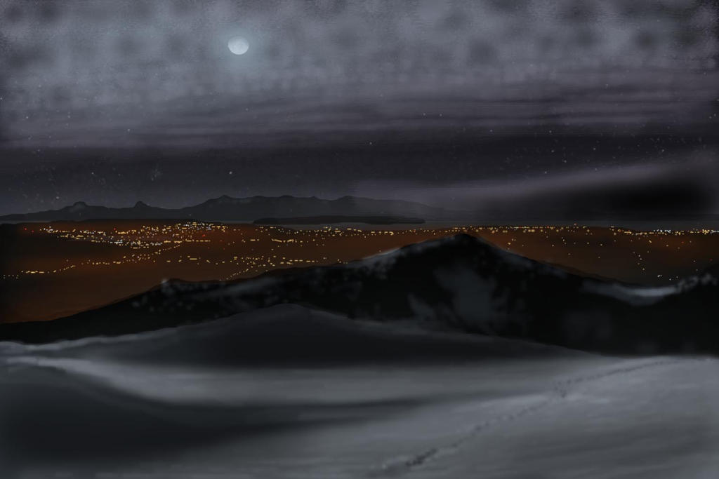
Another attempt at painting the scene on Persis
My legs were beginning to tire having broken trail all the way solo and upon summitting Persis I knew I could not finish the traverse even though I had plenty of time. Index loomed darkly purple in the distance and the traverse looked nasty with so many cornices I stood no chance. Surprising to me, I had cell reception and so sent a text to my mother that it was beautiful, I loved her and was turning around. This descent went smoothly and when I got back to FS 62 I laid down for a nap. Back at Goldbar, I waited until dawn and had a nice breakfast at the Mountainview diner before going home pretty satisfied with my summit. But in the back of my mind, Index rattled around. I needed to come back.
Attempt#3 (partly successful again)
![Ready for BW3?]() Ready for BW3?
Ready for BW3?
| Quite a bit of time passed before my next try. I was going to wait until next winter but a friend of Josh Lewis wanted to climb Index via the traverse from Persindex in July and invited me along. He had a plan to shortcut Persis by going to the high hairpin on Proctor Creek Road and its spur road FS 310. From there follow Proctor Creek up a nice gully to its source at the base of Persindex. Pretty simple huh? Nope. The creek running through this gully had several falls in it which forced us out onto some of the worst bushwhacking I've ever done. We managed to avoid BW4 (bush-whack 4) on the way up by looking for the path of least resistance but devil's club was always waiting
beneath some friendly looking salal, huckleberry or slide alder.
Eventually we found the right gully that led up a small snowy valley to the Persindex summit plateau, but only after a very time-consuming struggle with the brush. I crossed the snow fields and tagged Persindex summit, since it felt like we had climbed a mountain and just in case the traverse was too hairy, I didn't want walk away empty handed. It was a brief 100 foot scramble on steep heather and gnarled evergreen trees with nasty exposure to the East. The view was cool but I didn't stick around. I regrouped and we meandered to point 5308 where the way became increasingly less obvious. In fact, I lost my nerve here and took so long trying to figure out where to go that we timed out. Since we weren't finishing the traverse, we took a nap in the shade and soaked in the views. It was a perfect day with ideal conditions but I was disappointed in myself.
| ![Looking out at brushy scrambling]() Looking out at brushy scrambling
Looking out at brushy scrambling |
![5300' sub peak on Persindex]() 5300' sub peak on Persindex
5300' sub peak on Persindex | ![Turnaround point on the Traverse]() Turnaround point on the Traverse
Turnaround point on the Traverse |
Coming back down was easy enough on snow, starting with a fun glissade and following our tracks from earlier. Then we got to the green brush and route finding was again not easy. Our original path was not obvious at all and we ended up cliffing out repetitively. Each time my shins would take excessive abuse from branches and logs then we would be heart-broken that we had to go back up 2-300 feet and try a different way. After many failures and running out of water I decided to head for the main drainage to Proctor Creek which turned out okay at first. We refilled on water, dried out sweaty socks and rested. Then we hit another waterfall and had to cross over into thorns. My friend had to take over navigating since my motivation for movement in the terrain was low as dictated by my bruised and welted shinbones and cut up arms. After more of the same from before we just decided to drop. This is where we encountered legit veggie belays over 6-10 foot drops on nearly vertical terrain. I was convinced it wouldn't go but sure enough we never completely cliffed out. Sometimes the best holds were Himalayan Blackberry branches and 70 degree mossy rock. I think this is called BW4 and I do not want to know what BW5 is like.
Things eased up after half an hour and I became more positive when my feet were on solid ground. Normal bushwhacking through slide alder and the luxurious cedars felt like a great change in pace. Somehow we missed FS310, perhaps going parallel to it and stumbling upon some obvious homeless litter and old artifacts. We hit the car just as the sun was setting and so glad not to be doing any navigating in the dark. Will I return to this route? Never. I got something out of it and that was plenty painful. It's a passable route but I don't recommend it.
Attempt#4 (completely bogus)
A few days on and Josh was now in Peru on
his adventure of a life time climbing Alpamayo. I wanted to get out while I had the freedom and ended up doing some things but not nearly as much as I hoped.
Eastking arranged a nice
trip up to the gorgeously glaciated Ruth Mountain in the North Cascades and I set up my own
trip in the Glacier Peak Wilderness with help from my friend Joanna. They were both a joy and the terrain presented a decent challenge but my mind kept reminding me of my failures. And one that stood out was Index. Three attempts has happened to me before but never in such a short time-frame. Maybe I was jealous of my brother's peak resume (he had climbed Index in 2011 and had an amazing list of other ascents) or maybe I wanted to have success in my own goals. Well, when his buddy called me again to attempt from a different route, I could not turn him down.
Anderson Creek approach is an established route but doesn't have any trail on it. My only concern was all the brush this late in the season without snow-cover. Luckily my climbing partner had a plan to shortcut part of the creek by using the Lake Serene trail and then go across moderately steep woods to an old logging road that led to a pass and old logging camp then a faint boot path that led to a brook that fed into Anderson Creek. Got it? No? Me neither. But we did it anyway and it actually worked quite well with a pre-dawn headlamp start. We made excellent time getting to Anderson Creek and then followed its mostly dry rocky bed up to an open debris meadow at 2,600' where it split up into three distinct falls. Here is where the trouble started. We couldn't agree about which way to go so we tried each one. According to the route description it never gets above class 3. Well, maybe it was true but the terrain had horrible wet holds and green things on every place you wish you could put your foot. After attempting the first two on the right and making it quite a ways up the second, I had to turn back since it was looking sketchier by the minute. Scrambling on rock can be fun but this was mud covered in thorns. Or rock covered in slime. No thank you. We made one last go for the falls to the left which had dry and dirty rock all around it. It looked like it might have went in early season with enough snow to bridge the gap to the upper benches but when we got to it, there was nothing but trouble.
A little disappointed yet again, we had to turn around and go back the way we came. Maybe I was drained or just lost heart. It took me forever to get back to where our route left Anderson Creek. It was getting late by the time we reached the car and I couldn't even summon the energy to talk to a couple girls who were talking with my climbing partner. I was beginning to suspect I was jinxed on Index. My partner played it off cool and just tried to examine the novelty of the challenging routes we were choosing. Not many people do this sort of thing. Most people will brag about hiking to Lake Serene. He finished leftover time by driving over to the gate blocking easy access to the West Ridge of Index.
Attempt#5: Success via the 15 hour traverse
Months go by. I go on an
awesome trip up to the Snowfield Peak group with
gimpilator and then later another trip with
Fletcher Jordan up Buck and Berge. Both times I'm blasted and Josh shrugs it off his Andes conditioned shoulders by doing more trips back to back than I've ever dreamed of doing. Then he gets into a climbing accident in Banff and now he's laid up without use of his hands for months. And during the first month I am helping care for him. On month two, I am desperate for a break. And I get a call from his friend for one last go at Index.
It is on this one, the Persis-Index Traverse that we finally made it. I have to hand it to Josh's friend: he is tenacious and not easily deterred. We agreed that since the West ridge requires a ridiculous bike ride and the East is somewhat technical, that Persis is the only way to go. Adding fuel to this was Jacob Smith's recent posting on Summitpost of the Persis-Index traverse. More-over, we have been all over the area and have enough beta that we were sure to get this. Afterall, this is the last nice day of the year.
So at 6 am on the 27
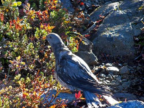
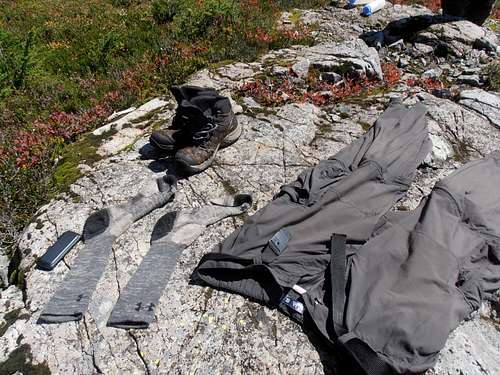
th we headed for Persis packed light with the intention of doing the whole traverse in a day. Some construction on 522 set us back a little but not much. The rest went down easily until 6220 where it deteriorated to scree. Since he is borrowing the car from someone else he decided we will not press our luck and park at a pull out before the road ends. At 8:40am we got moving quickly and flew up the trail at a generous speed getting soaked by dew from the recent rains. I had a camera this time and made feeble attempts to document our journey. Near the summit of Persis I took off most of my clothes to dry them out, a common theme for this trip since it never got above 65 degrees. Soggy boots couldn't be helped. I don't know why but I decided to go for a swim in one of the tarns, something I'd never done before. It was cold but tolerable, at least for a few seconds. I dried out and we pushed onas it was now 10:40am.
![wet Bird]() wet Bird
wet Bird
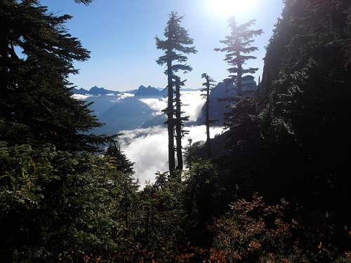
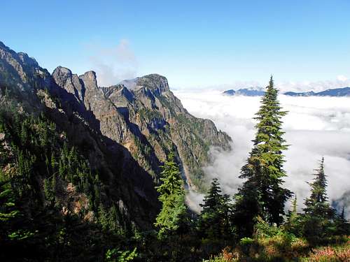
| ![Skykomish valley at a notch on Persis]() Skykomish valley at a notch on Persis
Skykomish valley at a notch on Persis
| ![Olympics from Persis tarn]() Olympics from Persis tarn
Olympics from Persis tarn
|
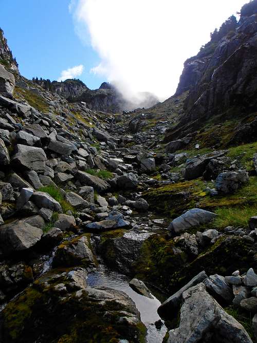
We worked our way to a faint path that led to a boulder field on Persis' Southern slopes. This was not my partner's first time going through here to Persindex so he knew exactly which gully to go up on the other side of the meadows. Of course he learned all this the hard way by cliffing out on each of the gendarmes on the way which have deceptively easy ramps to the top of each one. Down in the meadows near tree line I kept noticing steam rising from the plants and my friend's clothes from all the water evaporating. It was quite an amusing sight as I followed his lead to the little valley. Once arriving there I was a little let-down that there was no lingering snow to make travel easier. So began the talus slog up to Persindex.
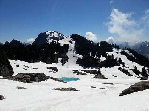
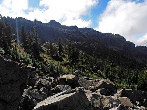
![Index and Persindex from Persis]() Index and Persindex from Persis
Index and Persindex from Persis
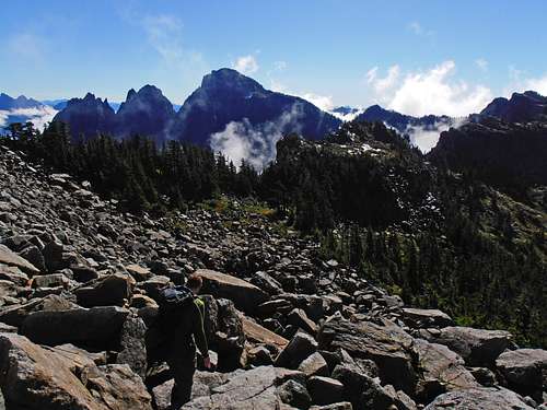
| ![Start of the gully to Persindex]() Start of the gully to Persindex
Start of the gully to Persindex
| ![Persindex Persis]() Persindex Persis
Persindex Persis
|
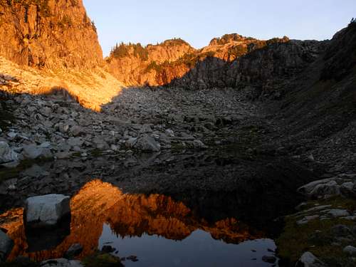
![Small valley to Persindex]() Small valley to Persindex
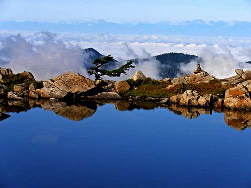
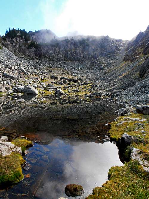
Small valley to Persindex | ![Cloudy Persindex reflection]() Cloudy Persindex reflection
Cloudy Persindex reflection | ![Drying clothes]() Drying clothes
Drying clothes
|
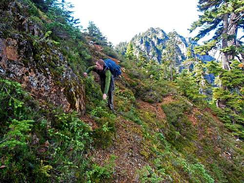
It felt like eternity but in reality it couldn't have been long because we arrived at Persindex just after noon. We dried out our things again by a creek-fed tarn near point 5308. It was our last reliable water source. This time we found a faint trail that bypassed all the nonsense that turned me around the first time. It jumps from one side of the ridge to the other depending on exposure and has very precipitous heathery slopes on the trail side. Views were spectacular and the further we got, the more excited I was that I may actually finish.
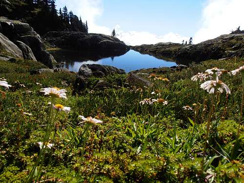
![Flowers hang on deep into September]() Flowers hang on deep into September
Flowers hang on deep into September
| ![Easy part of the traverse]() Easy part of the traverse
Easy part of the traverse
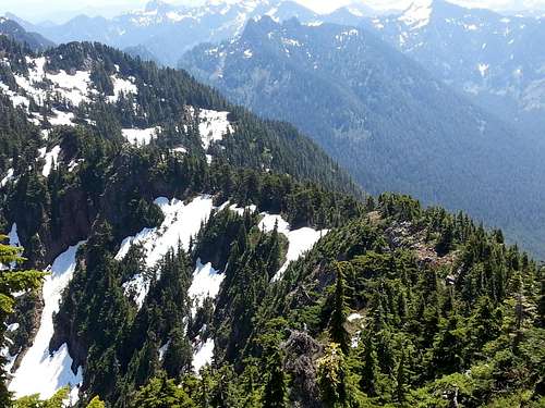
| ![Persis from the traverse]() Persis from the traverse
Persis from the traverse
|
After hours navigating brushier sections to avoid cliffs, we arrived at the crux: 200' of steep, muddy class 3 with down sloping footing and sub-prime veggie holds. I wish I had a hand-line or something for a rappel but caution was all we brought. It turned out to be enough and from the 4,900' saddle the rest of Index was just a casual mountain. Except for the steep snowfield that was melted out to reveal boulders held together with muddy glue. We had to go one at a time through that section. Actually, I considered turning around. It reminded me of my brother's accident and I didn't want to make the same mistake. I found an easier way across after waiting for several minutes debating the risks and merits of going now rather than later and caught up at the summit where we yet again dried out our clothes.
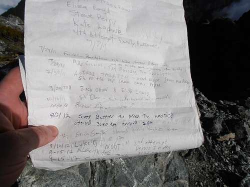
The summit register contained a list of many familiar names. We took pictures and panoramas. I ate some of what little food I had brought. My water tasted like plastic which was because I failed to clean the bladder properly before leaving but tried to get it down. I was beginning to feel a head-ache coming on and suspected the second half of the trip would be much less pleasant than the first half. The changing colors as the sun was setting provided some relief.
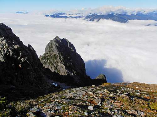
![Looking down at Middle Index above the clouds]() Looking down at Middle Index above the clouds
Looking down at Middle Index above the clouds
| ![Index summit register with familiar names]() Index summit register with familiar names
Index summit register with familiar names
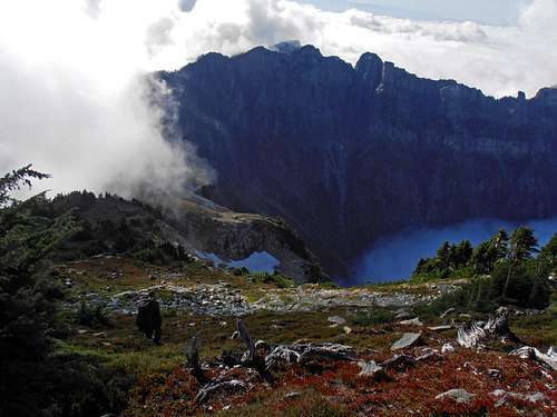
| ![Persindex from Index]() Persindex from Index
Persindex from Index
|
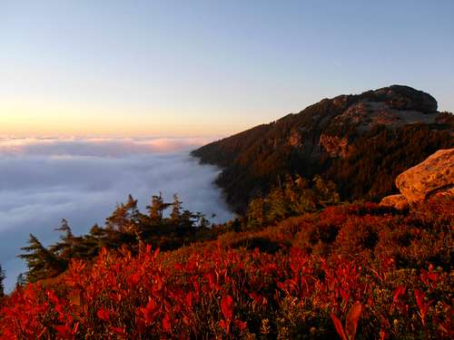
![Purple clouds below Persindex]() Purple clouds below Persindex
Purple clouds below Persindex
| ![Golden light reflection of Persindex]() Golden light reflection of Persindex
Golden light reflection of Persindex
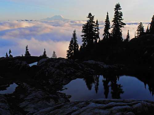
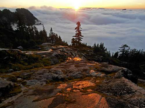
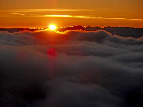
| ![Sunset on a sea of clouds]() Sunset on a sea of clouds
Sunset on a sea of clouds
|
![Mirror slabs]() Mirror slabs
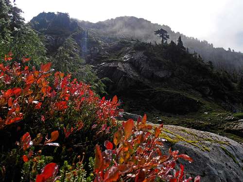
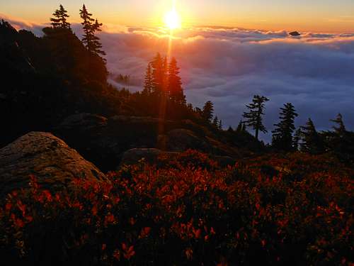
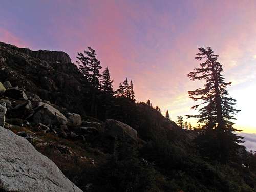
Mirror slabs | ![Persis at sunset with red bushes]() Persis at sunset with red bushes
Persis at sunset with red bushes | ![Olympics from Persindex]() Olympics from Persindex
Olympics from Persindex |
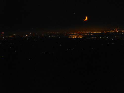
The rest was all the same adrenaline in reverse since we were fighting daylight to get back to the meadows below Persis before sunset. Naturally, I had to take some photos since I won't be back there anytime soon. Fall colors were stupendously red and there was a sea of clouds at about 3,000'. The views from Persindex were especially grand and I couldn't help but try to capture some of it. The sun dropped below the horizon all too quickly and the faint trail we followed in was hard to spot in the dark. We took a break before we got to the boulders and made a feeble attempt to dry socks one last time. My partner generously donated some food and I layered up. I admit I may have over done the photos and put us on track to be in the dark as we headed back up the boulder field on the South side of Persis. I was feeling really fatigued by this point and moved as if at high altitude: support weight with arms on one boulder, take one step, inhale, exhale, inhale, exhale, repeat. He was getting concerned when I stopped to break and take a picture of the moon so I put the camera away for good.
![Purple sunset above Persindex]() Purple sunset above Persindex
Purple sunset above Persindex
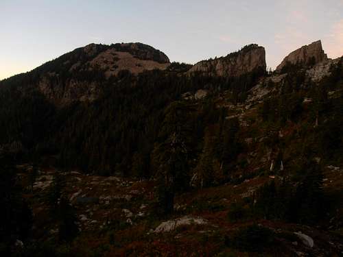
| ![Persis at dusk]() low light on Persis
low light on Persis
| ![Moon over Seattle]() Moon over Seattle
Moon over Seattle
|
We made it back to Persis summit area sometime around moonset which was something like 9? Anyway it felt like forever getting down. I was feeling lost and thought we were going the wrong way. But my partner was not leading me astray and found the trail back down. My confidence renewed I found some spring in my step and hurried down until about 4,500' where he had us take on last break. He had plenty of motivating things to say. Truly a decent fellow. Occasionally I would have to stop and say, “I can't believe I actually did it” with very limited energy. The road walk down felt much longer of course but we arrived at the car at 11:04pm Days later I'm still sore and can barely walk. Was it worth it? I don't know but I'm glad to have achieved such a difficult goal after so many tries in good company, good weather and a fun story to reflect on.
Comments
No comments posted yet.