Overview
This is a variation of the route described in the Panther Peak Wash. It was slightly shorter since there were other activities scheduled for the afternoon. In addition, the trail was very easy to follow the entire way UP. The return was slightly more difficult.
The entire trip was only 5 miles and about 1200' of elevation gain. It took us a little over 3 hours and we did not rush. After climbing Safford Peak the prior day, the Panther seemed very tame!
Directions if you want to repeat this adventure. From I-10 in northern Tucson take exit 248, Ina Road. Head west until the road ends, than turn left (south) on N Wade Road. Wade Road bends around to the west and turns into W Picture Rocks Road. Stay on W Picture Rocks Rd until you see the sign for the Cam-Boh Picnic area. Turn here and park in the area in front of the toilets. The trail starts just to the right of the toilet structure.
The Adventure
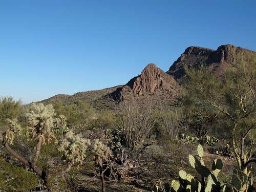
![Panther Peak from the Roadrunner trail]() Panther Peak from the Roadrunner Trail
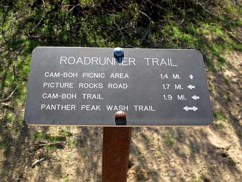
Panther Peak from the Roadrunner Trail![Sign at junction of Panther Peak Wash and Roadrunner trail]() Sign at junction of Panther Peak Wash and Roadrunner trail
Sign at junction of Panther Peak Wash and Roadrunner trail
The sign for the Roadrunner trail advertises 1.4 miles to the junction of Panther Peak Wash but my GPS measured it at 1.2 miles. At the wash, we made a left toward a fence, where a sign directed us to an opening in the fence. Just past this opening, a trail goes off to the right (east) up a small hill, past the warning that you must have permission to hike here. We followed this faint trail, which eventually brought us to a more well-defined trail. If you decide to follow in our footsteps, MEMORIZE or mark this junction as it is not obvious on the return.
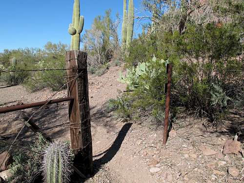
![Break in fence]() Entry through fence along Panther Peak Wash
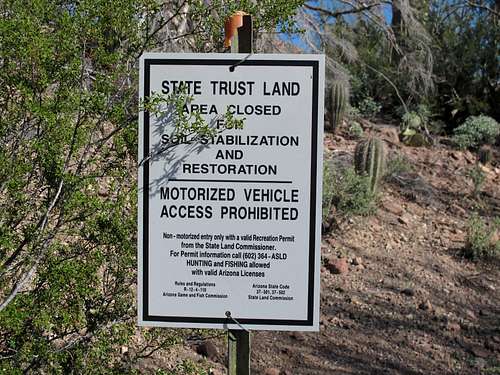
Entry through fence along Panther Peak Wash![Permit sign]() Restricted entry sign for Panther Peak
Restricted entry sign for Panther Peak
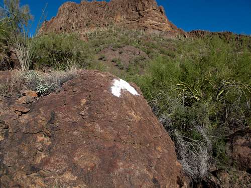
As we continued northeast on the well-worn and cairned trail, it arrived at the drainage between Panther and Safford Peaks. At this point there is a large blotch of white paint on a rock. We noted this landmark for the return, and added a GPS waypoint which is included in the attached GPX file. The trail then followed the stream bed upstream and was well marked with cairns.
![White paint near Panther Peak]() Bright White paint marks the trail transition between the drainage and the desert trail
Bright White paint marks the trail transition between the drainage and the desert trail
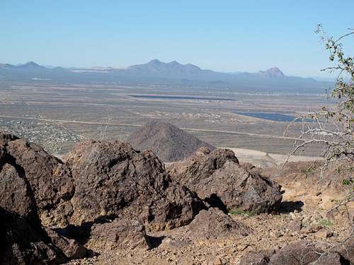
At the saddle between Panther And Safford Peaks, a well worn trail leads left (west) to the summit of Panther Peak. We enjoyed the sweeping views which included the remaining half of Twin Peaks. A chilly breeze on a warm 70 degree day sent us scuttling downwind behind some rocks to enjoy a snack.
![Panther Peak summit view]() View from the summit of Panther Peak
View from the summit of Panther Peak
On the descent there was an abundance of cairns which attempted to lure us downhill away from the white splotch on the rock. Fortunately we saw the paint and headed westward back to the main desert trail. However we were not so lucky finding the turn that led back to the Panther Peak Wash. The main trail continues and apparently circles around the peak and before we knew it we had passed the turn-off. We headed back and found several trails leading back towards the wash, but stuck with the original one that we came in on. Despite the extra "detour", we made it back in time for our lunch appointment.


Comments
Post a Comment