Topo US 2008


Topo US 2008
Page Type Gear Review
Object Title Topo US 2008
Manufacturer Garmin
Page By redsplashman23
Page Type May 2, 2009 / May 2, 2009
Object ID 6096
Hits 4170
Vote

Product Description

Topo U.S. 2008 replaced Garmin's Mapsource as its newest and latest Topographical software. It can be easily used to transfer maps, routes, and tracks to your Garmin GPS. Just make sure you have an SD Card large enough to support the maps you want to load. With a 2 GB SD card you can fit nearly the entire United States onto your Garmin GPS.

NOTE: This software only works to transfer maps onto a Garmin GPS via a USB port.

Also, you have to have the DVD in your DVD player to transfer the maps onto your GPS. You can't load the Maps onto your computer.

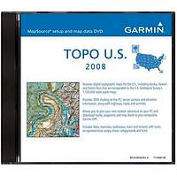


Features

  • Digital topographic maps, comparable to 1:100,000 scale USGS maps
  • Summit locations with elevations
  • Trails and rural roads; city neighborhood roads
  • Interstates and major highways
  • Coastline, lake and river shoreline; wetlands; perennial and seasonal streams
  • Searchable database of cities, geographic names, summits, lakes, and more
  • National, state, and local parks, forests, and wilderness areas
  • Terrain contours and topo elevations
  • Elevation profile on PC and compatible units; estimate terrain difficulty
  • Allows you to plan your next outdoor adventure on your PC and download routes, waypoints, and map detail to your compatible Garmin GPS
  • Lakes, reservoirs, waterways, rivers, and streams with icons to represent boat ramps, dams, campgrounds, and trails

    Images

  • Reviews

    No reviews written yet.