Our Next Big Mountain Trip
Going on special trips to the mountains with my family is something I always look forward to, and after memorable trips to Zion National Park two years ago and to various places in the San Juan, Sangre de Cristo, and Elk mountains of Colorado one year ago, I was looking forward to our next big trip. With my brother Johnny back for the summer and my parents willing to take us along in their big van, it was a perfect opportunity for us to visit some of the spectacular national parks in Montana and Wyoming. Up until this point almost all of our hikes had been limited to Utah and Colorado, and I knew that if I wanted to see the most rugged parts of the Rockies then it was time to head north. This would allow me to climb a couple peaks I’d been eyeing for some time that until recently I had no idea how to squeeze into a family vacation. Being in national parks, there would be plenty of stuff for my Mom, wife Liz, and son Matthew to see right off the sides of the roads, and my Dad and brother Johnny could come along on the two longer day-hikes that involved scrambling.
The first mountain I wanted to climb was Reynolds Mountain, a true horn located along the Continental Divide in the center of Glacier National Park, an area which George Grinnell once called the “Crown of the Continent”. After skimming through Edwards’ “A Climber’s Guide to Glacier National Park” and reading about the Southwestern Talus Slope Route in there and also here on SP, I felt it would be a good hike to take my Dad on, and if he wasn’t comfortable with the short section of scrambling then I could quickly tag the summit while he waited below.
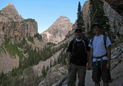
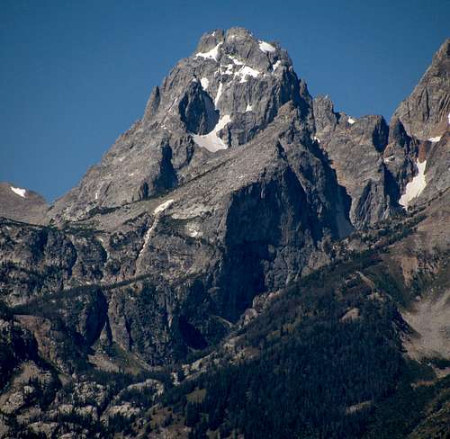
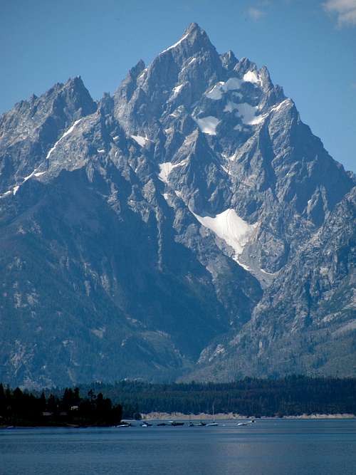
The second mountain I was hoping for a crack at was the Middle Teton, located at the birthplace of American alpinism. It would be a worthy goal in itself that also offered stunning summit views of the the Grand Teton to the north, which most people consider the closest thing you’ll see resembling the Matterhorn here in the United States. Since Johnny was fine with scrambling but had never been on a day-hike this grueling, he decided he’d skip the Reynolds Mountain hike to save his energy for the Middle Teton.
There were a few hurdles to overcome before the trip, the most significant of which involved overcoming the effects of a serious pulmonary embolism six months earlier. It came about as a result of what initially seemed like just another rolled ankle playing basketball of all things (finding out you’ve got thicker blood than most people after tearing the main vein in your leg isn’t a good thing). After experiencing sharp pains and muscle spasms all up and down my right side for the first month of my recovery from the largest clot in my right lung (in addition to getting completely winded after simply going up a few stairs), I wasn’t too optimistic about being able to hike much at all, but as the summer progressed I started feeling better and better. Taking warfarin blood-thinners all summer and ramping up on easier hikes like Ice Lake Basin in Colorado’s San Juan mountains and Mount Timpanogos in Utah’s Wasatch mountains made me feel confident that I’d recovered enough to be able to get to the tops of two more difficult mountains in a three day period without too much trouble. The previous summer I’d talked with my cousin David about climbing Teewinot together, but making the step up to class 4 on a route as sustained and exposed as the one on Teewinot’s East Face while still on warfarin wasn’t something I wanted to try. On doctor’s orders, I’d somehow refrained from joining in the lunchtime basketball games at work for most of the summer, but he said hiking and even a little scrambling should be fine (I guess you still have more control testing out loose rocks before stepping on them than you do over whether someone else’s foot ends up underneath yours as you’re jumping towards the basket).
This would also be our first time out and about in bear country, so Liz made sure I was equipped with a bear bell and bear spray. My Dad wanted to see Waterton Lake up in Canada as well, so we added passports to the list of items to take with. Finding out about the people who were recently killed by grizzlies in Yellowstone and the fugitive John McCluskey still being on the loose after last being seen where we’d be staying in Glacier National Park didn’t help, but we realized that it was much more risky driving on I-15 everyday than it was going to these places, and the scenic rewards would be much greater. Several people I’d talked to said that either Glacier or the Tetons were their favorite mountain locations, so I was excited to check them out, and if we were lucky we might be able to squeeze in a short drive through Yellowstone as well.
Day 1 – Drive to Glacier National Park
![Christus statue above Butte]() Christus statue
Christus statue
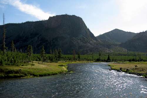
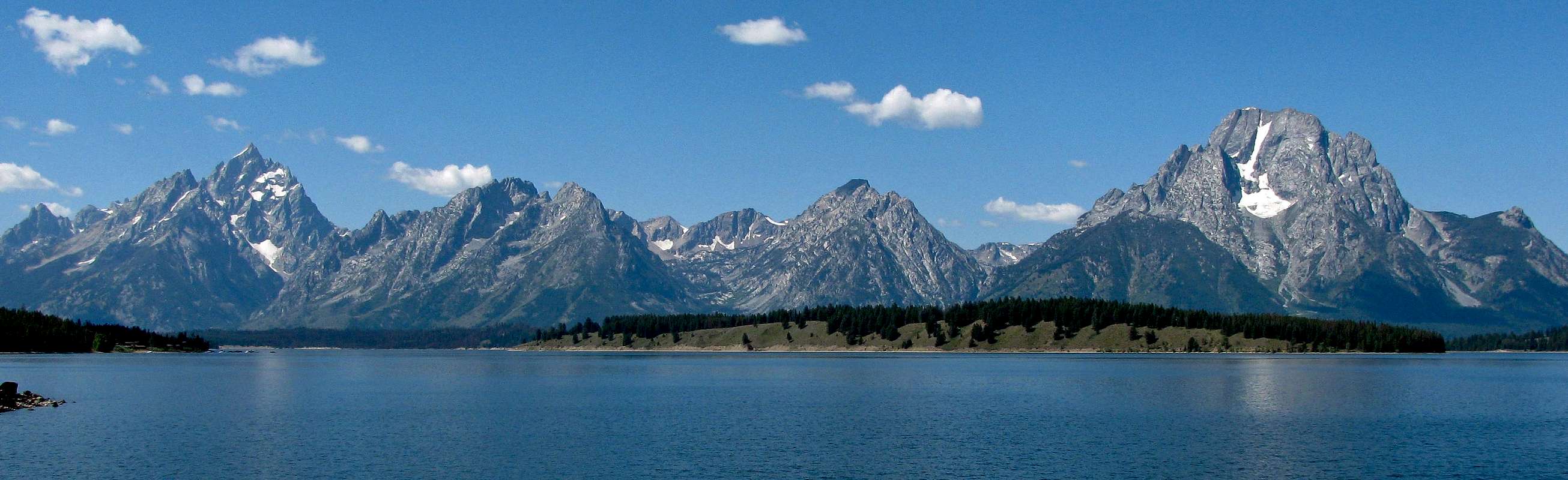
Our first day of the trip was mainly filled with driving, since we were going from Utah all the way up to St. Mary on the eastern side of Glacier National Park in Montana. Matthew had plenty of preparation for long rides during a trip down to Texas earlier that summer, so he was fine the whole way up. We could see the Tetons off in the distance to the east on the stretch of I-15 from Idaho Falls up through Dubois, and even though they were over 60 miles away, I could clearly make out Mt. Moran, the Grand, Middle, & South Tetons, as well as Buck Mountain (didn’t get any good pictures due to the haze, though). We were welcomed to Montana by a Christus statue overlooking the town of Butte, and continuing on US-89 north we began to see some of the more jagged Rocky Mountain peaks rising up to the west of the farms and plains on the east.
![Mt. Henry & Appistoki Peak]() Mount Henry & Appistoki Peak
Mount Henry & Appistoki Peak![Fusillade Mountain over St. Mary Lake]() Fusillade Mountain over St. Mary Lake
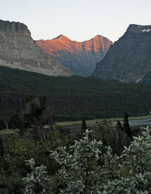
Fusillade Mountain over St. Mary Lake![Reynolds & Going-to-the-Sun at dusk]() Reynolds & Going-to-the-Sun Mountain
Reynolds & Going-to-the-Sun Mountain
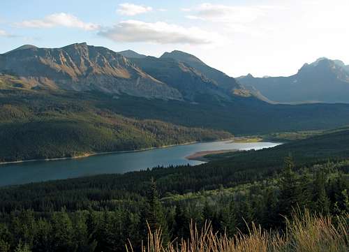
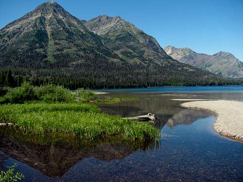
MapQuest directions projected our trip only taking about 10 hours, so I thought it would be nice to drive into the Two Medicine Lake entrance to Glacier National Park and make the short walk to Paradise Point at the upper lake before continuing to our hotel at St. Mary. The speed limits and winding roads off of the projected path were slow-going though, so after turning onto MT-49 from East Glacier Park Village, we decided to just continue on to St. Mary from there to settle in as the sun was going down. The sunset view of Lower Two Medicine Lake was quite nice, and before pulling into the hotel parking lot I caught my first glimpse of Reynolds Mountain’s distinct horn in the distance to the west. I had a feeling it was going to be a great week.
![Lower Two Medicine Lake]() Lower Two Medicine Lake
Lower Two Medicine Lake
We ate some burritos for dinner at Johnson’s Café (we brought enough snacks, oatmeal, cereal, pop-tarts, crackers, chips, trail mix, & fruit for our breakfasts and lunches on the trip) and then checked into one of the little cottages for the night.
Day 2 – Waterton Lake & Many Glacier
![Gable Mountain & Chief Mountain]() Gable Mountain & Chief Mountain
Gable Mountain & Chief Mountain![Chief Mountain]() Chief Mountain
Chief Mountain![Red Eagle Mountain & Little Chief]() Lower St. Mary Lake
Lower St. Mary Lake
The next morning we drove up to Waterton International Peace Park on the border with Canada, with views of several impressive mountains to the west whose names I didn’t know. After passing the Prince of Wales Hotel, we drove down into the small town of Waterton to get tickets for the boat ride across the lake. Matthew enjoyed walking around the town because there were several spots where deer were just sitting in the front yards of various houses (I guess they just come and go as they please).
![Peaks southwest of Upper Waterton Lake]() Peaks southwest of Upper Waterton Lake
Peaks southwest of Upper Waterton Lake![Campbell Mountain & Mt. Richards]() Campbell Mountain & Mt. Richards
Campbell Mountain & Mt. Richards![Arras Peak cliffs]() Arras Peak cliffs
Arras Peak cliffs![Miche-Wabun Peak]() Miche-Wabun Peak
Miche-Wabun Peak
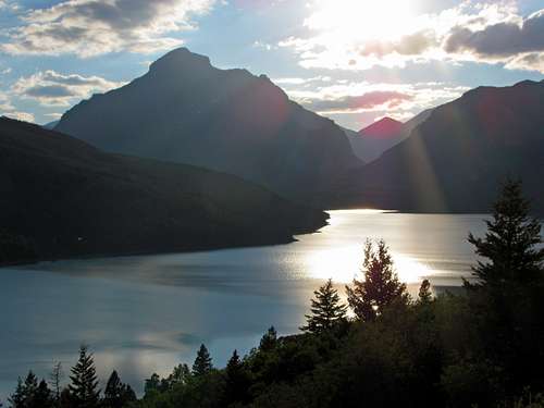
It took about an hour to reach the other (south) side of the lake, and on the way we saw impressive peaks such as Vimy Peak, Campbell Mountain, Olson Mountain, the Guardhouse, Porcupine Ridge, and Mount Cleveland, which is the highest peak in Glacier National Park. Crossing the Canadian/U.S border on the lake we saw a 50-foot wide line where all the trees had been cleared out on either side, extending up the mountains along the border. Once on the U.S. side they stamped a picture with a goat into each of our passports, which Matthew thought was pretty cool as well, and he kept wanting to look back at his “passport ticket” after that. The boat guide ran out of things to say on the way back to Waterton in Canada, so it was a quiet relaxing boat ride on the way back.
Since we were nearby, we decided to make the short drive to see the LDS temple in Cardston (yep, we’re Mormon) before going back down to the Many Glacier area. The guard at the border going into Canada was pretty relaxed, but the one on the way back into Montana grilled us about our food in the car. Since we’d removed the sticker on the grape bag from Walmart and couldn’t prove we’d bought them in the States he kept those, but he let us bring everything else back in (we teased him that he must have been in the mood to have some grapes for lunch, although I’m sure he was just doing his job).
![Swiftcurrent Creek below Grinnell]() Swiftcurrent Creek below Grinnell Point
Swiftcurrent Creek below Grinnell Point![Swiftcurrent Lake wildflowers]() Swiftcurrent Lake wildflowers
Swiftcurrent Lake wildflowers![Mt. Gould]() Mt. Gould
Mt. Gould![Lake Sherburne]() Lake Sherburne
Lake Sherburne
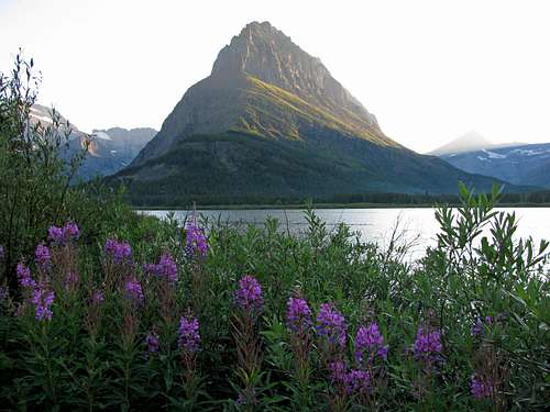
On the way to Swiftcurrent Lake in the Many Glacier area of the park we saw several cars pulled over, so after doing the same and jumping out we were just in time to see a mother grizzly bear crossing a meadow in the distance, with her three cubs darting through the clearing one at a time. I’m glad we got to see them, even though it was from pretty far away (more relaxing that way, though). We continued on the road, and the views of Mount Grinnell and Mount Gould were awesome. Parking where Swiftcurrent Creek flows out of Swiftcurrent Lake, we hiked a short distance down the road past the Many Glacier Hotel, and walked within a few feet of a couple dear who weren’t too scared of us. The sun had set an hour before and we were hungry, so we finally drove back to St. Mary, stopping off at the Two Sisters Café halfway between the towns of Babb and St. Mary for some great burgers (it was also a lot more affordable than the other places we’d seen). After getting back to the hotel (we moved into the main part of the St. Mary Lodge this night) I went to sleep with a full stomach, looking forward to the next day’s hike.
![Wynn Mountain alpenglow above Swiftcurrent Creek]() Wynn Mountain alpenglow above Swiftcurrent Creek
Wynn Mountain alpenglow above Swiftcurrent Creek![Mt. Siyeh sunset]() Mount Siyeh sunset
Mount Siyeh sunsetDay 3 – Reynolds Mountain
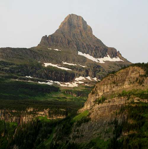
![Reynolds Mountain at dawn]() Reynolds Mountain from the east
Reynolds Mountain from the east
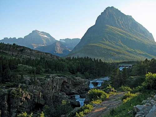
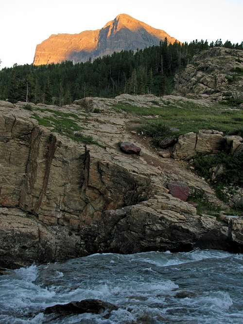
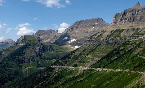
My Dad and I woke up in time to catch the first shuttle leaving the St. Mary entrance to the park at 7 in the morning. The mountain views on the Going-to-the-Sun road up to Logan Pass were quite simply the best I’d seen on any road in the U.S., hands down. None of my pictures came out that well due to the dirty windows on the shuttle though. We had to wait in a line of cars for a few minutes where construction on the road along the final cliffy section just before the Logan Pass Visitor Center cut traffic down to a single lane, but I didn’t mind just sitting and watching the sun light up the peaks in the area. I hadn’t shown my family many pictures of Reynolds Mountain beforehand, because I’m sure they would have freaked out after seeing its distinct horn shape (especially when viewed from the east), so after pulling into the visitor center parking lot I informed my Dad that the peak to the south (which from this angle appeared much more tame) was the one we’d be climbing.
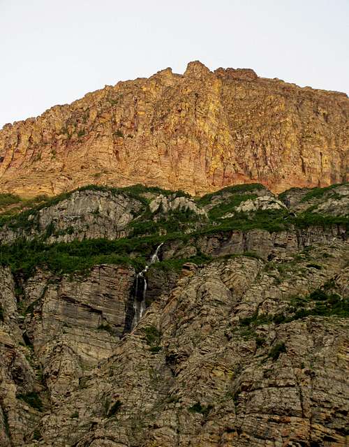
![Piegan Glacier falls]() Piegan Glacier falls
Piegan Glacier falls![Reynolds Mountain]() Reynolds Mountain near Logan Pass
Reynolds Mountain near Logan Pass![Hidden Lake trail]() Hidden Lake trail
Hidden Lake trail![Logan Pass boardwalk trail]() Boardwalk trail
Boardwalk trail
The parking lot only had a couple cars in it, and as we started walking southwest away from the visitor center on the path that soon transitioned into a wooden boardwalk, we only saw a few people ahead of us in the distance. Right off the bat we saw a couple deer, as well as some pikas that appeared to be playing tag. The scenery was phenomenal, and I could see why so many people made the hike to the Hidden Lake Overlook. We would only be going partway there, before turning south to make our way towards Reynolds Mountain. There were a few small patches of bright pink and yellow wildflowers, and we crossed some run-off from the snowfields below Clements Mountain a couple times, including one spot with some nice waterfalls. Here are some of the furry creatures we saw along the trail at Logan Pass:
![Logan Pass deer]() Deer Deer | ![Logan Pass marmot]() Marmots Marmots | ![Logan Pass bighorn sheep]() Bighorn sheep Bighorn sheep | ![Logan Pass mountain goats]() Mountain goats Mountain goats |
|---|
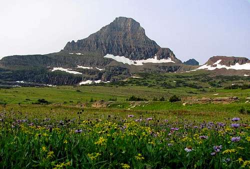
![Logan Pass wildflowers]() Logan Pass wildflowers
Logan Pass wildflowers![Mt. Clements runoff]() Clements Mountain runoff
Clements Mountain runoff![Bearhat reflection]() Bearhat Mountain
Bearhat Mountain![Clements Mountain]() Clements Mountain
Clements Mountain
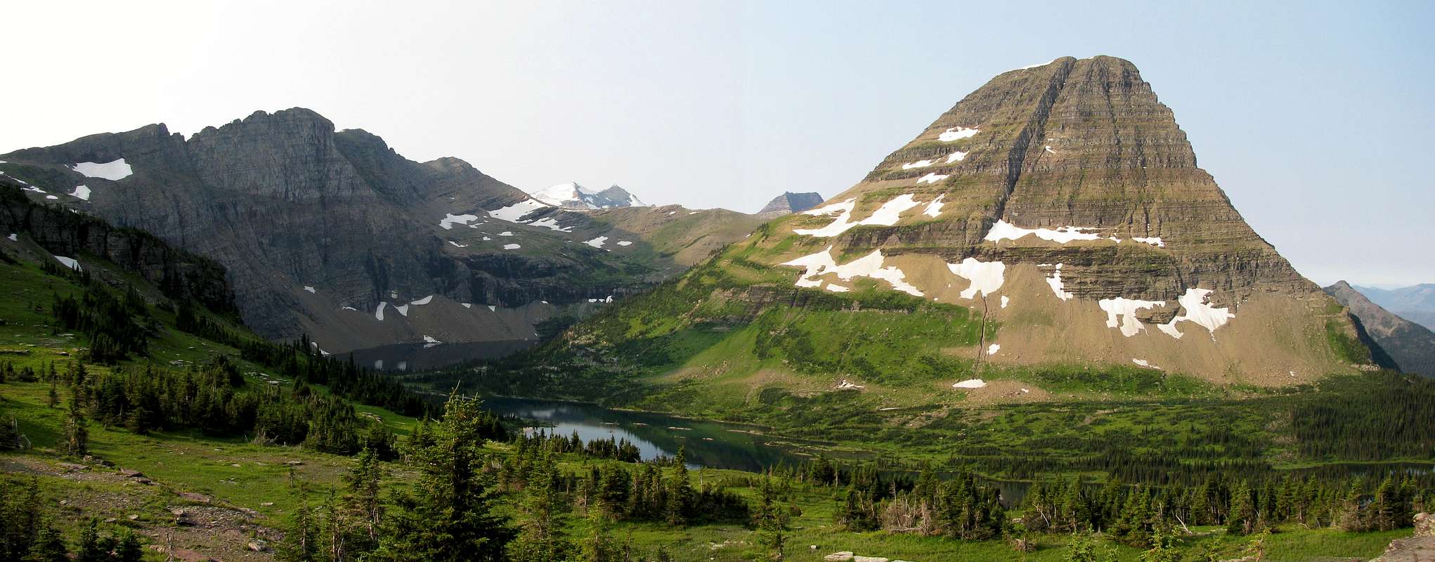
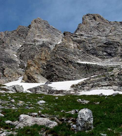
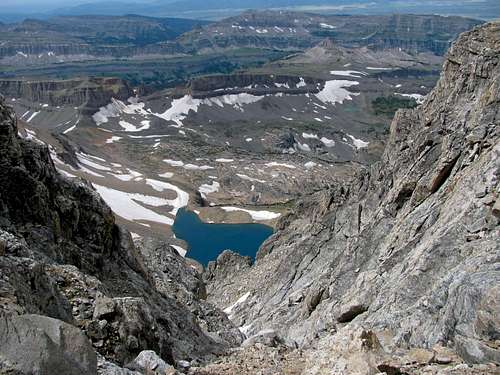
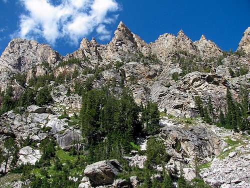
As we gained more elevation, Bearhat Mountain came into view above Hidden Lake pass. I saw the trail we’d be taking off to the left, but decided to continue a bit farther so we could at least catch a glimpse of Hidden Lake from that vantage point. The view over Hidden Lake to the Dragon’s Tail and Bearheat Mountain was definitely one of the best we’d seen in the park. A couple friendly goats crossed the path right in front of us on our way back to the trail split, at which point we soon came to several snowfields as we made our way closer to Reynolds Mountain.
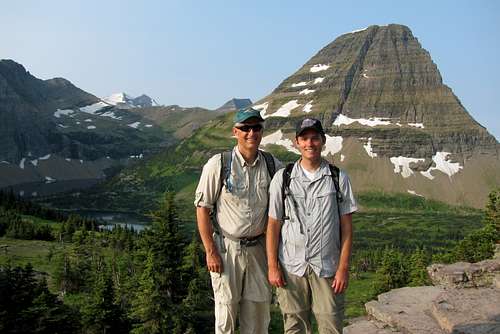
![Me and my Dad]() Me and my Dad
Me and my Dad![Clouds moving into Logan Pass]() Clouds moving into Logan Pass
Clouds moving into Logan Pass![]()
Hidden Lake Overlook
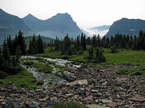
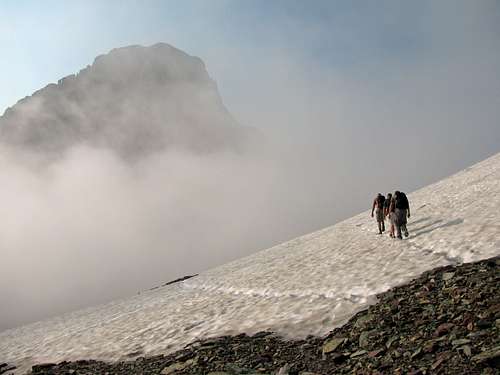
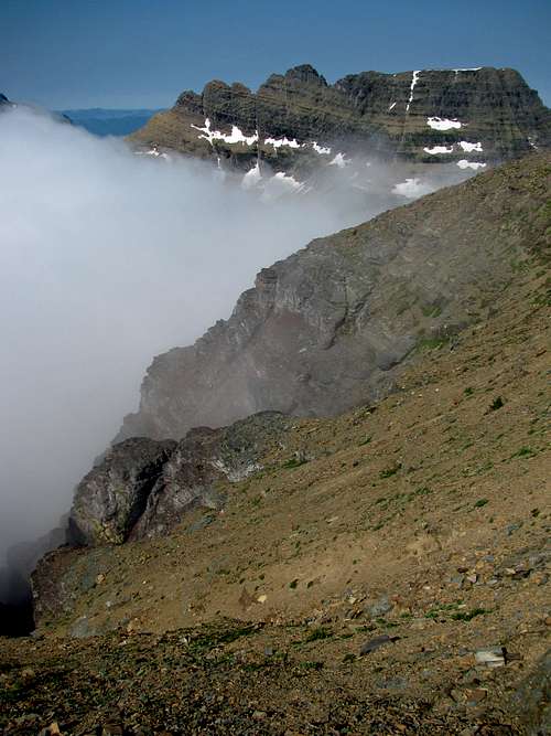
The first snowfield was nice and flat, but the next two were a little bit steeper. Luckily for us, there were some well-worn tracks in the snow that we could step in. To the east we could see several clouds coming in over St. Mary quite quickly, even though the forecast I checked two days previously said it was supposed to be sunny. They weren’t storm clouds though, so I wasn’t that concerned. We let a small group of three fast-moving hikers pass us before the last snowfield (they were going up the goat trail on the north face), and at this point the clouds had started to obscure our view of the peak. We continued on into the clouds and mist, until we reached the spot where I imagined we’d be able to look down on Hidden Lake again. Sure enough, we caught some glimpses of it in between the clouds that were streaming across the ridge we were on. After a short snack break we continued on.
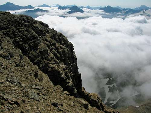
![Reynolds above the clouds]() Reynolds above the clouds
Reynolds above the clouds![Dragon s Tail above clouds]() Dragon's Tail
Dragon's Tail![Mt. Clements above clouds]() Clements Mountain above clouds
Clements Mountain above clouds
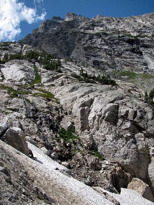
Wrapping around the west side of Reynolds Mountain, my Dad and I felt a little like Frodo and Sam, what with all the steep cliffs around us shrouded in mist. Our view cleared up every now and then, but upon rounding the corner below the mountain’s southwest ridge we were engulfed by clouds again. I had printed out a couple different route descriptions, but I could not see the break in the cliffs we were looking for because of the fog. One route description said to continue along the southern cliffs for a little bit, so we continued for a few hundred yards. I still didn’t see a nice entry point to get on top of the cliffs to get to the southwest slopes, so we continued on the trail. Finally finding something that looked easier than what we’d seen up to that point, I decided it would be a good spot for going up.
![Reynolds southeast cliffs]() Reynolds southeast cliffs
Reynolds southeast cliffs![Reynolds Mountain south slopes]() Scree on south slopes
Scree on south slopes![Reynolds cliffs south of summit]() Cliffs south of summit
Cliffs south of summit
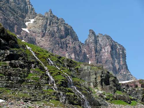
My Dad wasn’t as interested in getting to the top, so after he agreed to wait for me (I told him I’d be gone for exactly an hour and a half, and since it was unlikely bears ever went up above the cliffs, I left him with the bear spray), I started switch-backing up the cliff that was broken up every now and then by some flatter patches of grass and wildflowers. Since this part was bordering on Class 4, I knew this wasn’t the exact right way to go, but figured I couldn’t have been too far off. As I got higher I could finally start to see above the clouds, and looking straight up at the south face and comparing my view with that of the one from some route photos from SP, I knew that we had overshot the correct entry point onto the south slopes by quite a bit. I was forced to ascend the southeast slope instead, which was miserably loose and quite steep (over 45 degrees in some spots). I’d never been on a slope this loose before, and to avoid losing all the ground I gained by sliding back after every step, I had to burst upward for about a dozen long steps or so each time. I dug my fingers into the smaller scree, which was almost like sand in some places, and made my way back to the northwest in an attempt to meet back up with the trail. Eventually I spotted it, and once on the right trail it was much more easy-going.
![Out of the clouds]() Out of the clouds and onto the scree
Out of the clouds and onto the scree![View east from Reynolds standard scramble]() View east from Reynolds standard route scramble
View east from Reynolds standard route scramble![Peaks over Hidden Lake]() Peaks over Hidden Lake
Peaks over Hidden Lake![Reynolds exposed scrambling]() Exposed scrambling
Exposed scrambling
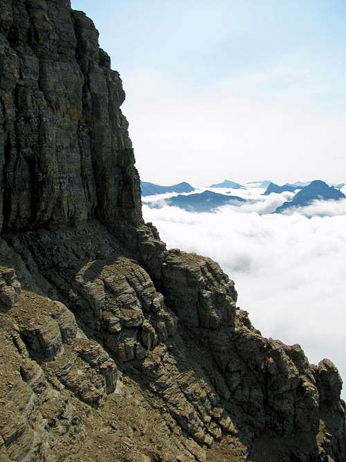
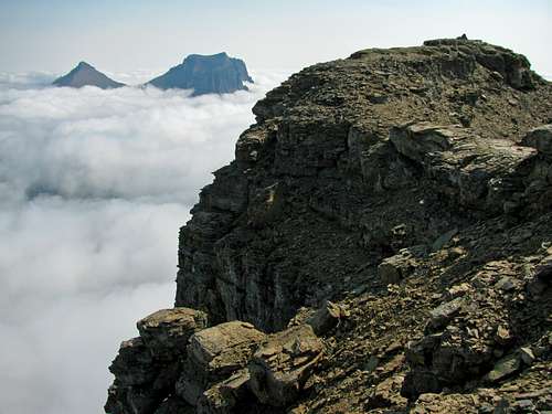
As I came to the bottom of some sheer cliffs below the summit, I turned around to admire all of the peaks popping up above the clouds in the distance to the east, south, and west. The view was typical of the ones I’d seen growing up skiing in Switzerland, which you don’t seem to get as much with the dry weather in most parts of the U.S. Rockies. The route up the cliffs to the west was steep but well-marked with cairns from here on, so I just followed them without any problems. I passed the part where you have to step around a sheer cliff (the trail is still a couple feet wide, though), and from that point on the scrambling was easier. After getting to the westernmost part of the trail, it turned back around to the east and the grade lessened to the point where I no longer had to use my hands. The exposure of the cliffs dropping off into the clouds was pretty intense, but the trail leading up the ridge to the summit cairn was as wide as a road.
![South side of Reynolds summit]() South side of Reynolds summit
South side of Reynolds summit![North side of Reynolds summit]() North side of Reynolds summit
North side of Reynolds summit
These are some of the other peaks I saw off in the distance from the summit:
![Entry point to Reynolds southwest slope]() Correct entry point to southwest slopes
Correct entry point to southwest slopes![Dragon s Tail]() Dragon's Tail from trail west of Reynolds
Dragon's Tail from trail west of Reynolds
Once on top, I enjoyed the elation that came with obtaining such a spectacular summit, and let out a loud celebratory whoop. With my earlier route-finding problems I didn’t end up leaving the summit until 11:15 (an hour after I left my Dad), but going down was much quicker. As annoying as it is to ascend a really loose scree slope, the enjoyable scree-skiing on the way back down makes up for the trouble. I made it down from the summit to where we should have entered the cliffs leading to the southwest scree slopes in just over 20 minutes, and ended up getting back to my Dad exactly when I guessed I would (hour and a half after I left him).
![Reynolds summit shot]() Trying to look tough on the summit
Trying to look tough on the summit![Bearhat Mountain over Hidden Lake]() Bearhat Mountain over Hidden Lake
Bearhat Mountain over Hidden Lake![Going-to-the-Sun cliffs]() Going-to-the-Sun cliffs
Going-to-the-Sun cliffs![Reynolds mountain over pond]() Reynolds Mountain over pond
Reynolds Mountain over pond
The walk back down was uneventful, besides walking by another goat just a few feet off the trail. We saw two more hikers on our way down, who said they would be climbing the Dragon’s Tail (which in total made only 5 people that we saw on the Reynolds Mountain trail leading away from the main Hidden Lake trail). Once we got back to where the trail meets up with the Hidden Lake Overlook trail, we were greeted by hordes of people. Most of them were fine, but one lady who must have felt the call of the wild decided to start chasing a bighorn sheep that was hesitantly crossing in between two big groups of people on the boardwalk trail. She got enough disapproving yells and looks from everyone else that I didn’t really feel the need to chime in as well. After making it back to the now completely filled parking lot, we munched on our leftover trail mix, cookies, and pop-tarts as we waited for the rest of the family to come.
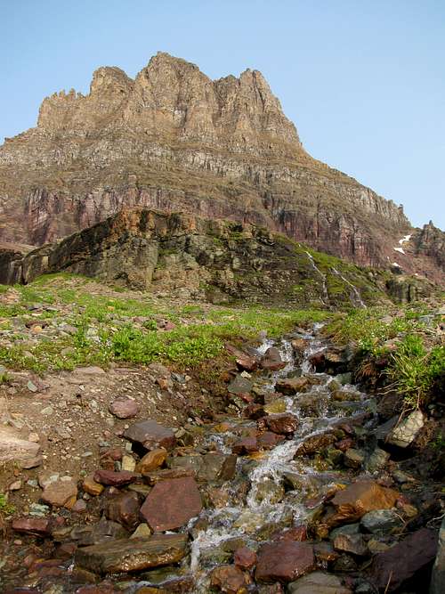
![Cascades below Mt. Clements]() Cascades below Clements Mountain
Cascades below Clements Mountain![Going-to-the-Sun Road below Garden Wall]() Going-to-the-Sun Road below Garden Wall
Going-to-the-Sun Road below Garden Wall![St. Mary Falls]() St. Mary Falls
St. Mary Falls
Liz, Matthew, and my Mom had hiked to St. Mary Falls after checking out of the hotel, so when they arrived we decided to just walk around the gardens west of the Logan Pass Visitor Center for a little bit. Matthew especially liked seeing the all of the pikas running to and fro, as well as the bighorn sheep off in the distance. After that we continued driving west towards Lake McDonald. On the way we were treated to some great views of the Garden Wall, Heaven’s Peak, and the row of peaks extending west from Mount Oberlin. Eventually we made it to the western entrance of the park (got a T-shirt with a picture of two hikers in front of Mt. Reynolds at the gift shop), dinner at the A&W just past the town of Hungry Horse, and our hotel in Hungry Horse, and I felt a bit sad knowing that our short time there was already over. I’d finally had my first taste of Glacier National Park, and it was everything I hoped it would be. In my opinion it is the nation’s most spectacular park, so I know we’ll be coming back in the future.
Here are some more shots taken on the Going-to-the-Sun Road on the way from Logan Pass to Lake McDonald:
![Mt. Gould cliffs]() Garden Wall Garden Wall | ![Mt. Oberlin]() Mt. Oberlin Mt. Oberlin | ![Heavens Peak]() Heavens Peak Heavens Peak | ![Mt. Cannon western cliffs]() Mt. Cannon cliffs Mt. Cannon cliffs |
|---|
![Mt. Oberlin and falls]() Mount Oberlin and falls
Mount Oberlin and falls![Mt. Cannon cliffs]() Mount Cannon
Mount CannonReynolds Mountain Stats
DISTANCE:
6 miles roundtrip
HIDDEN LAKE TRAILHEAD:
6,646 feet
SUMMIT ELEVATION:
9,125 feet
ELEVATION GAIN:
2,500 feet
DIFFICULTY:
CLASS 3
TIME:
5.5 hoursDay 4 – Yellowstone National Park
![Madison River]() Madison River
Madison River![Fountain Paint Pot sulphur pits]() Fountain Paint Pot sulphur pits
Fountain Paint Pot sulphur pits
The next morning we left early for another long day of driving. We were originally going to just go south on I-15 and take the faster route to Jackson, but instead decided to drive down through Yellowstone instead. The roads that took us to the western entrance to the park took a little longer than we anticipated though, so we didn’t even get into the park until about 5 pm. Before the entrance we passed a lake that was created by a reservoir breaking, and there were still several dead trees sticking out of the water where the land used to be dry. We didn’t have much time, so we tried to figure out which of the few sites we should see. Instead of backtracking on the loop that would have taken us up to Grand Canyon Falls, we just went along the road between the west and south entrances of the park, since the construction delays past the Madison junction would have likely caused us to get to Jackson after midnight.
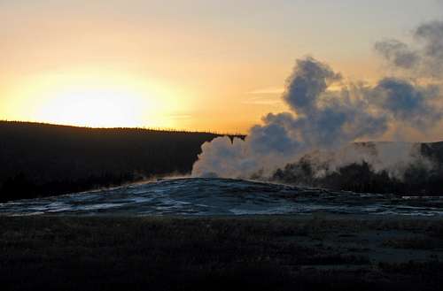
![Fountain Paint Pot geyser]() Fountain Paint Pot geyser
Fountain Paint Pot geyser![Grand Prismatic Spring]() Grand Prismatic Spring
Grand Prismatic Spring![Grand Prismatic Spring runoff]() Grand Prismatic Spring runoff
Grand Prismatic Spring runoff![Grand Prismatic Spring delta]() Grand Prismatic Spring delta
Grand Prismatic Spring delta
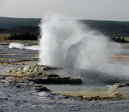
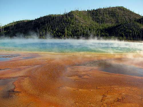
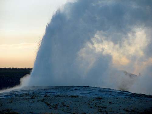
We first stopped at the Fountain Paint Pot, which contained several bubbling sulfur pits, in addition to an impressive geyser. After that we drove around the Great Fountain Geyser (didn’t stick around long enough to see it erupt), and stopped at Middle Geyser Basin. The steam rising from the Grand Prismatic Spring felt quite warm when it blew across our path on the boardwalk, and the blue water contrasted nicely with the bright orange rock. We weren’t sure when Old Faithful would go off, but figured that we should go there next. After sticking around for over an hour after arriving at the giant, crowded parking lot outside the shops and hotels near Old Faithful, it finally went off, but it wasn’t as spectacular as I thought it would be (even though it’s much smaller, I liked the geyser at Fountain Paint Pot more). It was still a long 2-hour drive in the dark to Jackson, and we didn’t get there until about 11 pm. We ended up having to find a new hotel at the last second (internet booking site lost our reservation), so after packing for our big hike the next day we finally got some shut-eye at around midnight.
![Old Faithful erupting]() Old Faithful erupting
Old Faithful erupting![Sunset at Old Faithful]() Sunset at Old Faithful
Sunset at Old FaithfulDay 5 – Middle Teton
It felt like I had barely closed my eyes when the alarm went off at 5:20, but I was determined on an early start since I estimated it would take us about 12 hours to do Middle Teton. My parents were kind enough to drive us to the trailhead, which despite not looking that far away on the park map took almost half an hour. On the way to the Lupine Meadows Trailhead, we could now see how abruptly the Tetons rose from the valley below, which made me both excited and nervous at the same time. As we pulled into the parking lot, it was just light enough that we didn’t need flashlights. It was probably best to wait until this time anyways, since there would be less chance of stumbling upon a bear as it got lighter. I took the magnet off the bear bell on my pack, made sure the bear spray was easily accessible within the holster on my hip, and we were off.
![Me and Johnny]() Me and Johnny
Me and Johnny
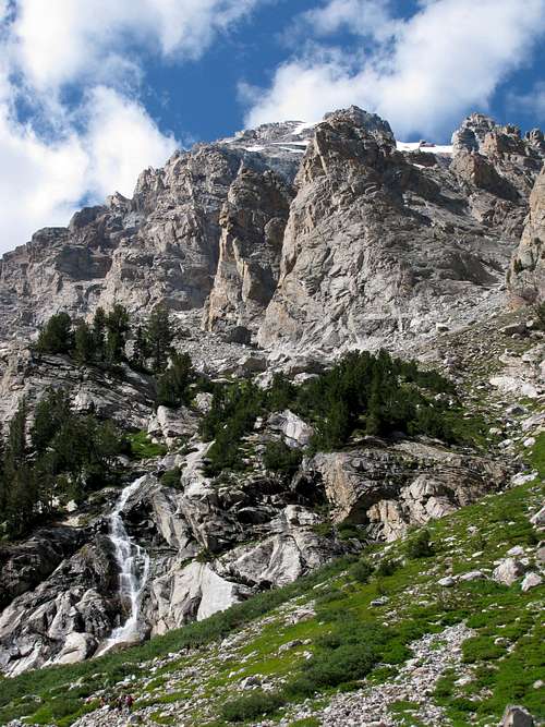
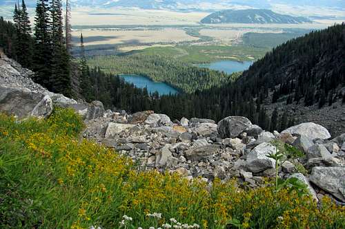
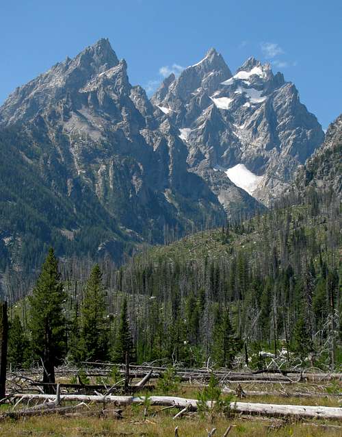
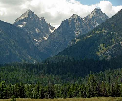
Johnny and I jingled our way up the trail, which was pretty mild and flat for the most part. There were only a few large switchbacks, and the first 2,000 feet and 3 miles or so went quite quickly. There were a couple places where the trail split (we had to take a right at the first branch, and then a left), but in both places there were trail signs showing us the way to go. The views of the flat valley below were nice, with Bradley Lake and Taggart Lake visible once we got higher. As the trees became sparser, we soon found our path heading west into Garnet Canyon, with the Middle Teton standing watch over us in the distance.
![Garnet Canyon stream crossing]() Garnet Canyon stream crossing
Garnet Canyon stream crossing![Stream below Middle Teton]() Stream below Middle Teton
Stream below Middle Teton
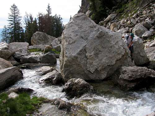
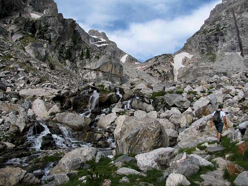
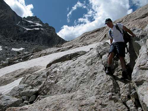
As the canyon walls narrowed, the dirt trail gave way to one with more rocks, and eventually we came to a spot where the trail meandered through a series of small waterfalls from the stream flowing down from the north fork of Garnet Canyon higher up. We lost sight of the trail a few times in this section, but there were enough giant boulders sticking out of the water that we were able to hop our way across. The views of the surrounding spires were quite impressive (Nez Perce to the south & slopes of Disappointment Peak to the north), and from the sheer cliffs everywhere it was easy to see why most of the peaks in the Tetons were classified as technical.
![Wildflowers below Middle Teton]() Wildflowers below Middle Teton
Wildflowers below Middle Teton![South Fork of Garnet Canyon]() South fork of Garnet Canyon
South fork of Garnet Canyon![Disappointment Peak]() Disappointment Peak
Disappointment Peak
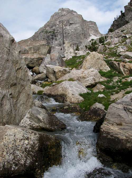
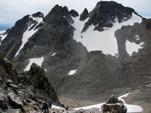
Walking through the meadows we saw several tents, and it appeared that most of the people up here had camped overnight instead of opting for a day-hike. We continued on the trail past several cairns, and at this point we entered what would seem like a never-ending boulder field. It had taken us just under 3 hours to get to this point, and even though we had completed about 2/3 of the total one way mileage to the top, the remaining 1/3 would take 4 more hours. I tried to pick lines that would keep us in the middle of the south fork leading to the saddle between South Teton and Middle Teton, but sometimes we’d need to change our course due to steep little snowfields and runoff water that made the terrain more slippery.
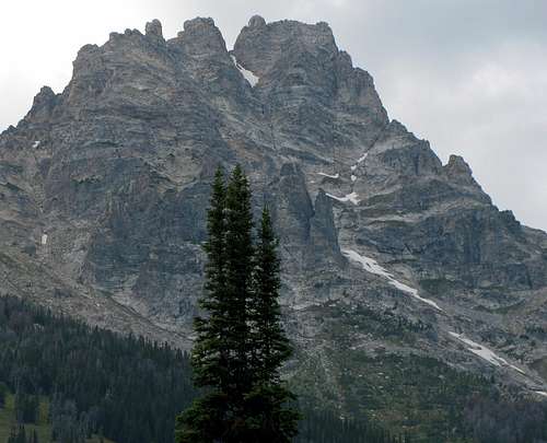
![Middle Teton standard route]() Middle Teton standard route
Middle Teton standard route![Middle Teton cliffs]() Middle Teton cliffs
Middle Teton cliffs![Steep snow slope]() Steep snowfield we went around
Steep snowfield we went around
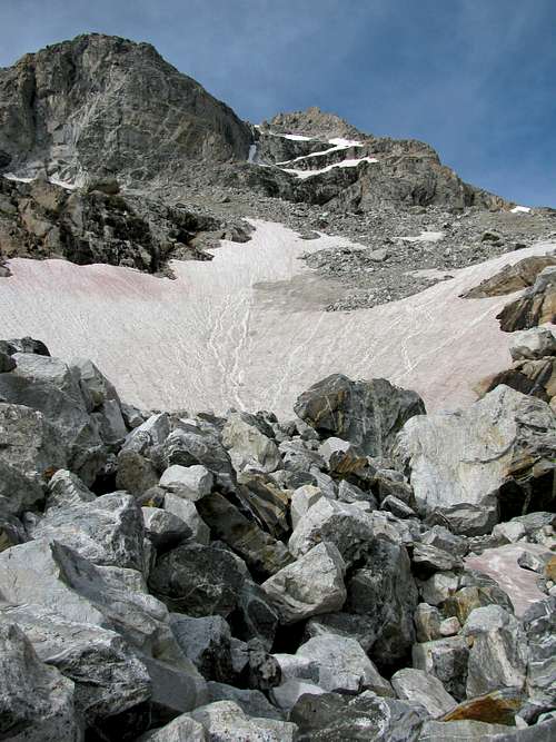
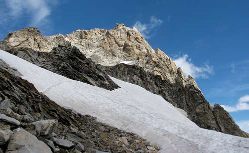
Up until this point it had been mostly overcast with pleasant temperatures, but about halfway up the south fork of Garnet Canyon, some bone-chilling winds came whipping down from the saddle above us. Johnny had brought a jacket, and even though I’ve always been warm enough on big mountain hikes wearing a T-shirt, this was probably the first time I regretted not bringing a jacket for myself. Johnny’s legs started cramping up due to the cold, and despite not feeling tired at all, my legs also felt like the cold was on the verge of causing them to cramp up. We continued up the long boulder fields, past a couple larger snowfields (one which contained some peculiar red watermelon snow), until we were forced to make a route decision.
![South Teton from southwest couloir]() South Teton from southwest couloir
South Teton from southwest couloir![Icefloe Lake from southwest couloir]() Icefloe Lake from southwest couloir
Icefloe Lake from southwest couloir![Buck Mountain from Middle Teton]() Buck Mountain
Buck Mountain![Teewinot from Middle Teton]() Teewinot
Teewinot![Icefloe Lake]() Icefloe Lake
Icefloe Lake
I had printed off two route descriptions of the Southwest Couloir route on Middle Teton (one from a Teton Rock Climbs CD I got for Christmas, and the other from SP), and since the one that advocated getting to the couloir by turning northwest before getting to the saddle seemed shorter, I decided to try that one. It was a mistake. There was a lot more snow than I had expected to see at this elevation at this time of year (I probably underestimated this since all my previous big hikes had been significantly farther south), and this made the route a lot harder. It recommended going straight up the edge of a snowfield to get to the couloir, but with no visible tracks leading up that way and the grade exceeding 50 degrees in some places, I picked a line for us that would keep us on the steep rock slopes just above the snow slope, below the sheer cliffs on the south side of the mountain. Just to get through the snow to that point, we had to climb through a narrow stretch of boulders in the middle of the snow. At this point Johnny began to slow considerably. I wondered if he would have had an easier time taking the longer but less steep approach to the saddle, but even on the more gradual parts he was tired. I gave him a couple Tylenol, but with altitude sickness setting in he was in no condition to keep going. It had taken us over 3 hours to get from the meadow to the base of the couloir, and at Johnny’s rate it would have probably taken another 2 hours to get to the summit. He said he was fine with filling up on water and snacks while waiting for me (he had brought 6 liters of water, and the extra weight might have been a factor in him being tired), so I continued on by myself. I felt bad that he wouldn’t make it to the top, but he still had seen some great views on the hike, and camped out between some boulders to escape from the cold wind in a spot where he could look down on Icefloe Lake and Idaho to the west.
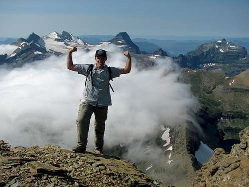
![Middle Teton summit pic]() Obligatory summit shot
Obligatory summit shot![View east from Middle Teton]() View east from summit
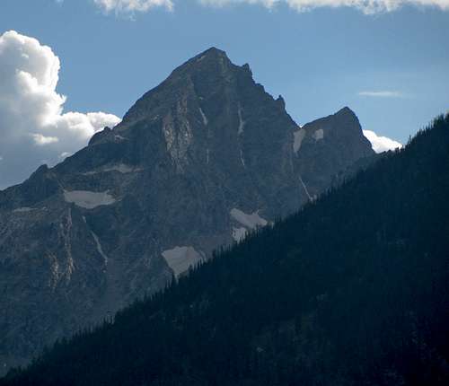
View east from summit![Grand Teton over Middle Teton cliffs]() Grand Teton
Grand Teton![View south from Middle Teton]() View south from summit
View south from summit
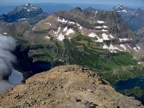
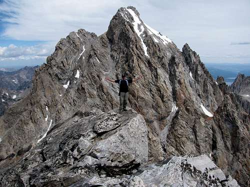
A couple groups that had passed us earlier were now going back down, and they said I was about 600 feet from the top. I didn’t have to ask them about the view, since I had scoured trip reports on the internet about this climb, and knew that the view of the Grand from the summit was one of the best around. The climb up the middle of the couloir itself wasn’t that steep, but the loose rocks made me opt for some of the steeper, more solid rock off to the sides a few times on the way up. I felt out of breath and got that burning tired feeling in my legs every few dozen feet or so, but never rested for more than a few seconds. I’d forgotton to remove the bear spray canister from the holster on my hip, so it got a bit banged up during sections of the climb where I had to slide up next to some big rocks, but not too badly. It took me about half an hour after leaving Johnny to get to the top, and I was blown away by the view that suddenly greeted me after climbing over one of the boulders below the summit. There was the Grand Teton in all its glory, with Cascade Canyon visible down to the northwest, and Teewinot off to the east. To the south was the South Teton, in addition to Buck Mountain behind that. It was cool knowing that there were only two higher peaks in the entire range (Grand Teton and Mount Owen), and despite not even cracking 13,000 feet, this peak felt just as high and rewarding as any of the 14ers I’d climbed in Colorado. I was finally able to get a picture of myself with the Grand behind (took some creative arranging of the camera resting on my pack and mini-tripod to get a decent shot, without anything slipping down the steep summit block it was resting upon), at which point I decided to go back down. It had taken 7 hours to get to the top, which meant we’d need to get back to the trailhead in less than 5 hours in order to make it down in time for when I told Liz and my parents that we’d be done.
![Middle Teton from Middle/South saddle]() Middle Teton from Middle/South saddle
Middle Teton from Middle/South saddle![Johnny down-climbing]() Johnny down-climbing
Johnny down-climbing![West face of South Teton]() South Teton west face
South Teton west face![West face of Middle Teton]() Middle Teton west face
Middle Teton west face
I got down close to the area where I remembered leaving Johnny, but he was nowhere to be found. I shouted his name a few times, but heard no reply. Hopefully he hadn’t started going down by himself, but since I’d told him to wait exactly where he was until I got back, I knew that likely wasn’t the case. Eventually I heard him shouting back to me faintly, but I had no idea which direction the sound was coming from. The wind, which had graciously stopped during my time on the summit, had now returned, and in combination with the echoes coming off the cliffs around me made it impossible to tell where the sound was coming from (on the way down, another climber going up yelled “hi” to me, and it took me a few seconds looking around to actually see him). I looked down towards the path leading to the saddle and saw no movement, so decided to look back at the way I’d come down to see if I’d accidentally passed him. Johnny finally stuck his head out from behind a boulder a couple hundred feet higher up the mountain, and after seeing me waving my arms he started coming down. I thought I had taken the same way down, but with him resting in between the boulders I had somehow missed him. With no harm done, we made our way down the easier path leading to the saddle.
![Middle Teton over Garnet Canyon south fork]() Middle Teton over Garnet Canyon south fork
Middle Teton over Garnet Canyon south fork![Grand Teton over Garnet Canyon north fork]() Grand Teton over Garnet Canyon north fork
Grand Teton over Garnet Canyon north fork![Garnet Canyon wildflowers]() Garnet Canyon wildflowers
Garnet Canyon wildflowers![Garnet Canyon meadow]() Garnet Canyon meadow
Garnet Canyon meadow
With the relatively steep snowfields and miles of boulders to traverse, I told Johnny to be careful, since injuries almost always occur on the way down when hikers are tired and get careless with their feet placement. Johnny did fine and never had any problems at all though, despite the attention to detail it takes to make it through such terrain for an extended period of time. Going down was much easier, and we found several cairns that had somehow eluded us on our way up. We made it to the meadows again after just a couple hours, and from there it was all downhill easy trail hiking. Johnny had guzzled his 6 liters of water already, but with the cool weather I had only drunk a couple of my 4 liters, so we shared the rest after that. We passed some unopened beer cans in the stream farther down Garnet Canyon (blocked off by some rocks to prevent them from floating away), which made us wish we’d brought some soda to keep cool for our return trip down as well.
![Disappointment Peak spires]() Disappointment Peak spires
Disappointment Peak spires![Bradley Lake & Taggart Lake]() Bradley Lake & Taggart Lake
Bradley Lake & Taggart Lake![Nez Perce]() Nez Perce
Nez Perce
Getting back to the trailhead only took 2 more hours after that, and we made it back about half an hour before I thought we would, just like on the Reynolds Mountain hike. We passed several hikers on their way up who probably thought I was silly since I was the only person there with a bear bell, but I thought it was still a good idea to wear it just in case there was a bear nearby and we hadn’t been talking or making any noise for a while. One hiker said he actually saw a bear right off the trail near the bottom, but our noise must have scared it off because we never saw it. After the family picked us up and we were driving away, we were able to show them the mountain we’d climbed from down below, and it felt good having finally summited a Teton peak. It was actually easier than I thought it would be, which may have been due to me having this picture in my head of all the Teton peaks being so difficult that only extreme mountaineers attempted them, which isn’t the case.
![Teewinot from Lupine Meadows trailhead]() Teewinot from Lupine Meadows trailhead
Teewinot from Lupine Meadows trailhead![Buck Mountain north face]() Buck Mountain north face
Buck Mountain north face![Moose Junction moose]() Moose Junction moose
Moose Junction moose![Grand Teton sunset]() Grand Teton sunset
Grand Teton sunset
On the way back to Jackson we spotted a moose off the side of the main road, which was neat because it allowed us to knock another unique animal sighting off our checklist. That night I enjoyed two big cans of meatball spaghettios to celebrate a successful trip. We also got to change hotels to one at Teton Village that had a narrow spiral staircase leading to a loft, which Matthew thought was the coolest thing ever. It was a nice way to end the day, and we still had part of one day left to enjoy some of the more family-friendly spots.
![Tetons from near Moose Junction]() Tetons from near Moose Junction
Tetons from near Moose JunctionMiddle Teton Stats
DISTANCE:
15 miles roundtrip
LUPINE MEADOWS TRAILHEAD:
6,732 feet
SUMMIT ELEVATION:
12,804 feet
ELEVATION GAIN:
6,100 feet
DIFFICULTY:
CLASS 3
TIME:
11 hours
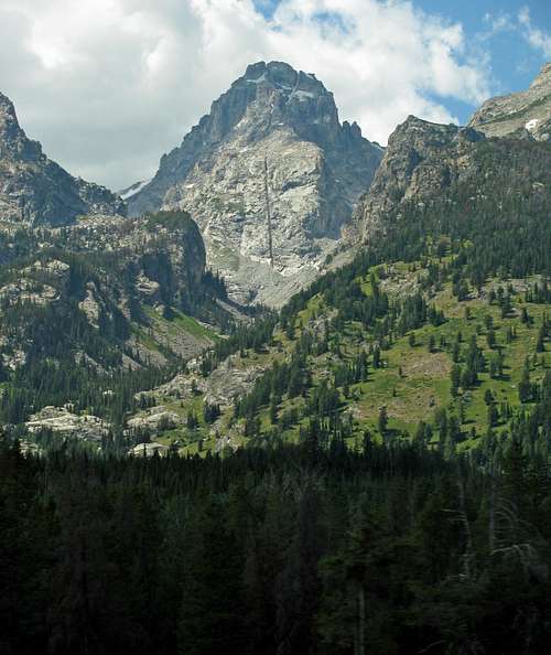
![Middle Teton over Garnet Canyon]() Middle Teton over Garnet Canyon
Middle Teton over Garnet Canyon![Middle Teton & Disappointment Peak]() Middle Teton and Disappointment Peak
Middle Teton and Disappointment PeakDay 6 – Jenny Lake
![Tetons from near Glacier View Turnout]() Tetons from near Glacier View turnout
Tetons from near Glacier View turnout![Snake River lookout]() Snake River lookout
Snake River lookout![Mt. Moran from Oxbow Bend]() Mt. Moran
Mt. Moran
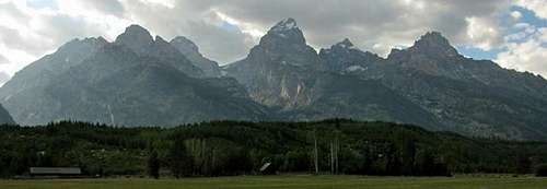
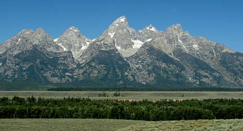
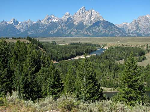
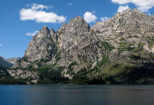
The next morning we slept in (as long as Matthew would let us), and after checking out, drove back north to see some more of the mountains. We stopped off at the Snake River overlook and Oxbow Bend overlook for a couple of the more famous views of the Tetons, and then continued the loop by going back down to the south along the Teton Park Road. As we got closer to Jenny Lake, the Cathedral Group (Teewinot, Grand, & Owen) became more and more prominent.
![Cathedral Group over Jackson Lake]() Cathedral Group over Jackson Lake
Cathedral Group over Jackson Lake![Cathedral Group from Teton Park Road]() Cathedral Group from Teton Park Road
Cathedral Group from Teton Park Road![Mt. Owen over Cascade Canyon]() Mt. Owen over Cascade Canyon
Mt. Owen over Cascade Canyon![Hidden Falls]() Hidden Falls
Hidden Falls
On the shuttle boat ride to the other side of Jenny Lake there was a strong wind blowing from the south, and since we were near the back port side of the boat, the spray that was kicked up drenched us pretty good. Fortunately it was sunny, so on the short hike to Hidden Falls we were able to dry off. The trail was really crowded, and a bunch of impatient people kept trying to pass everyone. Despite not being very long to the falls, the trail was quite a bit rockier than the first parts of the trail leading up to Garnet Canyon, so Matthew had to go a bit slower. Eventually we got to the falls, which were comparable to a couple falls in the Wasatch we’d seen like Bridal Veil Falls and Stewart Falls. I liked the part of the trail that looped back down to the other side of the boat dock the most though, since you could see the stream right off the side of the trail. After eating way too much at Taco Bell in Jackson for lunch, we made the drive back down to Utah.
![Buck Mountain & Mt. Wister]() Buck Mountain and Mount Wister
Buck Mountain and Mount Wister![Peaks west of Jenny Lake]() Peaks west of Jenny Lake
Peaks west of Jenny LakeSummary
This was definitely the best mountain vacation I’ve been on yet, highlighted by two spectacular peak climbs. It’s possible I’ll never get into backpacking or bagging more difficult technical peaks, but that’s fine with me if I can climb mountains like Reynolds Mountain and Middle Teton. Both of them are rewarding day-hikes easy enough for anyone with a little scrambling experience, and are found in some amazing places with enough things to see for the rest of the family as well. Part of the satisfaction in climbing them also came from the fact that I was able to lay out a detailed plan of exactly how and when to climb them and then accomplish that goal.
![]()
Tetons over Jackson Lake
I’m really grateful that my wife lets me drag her along on all of my mountain adventures, since I know several guys who aren’t so fortunate. After our outings the last few summers, our 3-year old son Matthew is now the one who’s always asking when we’re going on our next hike, which is pretty cool. You definitely can’t go wrong with the Glacier or Grand Teton National Parks if you’re looking for some of the best places to experience the outdoors, especially with kids who like mountains and wildlife.


Comments
Post a Comment