
-
 1876 Hits
-
 70.83% Score
-
 1 Votes
|
|
Route |
|---|---|
|
|
45.82990°N / 7.54730°E |
|
|
Easy path |
|
|
Half a day |
|
|
Walk up, ski mountaneering |
|
|
Starting point: m. 1740
Level 803 meters
Walk up: 2,15 hours
Path 105 -8-9
Route Description
Follow the non asphalted road till an old abandoned farm, continue, cross another non asphalted road, close to another old farm; a large path enters in the bush till a place where there are two very old damaged signs. Leave the path number 105, that goes to the Finestra col, and take the path on your right, direction north.
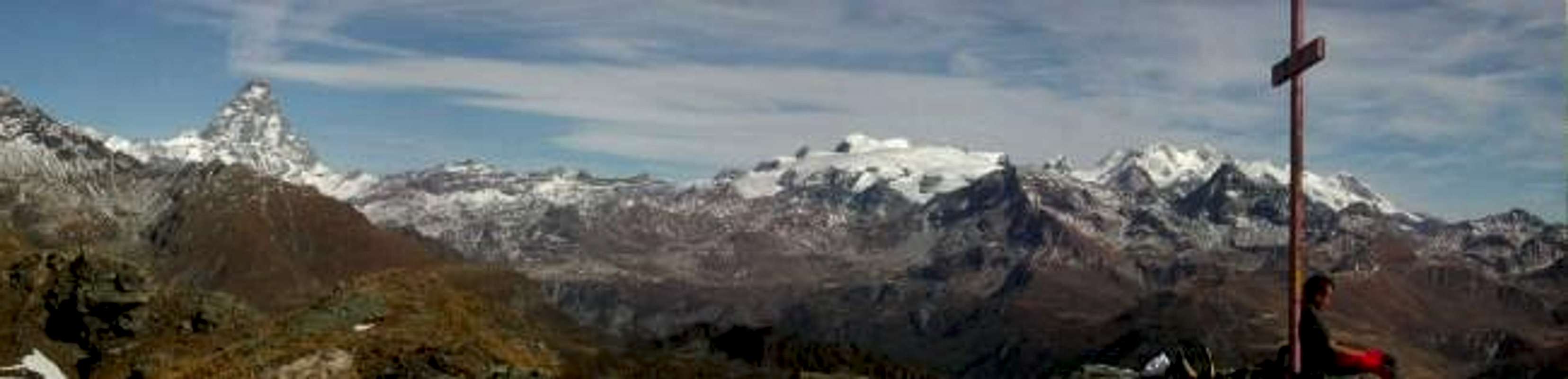
The first part is in a bush of pick pines, a lot at the beginning, less, walking up. Continue after the bush; you will find the last enormous pick pine, colorfull, follow the path sometime steep, till the large ridge that brings to the top. The view is very wide. In the top there is a big cross.
This is not the real top, is the south one, but the way to go to the real one, a few meters higher, is dangerous, you must traverse some small moving stones up a hoverhanging.
The view is the same, and usually nobody risks for nothing better......

Essential Gear
Normal walk up
Miscellaneous Info
If you have information about this route that doesn't pertain to any of the other sections, please add it here.