
-
 1370 Hits
-
 75.81% Score
-
 6 Votes
|
|
Route |
|---|---|
|
|
40.27304°N / 5.29384°W |
|
|
Hiking, Mountaineering, Skiing |
|
|
Most of a day |
|
|
F - PD |
|
|
Approach
For reaching Laguna Grande from Plataforma (1760 m), follow a wide bad paved trail Wwards to Prado de las Pozas (1902 m). Pass this meadow from east to west and cross the creek over a little bridge, ascend to Los Barrerones (2183 m), to the right of a rounded shoulder. When the trail becomes flat don't loose height to the right (attention in winter because of ice and on foggy days) and walk downwards to the north side of Laguna Grande. 2h 10 min.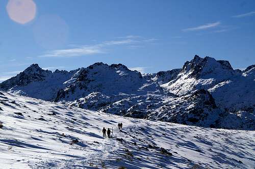
Towards Circo de Gredos and Laguna Grande
Once there the first and best option would be to reach Refugio Elola by surrounding the lake and pass the night there. 2h 30 min. It's also posible to bivouac on Laguna Grande surroundings knowing that is forbiden to pitch tents. Anyway, they use to permit having pitched tents during the night.
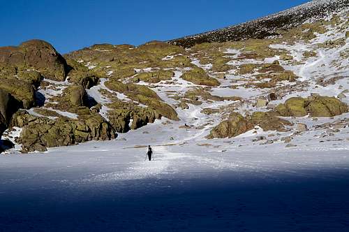
The icy lake crossing
Route Description
The second option would be to cross the lake's end. Just 20 meters high over Laguna Grande take a path signed by little cairns to the right. It's over rock so it isn't well seen. Descend on the trail and cross to the other side of the lake where there are some smooth big rocks. Pass above them to the west and then to the northwest trying to join a well marked ascending trail. This stoned path is known as Trocha Real. It surrounds Risco Negro (2295 m) zigzaging to the north joining Circo de Gredos and Gargantón by a narrow unnamed col (2078 m). Follow descending through some curves first and then almost straight to Majada del Gargantón (2020 m). This is a nice meadow near the creek. Cross it to the other side and start another zigzaging section wich ascends on Cabeza Nevada huge southeast flank. The trail goes NNW wards first and then to the west. Around 2150 m leave Trocha Real turning right (north) towards the broad east ridge of Cabeza Nevada. Once there turn left (west) again on rocks for treading the top (2427 m) wich is on the north end of the broad summit. 5 h 15 min.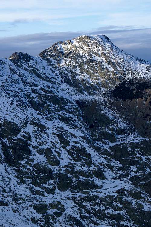
Cabeza Nevada from the summit of Morezón
The descent is on the same route of ascent but at the begining if you don't want to traverse the SE flank on that route, is also posible to reach Portilla del Pluviómetro (2330 m) to the south of Cabeza Nevada. And then descend southeast wards to Trocha Real on rocks too. It's advisable to save one's energies for the descent because there is still an ascent to Los Barrerones. Total time: around 10 hours.
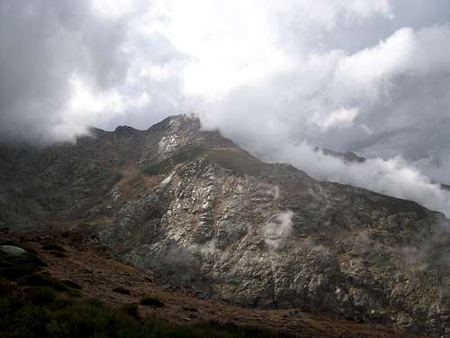
Bye Cabeza Nevada
Gear
In winter and early spring take warm clothes, crampons and ice axe. The weather can change so quick from fall to mid spring so gather information about the weather before attempting. In summer take sunscreen and cap but don't forget a soft or hardshell. Usually there are eveving storms in late August and September. Take always a map and altimeter or a gps device.
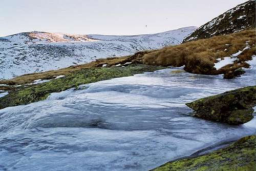
Ice in Los Barrerones NW...