
-
 5615 Hits
-
 79.04% Score
-
 10 Votes
|
|
Route |
|---|---|
|
|
28.01120°N / 15.70263°W |
|
|
Download GPX » View Route on Map |
|
|
Hiking |
|
|
Spring, Summer, Fall, Winter |
|
|
Half a day |
|
|
Walk-Up |
|
|
Overview
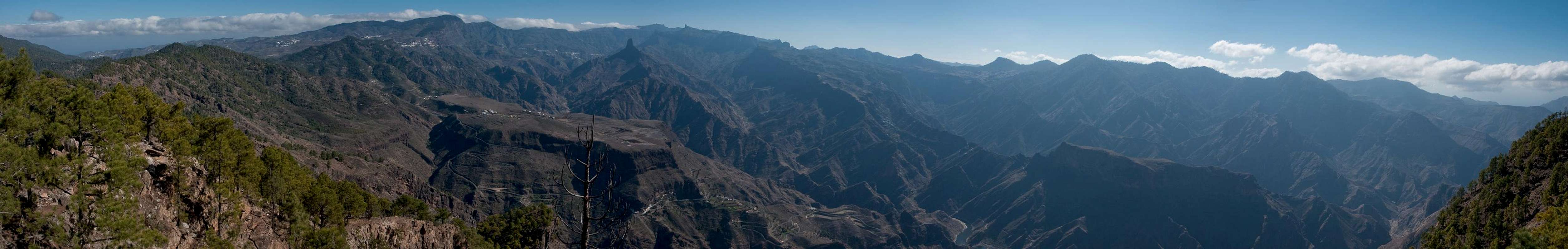
 Acusa Plateau and Altavista
Altavista de Gran Canaria is famous for its far reaching views, mainly towards the neighbouring island of Tenerife with its highpoint Pico del Teide. However, the close-up views into the barrancos , craters and gorges of Gran Canaria are impressive as well.
The normal route to Altavista, which starts at the mountain village Artenara follows alod caminos, which formerly connected the village with the coast. The first of them, up to Altavista, follows a ridge, which at the same time is the boundary of the giant erosion crater, Caldera de Tejada. It stays on the caldera's inside for most of the time and only in a couple of saddles can you glimpse a view of the Tamadaba Massif on the northern outside of the crater. A worthwhile, if somewhat strenuous alternative is a path heading down to the plateau of Acusa and back up to Artenara.
Getting There
 Cloud Cascade above Tejeda
- From the airport take motorway GC1 northward to the exit Telde.
- Turn westward onto GC10 and in Telde take GC 41 in the direction of Vega de San Mateo.
- There turn left on GC15, direction Cruz de Tejeda, where you meet GC60, which you follow to an intersection just shy of Tejeda Village.
- Turn right on GC210 and drive along the caldera walls towards Artenara. There's a parking lot north-west of the central roundabout.
Route Description
  |
- General:
- Start altitude: 1210m
- Summit altitude: 1376m
- Prevailing exposure: S
- Type: Hike
- Protection: None
- Start altitude: 1210m
- Effort: 2 - 800m on the ridge, 1000m if you take the detour on one of the legs
- Power: 1 - Easy
- Psyche: 1 - No problems but take care at the utmost end of the route: soft ground above deep drops.
- Difficulty: 1 - Easy
- Orientation: 1 - Marked and easy
From the roundabout in Artenara take the southern exit, then take the next road to the right, which climbs steeply westwards. The road ends at the local cemetary. Here take the right hand path, which stays on the crest, leaving its summit, Morro de los Cuervos, unclimbed. After a while the path winds down to the Tamadaba Road at Degollada del Sargento.
 |  |  |
Ignore the path leading down to Acusa (possible return path) and stay on the ridge instead. The path mostly stays on the southern side of the ridge, heading through a pine forest. Every now and then great views develop towards Caldera de Tejeda and the surrounding mountains. In one or two saddles the view opens to the north-western coast with the Tamadaba Massiv up front.
 |  |  |
The path now steeply descends into the final saddle where you find an intersection. The left hand route leads to Altavista, the right hand one to La Aldea on the coast (alternative ascent route). Take the left hand path which passes the summit and heads for the plateau at its western end. Head back up to the summit in the east.
 |  |  |
Upon returning there is an option of descending towards tha Acusa Plateau. The path starts in the third saddle from Altavista and heads straight down to the plateau. At 1100m you reach the lowest point where the path splits (straight to Acusa, left to Artenara). Take the Artenara path, which winds along the Altavista eastern slopes. It regains the regular path close to Degollada del Sargento. Turn right and return the way you came to Artenara.