
-
 48619 Hits
-
 94.33% Score
-
 47 Votes
|
|
Mountain/Rock |
|---|---|
|
|
38.00080°N / 107.7617°W |
|
|
Hiking, Mountaineering, Trad Climbing |
|
|
Spring, Summer, Fall |
|
|
13819 ft / 4212 m |
|
|
Overview
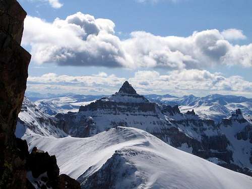
Teakettle Mountain is an often seen, seldom climbed sort of peak. Teakettle is easily seen from the summit of Mount Sneffels and its distinctive summit block lends the mountain its name. Complete with an almost perfectly circular handle to a wonderful little spout (which has been shortened due to rockfall). Teakettle is dwarfed and neglected by the nearby Mount Sneffels, yet the summit of Teakettle is one of the most distinctive in Colorado and should not be missed. Precipices lie on three sides and the summit is much like a table both in size and flatness making it the perfect location for a pleasant tea party!
Unfortunately, Teakettle's incredible summit is flanked by the typical loose volcanic rock which characterizes much of the San Juan Range. The work is tedious to get there, but the payoffs are immeasurable: A view down into stunning Yankee Boy Basin and to the regal queen of the area: Mount Sneffels.
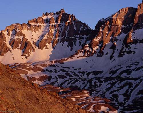 Alpenglow on Teakettle Mountain
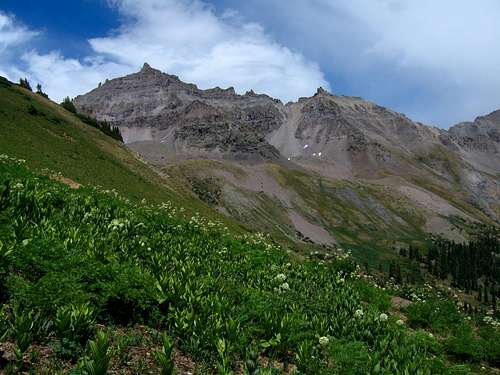 Teakettle from upper Yankee Boy Basin
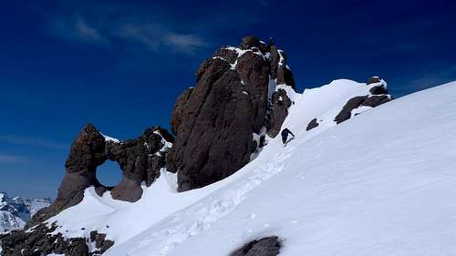
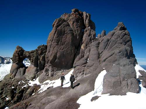 The famous summit block - Note the arch
Getting There
From Denver, drive to Montrose which takes about 5 hours. At the junction with US Highways 50 and 550 in the center of town, continue south for 47 miles on Highway 550 to Ouray.
YANKEE BOY BASIN ACCESS
Continuing south from Ouray on the highway, continue up and around the first major switchback and turn right into County Road 361 with signs for Yankee Boy Basin. Head up this steep but well-graded road for 6.5 miles and stay right at the Camp Bird road junction. Winter maintenance usually ends here. The steep cliffs and shelf section are spectacular yet scary for some people. There is a short stretch of shelf road just past the Camp Bird junction that was carved into the cliffside during the mining days. In the spring a waterfall often cascades over the road here making for a real sight to see and one strange drive! This dramatic stretch is just wide enough for one vehicle. Consider the road's condition and your comfort before proceeding.
It is a good idea to have 4WD beyond the Camp Bird entrance. In my experience driving this road, 2WD cars get held up on a fairly steep and loose section just before the dramatic shelf. All-wheel drive cars or passenger cars with decent clearance can make the road up into Yankee Boy Basin when dry. Pass the Imogene Pass junction and at 10,800 feet, the Governor Basin Road heads off to the left (at a large mine). A high clearance 4WD vehicle is required beyond this point. I was able to get my Toyota Camry this far in 2012. With a 4WD, continue and up to the right at the Governor Basin junction and park at the vault toilet facility 0.8 miles past the Governor Basin junction at 11,300 feet. At this small bathroom there is room for many vehicles and this is probably the most popular parking spot. Although a rougher road continues into the upper Yankee Boy Basin, park here for Teakettle Mountain.
2012 Update: The Yankee Boy basin Road will open May 1st each year from this point forward...regardless of whether it's clear of snow or not. Prior to this date, the road is closed at the gate at 9,100 feet elevation.
See the Southeast Ridge route page for a great description of the standard route up the mountain!
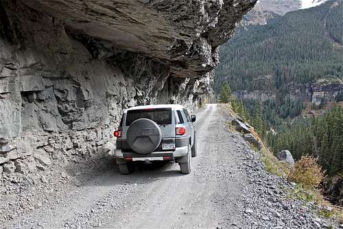 Road to Yankee Boy Basin
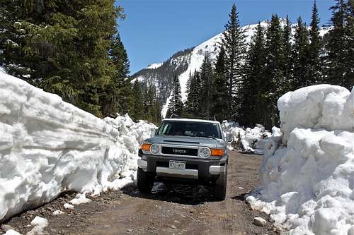 Yankee Boy Road after a heavy snow year
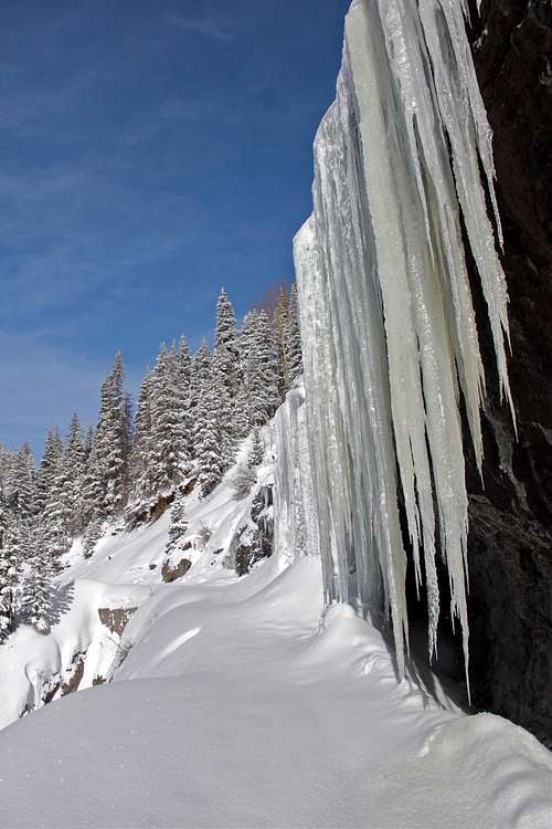 Yankee Boy Basin road in winter!
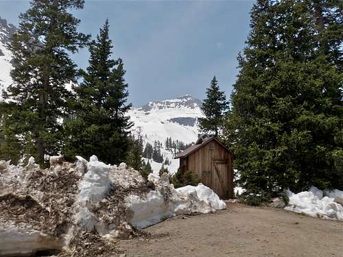 The famous toilet trailhead at 11,300 feet
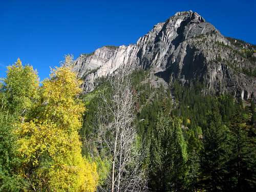 View from the Yankee Boy Road
Red Tape
A fee system for access to Yankee Boy Basin was in place until recently, when it came under fire from various opponents and proved publicly and politically unpopular. Thanks to local communities, this fee system has been lifted.
From a Rocky Mountain News Article:
ATTENTION COLORADO RESIDENTS - Scott McInnis has now withdrawn support of a fee program. Representative Dianna DeGette opposes the fee program. Senator Wayne Allard no longer supports a fee program (according to the paraphrased Rocky Mountain News article above). Senator Ben Nighthorse Campbell opposes a fee program.
Please keep this pristine area open and free for all to enjoy and practice "Leave No Trace" policies. Pack out trash and build campfires only in designated sites. Camping is only allowed in designated campgrounds along the Yankee Boy Basin Road. Respect private property signs and don't be that guy who ruins it for everyone!
When To Climb
June through September is the best time to make the climb, but the snowfall from the year before determines the accessibility. Snow is possible at any time of year, so be prepared. Winter climbs are possible but only recommended for experienced climbers with the required gear.Climbing Periods:
October-May: Expect high snow levels and high wind in places. Snow can fall at any time without warning. You shouldn't attempt a mountain at this time if you are not an experienced climber. Even then, you shouldn't attempt the mountain if you are not familiar with the area. Avalanches occur with high frequency in various places and are the single biggest killer in the Colorado winters. Be sure to know where these places are and avoid them if possible. January through March will be the coldest and windiest time with the avalanche dangers peaking in March.
June: This is a transitional period between spring and summer. Snow levels start to fall quickly in June, but in the Rockies, snow levels can still be quite high in June and often are. One of the best reasons to go in June is because it is before the monsoon season in which there is a regular occurrence of lightning storms and this is also the prime time for spring snow climbing. Snow couloirs and slopes have firmed up and allow for fun climbing. Freezing temperatures however still occur regularly at this time.
July-August: This is the peak of climbing season in Colorado although it occurs at the same time as the monsoons. In a normal year, lightning storms occur regularly at around noon. Do not attempt to climb the peak during a storm. Unfortunately, this time also is the peak fire season and often thick smoke can fog many places in Colorado, obstructing views and making it hard to breathe.
September: This is the other transition period for the mountains where summer transitions into fall/winter. At this time, the aspens change color and the first snows begin to fall. Cold temperatures begin to occur regularly again and by mid-October, snow becomes permanent. This is hands down, the best time to climb a Colorado Peak. The air becomes crisp and clear and the mountains are so colorful. Some of my best and most vivid memories in the mountains come from September in the Colorado Rockies.
This is a frequent avalanche slide area. Check here for an avalanche forecast
 Teakettle Mountain under spring snow
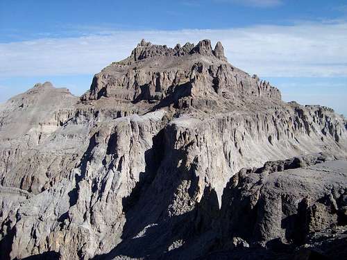 No snow in the middle of summer!
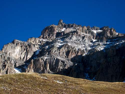 Teakettle Mountain after a fall storm
Camping
Since 2001, camping in Canyon Creek (the road/drainage you drive up to reach Yankee Boy Basin from Ouray) has been in designated sites only. There are 3 camping areas. Listed from lower down the road to the highest, they are Angel Creek, Thistledown, and Atlas. Atlas is near tree-line and only 2 miles or so from the highest Sneffels trailhead. Camping in these sites does cost $10 but isn't worth it in my opinion. These sites do not guarantee anything, don't have water or a table, however, there is a fire ring and porta-potty facility.
For more developed camping for those with families or ones that need all the bells and whistles, go to the USFS Ampitheater Campground. It is close enough to provide good access to Mount Sneffels. This campground has hosts, tables, clean bathrooms, firewood and it's located only a few minutes from Ouray where you can satisfy your hunger before embarking on a climb.
External Links
Teakettle Mountain during a rare winter ascent
Weather Forecast
Current Yankee Boy Basin Trailhead conditions
Summitpost Ouray Ice Park Page
Gerry Roach's Colorado 13ers book is essentially the bible for climbing the high 13ers in Colorado.