Toggle navigation
Mountains
Routes
Images
Trip Reports
Forum
What's New
People
Areas & Ranges
Articles
Trailheads
Canyons
Huts & Campgrounds
Albums
Logistical Centers
Fact Sheets
Lists
Custom Objects
Gear
Plans & Partners
WELCOME TO SUMMITPOST
SIGN IN
REGISTER
Mount Jefferson
Additional Parents
South Ridge
Image
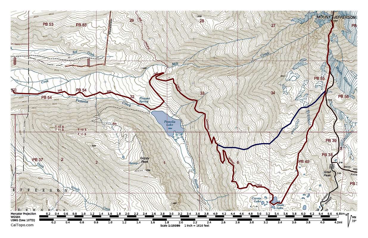
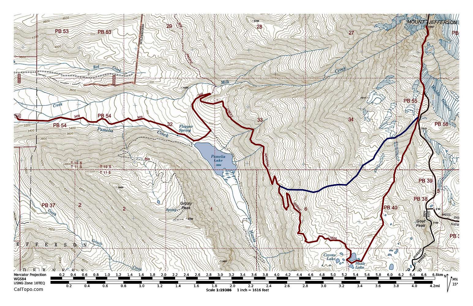
Mount Jefferson Pamelia Lake Routes
View High-Resolution Image
Mount Jefferson Pamelia Lake Routes
Mount Jefferson Pamelia Lake Routes. South Ridge (red, ~23 miles with ~7800' of elevation gain) & Southwest Ridge (blue, ~15 miles with ~7400' of elevation gain). Click to enlarge.
« PREV
NEXT »
Brian Kalet
on
Aug 29, 2014 2:42 pm
Comments & voting
Other parents
Lat/Lon:
44.67410°N / 121.7996°W
Image Type(s):
Topo/Diagram
Image ID:
911357
16692 Hits
70.83
% Score
1
Votes
Log in to vote
Comments
No comments posted yet.
to post!
Don't have an account?
Mount Jefferson
(Mountain/Rock)
« PREV
Viewing
#212 of 228
GALLERY
NEXT »
Brian Kalet's Image Gallery
« PREV
Viewing
#314 of 414
GALLERY
NEXT »
South Ridge
(Route)
Loading....
×
You need to login in order to vote!
User Name
Password
Remember me
Forgot your password?
Log me out when I close my browser.
Keep me logged in all the time.
sign in as a user
Don't have an account?
Register now for FREE
Rating available
Suggested routes for you
People who climb the same things as you
Comments Available
Create Albums
Register Here


