
-
 2676 Hits
-
 72.08% Score
-
 2 Votes
|
|
Route |
|---|---|
|
|
46.73630°N / 12.79150°E |
|
|
Hike |
|
|
Half a day |
|
|
Walk-Up |
|
|
Approach
See the main page as to how you can get to Lesachtal Valley. In the east of St. Lorenzen there is a road which leads north into the Radegunder Bach Valley. It leads to the trailhead at Tuffbad.Route Description
- Start altitude: 1262m
- Summit altitude: 2221m
- Prevailing exposition: N
- Type: 2h 30min over paths
- Protection: marked
Head out north from Tuffbad along the forest road which runs through Wildensender Bach Valley. At an intersection (left to Weittalspitze) take the right trail which soon crosses the creek. Shortly after the creek crossing signs show you the path to Riebenkofel and Soleck (mark No 22). The trail climbs steeply through a dense forest and gets over the timberline at some 1900m.
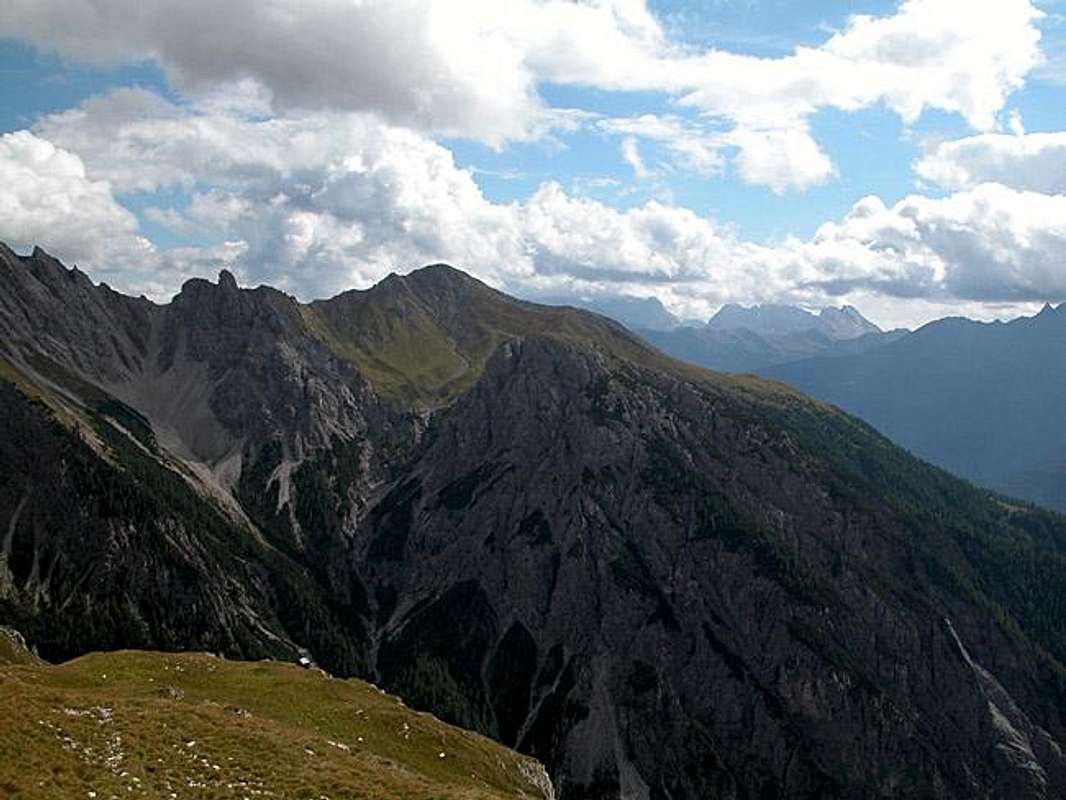
From here on you can see the Riebenkofel summit right in front of you. The trail meanders across a number of beautiful ledges which crisscross between large vertical limestone walls, outcroppings of the Soleck summit. The contrast between blue sky, white limestone and the colourful meadows is just breathtaking. As you leave these walls behind you notice a small pass into which the trail leads.
Here (in principle though I didn't witness it) you get a first breathtaking view into the Wildensenderbach Valley and up to the Lienz Dolomites Main Ridge. The trail to the summit turns off left (right to Riebenkofel) and heads north-west. A few moderately exposed sections and a turn to the north take you to the Soleck summit. The summit itself is a small plateau. If you descent some 15m to the north you will stand directly above the drop of the Soleck north face.
 |  |  |