
|
|
Route |
|---|---|
|
|
45.92041°N / 10.96300°E |
|
|
Hiking, Scrambling |
|
|
Spring, Summer, Fall |
|
|
Half a day |
|
|
EE |
|
|
Overview
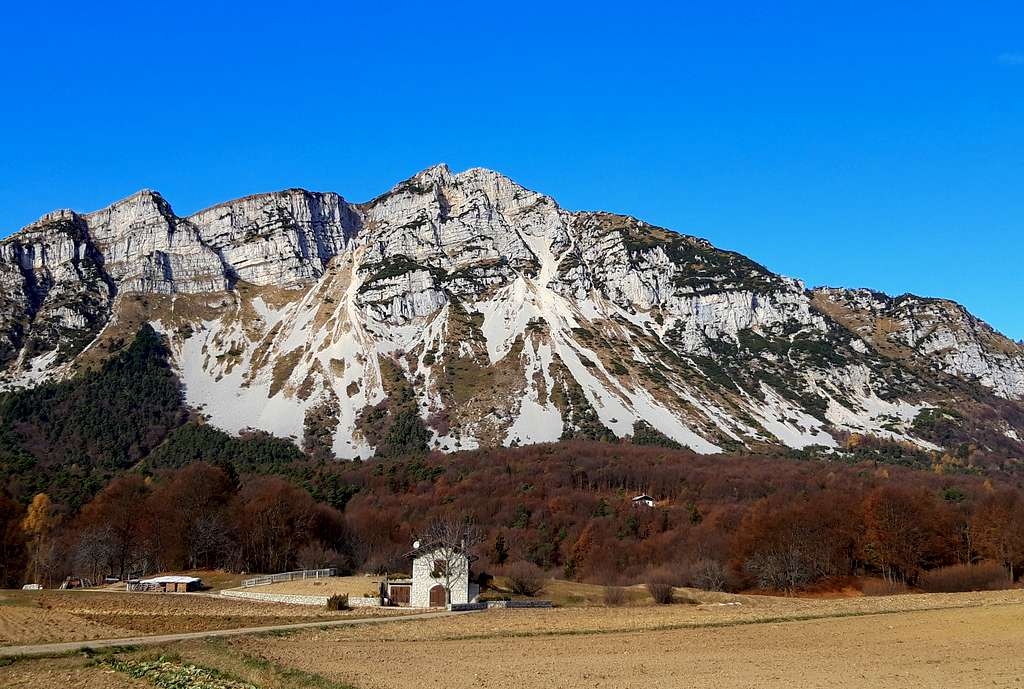
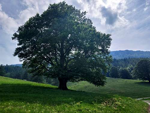
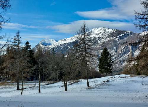
Monte Stivo 2054 m is a fine mountain located in the Trentino Pre-Alps, Bondone-Stivo chain. It is situated to the North-East of the Garda Lake in a dominant position above the town of Arco in Southern Trentino and between the Valle del Sarca to the West and the Vallagarina to the East. Monte Stivo is connected to the North to Monte Bondone by a long ridge, while to the South is facing Monte Altissimo di Nago, the Northern slopes of Monte Baldo and Garda Lake. Monte Stivo is one of the most interesting and panoramic mountains in southern Trentino and the summit is a rather popular destination thanks to the routes that don't present particular difficulties and with not excessive vertical gain. It is only necessary to have a certain resistance to overcome a difference in level of just over 800 meters.
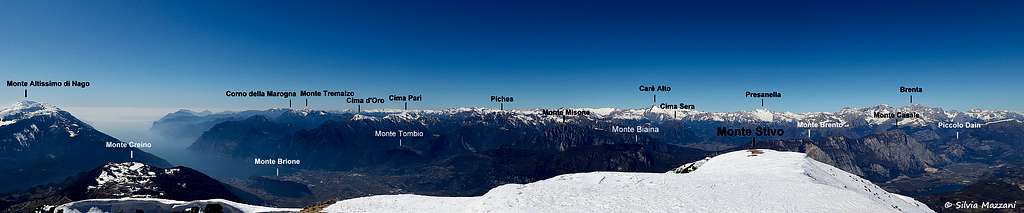
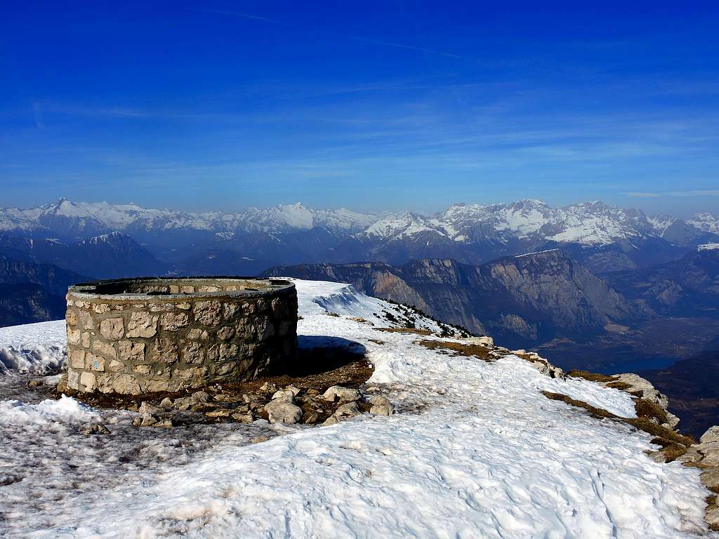
On the summit there is an iron cross and a circular stone construction equipped with a metal wheel bearing the names of all the peaks visible in every direction. About forty meters below the summit on the West side is situated the fine Refuge Prospero Marchetti 2012 m. (about 800 meters). With its geographical position and the altitude of 2059 meters, Monte Stivo is an exceptional panoramic point overlooking the Garda Lake, the Sarca Valley and Vallagarina. From the top the view sweeps over the Pasubio, the Piccole Dolomiti and the Lagorai to the East, the Monte Altissimo and Monte Baldo group to the South, the wild Alpi di Ledro to the SW, the Sarca Valley walls and the Adamello and Presanella groups to the NW, the Brenta Dolomites to the North.
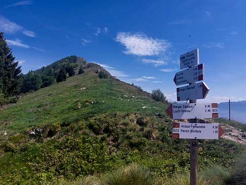
The summit of the Stivo is accessible from several sides (Passo Bordala, Santa Barbara, Malga Campo). It's a fine destination also in wintertime, on skis or by foot. In fact, even after fresh snowfalls there is almost always a good trace that rises from the side of S. Antonio. The proposed route is instead a fine loop starting from Malga Campo di Drena, a beautiful, varied and panoramic loop that reaches the top of the Stivo and develops mainly on the north side.
Getting There
The starting point for the ascent is Malga Campo 1379 m. Malga Campo can be reached starting from Arco di Trento following the signosts to Dro, here at the crossroads take the right direction to Drena. Reached Drena, proceed for about 2 km east of the village along the provincial road to the crossroads in the locality of Casa del Luch, where a narrow asphalted road of about 5 km with numerous hairpin bends climbs north to Malga Campo di Drena 1379 m, where you leave the car.
Route Description
Monte Stivo loop from Malga Campo
Difficulty: EE
Difference in level: 700 m from Malga Campo
A fine and worthwhile itinerary, leading on a panoramic summit
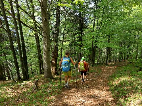
From Malga Campo you briefly reach Malga Campo di Arco, then at the crossroads continue left towards the NE for trail 623 which enters the magnificent beech and larch forest. After a few zig zags that shorten the path by cutting the hairpin bends of the road, the path heads South along a long diagonal in the wood, then go beyond the edge of the vegetation exiting to the large La Bassa Madonnina saddle at 1684 m.
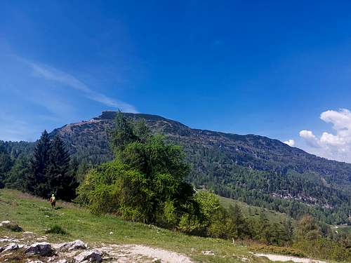
Here you turn sharply to the right on the path 617 which runs along the crest of the Stivo between rocks, pines and rhododentres up to the final steep rocky stretch leading to the summit.
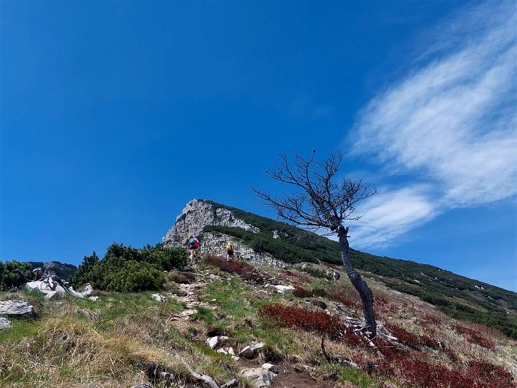
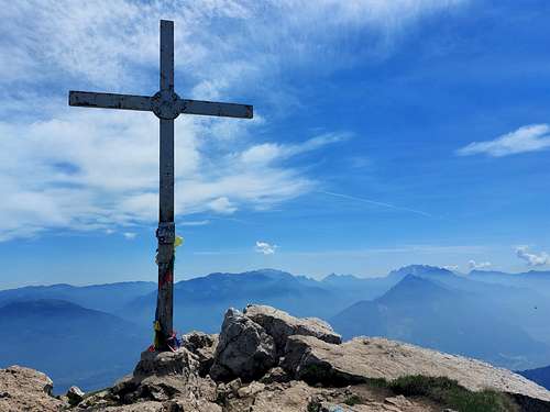
Here the path forks: we proceed to the left with the 617 bis, more interesting and shorter, which climbs steeply up the rocks along the ridge, while the 617 proceeds to the right along the coast towards the Southwest and, having reached the North shoulder, leads to the Rifugio Prospero Marchetti m 2012. Reached the top with the summit cross we can enter the panoramic stone observatory equipped with metal directional arrows, indicating the name and the altitude of the numerous surrounding mountains, means of which it is possible to identify all the most important peaks at 360 degrees with an easy and very interesting recognition.
From the summit head to the NW and in a few minutes you will reach the refuge not visible from the summit. Here you need to be a little careful because the signposts are a bit vague. When you reach the refuge, leave the path to Malga Stivo to the left (n 608), instead go to the right passing alongside the refuge and continue briefly Northwards until you reach a crossroads. On the right the path 617 that we had ignored uphill preferring the more direct 617 bis rejoins the ascent itinerary. It is ignored again in favor of the left path. So we take the path 666 which proceeds NW between pines and rocky ridges reaching the clearing called Mandrie Alte, with spectacular views of the Valle dei Laghi and the Brenta Group. At the signposts on a wooden pole, the path crosses the 666 which on one side turns to the north-east and returns to the north side of the Stivo, while on the other it proceeds to the west. Instead, we descend decisively towards the North taking the 666 bis, in the direction of the visible Malga Vallestré to the north. The path gradually descends into the larch forest until it crosses the road that descends to Malga Campo, near a wooden gate. You go down along a stretch of concrete road, at the next crossroads you go down and after another bend you reach the Malga Campo car park.
Essential Gear
Normal hiking gear.
Red Tape
No fees no permits required
When to climb
Best period goes from May to the end of October
Hut
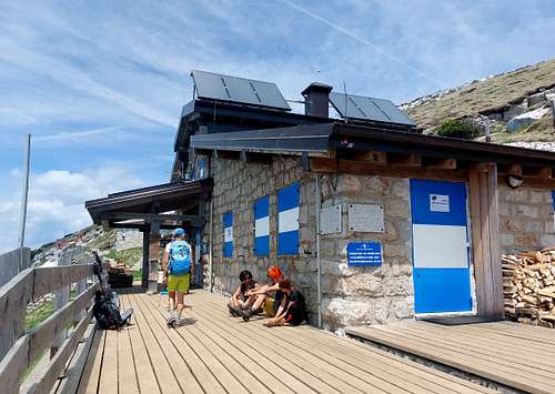
Rifugio Prospero Marchetti allo Stivo, 2012 m
Owner: S.A.T. Arco
Guardian: Alberto Bighellini
Size: 23 persons + 4 in the winter shelter
Open: from June to September and Christmas holidays. In the remaining periods it's open during the weekends
The refuge is dedicated to the founder and first president of the SAT (Società degli Alpinisti Tridentini), was inaugurated in 1906 and then repeatedly extended and renovated.
Accomodation
Several possibilities of accomodation in Arco, Dro, Drena and surroundings (Sarca Valley)
Bibliography
Kompass 687 - 1.25.000
LagirAlpina sheet 15 - Valle del Sarca - 1:25.000