The 2013 "Unfinished Business Tour"
Ruvicha and I set out in August on what we called our 2013 Sierra “Unfinished Business Tour.” The genesis of the name lies in the fact that, when hiking in 2012 with friends Brian and Jim, we had to abort attempts on Matterhorn Peak, Mt Morgan, Mt Tom and Basin Mountain, either due to deteriorating weather, lack of time or ebbing energy.
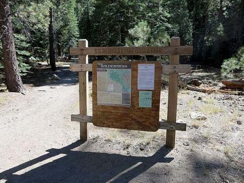
After a warm-up hike of Freel Peak and Jobs Sister overlooking South Lake Tahoe, we arrived at the Paha Campground near Twin Lakes and eyed our first target: Matterhorn Peak via Horse Creek Canyon and the southwest slope. Getting there in the late afternoon, we drove to Mono Village at the west end of Twin Lakes and took some time to make sure we could find the trailhead, which in this case was a bit of a challenge. It was good to scout this in the daylight, which saved some frustration in the dark the next morning when we started our hike.
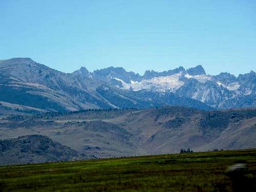
![Matterhorn and Sawtooth Ridge]() Matterhorn and Sawtooth Ridge from Twin Lakes Road
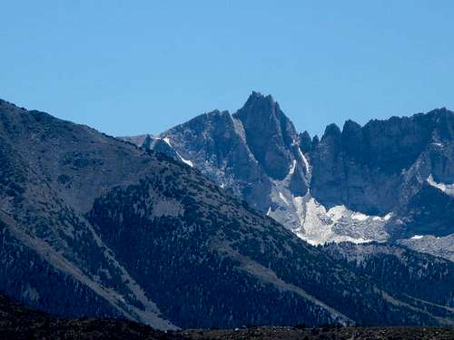
Matterhorn and Sawtooth Ridge from Twin Lakes Road![Matterhorn Peak]() Matterhorn Close-up from Twin Lakes Road
Matterhorn Close-up from Twin Lakes RoadFinding Horse Creek Canyon Trail
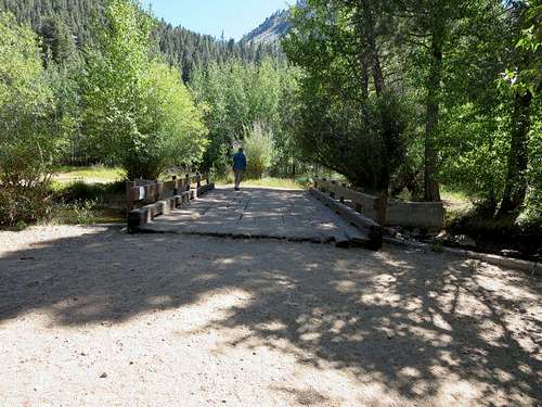
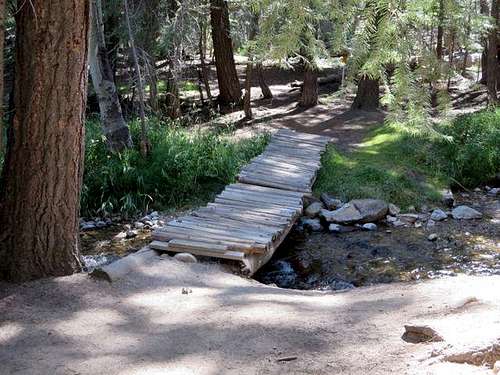
To get to the trailhead, pass the Mono Village campground kiosk on the lefthand side and angle slightly to the left down a dirt road lined by RVs and trailers. At the end of the road, Horse Creek can be heard. Proceed down to the creek, locate and cross the bridge. On the south side of the creek, take the second right trail (the first swings back toward the creek). The trail will shortly fork: take the left fork and you will almost immediately see a sign pointing to the left saying “Hiking Trail.” Follow that trail for some distance to a small bridge, cross it, and follow the trail to the left. When you hit the first intersecting trail, turn right up the hill, and that will take you to the trail to Horse Creek Canyon.
![First Bridge to Horse Creek Canyon Trail]() Bridge Across Horse Creek
Bridge Across Horse Creek![Second Footbridge to Horse Creek Canyon Trail]() Second Footbridge to Trail
Second Footbridge to Trail![Start of Horse Creek Canyon Trail]() Horse Creek Canyon Trail
Horse Creek Canyon TrailAscending the Lower Canyon
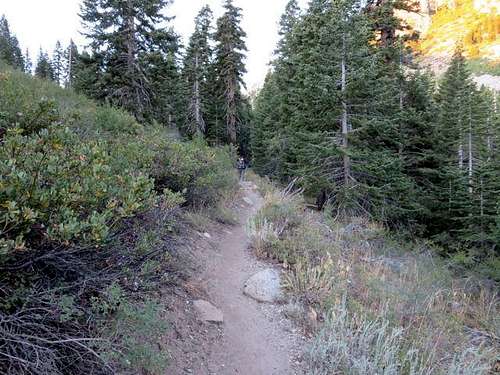
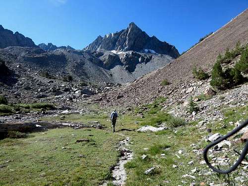
On the morning of our hike, we got started at 6:00 am. We followed the sandy and well-used trail, which quickly began a series of switchbacks that climbed higher and higher through trees above Twin Lakes and Mono Village. Although the trail at one point seemed to climb a considerable distance away from Horse Creek Canyon, it ultimately turned back, bringing us to Horse Creek, which we thereafter saw or heard for a good portion of the hike.
We got our first view of Matterhorn Peak about 1.5 miles from the start (note: all the distances in this report are measured from the car in the parking lot at the Mono Village marina, not the trailhead). As we gained the view of Matterhorn Peak, we passed out of the switchbacks to a trail that climbed along the east side of the canyon above Horse Creek. There is a pretty water cascade around mile 2.
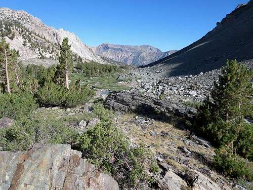
After 2.5 miles, we reached the fork between the Cattle Creek (to the left) and Horse Creek (straight ahead) trails. At this point, we found ourselves walking on more level ground through a forested meadow, the creek not far to the west but flowing more slowly.
![Switchbacks Above Mono VIllage]() Trail Climbs above Mono Village and Twin Lakes
Trail Climbs above Mono Village and Twin Lakes![FIrst View of Matterhorn Peak]() First View of Matterhorn Peak
First View of Matterhorn Peak![Trail above Horse Creek]() Trail Climbs above Horse Creek
Trail Climbs above Horse CreekRockslides and the Headwall
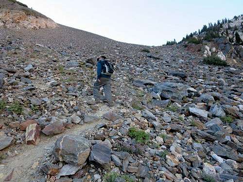
At the end of the meadow at about 2.9 miles, we encountered the first of several rockslides from the eastern side of the canyon. We found good rock cairns to guide us across to pick up the trail on the other side. After the last rockslide, we approached the headwall over the lower canyon. We found a trail climbing the headwall, but it was easy to lose it going up, requiring some modest boulder-hopping. The trail was much easier to follow coming down; never mind if you go off trail here; you’re likely to run into it again before too long.
We aimed to come out on the right (west) side of the headwall. At this point, we could hear the creek underneath us through the rocks.
![Slides and Headwall]() Rockslides and the Headwall
Rockslides and the Headwall![Ascending Headwall]() Ascending the Headwall
Ascending the HeadwallThe Meadow
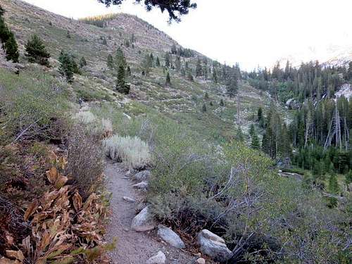
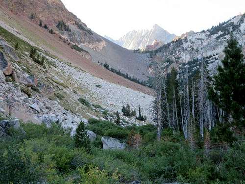
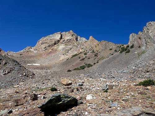
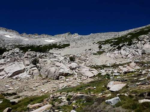
Once above the headwall, we found another meadow, this time with fewer trees, through which Horse Creek meandered, surrounded by high mountains. The trail-finding proved periodically difficult, and we got off trail several times before finding our way back to it.
At 4.4 miles and an altitude of 9500 feet, we found a moraine slope climbing up the right (west) side of the canyon. In 2012, I thought this might offer a short cut to the southwest slope of the Matterhorn and climbed the moraine, hence our name for it: the "Ambret Variation." Those who ascend the moraine slope will be rewarded with the view of a beautiful small tarn, but any further climbing will be technical—Class 4 or 5—and would appear to require considerable time and effort to get to Matterhorn’s summit. The alternative is to descend shaky and flaky Class 3 rock down to regain the main trail (which loops around). We do NOT recommend the "Ambret Variation."
![Meadow above Headwall]() Meadow above the Headwall (looking north toward Twin Lakes)
Meadow above the Headwall (looking north toward Twin Lakes)![Ambret Variation]() "Ambret Variation" -- NOT recommended
"Ambret Variation" -- NOT recommended![Horse Creek Canyon Trail]() The Trail
The Trail Upper Horse Creek Canyon
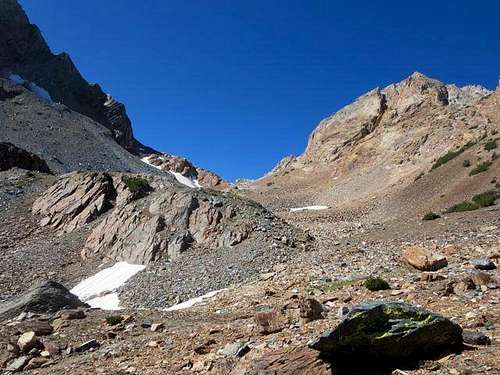
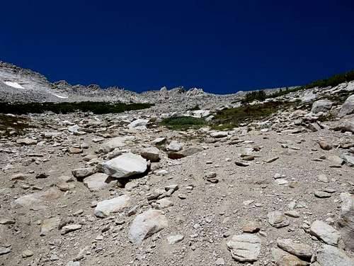
This time we followed the main trail as it began to climb and looped around toward the west and eventually northwest. As before, we found bits of trails, but they were easy to lose, and we spent considerable time going cross-country over boulders and rocks before regaining the trail … for a short time before it again disappeared.
![Ascending Upper Horse Creek Canyon]() Upper Horse Creek Canyon
Upper Horse Creek Canyon ![Getting Close to the Canyon s Top]() Upper Horse Creek Canyon
Upper Horse Creek Canyon ![Ambret Variation Descent]() Where the "Ambret Variation" Descends to Main Trail
Where the "Ambret Variation" Descends to Main Trail![Nearing the Top of Upper Horse Creek Canyon]() Nearing the Top of Upper Horse Creek Canyon
Nearing the Top of Upper Horse Creek CanyonAscending the Southwest Slope to the Summit
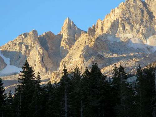
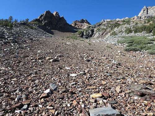
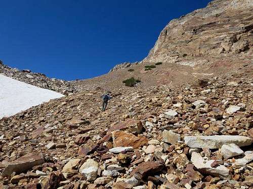
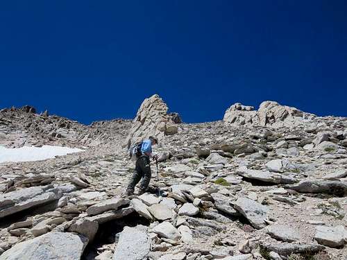
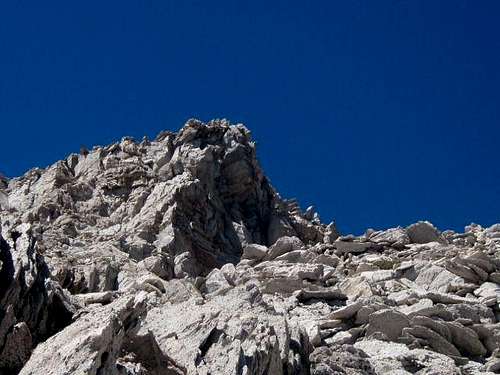
At 5.8 miles and an altitude of 10,900 feet, we passed to the northwest out of Horse Creek Canyon and almost immediately gained our first view of Matterhorn’s southwest slope to our right (north). After a rest break, we began working our way up the steep sandy slope and talus toward the two rock gendarmes that framed the Matterhorn summit. We arrived at the base of the left gendarme at 6.4 miles and an altitude of 11,800 feet. Thereafter, we found a mixture of sand, scree and small boulders to ascend, with no real trail visible.
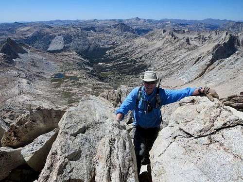
Clearing the gendarmes, we headed up toward the summit bloc and arrived at the top of the east couloir, which was devoid of snow. After taking some pictures, we angled toward the left (northwest), which we understood to be the easier ascent to the top. Although one guidebook had suggested a use trail to the summit, we found nothing looking like that, and climbed the last 200 feet of Class 3 rock, reaching the ridge that runs from the Matterhorn northwest to the other Sawtooth mountains and following that ridge to the right to the summit at 6.7 miles from our starting point (remember, that’s from the car).
![Southwest Slope of Matterhorn Peak]() Southwest Slope of Matterhorn
Southwest Slope of Matterhorn![Southwest Slope of Matterhorn Peak]() Moving up Southwest Slope; Gendarmes Frame Summit
Moving up Southwest Slope; Gendarmes Frame Summit![Southwest Slope of Matterhorn Peak]()
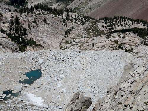
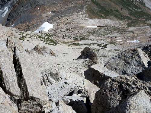
![Horse Creek Canyon]() Horse Creek Canyon from Top of East Couloir
Horse Creek Canyon from Top of East Couloir![View Down East Couloir]() View Down East Couloir
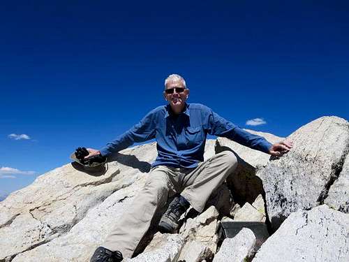
View Down East Couloir![Matterhorn Summit]() Matterhorn Summit (photo credit: Ruvicha)
Matterhorn Summit (photo credit: Ruvicha)![Ruvicha Summits Matterhorn]() Ruvicha Summits Matterhorn
Ruvicha Summits Matterhorn![Atop Matterhorn]() Atop Matterhorn
Atop MatterhornSpectacular Summit Views
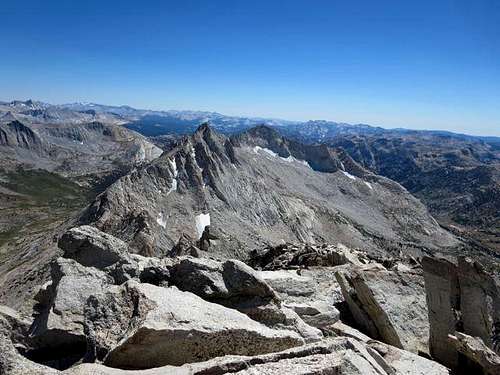
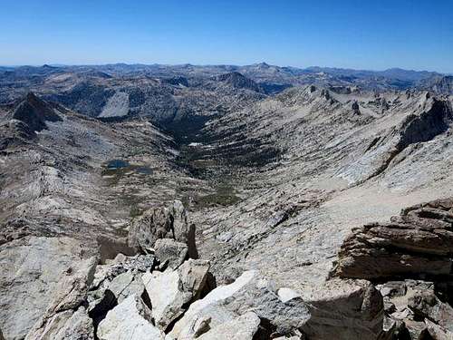
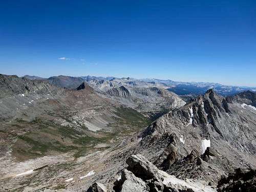
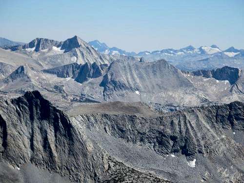
We spent thirty minutes on top, taking in the spectacular views in all directions, including Horse Creek Canyon, the Sawtooths, Slide Canyon, Whorl Mountain and many of the peaks of Yosemite, including Coness and Lyell. We are not big fans of exposure but nevertheless found a way to the top that was very manageable. For those who like exposure, you’ll find several opportunities on the summit to look down 1000 feet.
![Sawtooth Ridge]() Whorl Peak from Matterhorn Summit
Whorl Peak from Matterhorn Summit![Slide Canyon]() Slide Canyon from Matterhorn Summit
Slide Canyon from Matterhorn Summit![Spiller Canyon and Whorl Peak]() Spiller Canyon and Whorl Peak from Matterhorn Summit
Spiller Canyon and Whorl Peak from Matterhorn Summit![Mt Conness and Mt Lyell]() Conness and Lyell from Matterhorn Summit
Conness and Lyell from Matterhorn Summit![Sawtooth Ridge]() Sawtooth Ridge Looking Northwest from Matterhorn Summit
Sawtooth Ridge Looking Northwest from Matterhorn Summit![Matterhorn and Slide Canyons]() Matterhorn and Slide Canyons in Background
Matterhorn and Slide Canyons in BackgroundHeading Down
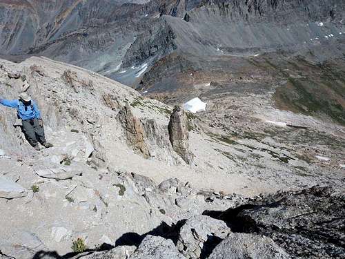
Heading back down, we decided to steer to the right (northwest) of both of the rock gendarmes, as it appeared that there would be faster going on sand and fewer rocks to cross. It proved a faster descent route than passing through the gendarmes would have been. (It might have been a faster ascent route as well.)
Returning to the trailhead was slower going than we would have liked. Rubbery legs, several boulder fields to cross, and missed trails—we made the hike’s motto “why follow a trail when you can go cross-country?”—slowed us considerably.
![Heading Down SW Slope]() Ruvicha Begins Descent
Ruvicha Begins Descent![View Down SW Slope]() View Down Southwest Slope
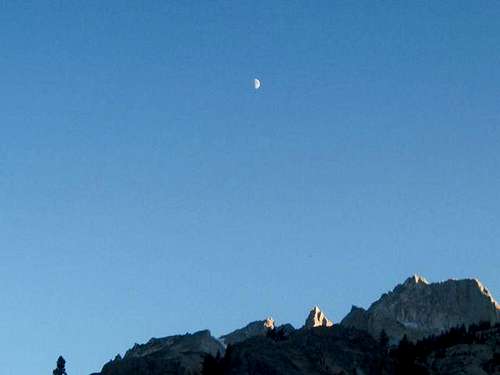
View Down Southwest Slope![Moon over Matterhorn Peak]() Moon over Matterhorn from Horse Creek Canyon (photo credit: Ruvicha)
Moon over Matterhorn from Horse Creek Canyon (photo credit: Ruvicha)A Great Hike
All and all, however, we found it a great, if tiring, day-hike. The views from the summit are terrific, and the combination of high mountains, forested meadows and Horse Creek made it one of the prettiest hikes we have done in the eastern Sierra. While the Matterhorn summit poses an intimidating view from Bridgeport or Twin Lakes, the route via Horse Creek Canyon and the southwest slope is mostly a Class 1/Class 2 walk-up until the last 200 feet, where some climbing is necessary. But the summit views made it all worthwhile.


Comments
Post a Comment