The Himalaya's beside a toothpaste made from some scented herbs meant for me a country existing just is the fairy tales, lost in the haze of the immense distance and I thought it would remain that maybe forever…Recently this mythical province turned into a tangible reality with all of its miracles and wonders. Clicking with fervour our cameras we tried to record as much as possible of these miracles, of course unsuccessful. But never mind! We still can remember the innumerable waterfalls, the endless humming of the river attending us, the booming of the wind at a middle of a suspension bridge, the billions of stars above us, the chilly breath of the mornings or the whistling of the mule drovers.
It was tough, but it was worth to do it, surely every of us got shorter with thousands of calories, but we returned home with hundreds of experiences we had not lived before.
Kathmandu
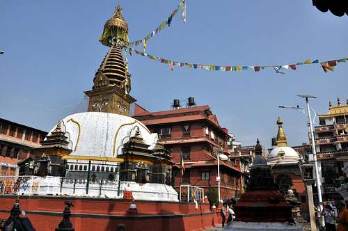
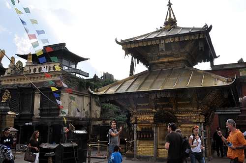
First day we spent with purchasing the permissions for the Conservation Area, shopping some missing items, as sleeping bags, gas tank for the camping stowe, and visiting some famous places in the town, as Pashupatinath or Swayambhunath (Monkey temple).
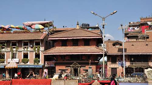
Shree:Gha (Sheegal) - Thamel district
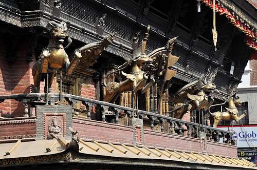
Ornamental facade in Thamel district
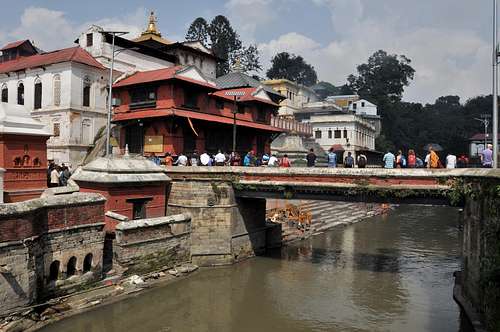
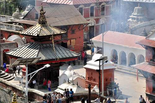
One of the most sacred Hindu temples of Nepal - Pashupatinath Temple is located on both banks of Bagmati River on the eastern outskirts of Kathmandu. Pashupatinath is the most important temple dedicated to god Shiva. Every year this temple attracts hundreds of elderly followers of Hinduism. They arrive here to find shelter for the last several weeks of their lives, to meet death, be cremated on the banks of the river and travel their last journey with the waters of the sacred river Bagmati, which later meets the holy river Ganges. Hinduists from every corner of Nepal and India are arriving here to die.
It is believed that those who die in Pashupatinath Temple are reborn as a human, regardless of any misconduct that could worsen their karma. The exact day of their death is predicted by astrologers of the temple. If you are attracted to the places where the spirit of death can be felt, then consider Pashupatinat has your first destination. It is a temple with special atmosphere of death; death is present in almost every ritual and every corner of it.
Pashupatinath
Pashupatinath
Pashupatinath
Pashupatinath
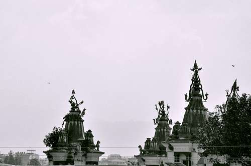
Swayambhunath
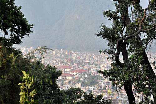
The city from Swayambhunath
The tour
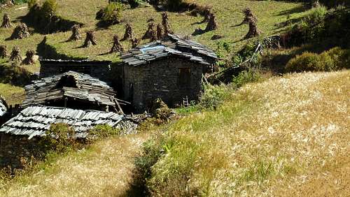
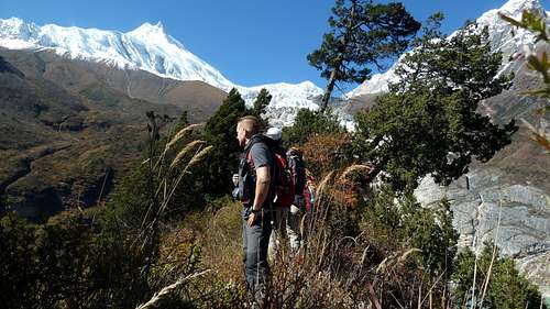
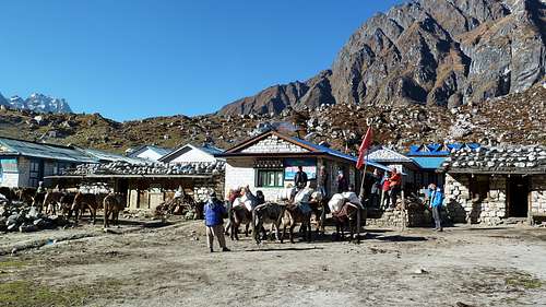
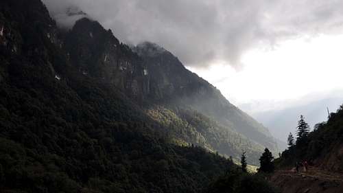
We had to wake up very early in the morning to avoid the rush hour. There was a long journey in front of us. Driving on asphalt we proceeded quite well, but after we turned on a dirty road, at the first serious pot-hole we had to realize that our van was too weak for that terrain, so continued our tour on foot. After about an hour of walking we could get on a local bus, almost full with passengers and some boxes with hundreds of one-day chickens. With a second change to another bus just before dusk we reached our first destination in Soti Khola. There we slept for the first time in a so called tea-house. The trail started here, following all the time the river Budhi Gandaki, with a daily elevation of 5-600 meters, just perfect for acclimatization.
On way to Aarughat
Soti Khola
Soti Khola to Machha Khola
The friendly and devout
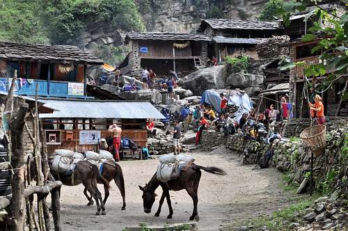
Machha Khola to Jagat
Break at the primary school
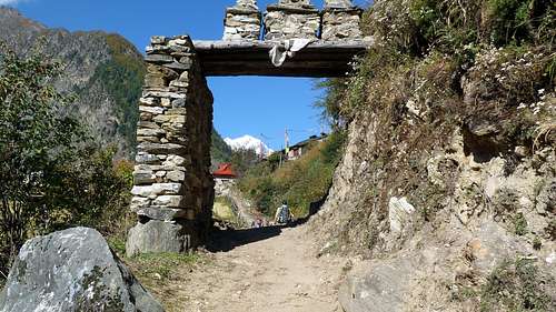
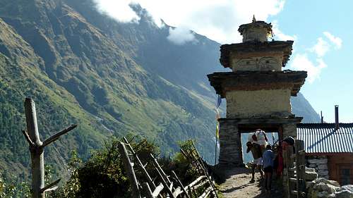
At Jagat we reached the border of the Manaslu Conservation Area, from here we hoped we would not see more coke bottles or plastic bags just thrown away.
The Manaslu Conservation Area, declared as such in December 1998 under the National Parks and Wild Life Conservation Act, subsumes Manaslu within it. The area covered under the conservation zone is 1,663 square kilometres (642 sq mi) and is managed by the National Trust for Nature Conservation (NTNC) of Nepal. The status of "conservation area" applied to the Manaslu area or region was with the basic objective "To conserve and sustainable management of the natural resources and rich cultural heritage and to promote ecotourism to improve livelihood of the local people in the MCA region."
Jagat to Bihi
Barefooted
Still life
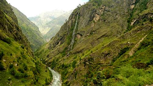
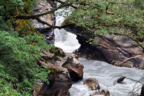
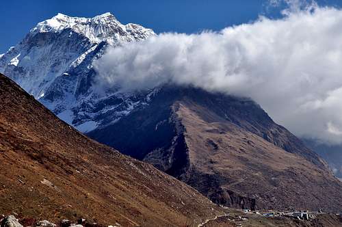
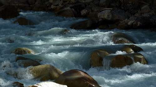
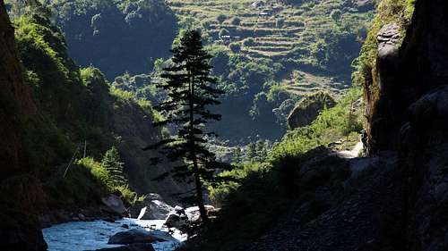
Valley of river Budhi Gandaki
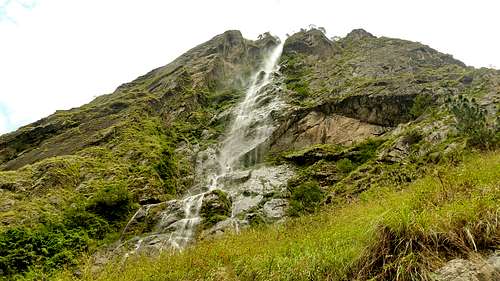
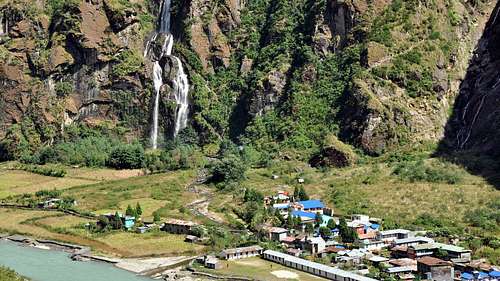
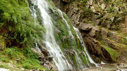
Waterfall just beside the trail
From Bihi we slowly left behind the Hinduist region and entered the Buddhist one. This two are the main religions of Nepal. The overwhelming majority of the Nepalese population follows Hinduism, and Buddhism is the dominant religion of the thinly populated northern areas, which are mostly inhabited by Tibetan-related peoples, such as the Sherpa.
Bihi to Namrung
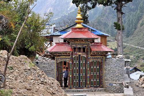
Beautiful gate in Namrung
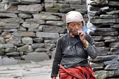
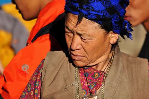
Our landlady in Namrung
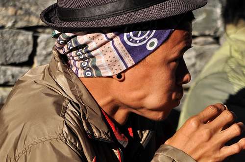
The Hatted – one of our porters
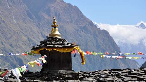
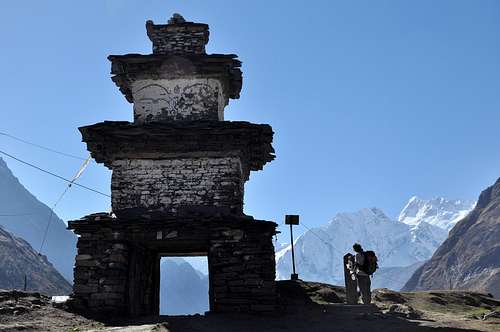
More and more chortens we met in our way. Chorten is a Buddhist shrine, typically a saint's tomb or a monument to the Buddha.
Namrung to Lho Bazar
Namrung to Lho Bazar
Namrung to Lho Bazar
Namrung to Lho Bazar
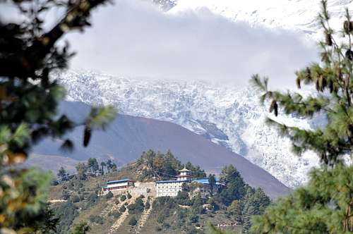
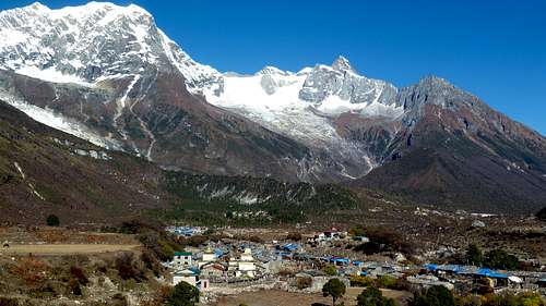
Manaslu and the monastery -Lho Bazar
Lho Bazar
Lho Bazar
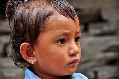
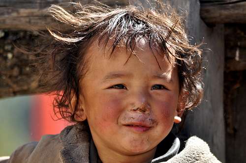
Faces – Nepali kid
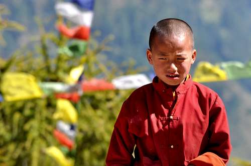
Faces - Young monk
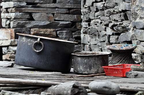
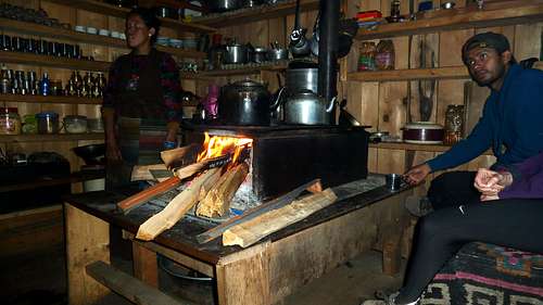
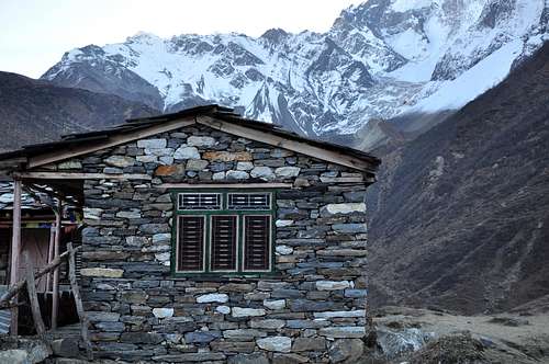
The night before Samagaon: maybe our best evening, with very nice accommodation and a very kind landlord and landlady. We were allowed to enter the kitchen and we could follow how our dinner was prepared. Some of us had the umpteenth occasion to taste the most popular and most common nepali dish, the dal bath: a traditional meal popular in many areas of Nepal, Bangladesh and India.
It consists of steamed rice and a cooked lentil soup called dal. It is a staple food in these countries. Bhat may be supplemented with roti in Nepal (rounds of unleavened bread). Dal may be cooked with onion, garlic, ginger, chili, tomatoes, or tamarind, in addition to lentils or beans. It always contains herbs and spices such as coriander, garam masala, cumin, and turmeric. Recipes vary by season, locality, ethnic group and family.
Dal bhat is often served with vegetable tarkari or torkari – a mix of available seasonal vegetables. It is also called Dal Bhat Tarkari in Nepali. There may also be yogurt or curry made of chicken, goat meat or fish. A small portion of pickle (called achar) is sometimes included.
Kitchen
6 AM
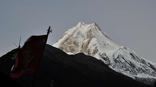
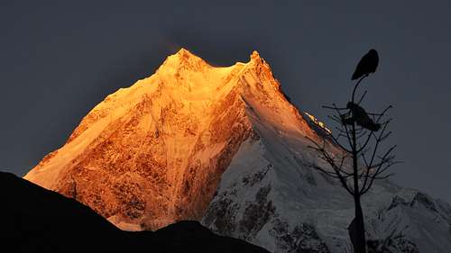
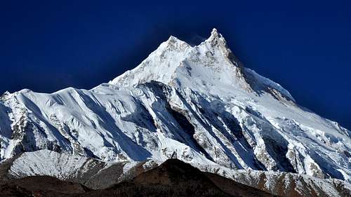
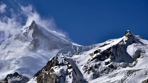
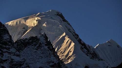
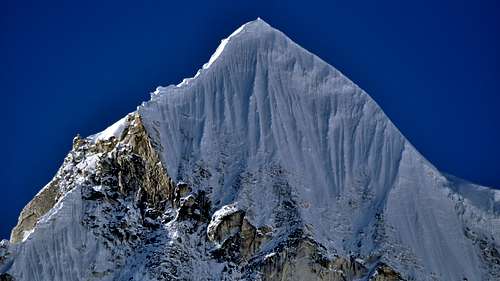
Shine, Manaslu!
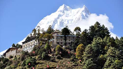
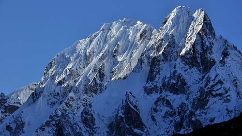
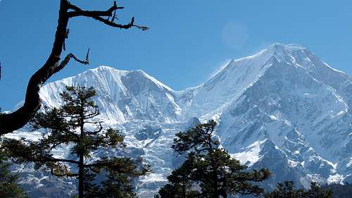
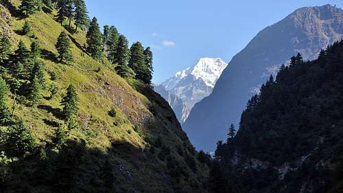
Manaslu (Nepali:मनास्लु, also known as Kutang) is the eighth highest mountain in the world at 8,163 metres (26,781 ft) above sea level. It is located in the Mansiri Himal, part of the NepaleseHimalayas, in the west-central part of Nepal. Its name, which means "mountain of the spirit", comes from the Sanskrit word manasa, meaning "intellect" or "soul". Manaslu was first climbed on May 9, 1956 by Toshio Imanishi and Gyalzen Norbu, members of a Japanese expedition. It is said that "just as the British consider Everest their mountain, Manaslu has always been a Japanese mountain".
Manaslu is the highest peak in the Gorkha District and is located about 64 km (40 mi) east of Annapurna.The mountain's long ridges and valley glaciers offer feasible approaches from all directions, and culminate in a peak that towers steeply above its surrounding landscape, and is a dominant feature when viewed from afar.
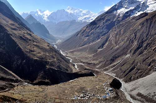
Samagaon
Somewhere above Samagaon
In Samagaon we had a half day for rest, but about half of the team instead of rest decided to make an acclimatization climb to a smaller peak in the surroundings. From the village situated at 3.500 meters above the sea level, we climbed about 600 meters to 4.100.
Next day with a short walk and an elevation of about 300 meters we reached our last stop before the Larkya pass. Here we spent two nights, and we did two another acclimatization climbs to 4.100 and 4.500 meters above the sea level.
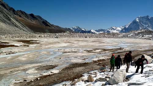
From Samagaon to Samdo - Manaslu again
Chorten at the entrance of Samdo
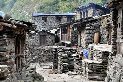
Guest-house in Samdo
Backview to Samdo
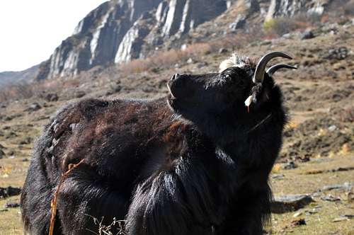
Angry yak
Above Samdo
From above Samdo
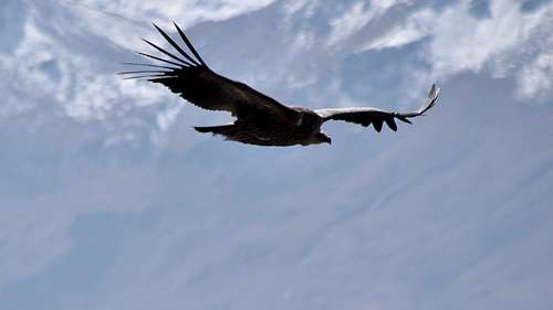
Vulture
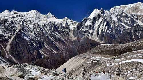
The majority of the group had never been above 3.000 meters, so we didn’t know how would they support the thin air of the pass. The evening before departure we decided to miss the lass stop at Dharamshala, and to do the last two sections during one day. An early start was a must, so we woke up at 2 am, and at 3 am we left behind the last houses of Samdo. We had to climb more than 1.300 meters up to the pass, and from there 1.400 meters to descend to Bhimtang, the first village on the other side of the pass.
To Larkya pass
To Larkya pass
To Larkya pass
To Larkya pass
We've done it!
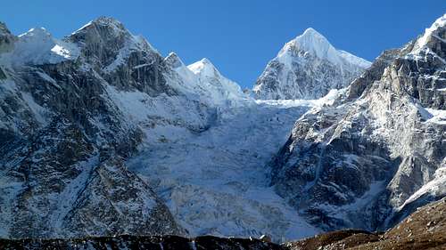
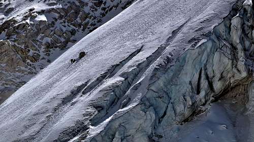
Glacier of Manaslu as seen from Larkya pass
Larkya pass – we started to descend
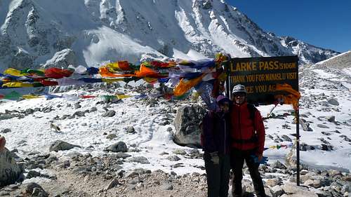
Larkya La (pass) is not the highest of the trekking passes of Nepal, but it carries its own challenges and dangers, not least because of the need to commit to a 10-12 hour day, including four or five hours at altitude on rough and exposed terrain.
A long 1400-metre descent led to the first settlement on the other side of the pass, Bhimtang.
Morning in Bhimtang - packing the mules
One of the many peaks you can see from Bhimtang
Bhimtang to Tilje
Bhimtang to Tilje
Bhimtang to Tilje
Bhimtang to Tilje
Tilje to Jagat
Tilje to Jagat
Tilje to Jagat
Tilje to Jagat
Besi Shahar
Besi Shahar
And finally, a short motion picture medley, with some interesting momentums of our trip.
Kathmandu again
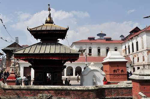
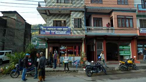
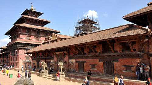
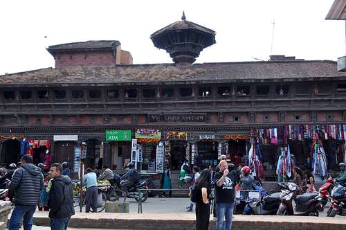
As we had finished the circuit one day earlier than we planned, we had an extra day in Kathmandu to buy the gifts for the relatives and friends and to roam a little more in the city. So we had the chance to ramble all around the Thamel district and to visit the Patan Durbar square in Lalitpur. This square is one of the three Durbar Squares in the Kathmandu Valley, all of which are UNESCO World Heritage Sites. One of its attraction is the ancient royal palace where the Malla Kings of Lalitpur resided.
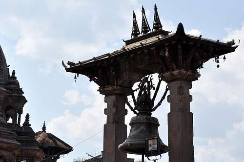
The Durbar Square is a marvel of Newa architecture. The Square floor is tiled with red bricks. There are many temples and idols in the area. The main temples are aligned opposite of the western face of the palace. The entrance of the temples faces east, towards the palace. There is also a bell situated in the alignment beside the main temples. The Square also holds old Newari residential houses. There are various other temples and structures in and around Patan Durbar Square built by the Newa People.
Unfortunately the square was heavily damaged on 25 April 2015 by a huge earthquake.
Patan Durbar square
Patan Durbar square
Patan Durbar square
Patan Durbar square
Patan Durbar square
Patan Durbar square
Patan Durbar square
Itinerary
Total days
Trekking days
Itineraries description
Altitude
1
-
Arrival in Kathmandu
1400 m
2
-
Sightseeing in Kathmandu
1400 m
3
1
Drive to Soti Khola via AruGhat
600 m, 800 m
4
2
Soti Khola to MacchaKhola
1000 m
5
3
Maccha Khola to Jagat
1400 m
6
4
Jagat to Bihi
1860 m
7
5
Bihi to Namrung
2600 m
8
6
Namrung to Samagaon trough Lho Bazar
3100 m, 3500 m
9
7
Rest day in Samagaon
3500 m
10
8
Samagaon to Samdo
3800 m
11
9
Samdo - rest day
3800 m
12
10
Samdo to Larkya Phedy (Dharamshala)
4460 m
13
11
Cross the pass and reach Bhimtang
5106 m, 3700 m
14
12
Bhimtang to Tilje
2100 m
15
13
Tilje to Jagat and Jeep to Besi Shahar
1300 m, 800 m
16
14
Besi Shahar to Kathmandu via public transportation
Parents refers to a larger category under which an object falls. For example, theAconcagua mountain page has the 'Aconcagua Group' and the 'Seven Summits' asparents and is a parent itself to many routes, photos, and Trip Reports.


Comments
Post a Comment