
-
 6351 Hits
-
 84.82% Score
-
 19 Votes
|
|
Route |
|---|---|
|
|
45.91690°N / 7.86331°E |
|
|
Mountaineering |
|
|
Summer |
|
|
Half a day |
|
|
Alpine F |
|
|
Overview
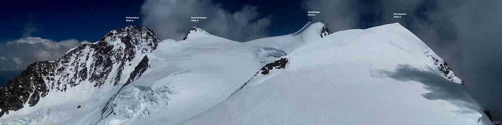
Ludwigshöhe 4341 m Normal route
Ludwigshöhe 4341 m is a mountain belonging to the Pennine Alps, Monte Rosa Massif, and located on the Swiss-Italian watershed, along the line starting from Lyskamm and heading to Punta Gnifetti and Punta Dufour. It forms a small group made up of three "toy Fourthousander" together with Parrotspitze, the highest and the Northernmost, and Corno Nero, the Southernmost amongst the three. These mountains appear small only when considered from the Lys Glacier side. In fact, there is to be observed that this set of three peaks takes on a completely different and extremely crabby look when viewed from the Valsesia side. Ludwigshöhe opposite sides are totally dissimilar: gentle, brief and snowy the Swiss one, impressive and high the Italian, overlooking Alagna, falling towards the Piode glacier and the Valsesia with a 700 m high face and part of the so-called majestic "Valsesiana" wall of Monte Rosa.
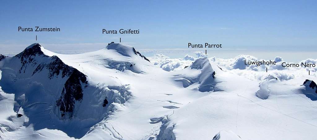
Ludwigshöhe easy but profitable Normal route is part of the so-called "crossing of the Monte Rosa peaks", in which some different summits can be variously combined each other with ease. Ludwigshöhe Normal route is frequently climbed together with Piramide Vincent, Balmenhorn, Corno Nero and Punta Parrot. Ludwigshohe is very popular being only 100 m high above the Col de Lys 4248 m, moreover its interest is also due to the fact that this summit is the tripoint between the italian Aosta Valley and Piedmont and the swiss Valais.

|
 is very...")
|
Getting There
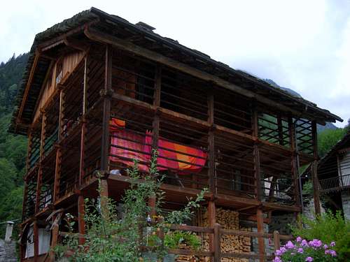
Walser house in Val Sesia
Two different road approachs are possible depending if coming from the Valle di Gressoney (Aosta) or from Val Sesia.
Access via Valle di Gressoney (Aosta Valley) - From the A5 Torino – Aosta Highway, exit to Pont St. Martin and take the Valle di Gressoney, getting to Gressoney St. Jean, Gressoney La Trinité and Staffal. From Staffal take the Cable car to Alpe Gabiet – Passo dei Salati - Indren
Access via Val Sesia (Piedmont) - From the A26 Highway exit to Romagnano Sesia and take the road to Varallo Sesia. Here continue following all the Val Sesia road to Alagna Valsesia. From Alagna Valsesia take the Cable car to Pianalunga - Passo dei Salati – Indren
Route Description
Ludwigshöhe Normal route
Difficulty: F (Alpine scale)
Difference in level: 730 m from Capanna Gnifetti - 870 m from Rifugio Mantova
A pleasant route up one of the minor 4000s on Monte Rosa group, following at first a great glacier – the Lys Glacier - then the gentle NW ridge of the peak. The ascent is easy, but involving a complete glacier's equipment. Lys Glacier has several crevasses - often hidden in early summer - so it is necessary to cross it proceeding enroped.
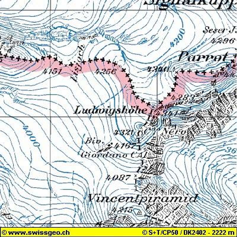
From the shelters – Rifugio Mantova or Capanna Gnifetti – gain the starting point of the Garstelet Glacier, behind Capanna Gnifetti and cross it (crevasses), heading to NE then to North, rising along gentle angled ice-slopes and skirting the SW wall of Piramide Vincent. Continue always along the track on the Lys Glacier heading to the Lys Col. After a main level section, climb a steepest section heading to the left. Once reached the great basin of Balmenhorn, leave to the left the track to the Lys Col and proceed to the marked track to Punta Gnifetti.

|

|
Passed the rock of Balmenhorn, bend sharply to the right and head for the Zurbriggenjoch, between Corno Nero on the right and Ludwigshöhe on the left. Climb the SW snowy slope and the NW ridge to the summit. Another normal route is the NW ridge, which can be climbed directly from the snowy basin below Colle delle Piode, between Ludwigshöhe on the right and Punta Parrot on the left. The two routes can be combined by doing the crossing of the peak.

|

|

|
Descent - reversing the route
Essential Gear
Rope, axe and crampons
Red Tape
No fees no permit required
When to climb

Mountaineering: best months are June, July, August and September.
Ski: from the end of March to the end of May
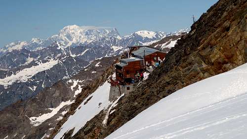
Huts
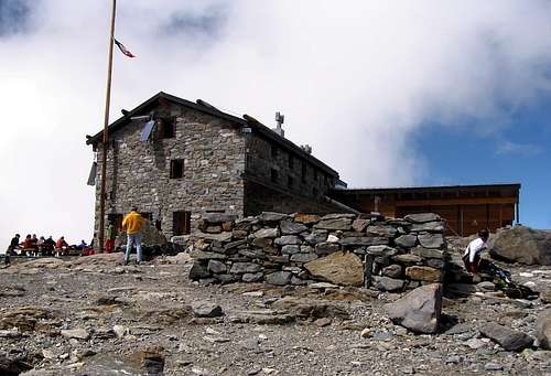
- Rifugio Città di Mantova m. 3470
Situation: Garstelet Glacier
Open: from June to September
Guardian: Guide di Gressoney
Size: 85 persons
Winter shelter: 15 persons
Phone: +39-0163-78150 / Mobile: +393470802910
- Capanna Gnifetti m. 3611
Situation: Garstelet Glacier
Open: from February to April and from June to September
Size: 176 persons
Winter shelter: 4 persons
E-mail: info@rifugimonterosa.it
Meteo
Meteo Valle d'Aosta
Meteo Piemonte
Guidebooks and maps
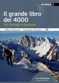

"Il grande libro dei 4000 - Vie normali e classiche" by Marco Romelli, Valentino Cividini - Idea Montagna Editore, 2015
“Monte Rosa” by Gino Buscaini - Guida dei Monti d'Italia C.A.I.-T.C.I.
"4000er Tourenfuhrer" by Richard Goedeke