|
|
Trip Report |
|---|---|
|
|
Jul 1, 2018 |
|
|
Hiking, Mountaineering |
|
|
Summer |
Getting there:
My wife and I spent the preceding month living in Puebla and I wanted to knock off at least one of Central Mexico’s mountains before we left. On a previous trip I had climbed Nevado del Toluca and didn’t have the gear to tackle Itza or Orizaba, so decided to ‘settle’ for La Malinche.
From Puebla, you can jostle with a two hour camioneta ride to Tlaxcala (~3.50USD) followed by a lengthy wait followed by a 1 hour Combi/Collectivo (~$1 USD) ride to the Vacaccional IMSS Malinche (National Park Lodge/Cabins and trailhead). However, we opted for a ~$17 USD – 70 minute uber ride given the time of day we were leaving. Our driver dropped us right at the entrance of the Vacacional and the front desk officer promptly got us situated with a cabaña for about $45 USD per night. The six-bed cabaña would rival or best any mountainside US NPS ‘cabin/yert-type’ accommodations. They were secure and clean with full electricity, hot water, and a fireplace for cold nights. There are 20 or so cabins of varying sizes on the grounds. Many come with kitchens. The resort area itself was well kept, felt very safe, and has a decent restaurant and convenient store along with soccer fields, basketball courts, and a spa. You can also rent campsites for around $3.50 USD which provides access for your party to the entire facility. During peak season, I would recommend reserving in advance, but in July when the weather can be a bit unpredictable, we came with no reservation on a Saturday and the place was probably less than half full.
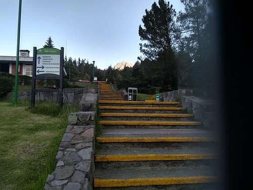
With one caveat, I would highly recommend staying at IMSS Vacacional Malintzi as a base for climbing Malinche. Sadly, the night of our stay, there was one cabaña full of college students (right next door to our cabaña) which turned into a very loud party around 1am with music and yelling until around 3:45. Not sure if this is a regular occurrence or not, but it was unpleasant.
The hike:
[This is my first SP trip report. I don’t usually keep such meticulous notes from my hikes. However, I was annoyed at the lack of specific information on trail section distances, features, etc. in this forum while planning La Malinche. The hike itself ended up being fantastic, so figured I’d do my civic duty.]
I awoke at 6:30am and departed the ‘official’ trailhead (Vacacional main gate – 10,201 ft) at 6:59am – right at sunrise The trail starts out to the right of the gate and cuts more or less straight at a gradual grade through tall pines, passing the winding park road a number of times over the first section of trail.
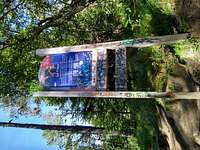
At 7:31am (1.65 miles, 11,431ft), I veered right, away from the park road, and more steeply uphill at this sign [Pic 1].
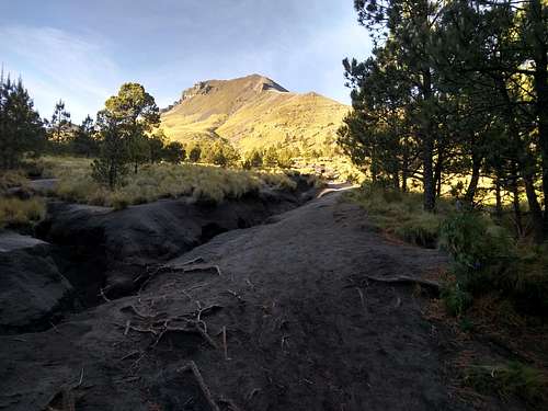
Over the next mile, the grade picked up noticeably through the trees before leveling off somewhat at around 2.7 miles (7:59am; 12,703ft). A short way further, I arrived at the below clearing where the rest of the route comes into view just before the 3-mile mark [Pic 2].
As discussed on the route page, there are two options for the next stage. The point just below the summit ridge sits right about at 13,800ft and took me a little less than 30 minutes to reach taking the direct (steeper approach). The main (shallower) path to the left is full of scree and sand and might easily have taken twice as long to crest.
Once past this stage, the last .4 miles and ~800 feet to the summit are fully visible and follow the obvious ridgeline. On a clear day (which I was lucky to have given the time of year), the summit ridge offers views of Mexico’s three highest peaks (Orizaba, Popo, and Itza). It struck me that this is likely the only spot in North America where you can see three mountains above 17,000 ft from a single hike.
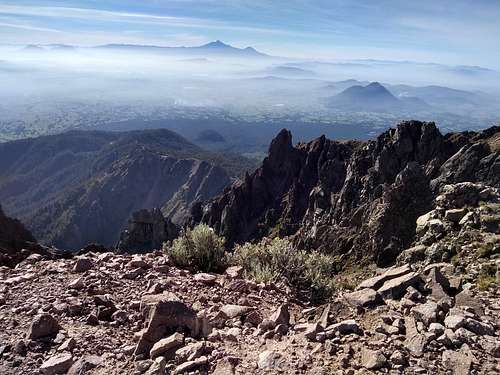
At 8:54am, I arrived at the summit (14,633ft according to my gps), exactly 3.95 miles into the hike feeling pretty good about tackling the ~4400ft of vertical in under two hours. Conditions couldn’t have been better.
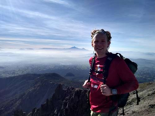
After 15 minutes on the summit, I began my return trip down the same path. I took things a bit more relaxed on the way down, stopping for a few photos of wild horses and to chat with other hikers on their way up.
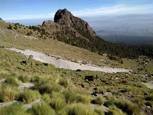
The trail wasn’t crowded, but amongst the 20 or so folks I passed along the way, I met hikers from Germany, Austria, France, Colombia, the States, and Mexico. I arrived back at the vacacional gate at 10:38 ready for a late breakfast at the Vacacional’s restaurant.
Total elapsed time of 3:39 and total hiking time of 3:15.
In sum, highly recommended for those spending any time in Central Mexico or those (like me) thinking about tackling the big Mexican mountains, but in need of a bit of acclimatization prior to spending serious time about 15k.
