-
 788 Hits
-
 78.27% Score
-
 9 Votes
|
|
Canyon |
|---|---|
|
|
46.24522°N / 13.61625°E |
|
|
Hiking |
|
|
Spring, Fall |
|
|
Overview
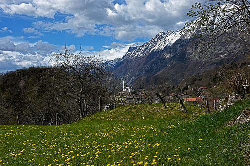
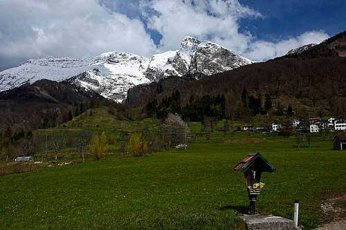
Krn group is especially known by its waterfals. It's tenths of them, if not even a hundred. The highest one exceeds 100 metres. So, this is not a page about a distinct canyon or gorge. It gives you a small area description and also a hint of what you may expect if exploring those wild gorges further. As people are nowadays less dependent on exploring that wilderness till the last square meter, nature there is again more pristine. You will also see some interesting geology.
The Name
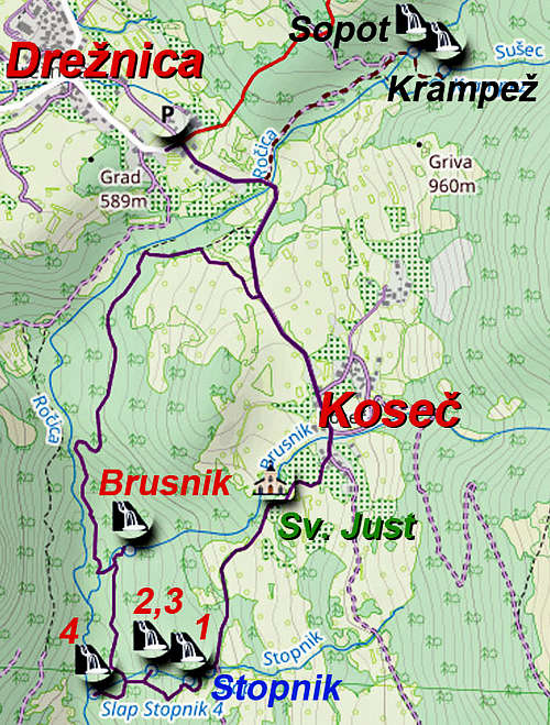
"Koseška korita" means "The Koseč Gorges". It's not a toponyme, but a tourist name for a circular trail, visiting a number of wild gorges and as much as 7 nice waterfalls.
Trail Head
The described tour can be started from two villages: Drežnica, the bigger of the two, and Koseč. The latter is reachable by an asphalted road, but it's closed for public traffic. So, the trail head is the free parking lot in Drežnica: 46.25551660663124, 13.617241260432136
What's In This Area?
Through Drežnica and Koseč three creeks are flowing: Ročica, Brusnik and Stopnik. The latter two are flowing into Ročica which later on the south flows into the Soča river. All three creeks are forming some deep gorges with some even inaccessible sections and on all three there are several waterfalls, the highest are reaching 25 metres. Finally our tour will shopw you also some cultural treasures.
The Circular Trail
Prologue
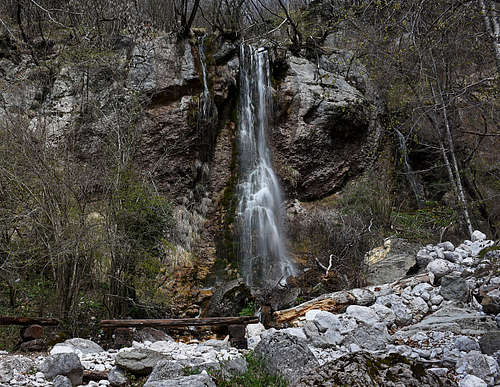
From the Drežnica parking lot we go by the asphalted road (closed for public traffic) towards the neighbouring Koseč village (so, not by the marked path towards the NE). Already on the first bridge (over the Ročica creek) we deter to the left, following the plates. A cart road along the creek brings us in 10 minutes to the Sopot waterfall (falling down on the left). In next few minutes going towards the right we are below the even more beautiful Krampež waterfall. There are actually two waterfalls, the path to the upper one is more demanding (secured), but the lower one with its cute pond is more nice.
Koseška Korita Circular Trail
We return on the main road and walk further southwards. At first into the Koseč village, but after we cross the Brusnik creek, plates direct us towards the right, down through houses. They say: Koseška korita, Sv. Just.
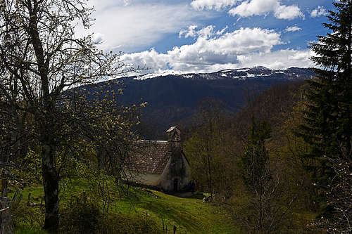
The small church of St. Just originates from the 14th century and in its interior there are valuable fresco paintings. Unfortunately the church is usually locked.


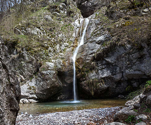
From St. Just the path is gently descending further towards the S-SW. So we reach the Stopnik creek and the path soon crosses it. Just abiove the small bridge there are two small, still quite nice waterfalls. Then the trail descends more steeply towards the SW and soon on the right the Stopnik 1 waterfall appears. It's 22 m tall, completely straigth. A bit lower there are Stopnik 2 and Stopnik 3 waterfall. These two appear as one, with a total heigth of 37 metres. From the viewpoint below there's a perfect view on the scene.
Continuing the descent towards the W we almost reach the Ročica canyon. Just above it there's a trails branching, our trail goes to the right. But it's also worth continuing those few minutes straight down. There we reach just above the Stopnik 4, the highest waterfall. Unfortunately there's no usual path down, to see it better.
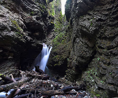
So, we return up to the crossroads and continue northwards, up along the Ročica canyon. We walk by a nice, forested terrace, on some places we can look down in the canyon. So we approach the Brusnik gorge. The descent into it is again steeper and when we are almost down, we notice a path deterring to the right. That one is well worth taking! Across a rock slab a few long pegs help us and also a cable, well needed to descend safely. We reach a very wild place. A completely impassable gorge above us and a small, nice waterfall on its lower mouth. On both slopes there are picturesque, layered rocks. Then we return, cross the creek by the usual trail and comfortably continue up, exiting the gorge.
A few minutes later we reach a nice, forested terrace above the Roćica, with a few benches. They are offered to tourists as healing bio-energetic points. After that, the trail goes only up again, towards the Koseč village. Coming out of the woods, we realize that we are already half way towards the Drežnica parking lot.
Some More Facts
- For the circular trail allow some 2 hours. For the additional 2 waterfalls on Ročica allow 30 minutes more.
- Even if the area is wild, the trail is just easy. On the Swiss Hiking Scale it would be graded T2. Only a few metres into the Brusnik gorge are T3. Sturdy shoes are not mandatory, have just something to walk safely and comfortably.
- The best season is early spring when snow is melting on high mountains. Or, also fall can be nice, but the creeks must have a lot of water.