Intro/Stats
Kelso Mtn (13164')
Torreys Pk (14267')
Grays Pk (14270')
Ruby Mtn (13277')
12 miles RT, 6700' gain
From Stevens Gulch 4WD TH
Slideshow
I've been wanting to climb Kelso Ridge for quite some time now, but wanted to wait for a nice forecast for a long ridge run to add Kelso to the day. Lonely Kelso rarely gets visited compared to its lofty 14er neighbors. I was studying the map and wondered if I could somehow add Ruby to the day if the weather held. I could only find one report on the south ridge of Grays to Ruby by Mark Brown, and he said the ridge was class 3 with routefinding. Wonder what it would be like to downclimb without having gone up it? Only one way to find out!
Kelso to Torreys via Kelso Ridge: What Crowds?
I set out from the Stephens Gulch 4WD trailhead at 5:15, hoping to beat the huge conga line that was about to form on the trail to Grays and Torreys. The forecast was calling for only a 10% chance of rain and the skies were crystal clear under a full moon. There was no need for a headlamp on the smooth trail after my eyes adjusted as the full moon lighted the way. It's been awhile since I hiked on such a nice trail. Only a couple groups were ahead of me, and I made good time up to the cutoff trail to Kelso Ridge at 12300' and the cairn was easy to find.
Once on the ridge, I headed north for Kelso.
A full moon above Torreys:
The ridge offers some scrambling initially. There is a steep buttress that I skirted on the west side and sidehilled across talus back up to the ridge. I should have just climbed the buttress as it was more effort to skirt. Once above this, the ridge mellows out to an open tundra walk with a few false summits.
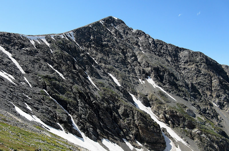
Nice view of Grays and Torreys from Kelso. Kelso Ridge is the S shaped ridge in front of Torreys:
I had a long day ahead of me, so I refueled for the upcoming traverse across Kelso Ridge. I headed back down Kelso's south ridge, this time skirting the buttress on the east side, which was easier on grassy, exposed ramps. I was pumped to try out Kelso Ridge. A group made their way over from the trail and I hoped to stay ahead of them. The ridge sees quite a few ascents, as evidenced by a decent climbers trail much of the way.
Kelso Ridge from just above the saddle:
Within the first ten minutes or so, I came to the first crux, a class 3 chimney that was nice and solid.
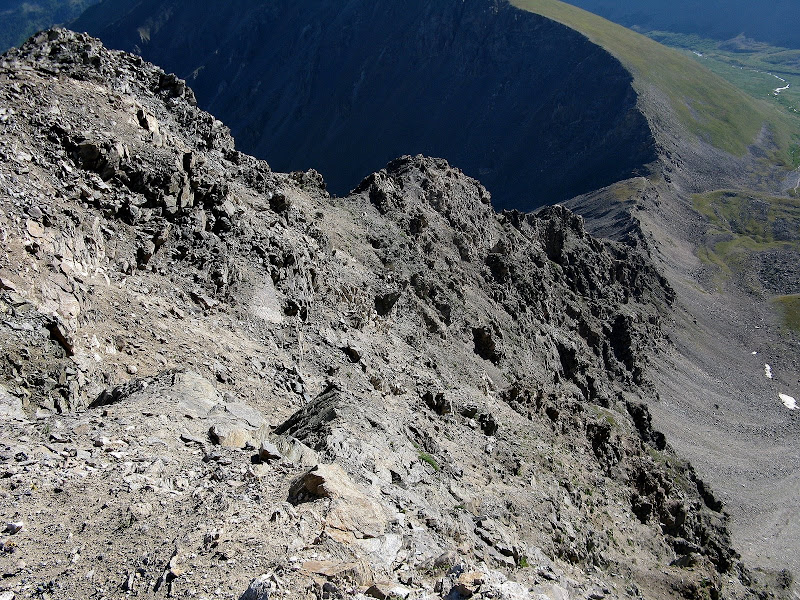
It was nice to be scrambling on the more solid rock of the Front range compared to the loose junk in the Elks! I didn't read up much on the this traverse, thinking I could easily stay out of trouble since it's only class 3. I had read somewhere that staying on the north side (climber's right) where there were difficulties was the easiest. I was trying to stay conservative with the lines I took since I was alone. Another white colored buttress was encounted at around 13K. I started climbing it but decided to back off, skirting below the ridge on the left side on some loose ledges.
Looking down the ridge about halfway up:
This terrain was very annoying, so I shot back up to the ridge when I could. Once past this, the ridge mellows out to class 2 until the difficulties near the top.
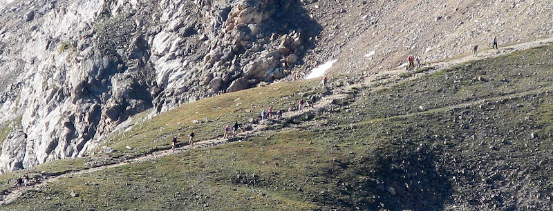
I could see a huge conga line of hikers on the standard route, sort of like a talking caterpillar! I count 16 people in this zoom of a short section of the trail. It was going to be a circus on the summits!
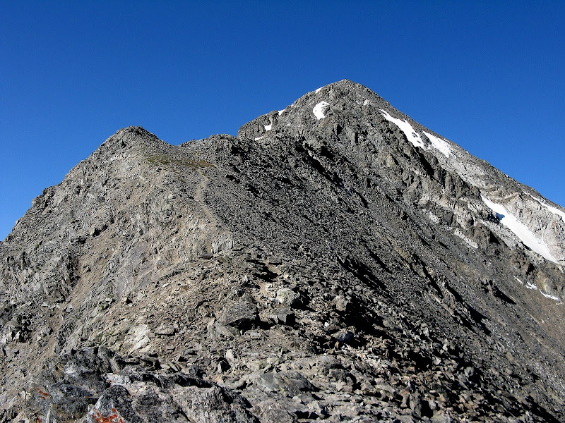
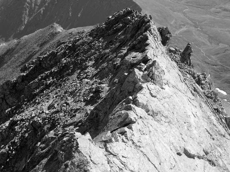
The ridge steepened again, and the long awaited knife edge finally revealed itself. I couldn't wait to see what challenges it held. I skirted the 4th class buttress to the left and climbed back up to the crest near the top of Dead Dog Couloir.
Nearing the knife edge:
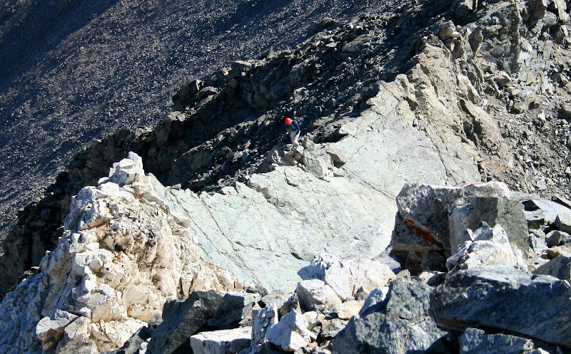
The knife edge was exposed as advertised, but it had plenty of holds and no loose junk to worry about. A fall to the right would be bad but probably not fatal. A fall to the left would mean a long ride down Dead Dog! 14ers.com member Mike Croft was on the summit of Torreys and got a nice shot of me on the knife edge.
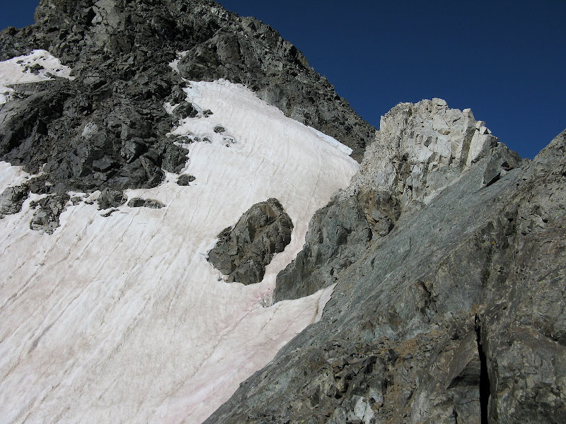
Looking down the knife edge before the white tower:
The white tower looks very intimidating until you get on it and discover that there are plenty of nice holds on the right side.
The white tower and knife edge from above:
Grays to Ruby Traverse
Once above this, it's a short stroll to the summit, which I was surprised was not too crowded yet! I topped out at 9:48, a 2.5 hour traverse from the summit of Kelso. I looked over to Grays and could see the swarms of people making their way over to Torreys. Since I'm an accountant and like to count things, I decided to see how many people I went past on the way over to Grays. Surely it would be less than 50 for such a short distance. The 3/4 mile to Grays took me 36 minutes and I counted 119 people! Imagine what it would have been like a couple hours later! There must have been 500 people on the trail today. Glad I don't hike popular 14ers much in summer anymore.
I shared the summit of Grays with at least 75 of my closest friends, hanging around long enough to take a couple pics. It was a textbook bluebird day with no threat of a storm, so I headed down the south ridge of Grays for Ruby. I followed a decent trail with some short switchbacks down to about 13780. The trail then descends the s.e. ridge into Horseshoe Basin. There were a few folks heading up this alternate, secluded route.
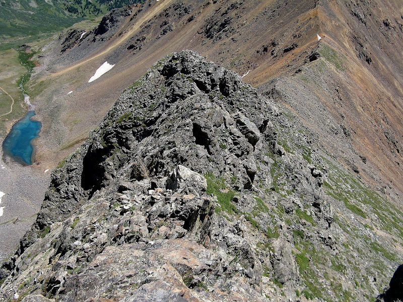
After the ridge splits, the south ridge steepens and become much more rugged, not your typical terrain in this area.
I could see there were plenty of grassy slopes on the west side that I could sidehill on if things got too hairy. I was able to stay on the crest of the ridge down to about 13400', where I came to a downclimb that I wasn't sure about being alone. I decided to bail down a gully and sidehill back to the ridge. It turned out to be much easier than it looked as I climbed the same spot on the way back up.
I'm pretty sure 5th class terrain awaits below this spot if you stay true to the ridge, but I could be wrong. Once back on the ridge, there was more, enjoyable class 3 scrambling down to the saddle. The 350' climb from the saddle to Ruby went quick even though I was feeling it and I skirted the false summit. The traverse took 2 hours and I could still see a hoard of folks on Grays.
The rugged south ridge of Grays from the summit of Ruby:
I called my wife with an ETA and headed down, dreading the 1400 foot climb back over Grays. I wolfed down some sugary treats for the last climb of the day. As expected, the routefinding was much easier going back up as you could see the terrain a lot better. I skirted the steep buttress again, but regained the ridge where I decided to bail on the way down. Even though I was gassed, the scrambling was real fun.
I topped out on Grays at 3pm and was shocked to see nobody up there other than buzzards swirling around looking for leftover goodies. I was glad to be back on the Grays trail and heading down for good.
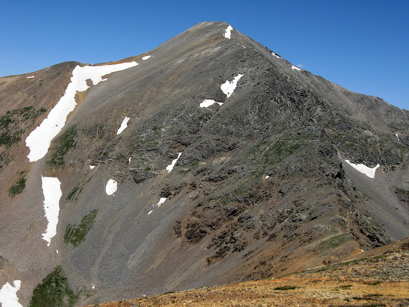
Torreys looking mighty fine:
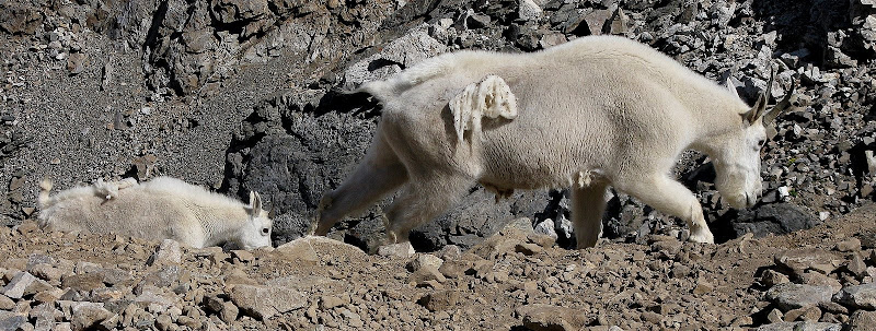
I ran into some goats on my way down. Seems like they were having a bad hair day and were looking for handouts.
There were still some folks heading down, but not as many as I expected. A guy stopped me and said he was out of water, having just descended Kelso Ridge thinking it would be shorter than the trail! He said it was a bit interesting. I gave him the rest of my Gatorade as we were just 1.5 miles away from the trailhead. I arrived back at the car a bit after 4:30, happy that the weather held that late in August on the road less traveled. If you're looking for a sporty, secluded route on Grays, give the south ridge a try!


Comments
Post a Comment